County Tops of England: Buckinghamshire
Haddington Hill: 267 metres (Grid Ref: SP891091)
Google Maps Open Source Maps| Route Statistics and Files | ||
|---|---|---|
| Start: Wendover Woods Car Park | Grid Ref: SP888089 | Distance: 1.9 miles (3.0 km) |
| Climbing: 15 metres | Time: 1 hour | Rating: Easy |
| GPX Route File | Google Earth File | Map: 181 Chiltern Hills North, Aylesbury, Berkhamstead and Chesham |
| Statistics | |
|---|---|
| Start: Wendover Woods Car Park | Grid Ref: SP888089 |
| Distance: 1.9 miles (3.0 km) | Time: 1 hour |
| Climbing: 15 metres | Rating: Easy |
| GPX Route File | Google Earth File |
| Map: 181 Chiltern Hills North, Aylesbury, Berkhamstead and Chesham |
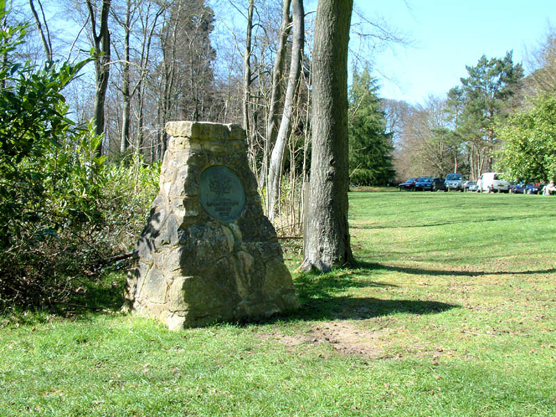
The Walk: A pleasant linear walk through the woods from one county top to another. Start from the car park in Wendover Woods and while near the car park look for the pillar (pictured) which signifies the highest point in the county of Buckinghamshire. Then follow a path south-east from the woods which eventually meets a road. Here your path meets the Ridgeway National Trail which you follow north on the road for a few metres before heading east across a field to another road which is crossed to reach Northill Wood/ Pavis Wood. Walk northeast through the wood to meet yet another road at Hastoe. You have now attained the highest point in Hertfordshire. (Note: unless you have arranged for transport you will have to walk back to the county top of Buckinghamshire!)
The Walk I Would Do: I would create a circular walk by doing as described to attain the county tops but to make the circular I would continue from Hertfordshire's high point to Hastoe Farm and then head south to meet Grim's Ditch. I would follow Grim's Ditch west to Coppice Farm then use the permissive paths available back to the south end of Wendover Woods. I would then locate a disused reservoir and a fort in the woods before walking back to the starting point. (Map and route file for my walk available on request)
Information: Haddington Hill, also called Wendover Hill, is a hill in The Chilterns, and the highest point in the English county of Buckinghamshire. It is owned by the Forestry Commission, whose Wendover Woods cover much of the hill. Many tracks run through the forest, and a car park is located near the summit among the trees: the flat summit means the precise location of the highest point is difficult to determine with certainty. However, in the woods to the east of the car park there is a large stone bearing the inscription 'Highest Point of the Chiltern Hills'. The stone is surrounded by trees. (Source: Wikipedia)


