
Bottesford to Grantham

December 2010. The advice was not to drive unless it was really necessary. Well, I can only stand so long stuck indoors — what I needed was a walk! The forecast for Friday had been unbroken sunshine, but on Thursday they changed it to grey cloud. For once I was pleased they got it wrong, as the day was spot on for walking: crisp underfoot with sunshine all day.

We took the morning bus from Grantham to Bottesford for a linear walk of nine miles back to Grantham. The chosen route would be easy, avoiding those hidden dangers of snow-filled ditches. When the A52 bypassed Bottesford it left some minor roads as dead ends, and these are now ideal for walking or cycling; in addition, the old mineral railway line has become Sustrans Route 15. Both offered traffic-free walking. The majority of the walk however would be alongside the disused Grantham Canal which has been surfaced and is a very popular route for walkers with red socks or prams, cyclists, and anglers.

(Note: This walk is kindly contributed by Ken Brockway)

Start Point
Bottesford
Grid Reference
SK806388
Total Distance
9.1 miles (14.7 km)
Total Climbing
67 metres
Estimated Time
4 hours
Difficulty Grade
Moderate

Ordnance Survey Explorer Map (1:25,000)

Essential paper map for exploring the route:
Walk Report & Journal

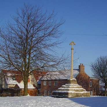
The town cross in Muston The town cross in Muston
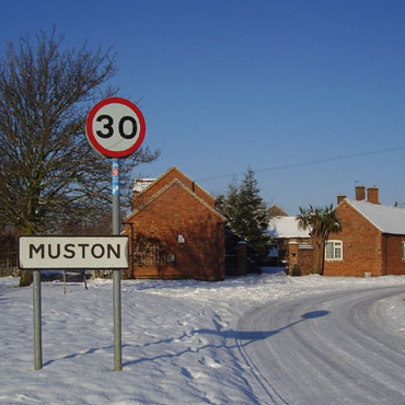
Leaving Muston to the east of the village Leaving Muston to the east of the village
The Walk: Before leaving Bottesford we indulged in a full cooked breakfast at the deli on Queen Street which set me up well on top of the usual cereal before leaving home. To make best use of off-road walking I started from Belvoir Road and joined the surfaced footpath to Easthorpe passing The Victory Commemoration Hall. Originally a temporary wooden structure built in 1947, the old hall was extended and revamped many times until 2003 when a successful bid to the National Lottery enabled the construction of this splendid new building.

The road through Easthorpe was like glass, but locals were driving with care, and because four wheels were better than two legs on this surface we progressed with due diligence. Turning into the Muston road we had the tarmac to ourselves. The snow in the centre of the narrow road still uncompacted was dry and powdery, drifting like dust as our boots disturbed it. Dog walkers use this now dead-end road and take advantage to let their pets run free; unfortunately the pet will sometimes show more interest in new friends than the call to heel from the owner.

Muston is a pretty village with some buildings of orange ironstone mixed with those of red brick and pantile roofs. The village cross, restored in Victorian times, stands on a 14th-century base. In finer weather there is a pleasant walk into fields, first crossing the River Devon by a plank bridge then bearing left to emerge into the churchyard, opposite which the Old Forge tearoom is a popular haunt for passing walkers.

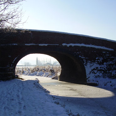
Grantham Canal - Stenwith Canal Bridge (No.60) Grantham Canal — Stenwith Canal Bridge (No. 60)
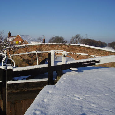
Lock 18, Bridge No.61 and The Dirty Duck Lock 18, Bridge No. 61 and The Dirty Duck
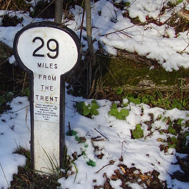
The Grantham Canal was opened in 1797 and abandoned in 1936, so it has lain idle for over 70 years, although not neglected as we will see. From its connection with the national waterways network by the River Trent at Nottingham the Grantham Canal climbs through 12 locks then meanders around the Vale of Belvoir on the same level for 20 miles before arriving at Stenwith, where we join it. Here it starts to climb again providing us the added interest of water cascading through the lock chambers.

Milepost 29 a modern copy, note miles from the Trent Milepost 29 (modern copy — note miles from the Trent)
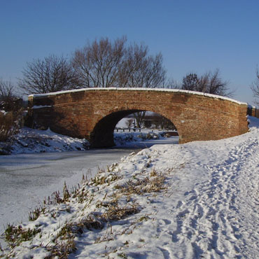
Grantham Canal - Denton Wharf Bridge (No.65) Grantham Canal — Denton Wharf Bridge (No. 65)
The Rutland Arms, known locally as the Dirty Duck, drew us towards it. While the door was open the lights were off, but a call attracted mine host Bob Taylor who was happy to draw us a pint. Bob has kept the 'Duck' for 40 years, but may well be looking to retire soon as he told us his landlord has recently increased the rent by a third.

Passing the last two locks the weather remains excellent, but there are few other intrepid walkers about — perhaps they have all gone back to work today? Approaching Grantham the canal navvies had to dig a cutting, at first allowing the passage of only one boat, but later widened to permit passing. It was here that a sparrowhawk swooped past us with prey in its talons and landed unseen in the brambles on the bank. As we closed in it flew off and dropped a very dead blackbird in our path, then perched in a tree watching us as we watched it. A standoff, but the hawk lost and flew on yet again, so we continued our journey soon to be passed by the bird no doubt off to retrieve lunch.

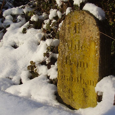
Original stone milepost, 2 miles from Grantham Original stone milepost (2 miles from Grantham)
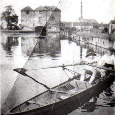
Original wharf and warehouse Grantham c1925 Original wharf and warehouse, Grantham c. 1925

At the A1, when cycling, I take to the road, but today we followed the canal first across Trent Road then to Earlesfield Lane where the route disappears under the council depot. Gone but not forgotten, Wharf Road in the town centre reminds us of the route to the former canal basin.

Digging in the many piles of useful papers stored at home I find the following extract from the Lincoln, Rutland and Stamford Mercury (first published 1713):

Grantham Navigation

A general meeting of the subscribers to the intended canal from Grantham in the county of Lincoln, to the River Trent, is appointed to be held at the Angel Inn (still an Inn) in Grantham aforesaid on Wednesday 9th January next at 11 a.m. by order of the committee:
David Lely
Geo. White (Solicitor)
Grantham 4th December 1792

Advertisement

Join The Walking Englishman Community

Connect with other walkers, share trail photos, and keep up to date with my latest route notes.