Brill, Boarstall and Muswell Hill
Overlooking the Vale of Aylesbury - From a hilltop village along quiet country lanes and fields
Google Maps Open Source Maps| Statistics and Files | ||
|---|---|---|
| Start: Brill | Distance: 5.2 miles (8.3 km) | Climbing: 148 metres |
| Grid Ref: SP 65225 14240 | Time: 2-3 hours | Rating: Moderate |
| GPX Route File | Google Earth File | About Brill |
| Statistics | |
|---|---|
| Start: Brill | Distance: 5.2 miles (8.3 km) |
| Climbing: 148 metres | Grid Ref: SP 65225 14240 |
| Time: 2-3 hours | Rating: Moderate |
| GPX Route File | Google Earth File |
Ordnance Survey Explorer Map (1:25,000)
The Walk: The walk begins at the edge of the attractive village of Brill. This is an area of common land, full of humps and hollows, the marks of old pits from which clay was dug for brick-making and a pottery industry that dates back to the Middle Ages. The village is 613 feet (187 metres) above sea level, and looks out over the Vale of Aylesbury. The most prominent building is the 17th century Brill Windmill. This is one of the oldest post mills in England. The actual milling machinery is in the weather boarded 'buck' to which the sails are attached. This is balanced on a central post, hence the name post mill -and the whole structure can be rotated to bring the sails into the wind.
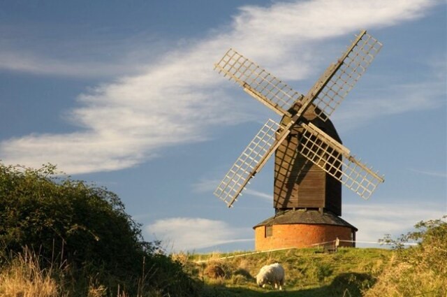 Brill Windmill
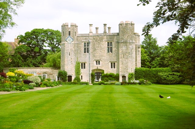 Boarstall Tower
The route leads through hills and fields to the hamlet of Boarstall. Once there was a considerable village here, dominated by a fortified manor house surrounded by a moat. Much has gone, but a good deal of interest still remains.
The Little Church of St James was consecrated in 1418, but was largely rebuilt after the Civil War. It is quite a plain structure, but has a fine wooden 17th century pulpit. In the churchyard, an ornate gate, embellished with a hunting horn, emblem of the Aubrey family, provides a glimpse into the grounds of Boarstall Tower. The tower was originally the gatehouse to the now demolished medieval manor house, and it rose up, battlemented and severe, above the moat. Later, it was domesticised, and its Tudor and Jacobin windows give it a rather more homely look. It is now in the care of the National Trust.
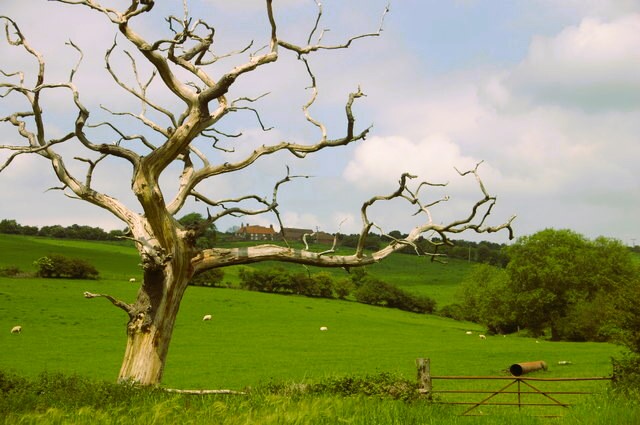 Countryside near Boarstall
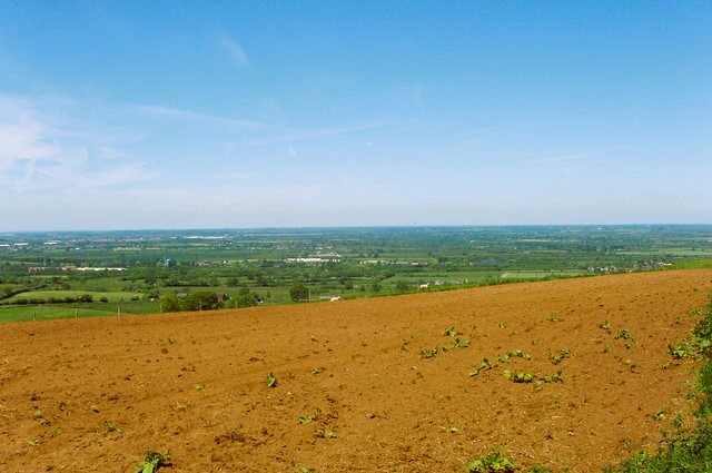 View to Buckinghamshire plains from Muswell Hill
The road passes a number of attractive farms. The older part of Village Farm is dated 1737 and has little dormer windows set in a mossy tiled roof, while the neighbouring Manor Farm is more imposing. Just beyond the farms is the entrance to the Boarstall Duck Decoy and Nature Reserve.
The road section of the walk ends at a path that climbs the rough grassy slope of Muswell Hill, passing a group of old oak trees which are home to a family of green woodpeckers. From the top of the hill, there is a panoramic view south over the plain and north over more undulating farmland.
The final part of the walk is along a quiet country lane sheltered by hedgerows. The lane dips briefly down before climbing back up the hill for the return to Brill.
Acknowledgment: Text derived from the Out and Out Series; Discovering the Countryside on Foot. Pictures courtesy of Wikipedia.


