Alcester, Wixford, Exhall and Oversley Green
From historic Alcester along Icknield Street, a Roman road and through woodland
Google Maps Open Source Maps| Statistics and Files | ||
|---|---|---|
| Start: Alcester | Distance: 5.5 miles (8.8 km) | Climbing: 91 metres |
| Grid Ref: SP 08916 57281 | Time: 2-3 hours | Rating: Easy |
| GPX Route File | Google Earth File | About Alcester |
| Statistics | |
|---|---|
| Start: Alcester | Distance: 5.5 miles (8.8 km) |
| Climbing: 91 metres | Grid Ref: SP 08916 57281 |
| Time: 2-3 hours | Rating: Easy |
| GPX Route File | Google Earth File |
Ordnance Survey Explorer Map (1:25,000)
The Walk: The walk sets out from the historic town of Alcester and takes in part of Icknield Street, a great Roman highway that ran from Wall, near Lichfield in Staffordshire to Stow on the Wold in Gloucestershire, where it met the Fosse Way. Next, the route leads through the tiny hamlets of Wixford and Exhall, with their wealth of timber-framed black and white buildings and returns to Alcester via a path along the borders of the Forestry Commission's Oversley Wood. There are many deciduous trees here and in autumn they form a rich, colourful backdrop.
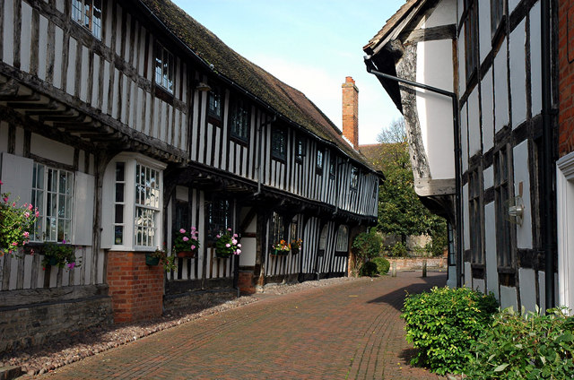 Malt Mill Lane, Alcester
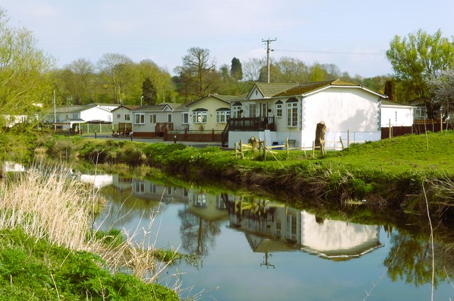 Oversley Mill Park and the River Arrow
A variety of wildlife may be encountered in the small area covered by this walk. There is much evidence - especially along Icknield Street, of a significant rabbit population. You may also see signs of badgers here - though you are far more likely to spot their setts, slides and dung pits than the animals themselves.
There have been many Roman finds in Alcester, several of them in recent years, when new buildings were being constructed. Many of Alcester's ancient buildings have been carefully renovated. Malt Mill Lane in particular is lined with magnificent rows of medieval timber-framed houses with projecting upper stories. Its restoration has won several architectural awards and is included on the National Heritage List for England.
Nearby is the early 17th century town hall, which once had open arches and a covered market place below. Dominating the town centre is the tower of the parish church, much of which was rebuilt in 1730 after a disastrous fire.
As you walk along Icknield Street you can catch glimpses of the hamlet of Arrow, named after the river. Its church is notable for its tower, said to have been designed by Horace Walpole. Further downstream is Arrow Mill, which was still grinding corn in the 1970's. It is now a hotel, and the turning mill wheel is a feature of the restaurant.
In front of the mill is a motte, or mound, on which a wooden castle built by Robert le Boteler in the 12th century, once stood. Nothing remains of it today. Beyond it, on a distant wooded hillside, stands the grand mansion of Ragley Hall, the home of the Marquis of Hertford. Its impressive grounds were laid out in the 1750's by Capability Brown.
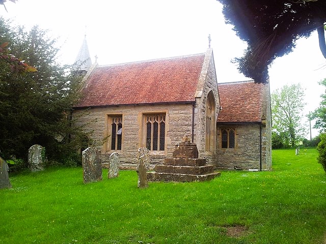 St Milburga's Church, Wixford
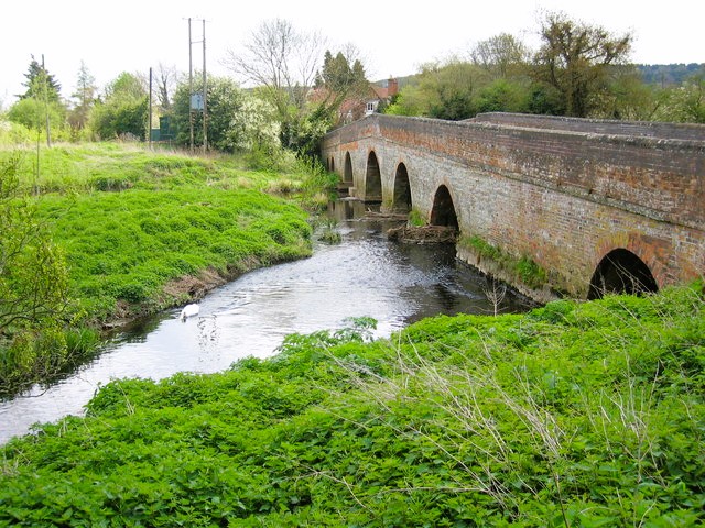 Bridge over the River Arrow, Oversley Green
St Milberga's Church in Wixford has a timber-framed bell turret and contains some fine 15th century brasses depicting Thomas de Crewe, who was a lawyer and adviser to Margaret Beauchamp, Countess of Shrewbury, and daughter of the Earl of Warwick. The brasses are over nine feet long. The church is sometimes locked, but the key is sometimes available.
To the east is Exhall, a hamlet reputed to be one of the 'Shakespearean villages' visited by the Bard and his companions for drinking contests. Its church includes some Norman work. The woods beyond Exhall have an abundance of bird life and wild produce: In autumn, there are elderberries, crab apples, hazel nuts, sloes and blackberries. Note also the coppiced trees. Beeches were regularly cut near to the ground to provide a crop of poles for making sheep hurdles.
The route drops down to the valley again, to cross the River Arrow via Oversley Bridge, a six-arched structure built in 1600. As you cross the river, you may see mallard, Canada geese, moorhen, and even a kingfisher. There are water voles here too, though they scurry for cover if they are alarmed.
Acknowledgment: Text derived from the Out and Out Series; Discovering the Countryside on Foot. Pictures courtesy of Wikipedia.


