Ladybower Reservoir, Derwent Reservoir and Derwent Edge
Gritstone moors, tors and reservoirs in the Dark Peak area
Google Maps Open Source Maps| Statistics and Files | ||
|---|---|---|
| Start: Fairholmes | Distance: 7.0 miles (11.3 km) | Climbing: 408 metres |
| Grid Ref: SK 17336 89335 | Time: 3-4 hours | Rating: Hard |
| GPX Route File | Google Earth File | About Laverton |
| Statistics | |
|---|---|
| Start: Fairholmes | Distance: 7.0 miles (11.3 km) |
| Climbing: 408 metres | Grid Ref: SK 17336 89335 |
| Time: 3-4 hours | Rating: Hard |
| GPX Route File | Google Earth File |
Ordnance Survey Explorer Map (1:25,000)
The Walk: This walk explores the challenging hill country and man-made lakes of the Peak District on the border between South Yorkshire and Derbyshire. It begins in the shadow of the Derwent Dam, scene of the wartime practice flights by the Dambusters Squadron. The dam, 115 feet (35 metres) high, can be looked particularly spectacular when surplus water from the Derwent Reservoir cascades over it. It is also impressive when it ices over in severe winters.
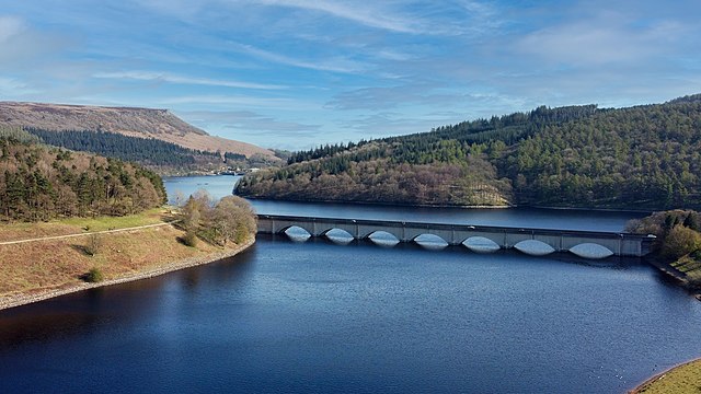 Ladybower Reservoir
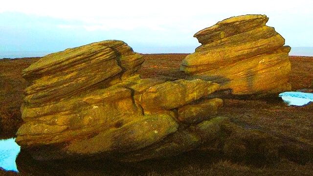 Sunlit Cakes of Bread highlighted on Derwent Edge
The walk begins at Fairholmes car park on the northern edge of Ladybower Reservoir and leads past Derwent Reservoir Dam to follow the path along the eastern bank of Derwent Reservoir. Soon, the first climb of the walk begins, leaving the reservoir edge and climbing uphill through Hancock Wood. Most of the hillside surrounding the reservoirs have been extensively planted with conifers. There is a continual cycle of felling and replanting, with most of the timber being used for fence posts and planks. At lower levels however, you pass between tracks of deciduous woodland, where there are sycamore, beech and oak trees.
The dense (and consequently dark) conifer plantations are not rich in their variety of wildlife, but coal tits and goldcrests can be seen, as well as the occasional goshawk. Grey wagtails and dippers can sometimes be found at points where streams flow down through the woodlands and into the reservoirs.
A steep climb up through the woods brings you out onto the wild expanse of Howden Moors, where there is a good covering of heather as well as cotton grass. Bilberry, cloudberry and crowberry also grow here, though less profusely. The moors look particularly splendid in early autumn, when the purple heather is in full bloom.
These are traditionally grouse moors and plenty of red grouse can still be seen, although their numbers have declined in recent years. Curlews and golden plovers are also in evidence, as well as kestrels soaring and hovering along the gritstone edges. The mountain hare, whose quarters turns white in the winter months, is one of the more interesting mammals to be found here.
Just below Back Tor, the route turns south along the ridge of Derwent Edge, which provides superb views on all sides. The craggy edges and gritstone tors are the last remnants of hard sedimentary rock that formed millions of years ago in shallow tropical seas.
They have been eroded by the Ice Ages and subsequently weathered by wind, rain, snow and ice into their present strange and fantastic shapes. The gritstone was frequently quarried for millstones, as well as local building stone.
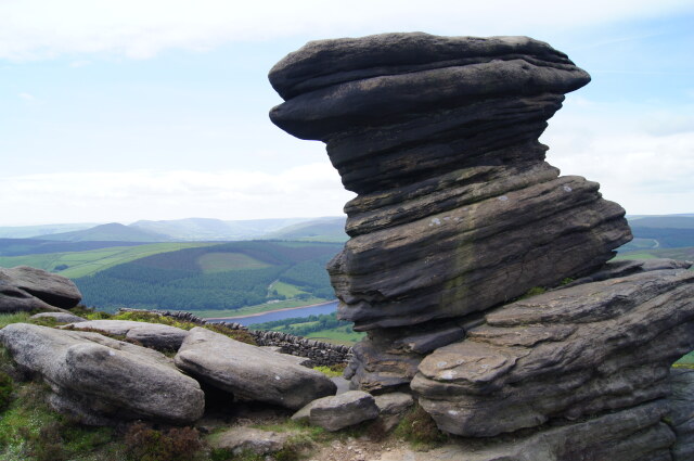 The Salt Cellar on Derwent Edge
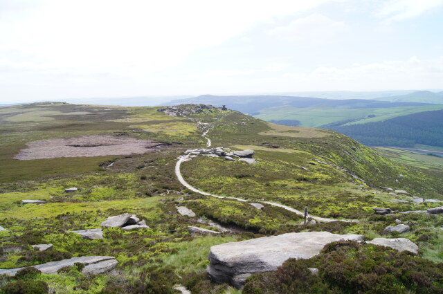 Derwent Edge
Over the years, the tors have acquired names to match their curious features. Cakes of Bread and the Salt Cellar are particularly easy to recognise. Just beyond White Tor, the route takes you steeply down through the pretty little valley of Grindle Clough towards Ladybower Reservoir.
When the Bamford Dam was built and the level of the reservoir began to rise to a level greater than anticipated, the village of Derwent became submerged along with much of the lower Derwent Valley. The cottages, farms, school, church and vicarage became unsafe, and had to be demolished in 1943. The bodies from the graveyard were reburied at Bamford and the residents of Derwent were rehoused at nearby Yorkshire Bridge.
Derwent Lodge, a shooting lodge owned by successive Dukes of Norfolk, but used as a youth hostel just before World War Two, also had to be demolished. For a time, the church spire could be seen rising above the water, but in 1947 it was considered unsafe and pulled down. The village's fine old packhorse bridge was rebuilt at Slippery Stones. In recent summers, during extreme droughts, the water level of the reservoir has dropped considerably, revealing traces of the village's buildings, walls and lanes.
The last section of the walk takes you along the bank of Ladybower Reservoir. Finally, you rejoin the original path past Derwent Dam and return to Fairholmes car park.
Acknowledgment: Text derived from the Out and Out Series; Discovering the Countryside on Foot. Pictures courtesy of Wikipedia.


