Rutland Water: The Hambleton Peninsula
A Walk on the Water - Exploring an inland peninsula that juts out into Rutland Water
Google Maps Open Source Maps| Statistics and Files | ||
|---|---|---|
| Start: Hambleton | Distance: 4.8 miles (7.7 km) | Climbing: 126 metres |
| Grid Ref: SK 90023 07592 | Time: 2 hours | Rating: Easy |
| GPX Route File | Google Earth File | About Rutland Water |
| Statistics | |
|---|---|
| Start: Hambleton | Distance: 4.8 miles (7.7 km) |
| Climbing: 126 metres | Grid Ref: SK 90023 07592 |
| Time: 2 hours | Rating: Easy |
| GPX Route File | Google Earth File |
Ordnance Survey Explorer Map (1:25,000)
The Walk: This walk is a circuit around Hambleton Peninsula, a long finger of high ground almost surrounded by Rutland Water, a vast reservoir. The walking is mostly level and passes through a mixture of sheep pasture and woodland. You are never far up from the water, which is used by yachtsman, windsurfers, a pleasure cruiser, anglers and a large number of waterfowl.
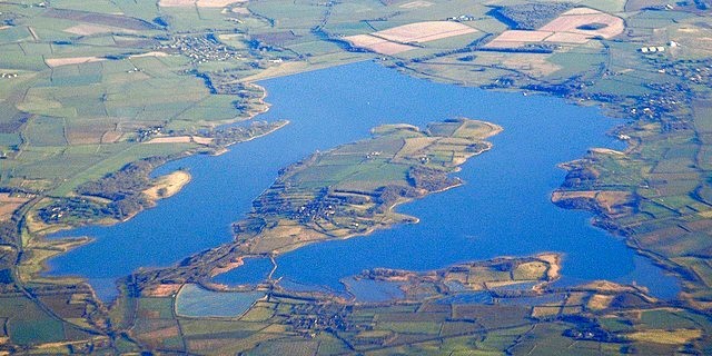 Rutland Water and the Hambleton Peninsula
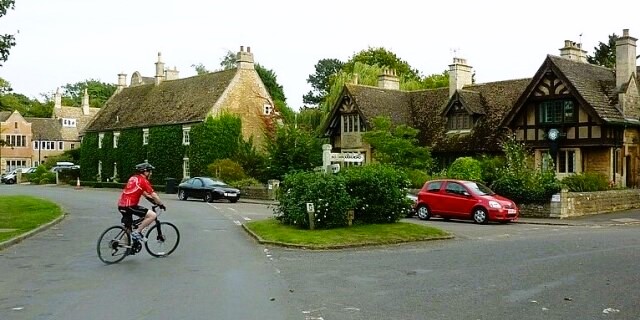 Hambleton
The walk begins at the village of Hambleton, which clusters around Hambleton Hill, commanding views in all directions over the water. In Anglo-Saxon times, the village was one of the capitals of Mercia, before being superseded in importance by nearby Oakham. According to the Domesday Book, Hambleton, one of only four places in Rutland to be mentioned, had three churches in 1086.
The current church dedicated to St Andrew dates from the 12th century, but is built on earlier foundations. Much of the present building is Victorian, but it contains a 12th century holy water stoup and coffin lids of a similar age. The 13th century tower has a broach spire.
From the village, a bridleway leads to a well defined track which skirts the peninsula and is part of a 24 mile (38 kilometre) walking and cycling circuit around Rutland Water. The waters are renowned for its fish, especially trout, and record catches have been made here.
The reservoir created to meet the burgeoning demand for water for Milton Keynes, Northampton, Wellingborough, Daventry and Corby, was begun in 1971 and completed six years later.
The shallow Gwash Valley was dammed near Empingham. The dam wall, visible from the walk, is 1,312 yards (1,200 metres) long and 131 feet (40 metres) high.
The reservoir has a capacity of 27 billion gallons (120 billion litres), making it, at time of construction, the largest man-made lake in Western Europe. It takes its name from the former county of Rutland, of which Oakham was the county town. The county, the smallest in England, at 152 square miles, was absorbed into Leicestershire in 1974.
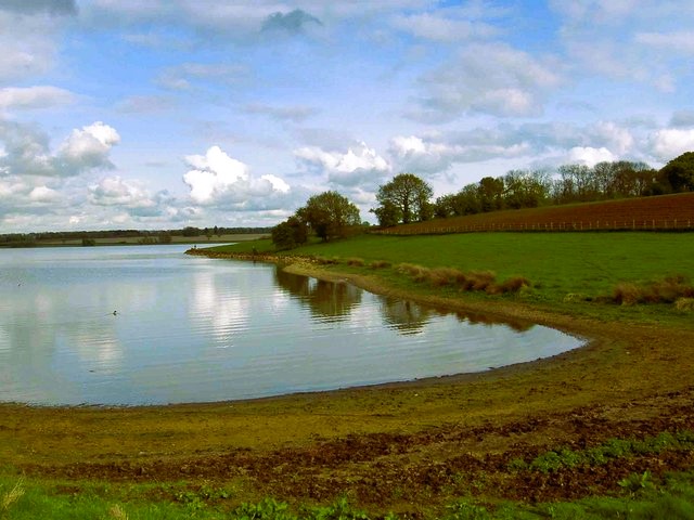 Barnhill Creek
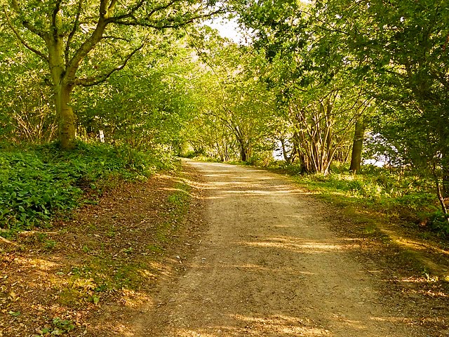 The path through Hambleton Wood
From the east end of the peninsula, there are views across to Normanton Church, which juts out into the water on a bed of rocks. Originally, it was have to be abandoned to the reservoir; monuments inside the church were moved to St Mary's at Edith Weston and 180 bodies in the churchyard were exhumed and cremated. However, in 1972 a voluntary group succeeded in raising the £30,000 needed to build a bank and a causeway of stones to protect the church. It now houses a museum about the construction of Rutland Water.
Barnhill Creek, a small inlet at the eastern end of the Hambleton Peninsula also offers good views eastwards across the reservoir towards Normanton Church, and also to the limnological tower and the reservoir dam.
The reservoir is a magnet for wild-fowl and you will see mallards, swans, grey herons and many other birds as you follow the circuit back to the village. More than 200 different species have been sighted, including ospreys on migration and great northern divers in winter.
There are two areas of woodland visited during the walk. The first, Armley Wood, is ancient woodland but much reduced in size due to the construction of Rutland Water. In the Middle Ages it was part of Barnsdale Deer Park. The wood is mostly ash and hazel with some well-grown oaks present. It lies on Upper Lias clay.
Armley Wood lies on the north shore of the peninsula and on the south shore is Hambleton Wood, which is managed by the Leicestershire and Rutland Wildlife Trust. Beyond Hambleton Wood it is a short walk back to the start in the village.
Acknowledgment: Text derived from the Out and Out Series; Discovering the Countryside on Foot. Pictures courtesy of Wikipedia.


