Southwell, Morton, Fiskerton and Rolleston
From a cathedral town to interesting villages in the Trent valley
Google Maps Open Source Maps| Statistics and Files | ||
|---|---|---|
| Start: Southwell | Distance: 8.7 miles (14.0 km) | Climbing: 51 metres |
| Grid Ref: SK 70152 53892 | Time: 4 hours | Rating: Moderate |
| GPX Route File | Google Earth File | About Southwell |
| Statistics | |
|---|---|
| Start: Southwell | Distance: 8.7 miles (14.0 km) |
| Climbing: 51 metres | Grid Ref: SK 70152 53892 |
| Time: 4 hours | Rating: Moderate |
| GPX Route File | Google Earth File |
Ordnance Survey Explorer Map (1:25,000)
The Walk: As well as its splendid minster, the town of Southwell, where this walk begins, has several other attractions. On the eastern side of Southwell Minister is Vicars Court, a lovely open quadrangle of beautifully proportioned Georgian houses built around 1780. On the other side of Church Street is Cranfield House, dating from the early 18th century, one of a row of houses built to house the minster's senior clergy.
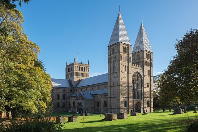 Southwell Minster
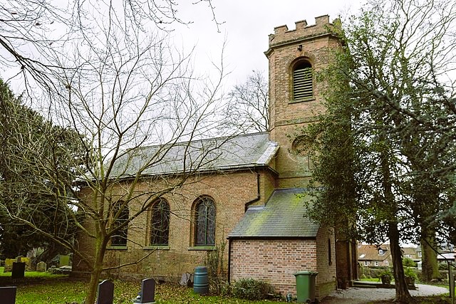 St Denis Church, Morton
In the 17th century, the Saracen's Head was a coaching inn and Charles I stayed here on his way to surrender to the Scots at Kelham. Oliver Cromwell also spent a night or two here not long afterwards.
Just north of the Saracens Head, Burgage Green is overlooked by Burgage Manor, where Lord Byron stayed with his mother when on vacations from Harrow, and later Cambridge, in the early 1800's.
At the Easthorpe end of Southwell is Bramley Tree Cottage. In 1805, a young tree in its garden produced the first crop of Bramley apples, named after the owner of the cottage. There is a blue plaque commemorating the planting of the tree outside the cottage.
As you approach the villlage of Morton, you cross the main Newark to Nottingham railway line, and pass a lovely little cottage built in 1849 for the Midland Railway. Morton lies clustered around a small red brick church built in 1756, though the churchyard has gravestones that predate the church. Evidence here suggests medieval strip farming, which disappeared from most of the country before the 18th century, continuing in Morton as late as 1839.
Neighbouring Fiskerton village is larger and boasted some industry in the mid 19th century, with a lace thread factory and a firm making blacking, ink and stove polish. Fiskerton has the long history; in 1270 it was granted a charter for a weekly market and a fair on the feast of Holy Trinity.
Fiskerton owes its existence to the River Trent. In the 19th century there was an extensive river trade, with barges plying upstream from Hull and Goole to Nottingham. Various warehouses, wharves and maltings were sited on this stretch, and the old wharf and Bromley Arms pub at Fiskerton are both still used by river traffic. Being full of fish, this reach is very popular with anglers and herons alike. Kingfishers can also occasionally be spotted.
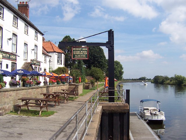 The Bromley at Fiskerton
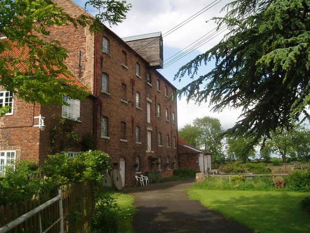 Fiskerton Mill
On the riverbank, just beyond Fiskerton, is a plaque commemorating the official opening of the Trent Valley Way, an 84 mile (134 kilometre) walkway along the river, opened in July 1989. This long distance footpath runs all the way from Long Eaton near Nottingham to West Stockwith near Gainsborough.
Leaving the river, you head north to Rolleston. Holy Trinity church in the village has a 12th and 13th century interior and 14th century windows. Kate Greenaway, author and illustrator of Victorian children's books, spent much of her childhood in the village.
To the north-west is Southwell Racecourse. The racecourse owes its existance to Archbishop Thomas of Beverley, who in 1110 encouraged the giving of alms in the north porch of Southwell Minster every Whit Monday. This event became an annual celebration, and sports and other attractions were added. The races were originally run at Low Wongs in Southwell, but were later moved to the current site on flat ground by the River Greet.
St Peter and St Paul church in Upton, Newark and Sherwood, perched on a hill to the north of the route, has a prominent nine pinnacle tower. The village was the birthplace of James Tennant, professor of Mineralogy at Kings College, Cambridge, and the man who cut the Koh-i-Noor diamond for Queen Victoria's crown.
Returning to Southwell, the walk crosses the track bed of a railway line that ran from Southwell to Rolleston Junction. This short branch line opened in 1847; operated by horse traction in its early years, it was used to carry special trains to the racecourse until 1964.
Acknowledgment: Text derived from the Out and Out Series; Discovering the Countryside on Foot. Pictures courtesy of Wikipedia.


