Hanging Stone and Lud's Church
A walk across iconic moors to a spectacular wooded gorge
Google Maps Open Source Maps| Statistics and Files | ||
|---|---|---|
| Start: Roach End | Distance: 3.7 miles (6.0 km) | Climbing: 206 metres |
| Grid Ref: SJ 99577 64486 | Time: 2 hours | Rating: Moderate |
| GPX Route File | Google Earth File | My Walk |
| Statistics | |
|---|---|
| Start: Roach End | Distance: 3.7 miles (6.0 km) |
| Climbing: 206 metres | Grid Ref: SJ 99577 64486 |
| Time: 2 hours | Rating: Moderate |
| GPX Route File | Google Earth File |
Ordnance Survey Explorer Map (1:25,000)
The Walk: This walk explores a corner of the Peak District National Park, passing through rocky moorland and woodland that forms part of a nature reserve. It begins at Roach End, a viewpoint at a bend on an unfenced moorland road, and continues along the spine of a ridge.
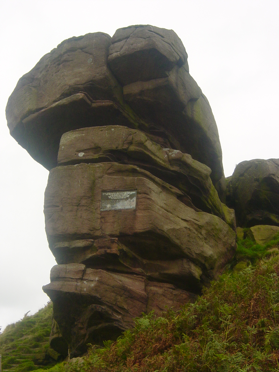 Hanging Stone
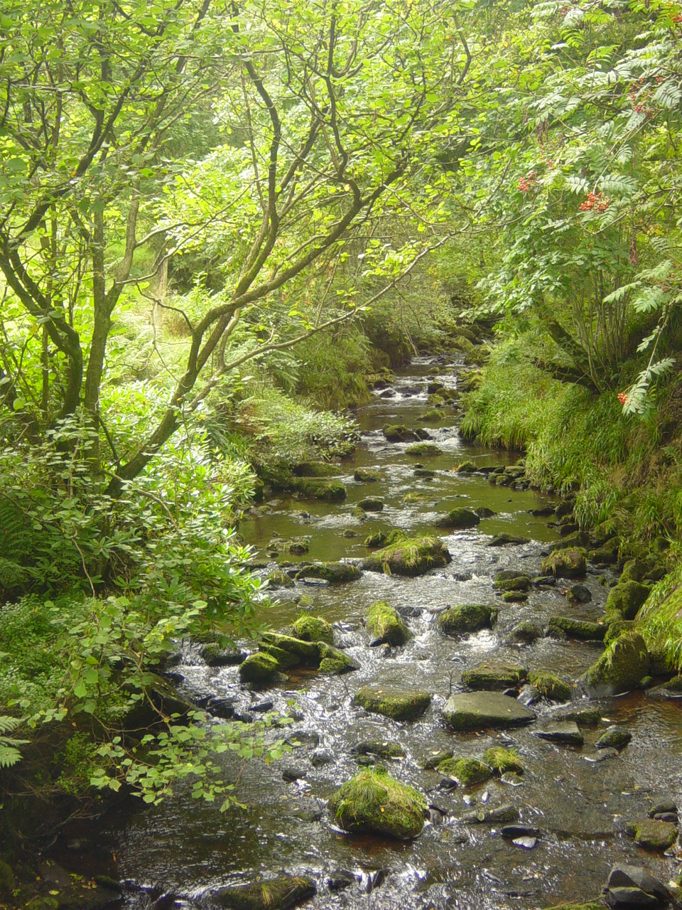 Black Brook
In winter, severe weather conditions often ravage the moorland, so lower growing vegetation such as heather and bilberry is predominant. This is sheep farming country in the lower reaches and the heather moorland is a draw to walkers, and rock climbers who challenge themselves to the sheer gritstone edges on the outcrops and ledges of the Roaches.
The dry-stone walls that punctuate this wild and rugged moorland are made from millstone grit, which forms the underlying geology of the area. A rough, hardly sandstone, it makes for well drained paths with a sandy feel under foot.
As you walk along the ridge, you can clearly see the difference between old and new dry-stone walling. The undisturbed rocks are very dark and have a good growth of lichen, while newly broken rocks have a bright pink hue.
Outcrops of the underlying millstone grit are often weathered into fascinating patterns and shapes. After descending from the ridge, a short diversion leads you to one such outcrop, Hanging Stone. On it is a plaque in memory of a relative of the previous landowner, killed in World War Two.
You then skirt the lower slopes of the ridge to reach the more sheltered landscape of the Dane Valley. Birch, Oak, Holly, Pine and Larch have all taken a hold in the valley, producing a forest to contrast strongly with the bleak windswept moorland above. Grasses, Bracken, Bilberry and Heather all grow in the shelter of the trees. Near to the path, if you wish to descend a little lower from the route, is the confluence of Black Brook and the River Dane.
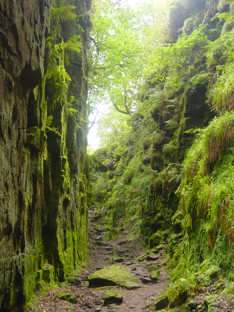 Lud's Church
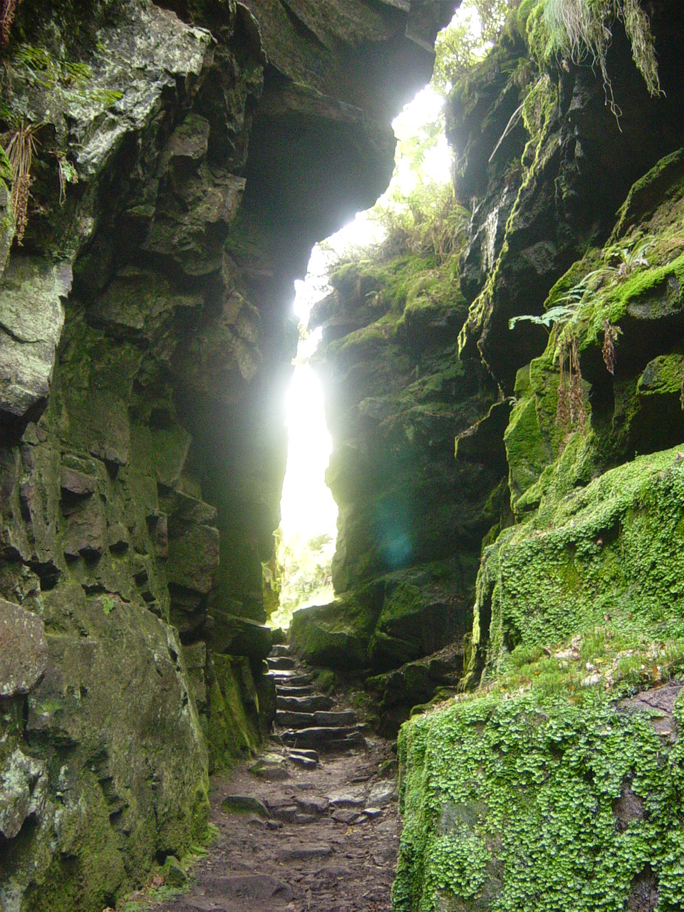 Steps out of Lud's Church
In the depths of Forest Wood is a natural cleft in the hillside. It was caused by a landslip and runs along the line of a geological fault. The clefts name is Lud's Church which has an interesting history.
In the late 14th century, John Wycliffe of Oxford propounded an early version of Protestantism. Wycliffe's followers, known as Lollards, were branded as heretics and were driven underground by repressive statutes in the 15th century. As a result, they were forced to hold their services in secret. One of the local landowning families were Lollards and used this narrow wooded gorge for such services. The name Luds Church is a corruption of 'Lollard's Church'.
The route wanders through the forest to emerge on the ridge's sheltered slopes, and a short steep climb takes you back to the start of the walk at Roach End.
Acknowledgment: Text derived from the Out and Out Series; Discovering the Countryside on Foot. Pictures courtesy of Wikipedia.


