Church Stretton and The Long Mynd
From a market town in a lush valley to high heather moors
Google Maps Open Source Maps| Statistics and Files | ||
|---|---|---|
| Start: Long Mynd Hotel, Church Stretton | Distance: 7.7 miles (12.3 km) | Climbing: 526 metres |
| Grid Ref: SO449935 | Time: 3-4 hours | Rating: Hard |
| GPX Route File | Google Earth File | About Church Stretton |
| Statistics | |
|---|---|
| Start: Long Mynd Hotel, Church Stretton | Distance: 7.7 miles (12.3 km) |
| Grid Ref: SO449935 | Time: 3-4 hours |
| Climbing: 526 metres | Rating: Hard |
| GPX Route File | Google Earth File |
Ordnance Survey Explorer Map (1:25,000)
The Walk: Shropshire is the county of contrasts, combining quiet, prosperous farmlands with wild, windswept heights. This walk gives a taste of both. It begins at Church Stretton, a market town that became a holiday resort in the middle of the 19th century. The town lies on a valley floor that carries the road and rail links between the ancient towns of Ludlow and Shrewsbury.
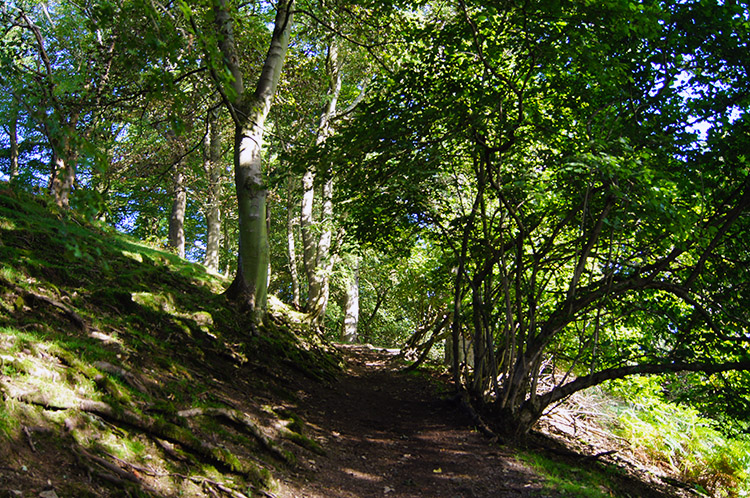 Woodland near Townbrook Valley
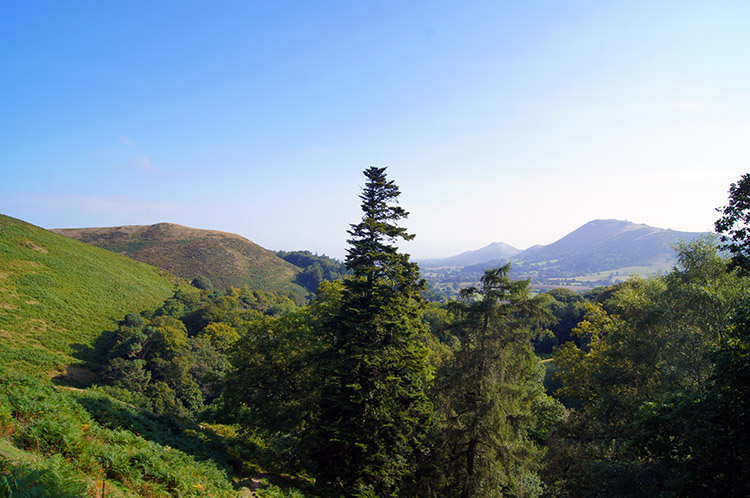 Looking to Caer Caradoc from Burway Hill
The Romans recognised the importance of this valley to communications. A Roman road, joining Wroxeter and Leintwardine also runs through the town, and gives the place its name. Stretton is derived from 'Street Town'.
There are several other Strettons in the area. According to legend, they were inadvertently named by King Charles I on his way through the valley. He remarked, on entering a village, what a little place it was, and it became known as Little Stretton. At the next town he commented on the attractive church, so then it became Church Stretton. When told the next village was also Stretton, he exclaimed "it is all stretton here" and it was thenceforth All Stretton.
The church Charles admired, St Laurence, can still be seen at the start of the walk. There was a church here at the time of the Domesday Book (1086) and the nave dates from soon after that. Further work was done in the 13th and 14th centuries, which accounts for the fine medieval timber roofs. A carving of Sheela-na-gig, a pagan female fertility symbol, can be seen on the north wall of the nave.
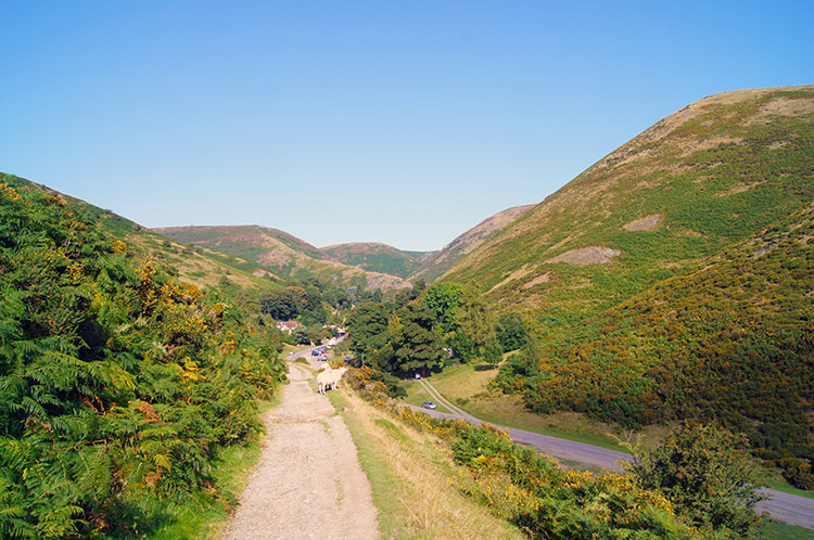 Carding Mill Valley
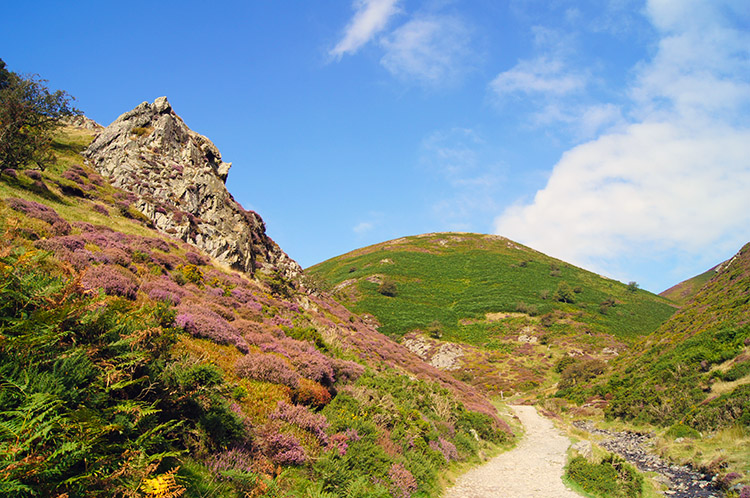 Rock outcrop beside Mott's Road
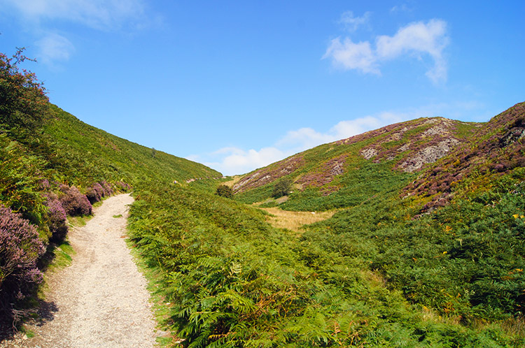
From the churchyard, you wind through the town towards the bulk of Long Mynd, a range of hills occupying 70 square miles. They are made of a volcanic pre-Cambrian rock, the oldest rock to be found in England. The steep eastern edges of Long Mynd are cut by a succession of deeply incised valleys, and the route goes up one of these.
Carding Mill Valley is a renowned beauty spot, now owned by the National Trust. It gets its name from a 19th century wool mill which replaced a flour mill that was already established here in the 15th century. The. wool mill continued in business until early in the 20th century, and was the centre of a thriving weaving industry producing cloth and rugs. The buildings have now been converted to recreational, business and residential use.
A tributary stream flows down from New Pool Hollow on the left. The reservoir constructed here in 1899 to meet the increased demands of the growing resort below, continued to fill this function until 1977. Further up the valley, at the site of the upper car park, another mill pool possibly provided the original water supply to the first mill, and later became a swimming pool.
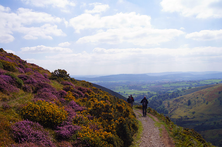
 Jack Mytton Way
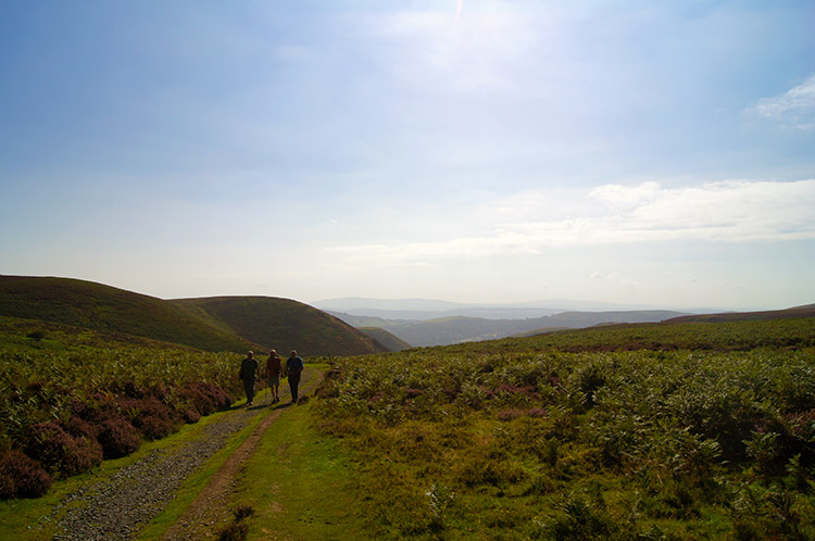 Looking back from Calf Ridge
A leat was built to divert the water from the occasionally unmanageable stream to the mill races, and traces of it remain in the valley. Just below this, a path along another tributary stream to the left leads to the waterfall of Light Spout.
Your route, though, takes you out of the valley by way of Mott's Road. The building of this track was financed by subscriptions raised by a Doctor Mott, who wanted to improve access to some of his more isolated patients living in farms on the other side of the Mynd.
Mott's Road leads across bleak moorland covered with heather, nracken and bilberries. Up until the 1880's bilberries were harvested by the poor of the district. In 1885 the crop was worth £600 pound.
 A meeting on Long Mynd
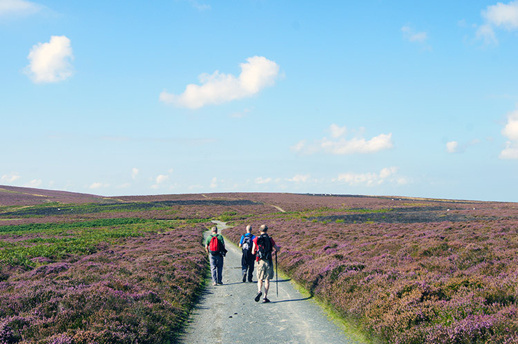 Following the Shropshire Way
Mott's Road meets The Port Way, an ancient track that was in use in the Bronze Age. It runs along the crest of a ridge that was once tree covered. It was cleared over the years to provide grazing for cattle and sheep, and The Port Way became an important drovers road.
Today, it provides fine views of the surrounding hills. The fort on the summit of Caer Caradoc to the east is supposed to have been the site of a last stand of the Celtic chieftain Caractacus in his fight against the Roman legions, led by Ostorius Scapula in 50 AD.
 View to the west from Pole Bank
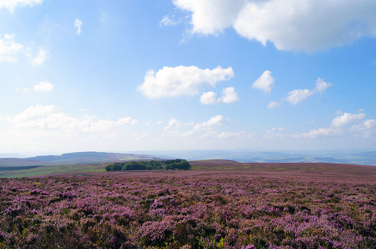 Purple glory
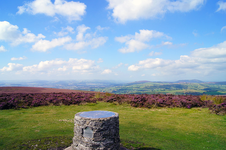
You carry straight on along the ridge to the summit of Pole Bank, 1,693 feet (516 metres) above sea level. Here a toposcope points out such distant landmarks as the Brecon Beacons, Cadair Idris, the Malvern Hills and the Fiddlers Ferry Power Station on the Mersey; though you will need crystal clear weather conditions to pick them all out.
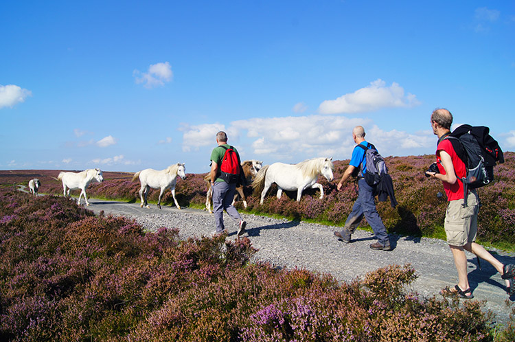
From here, you carry on a little further along the Port Way, which shares the path with the Jack Mytton Way, a walking, cycling and horse riding bridleway which stretches across the Shropshire Hills. That is until you pass Pole Cottage which is attractively placed, sheltered by a stand of tall pines, by turning left to follow a footpath along the edge of Round Hill. In late summer, this area, as is Long Mynd, is awash with the brillliant purple colour of flowering heather.
 On the path skirting around Grindle
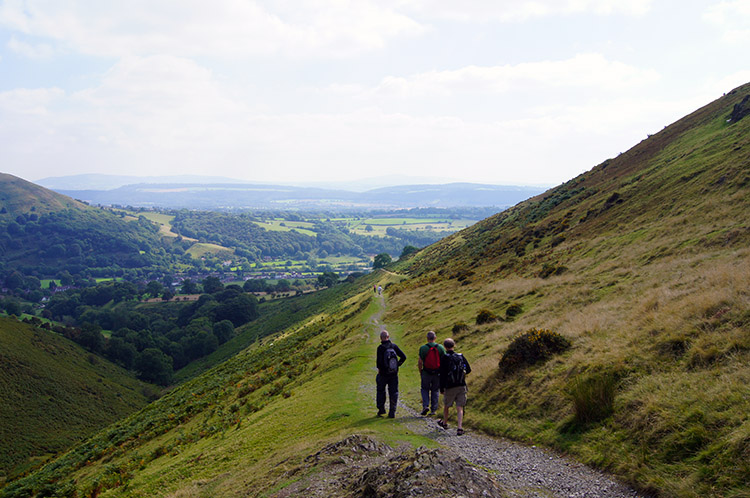 After Grindle Hollow the path skirts Callow
The walk now continues downhill, on a path disecting the gorgeous hummocks of Grindle and Callow, two small but striking hills, 459 metres and 411 metres high respectively. After rounding Callow you complete the descent by following a path above Small Batch towards Little Stretton. Around here, views of Caer Caradoc and the Lawley Hills are perfectly framed. After walking the outskirts of Little Stretton you cross the beck of Ashes Hollow and climb a short distance up to some fields to The Owlet.
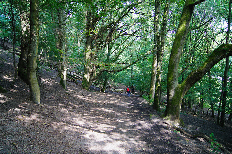 Woodland above and parallel to Ludlow Road
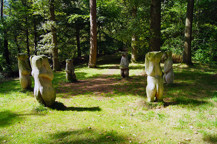 Circle of friendly bears at Long Mynd Hotel
Once in the woodland you follow a path on a parallel line to the Ludlow Road all the way back to Church Stretton. From the woodland the path leads down to Ludlow Road before another track leads straight back to a bridleway track though more woodland and back to Long Mynd Hotel; from where it is a walk back into town and the starting point of the walk.


