Turvey, Ouse Valley Way and Emmaus Village Carlton
A Tour of Turvey - A walk from a lovely stone-built village set in a verdant valley
Google Maps Open Source Maps| Statistics and Files | ||
|---|---|---|
| Start: Turvey | Distance: 4.6 miles (7.4 km) | Climbing: 49 metres |
| Grid Ref: SP 94187 52488 | Time: 2 hours | Rating: Easy |
| GPX Route File | Google Earth File | About Turvey |
| Statistics | |
|---|---|
| Start: Turvey | Distance: 4.6 miles (7.4 km) |
| Climbing: 49 metres | Grid Ref: SP 94187 52488 |
| Time: 2 hours | Rating: Easy |
| GPX Route File | Google Earth File |
Ordnance Survey Explorer Map (1:25,000)
The Walk: The village of Turvey plays host to some attractive features. Its houses and cottages are built from a mellow limestone, and there is a mill complete with mill pond, as well as a Saxon church. At the western edge of the village is the oldest stone bridge in Bedfordshire, spanning the lazy River Great Ouse.
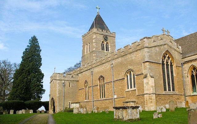 All Saint's church, Turvey
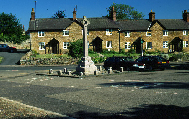 The village square and war memorial in Turvey
The walk explores the village of Turvey, once famous for its lace-making, and takes a detour into the surrounding countryside, from which its favoured position, surrounded by parkland in the lush valley of the Ouse can best be appreciated.
You start in the village square by the War Memorial, the Three Cranes pub and All Saint's church. You enter the churchyard and pass through a lychgate set in billowing yew hedges. Huge black oak doors embellished with some splendid 13th century ironwork - probably by John of Leighton, who also worked on Westminster Abbey - lead into the interior that was restored by Sir Gilbert Scott in 1852. Saxon work can still be seen in the rounded arches high on the south wall of the nave and in the tower, and there is a 13th century wall painting of the Crucifixion in the Lady Chapel. There are also four interesting 16th century monuments to members of the Mordaunt family, the lords of the manor from the 13th to the 18th century.
Leaving Turvey, you follow the Ouse Valley Way and pass Chantry Farm, with its ecclesiastical buildings and thick yew hedges, then follow the boundary of the late Georgian Turvey House, which is set in lovely parkland dotted with mature trees. The climb gives good views back into the village as you head east along a bridleway across fields. To the north is St Mary's, the parish church of Carlton, though it stands outside the village.
You descend along a bridleway through fields to a main road, then cross into woods and meadowland. On this stretch of countryside walking you pass the buildings of the Emmaus Village Carlton charity. Afterwards, as you return to Turvey, you pass a Jacobean manor house known as Turvey Abbey. The house took its name from the Benedictine Abbey of Bec, in Normandy, which once owned the land, but it was not used by a religious order until recently. It is now the Priory of Our Lady of Peace and houses Benedictine nuns.
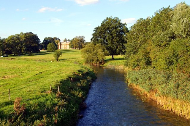 The parkland of Turvey House
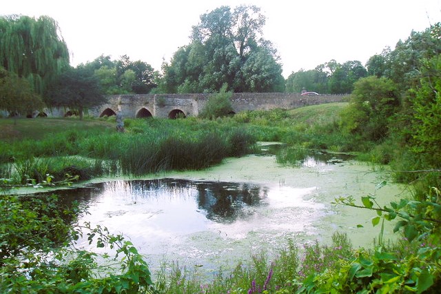 Turvey Bridge on the River Great Ouse
Beyond Turvey Abbey, down the main road, is a lovely square of 17th century workers houses, but our route goes through meadows and woodland to the River Great Ouse, where two statues known locally as Jonah and his wife stand in the mill pond, in front of the massive bulk of the renovated mill. Jonah once stood outside Ashridge House and was brought here in 1844. The head and body of his wife were found at the mill and assembled to join Jonah in the pond in 1953.
Nearby are Turvey's 11-arched 13th century bridge and the 17th century Ye Three Fishes Inn. ne of Guy Fawkes co-conspirators in the Gunpowder Plot (16O5) was arrested here. The pub has paid a price for its picturesque setting. Several flood gauges set in the wall testified to periodic inundations.
Walking back along the main road, you reached the Central Stores. The building, whose structure was altered in 1840, was once a coaching inn called the Tinker of Turvey, which dated back to 1150. The inside, featuring the Tinker, old Nell his wife, and their dog, is now in Luton Museum. Inside the stores, there are iron rings on the walls where prisoners destined for Bedford Gaol was shackled while waiting to change coaches.
Acknowledgment: Text derived from the Out and Out Series; Discovering the Countryside on Foot. Pictures courtesy of Wikipedia.


