Kirknewton, Hethpool Linn and Yeavering Bell
Upland country, a waterfall and a hill fort in the Cheviot Hills
Google Maps Open Source Maps| Statistics and Files | ||
|---|---|---|
| Start: Kirknewton | Distance: 7.1 miles (11.4 km) | Climbing: 435 metres |
| Grid Ref: NT 91396 30260 | Time: 3-4 hours | Rating: Moderate |
| GPX Route File | Google Earth File | About Kirknewton |
| Statistics | |
|---|---|
| Start: Kirknewton | Distance: 7.1 miles (11.4 km) |
| Climbing: 435 metres | Grid Ref: NT 91396 30260 |
| Time: 3-4 hours | Rating: Moderate |
| GPX Route File | Google Earth File |
Ordnance Survey Explorer Map (1:25,000)
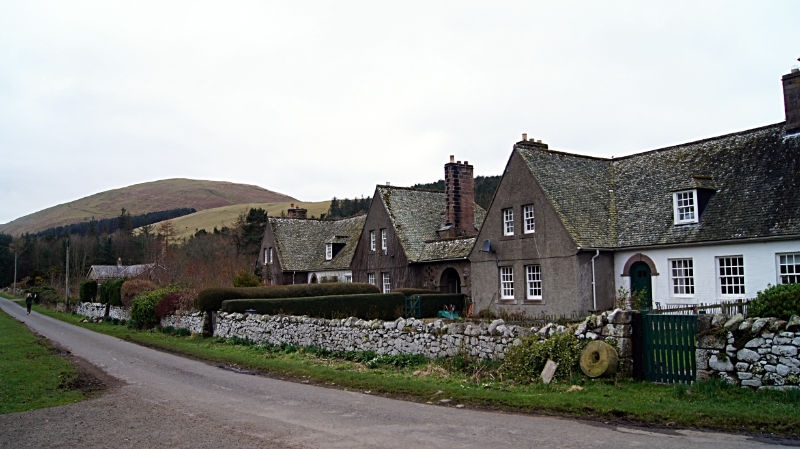
The Walk: The walk takes in some of the most attractive features of rural Northumberland: an ancient church; a quiet track leading to a sheltered wooded valley; rough upland pasture and moorland; and sweeping views of remote hill country. It begins in the beautifully situated village of Kirknewton, which nestles in a valley below Yeavering Bell, a shapely hill crowned by an extensive iron age fort. The village is characterised by the thick stone walls of its cottages, built to withstand attacks from Scottish border raiders. Its remarkable early English church has a chancel and south transept with pointed tunnel vaults set on walls barely three feet high. Inside is a stone carving, believed to be Saxon, showing three kilted Magi in adoration to the kings.
 Hethpool and Great Hetha
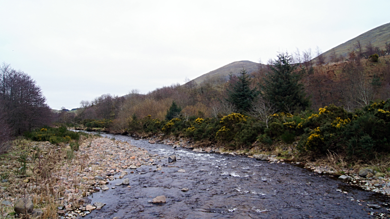 College Burn
From the village, you follow a track into the valley of College Burn, a salmon stream whose source is on the west flank of the Cheviot, six miles to the south. The burn is heavily wooded, in contrast to the bare hills above. A path through rough pasture descends to the burn at Hethpool Linn, a delightful waterfall in a sheltered spot. From Hethpool Linn, cross the footbridge which provides a perfect viewing spot for the waterfall and follow the north bank of College Burn upstream to the remote hamlet of Hethpool, which is no more than a grand house and a short row of terraced cottages.
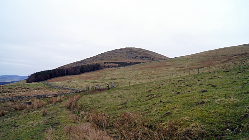
From Hethpool, cross College Burn for a second time, returning to the south side of the watercourse. You are now following the route of the notable St Cuthbert's Way long distance footpath. The path heads east across an open hillside, where red grouse are a common sight and where grazing sheep cautiously watch you as walk by. The path eventually reaches the remote farm of Torleehouse. Soon after passing the farm take a deep breath as the real climbing of the walk begins. There are benefits to the workout though because as you climb the hill, views open out on all sides. The Cheviot Hills, dotted with remote farms and cut by hidden valleys, roll away to the south. To the north, the hills end abruptly as the landscape becomes a flat patchwork of fields, irrigated by the River Tweed and its tributaries.
 St Cuthbert's Way
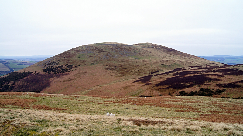 Yeavering Bell
As you continue climbing, Yeavering Bell dominates the way ahead, its stately form drawing the eye. The stiff climb towards its twin summits, one of 1,164 feet (355 metres) and one of 1,184 feet (361 metres), is rewarded by some fine views. Including one back down to the starting point of the walk in Kirknewton.
Around the twin summits is an extensive Iron Age settlement. A stone rampart encloses an area of 13 acres scarred with the pock marks of 130 circular stone huts, evidence of what must have been a very large community for the period. From the site of the forts you pass the remains of an ancient tower at Old Yeavering and return to Kirknewton.
Acknowledgments: Text derived from the Out and Out Series; Discovering the Countryside on Foot. Pictures courtesy of Wikipedia.


