City of Durham and the River Wear
A northern cathedral city walk on the banks of the River Wear
Google Maps Open Source Maps| Statistics and Files | ||
|---|---|---|
| Start: Market Place | Distance: 4.5 miles (7.2 km) | Climbing: 200 metres |
| Grid Ref: NZ 27397 42515 | Time: 2-3 hours | Rating: Easy |
| GPX Route File | Google Earth File | The City of Durham |
| Statistics | |
|---|---|
| Start: Market Place | Distance: 4.5 miles (7.2 km) |
| Climbing: 200 metres | Grid Ref: NZ 27397 42515 |
| Time: 2-3 hours | Rating: Easy |
| GPX Route File | Google Earth File |
Ordnance Survey Explorer Map (1:25,000)
The Walk: This walk passes through lots of attractive riverside and woodland scenery, all which is very popular with the folk of Durham and visitors alike. While this is delightful in itself, it is the finale of the walk that takes the breath away, with sumptuous views of the towers and walls of Durham Cathedral and Durham Castle rising majestically above the wooded cliffs which shield the River Wear in the city environs. Altogether, this walk is a thrill from start to finish.
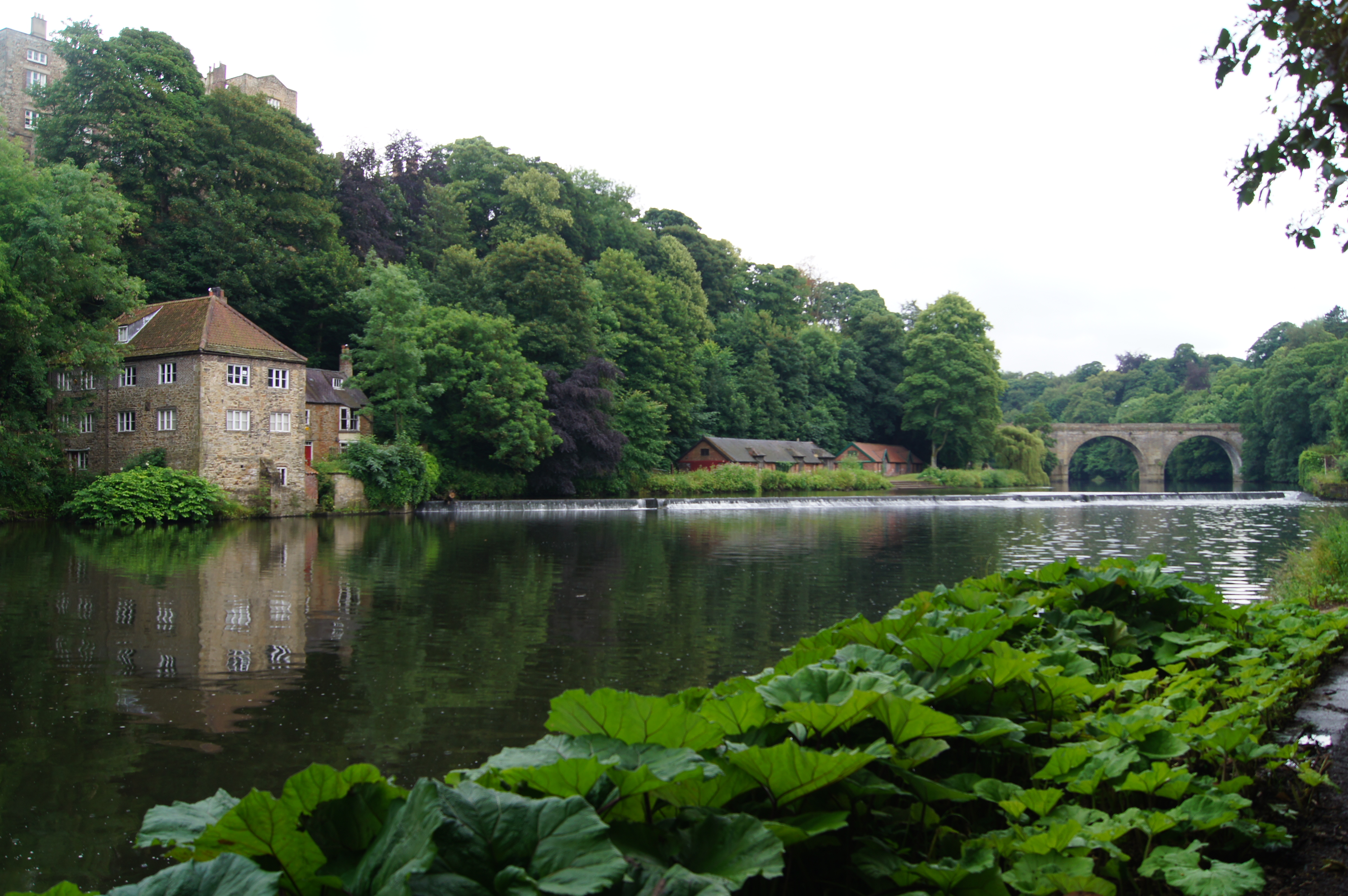 River Wear, Old Fulling Mill and Prebends Bridge
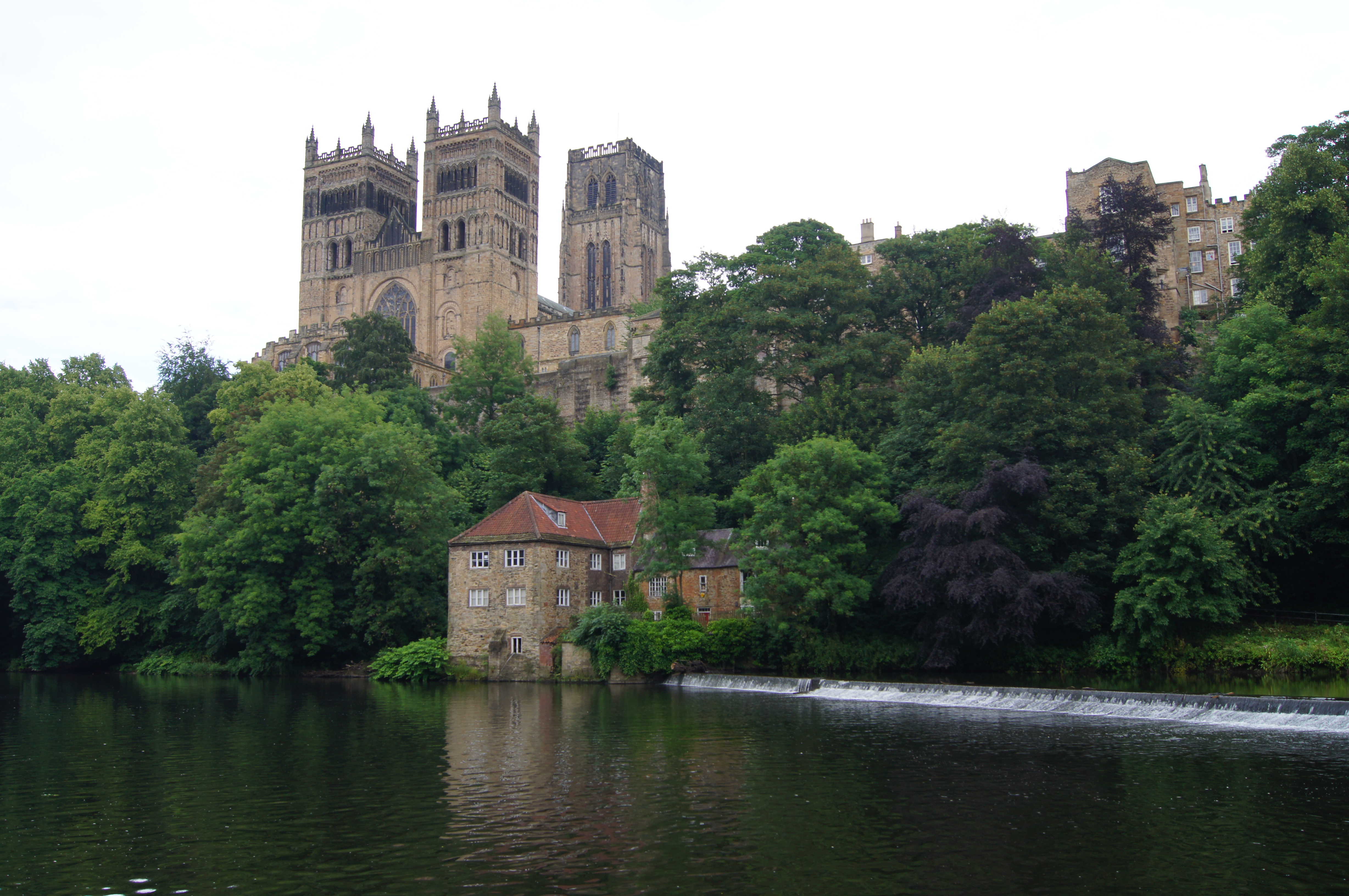 River Wear and Durham Cathedral
Beginning by the old toll gate in the market place, the walk initially heads east on city streets but soon heads down to the River Wear via the crossing of Baths Bridge, an elegant single span footbridge. Now the walk follows Elvet Waterside, past St Cuthbert's Society Boat Club and Durham Amateur Rowing Club, making the sweep from eastward to southward while doing so. It is gorgeous on this stretch of the River Wear. Look out for where Old Durham Beck feeds into the river on the far east bank.
Soon the climb from the river is made to the heady heights of Maiden Castle, an old Iron Age hill fort and one of the earliest sites in the city. From the ancient site the walk continues through the deep and lush greenery of Great High Wood, a beautiful woodland filled with semi ancient oak and beech trees. A special sight in the woods is reserved for those of you doing this walk when the bluebells are out in bloom. They are especially stunning here. The woodland is also famed for its wide variety of birdlife.
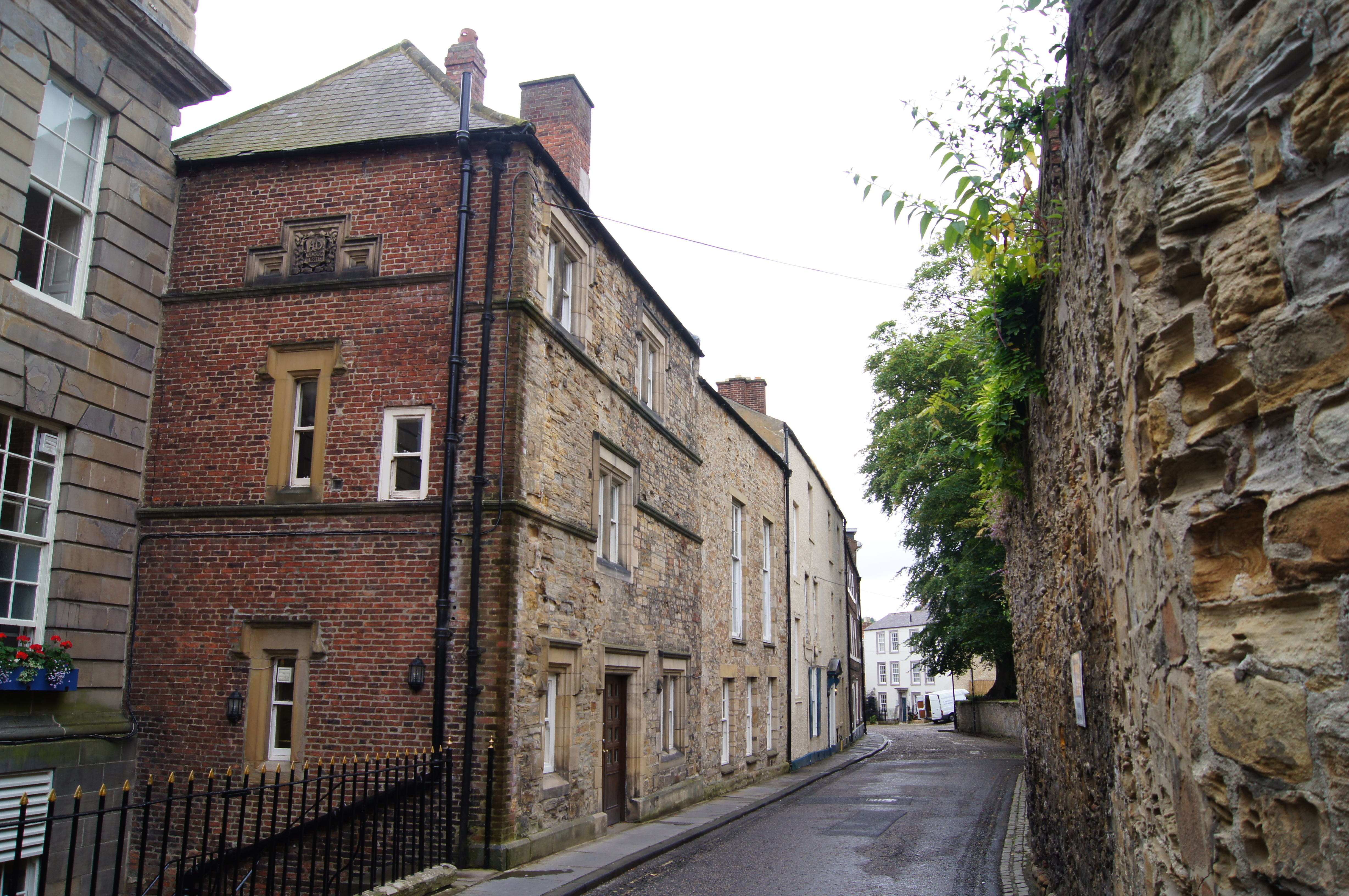 North Bailey, Durham
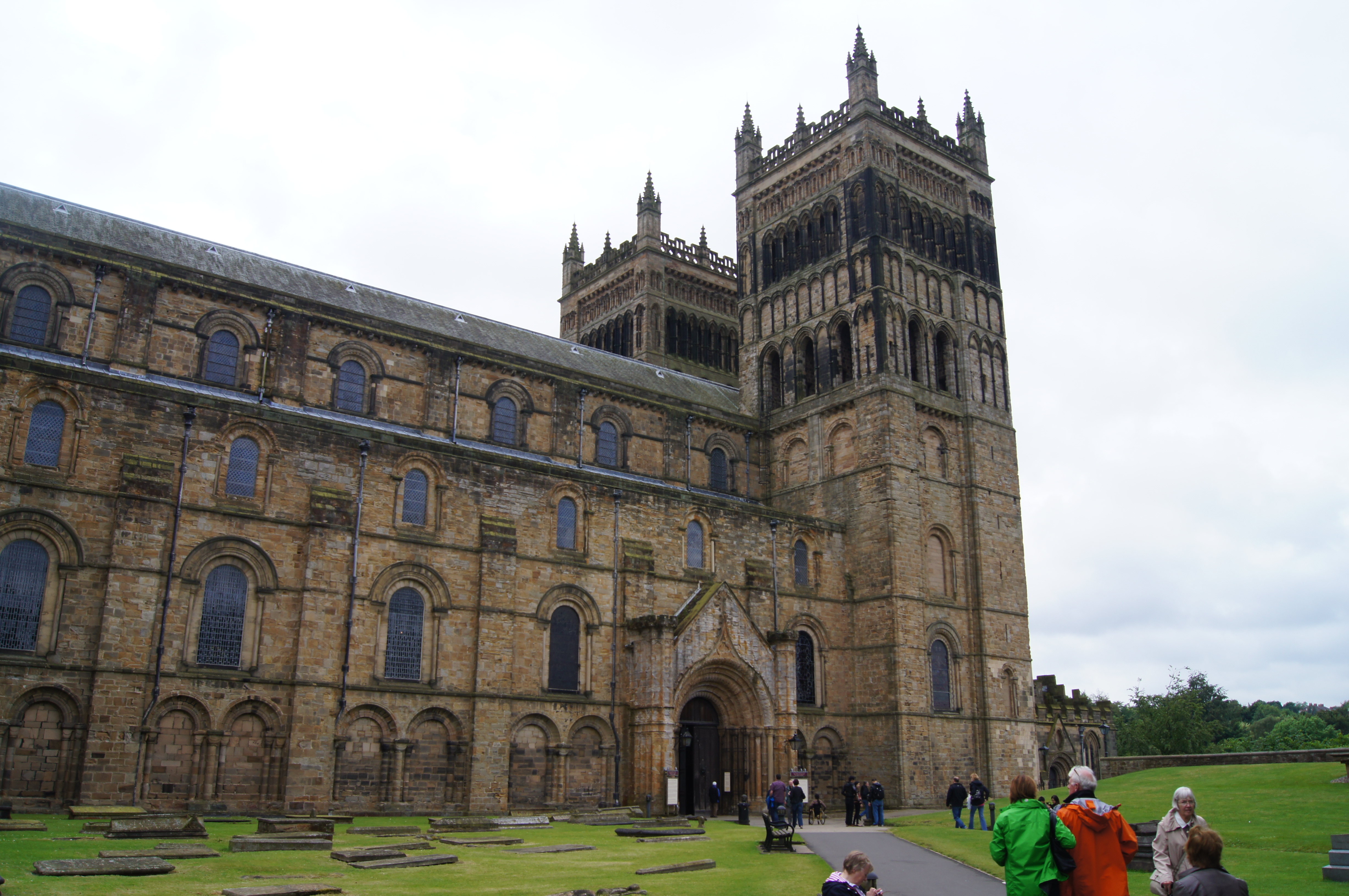 Durham Cathedral
The woodland stage of the walk ends at the southern extremity of the route, near to the north side of Pinnock Hill. A sweeping turn from heading south to heading north is made, following Hollingside Lane to Buck's Hill where Durham University's Botanic Gardens are sited. You may take a break from the walk route here to explore the beautiful displays on offer within the 10 hectare site. Refreshments are available in the gardens so its a good place to stop before the thrilling finish to the walk.
From the gardens and adjoining university campus the walk leads to Little High Wood and soon after an urban section back down to the river at Prebends Bridge. From here to Framwellgate Bridge the walk is truly stunning. There is much to admire including the Old Fulling Mill beside a river weir. Here looking up from the deep river gorge to the high towers of Durham Cathedral is a awesome sight. As are the walls of Durham Castle which are the last sight of note on the east bank before climbing back to street level at Framwellgate Bridge. Soon after your walk is ended back at Market Place but surely your day is not. There are all the sights seen to visit now, especially cathedral and castle. Oh, quirky Durham Museum is a must too.
Acknowledgments: Text derived from the Out and Out Series; Discovering the Countryside on Foot. Pictures courtesy of Wikipedia.


