Elterwater, Loughrigg Tarn, Skelwith Bridge and Elter Water
A short Lakeland walk that visits two very different lakes
Google Maps Open Source Maps| Statistics and Files | ||
|---|---|---|
| Start: Elterwater | Distance: 3.7 miles (5.9 km) | Climbing: 132 metres |
| Grid Ref: NY 32790 04759 | Time: 2 hours | Rating: Easy |
| GPX Route File | Google Earth File | About Elterwater |
| Statistics | |
|---|---|
| Start: Elterwater | Distance: 3.7 miles (5.9 km) |
| Climbing: 132 metres | Grid Ref: NY 32790 04759 |
| Time: 2 hours | Rating: Easy |
| GPX Route File | Google Earth File |
Ordnance Survey Explorer Map (1:25,000)
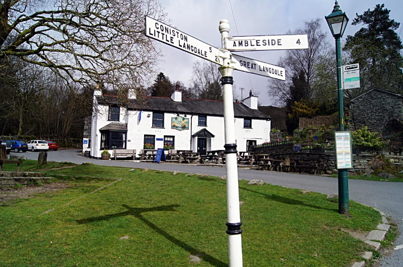
The Walk: The village of Elterwater, a cluster of stone houses below the Langdale Pikes, grew up around the bridge over Great Langdale Beck. This was carefully sited where the solid rock of the gorge upstream gives way to the peaty mud at the fringes of Elter Water. Just upstream from the bridge are the remnants of a waterwheel. The mill it powered produced gunpowder for use in Lakeland mines and quarries.
 Elterwater
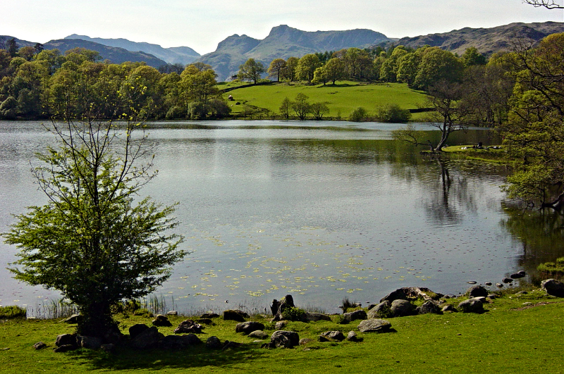 Loughrigg Tarn
The sheared, slaty rocks that form the rugged scenery in this part of the Lake District were formed from ancient lava and volcanic ash, and are known geologically as the Borrowdale Volcanic Group. The stone is almost as hard as flint, and was used in the same way by Stone Age man to make axes and other sharp implements. Today, it is used everywhere in the roofs and walls of buildings, and in the dry stone walling that defines the boundaries here. It also offers shelter for the hardy Herdwick sheep that graze the slopes.
The first part of the route leads along quiet lanes towards Loughrigg Tarn. It is as attractive now as it was in 1810, when William Wordsworth described it in his 'Guide to the Lakes' as "a most beautiful example of a miniature lake, a quiet and fertile domain, with a margin of green firm meadows, surrounded by rocky and barren steeps, overlooked by the solemn pikes of Langdale" (see my Loughrigg Tarn walk here).
On the uphill stretch to the lake, it is worth pausing to take in the view to the south-west of the Old Man of Coniston, with Wetherlam nearest, then Swirl How and Grey Friar (see my walk here). The jagged outline of the Langdale Pikes (see my walk here) stands out to the west. A lane leads down from the tarn to join the Langdale road at Skelwith Bridge, a two span structure across the River Brathey. Before the creation of Cumbria, the river formed the boundary between Westmorland and Lancashire.
 Skelwith Force
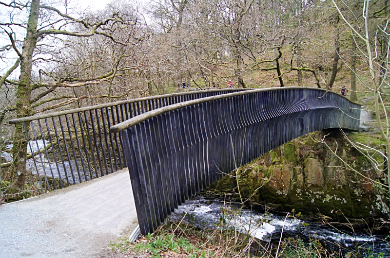 Footbridge near Skelwith Force
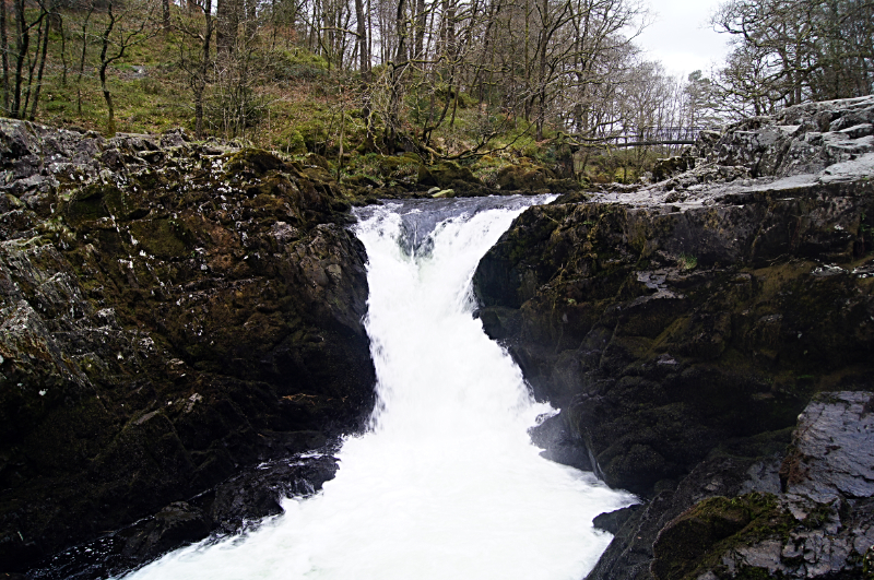
Just before Skelwith Bridge are the shop and workshop of the Kirkstone Slate Company. The attractive local green slate stone is made from volcanic ash laid down in thin layers that split easily, like slate. It has been sent all over the world for making fireplaces and ornaments, and for facing some fine buildings.
The volcanic rocks are very resistant to erosion by water or ice, and the bar of this rock has formed a waterfall, Skelwith Force, where the River Brathey foams and cascades into deep, greenish pools. The falls are especially impressive after rain, when the river is in spate.
Downstream from here, the Brathey flows gently over sand, silt and clay washed up from the upper valleys. It runs into a saucer shaped hollow scoured out of the softer rock by glaciers, and now filled with the still waters of Elter Water.
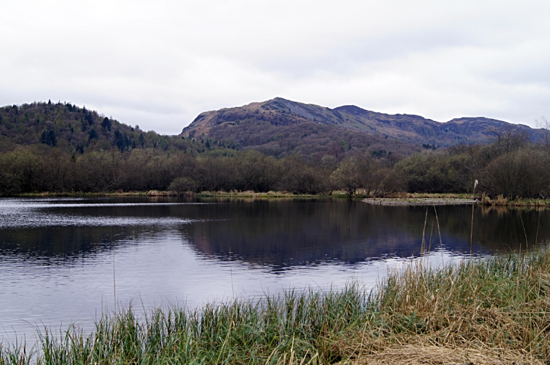 Elter Water
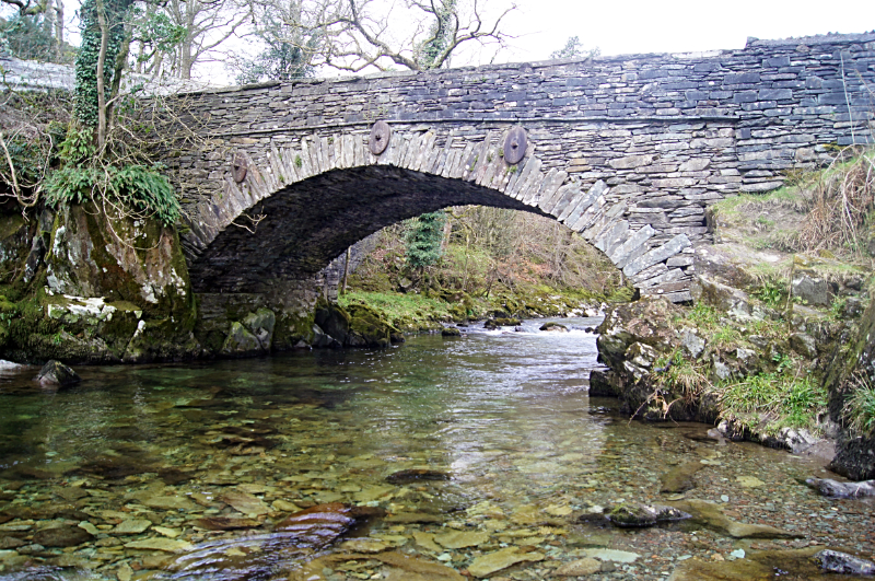 Great Langdale Beck at Elterwater Bridge
Elter Water is slowly shrinking; at one time, the flat land around the Water was part of the lake. Gradually, reeds have colonised the sediment on its fringes, a process which is still continuing.
The path goes through a National Trust woodland, where oak, ash, larch, birch and beech trees can be found. By the waterside are willows and alders. Alder is particularly well suited to a waterside habitat; its nut like seeds float, ensuring that they are distributed along the banks.
From Elter Water, the route returns on a well maintained hard path to Elterwater Bridge and the village of Elterwater, running parallel with Great Langdale Beck, a clear stream flowing briskly over a bed of pebbles.
Acknowledgments: Text derived from the Out and Out Series; Discovering the Countryside on Foot. Pictures courtesy of Wikipedia.


