Welburn, Castle Howard and Coneysthorpe
Along the edge of a great estate to see follies and historic buildings
Google Maps Open Source Maps| Statistics and Files | ||
|---|---|---|
| Start: Welburn | Distance: 7.0 miles (11.2 km) | Climbing: 166 metres |
| Grid Ref: SE 72134 67818 | Time: 3-4 hours | Rating: Easy |
| GPX Route File | Google Earth File | About Castle Howard |
| Statistics | |
|---|---|
| Start: Welburn | Distance: 7.0 miles (11.2 km) |
| Climbing: 166 metres | Grid Ref: SE 72134 67818 |
| Time: 3-4 hours | Rating: Easy |
| GPX Route File | Google Earth File |
Ordnance Survey Explorer Map (1:25,000)
The Walk: The walk skirts the landscaped parkland of Castle Howard, with its man-made river and lakes, and its interesting and dramatic monuments. Around the route are ancient and gnarled oak trees, some hundreds of years old, and many other magnificent hardwood trees. The attractive village of Welburn is the starting point of the walk. The village's Crown and Cushion public house acquired its name after Queen Victoria's visit to Castle Howard in 1851. The preparations included the building of Castle Howard railway station for her arrival, and the decoration of the route she would have taken from the station. Part of this featured a crown on a cushion outside the present pub.
 Kirk Hill Mausoleum
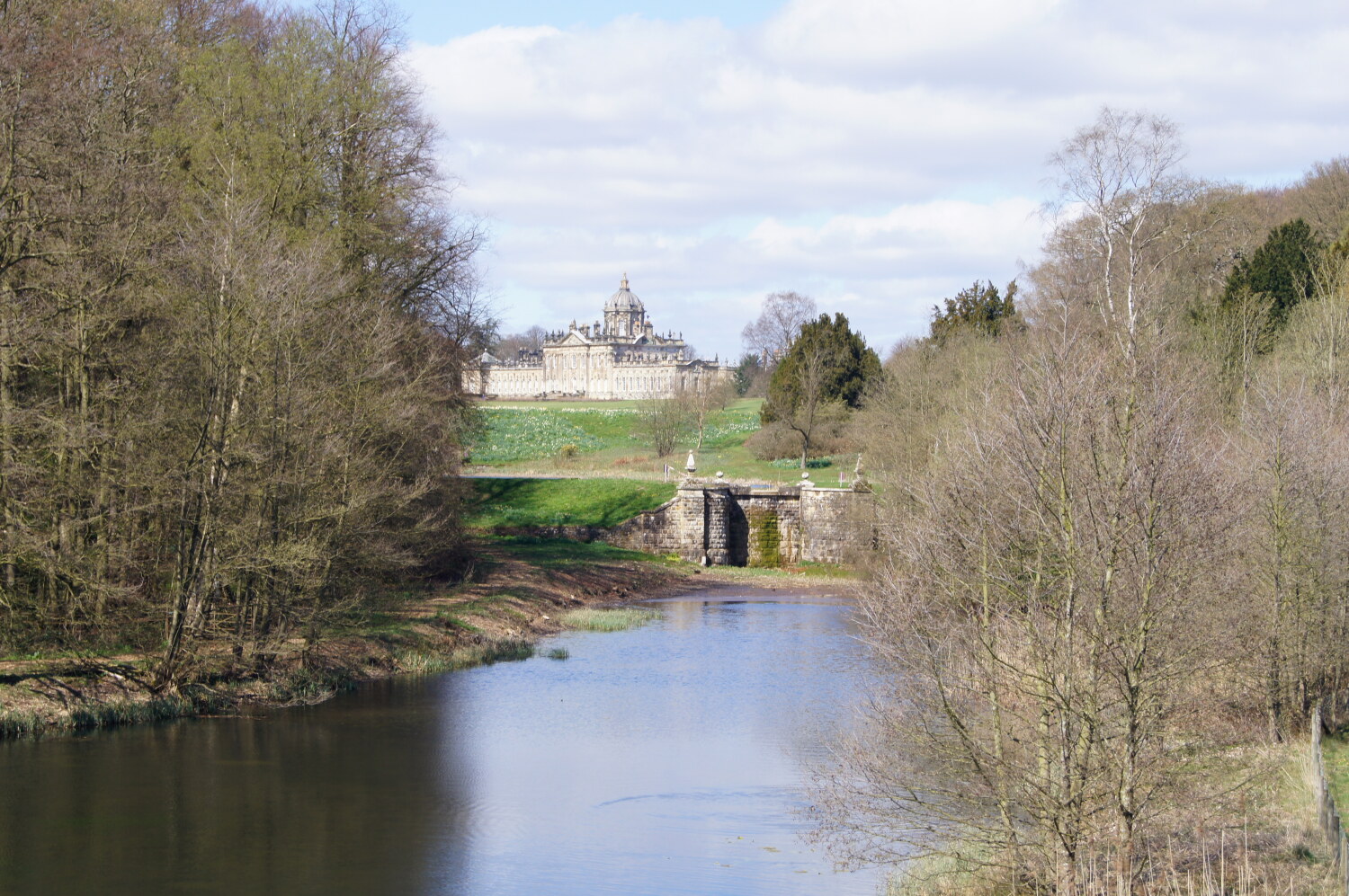 View to Castle Howard from New River
Just outside the village, a broad bridleway leads past the ancient oaks between fields to Pretty Wood. Descending into the wood, you pass another venerable oak tree of enormous girth. Deep in the woods is the Four Faces monument, a folly built in classical style. Although worn and crumbling, this little piece of fantasy seems in keeping with the ancient tranquility of the woods, which in spring, are carpeted with bluebells.
A broad path leads through the woods, a mixture of hardwoods and conifers, and soon there is the first view on the right of the impressive Kirk Hill Mausoleum, which was designed by Nicholas Hawksmoor. Completed in 1733, it is the burial place of the Earl of Carlisle and the Howard family. As you leave the wood, Hawksmoor's great pyramid comes into view on the left; on the top of St Anne's Hill. It contains a portrait bust of Lord William Howard, the first Howard to inhabit the castle in the 16th century. Lord William married Elizabeth Dacre, thereby inheriting estates which included Henderskelfe, where Castle Howard was later to be built.
The track leads down towards the New River Bridge, which dates from the 1740s. This was built to improve the view, but also usefully carries the footpath over the artificial river and to the next stage of the walk.
Ahead is Castle Howard itself, with its Grand Dome a prominent feature. The Dome was not part of the original plan. As the house was built the architect John Vanbrugh borrowed from various architectural styles to which he added his own imaginative touches. In 1940 the dome and a large section of the south front were completely gutted by fire. Twenty years later the dome was rebuilt, and in 1981 the filming of the television series 'Brideshead Revisited' created an opportunity to begin restoring the empty rooms of the south front.
In the centre of the lawns is the Atlas Fountain. A reservoir feeds the fountain and the overflow, and in turn, feeds the South Lake. The water then goes over a cascade into Temple Hole and rushes over Garretts Falls before passing under New River Bridge and joining the natural course in Lowdy Gill.
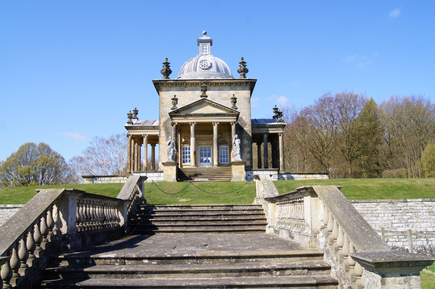
As you head away from the bridge, you come to Vanbrugh's 'Temple of the Four Winds', a summer house on a little promontory, in an atmospheric setting, decorated inside in white and gold. The footpath skirts the estate wall bounding Ray Wood, which is to the east of the house. It was already a wood when Castle Howard was completed in 1759. The third Earl created walks and arbours within the woods, together with scattered statues and fountains. In the middle of the wood is the massive reservoir that supplies not only the lake, but also the river system. Today, new trees replace some of the older ones and a woodland garden of shrubs, trees and rhododendrons has been created. Nature walk leaflets are provided for visitors to Castle Howard's grounds.
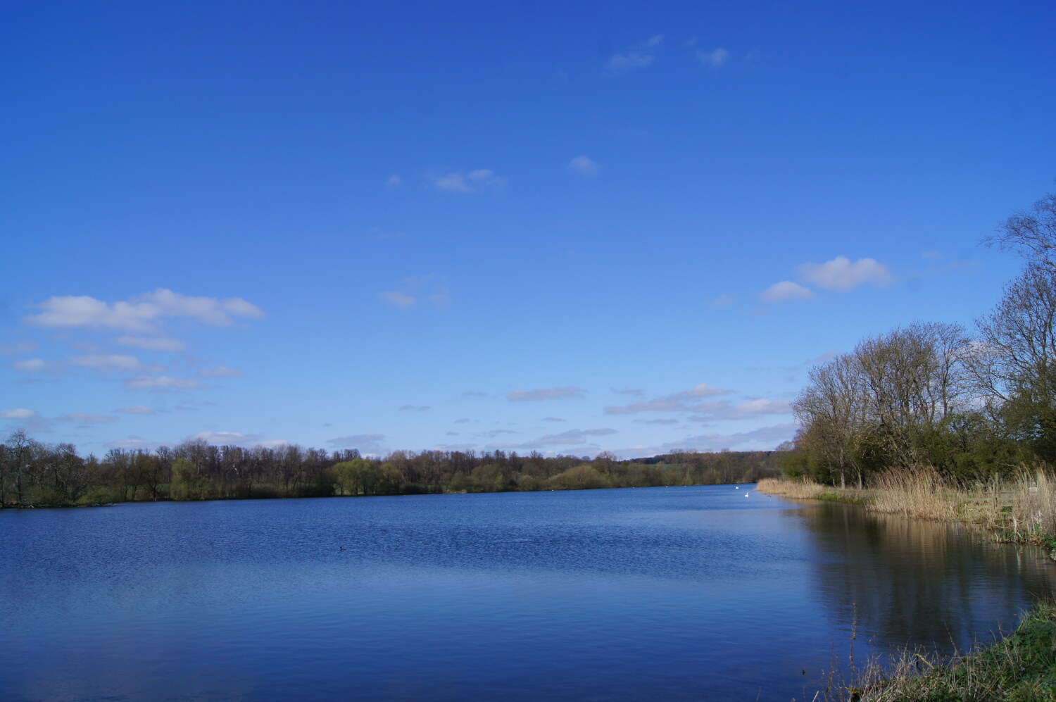 Castle Howard Great Lake
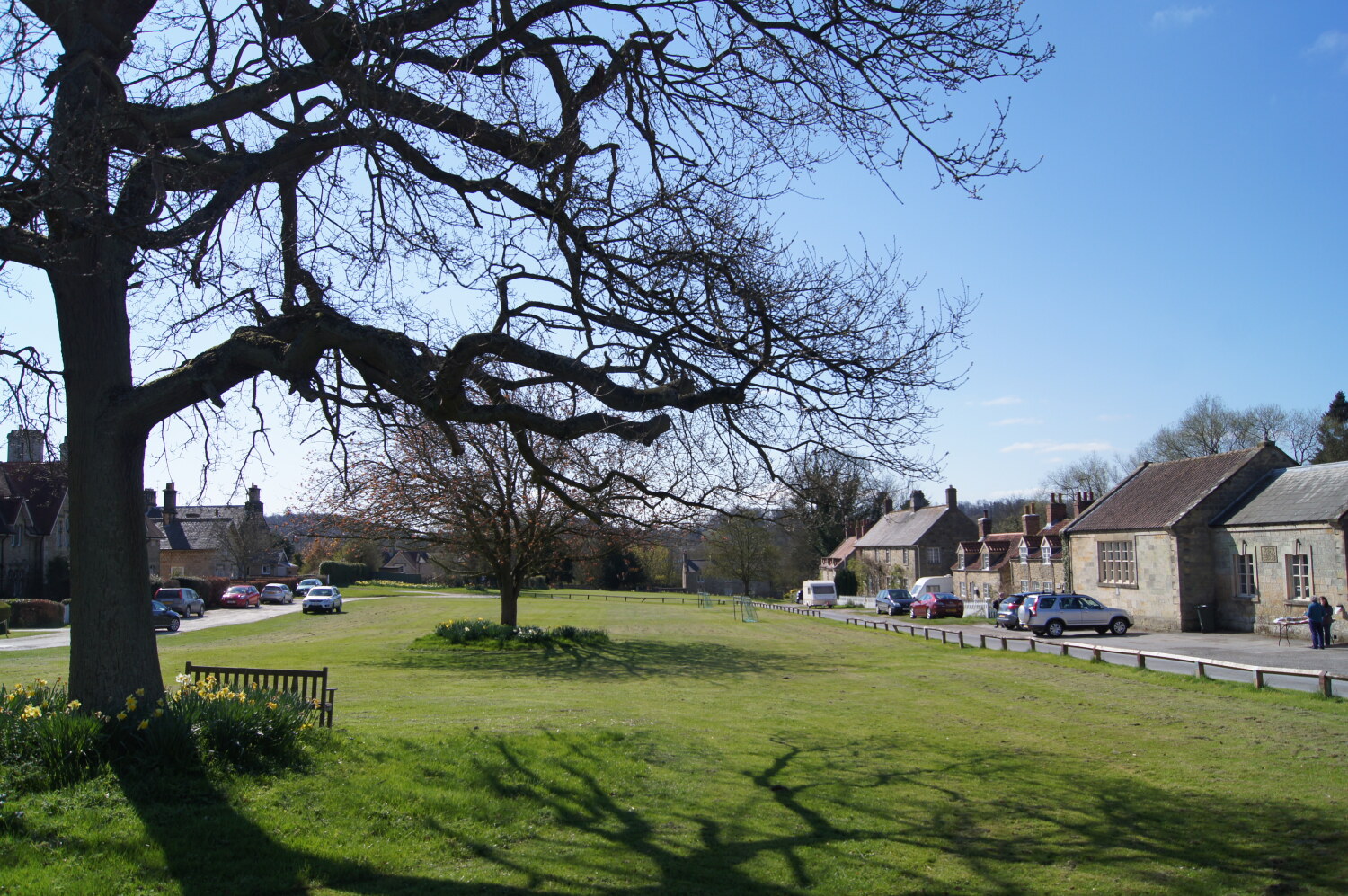 Coneysthorpe
The footpath now passes between more oak trees of great age and size towards the Great Lake. As the track leads on to Coneysthorpe village, the prominent ridges are evidence of the medieval 'ridge and furrow' method of cultivation. After exploring the extremely pretty village of Coneysthorpe, a permitted path gives access to the path around the top of the Great Lake, with fine views across the water to the northern prospect of Castle Howard. The Great Lake was constructed in the 1790s. Today, there is a pleasant path along one side of it from which to enjoy the views.
The path around the top of the lake brings you on the Five Mile Avenue, which at this point is lined on both sides by two ranks of enormous lime trees. About one mile ahead, the 100 foot high obelisk acts as a focal point and marks the intersection between the avenue and the entrance to Castle Howard. The obelisk was built in 1714, and part of the inscription points out that the third Earl of Carlisle had erected a castle where the old castle of Henderskelfe had stood. The rest of the inscription is a reminder that the 3rd Earl was also responsible for the plantations in the park, as well as other outworks and monuments.
A little further on is the gatehouse. A left turn in front of the arch leads along a quiet farm lane. On the right stretches Vanbrugh's perimeter, castle wall, and mock fortifications, all designed to surprise and impress visitors. As you continue, the vista opens out and the Pyramid comes into view on the right, with the Mausoleum dominating the view ahead. The short path up to Pretty Wood is the same as that followed on the outward journey. Now, on entering the wood, the way lies straight ahead and dips into a dell before emerging into a meadow. The path across the meadow links with the track leading back to the village of Welburn.
Acknowledgments: Text derived from the Out and Out Series; Discovering the Countryside on Foot. Pictures courtesy of Wikipedia.


