Sunderland Point
Wading birds and an old harbour at the mouth of the River Lune
Google Maps Open Source Maps| Statistics and Files | ||
|---|---|---|
| Start: Car Park | Distance: 1.7 miles (2.6 km) | Climbing: 12 metres |
| Grid Ref: SD 42650 56206 | Time: 1 hour | Rating: Easy |
| GPX Route File | Google Earth File | About Sunderland |
| Statistics | |
|---|---|
| Start: Car Park | Distance: 1.7 miles (2.6 km) |
| Climbing: 12 metres | Grid Ref: SD 42650 56206 |
| Time: 1 hour | Rating: Easy |
| GPX Route File | Google Earth File |
Ordnance Survey Explorer Map (1:25,000)
The Walk: Sunderland Point lies at the end of a road that is buried under water at every high tide. Marshy inlets form part of the mouth of Lancashire's River Lune and at low tide the muddy channels are the rich feeding ground of numerous waders which assemble in flocks to feed. The long-legged waders include the oystercatcher, easily picked out by its black and white plumage and orange beak. Grey herons may be seen on the mud flats standing still, or flying with slow wing beats and dangling legs.
 Sunderland Point
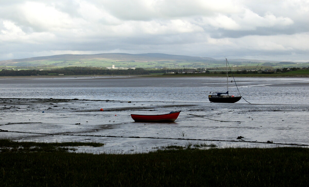 River Lune at Sunderland Point
The car park at the start of the walk is an excellent spot from which to observe the bird life. At high tide, this area of shingle beach is often completely covered by the water. So be sure at a time your walk correctly.
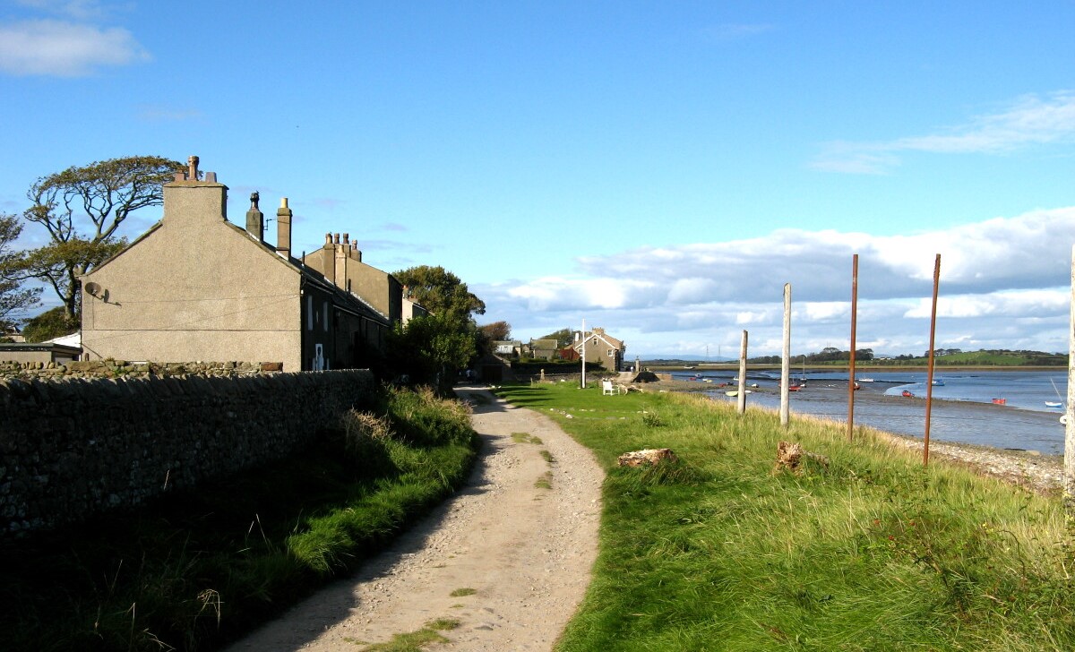
The cluster of cottages on this remote peninsula is a reminder of Lancashire's early trading days in the 17th century, when transatlantic ships sailed up the River Lune to Lancaster, carrying sugar, tobacco, rum and ginger. The first wool of the cotton plant was shipped here from America, as well as mahogany from the West Indies.
The Lune was not a good river for seagoing vessels however, because of its numerous shoals and shallow water. The solution was to unload and load ships at Sunderland Point at the mouth of the river. Cotton wool was stored in warehouses which have since been converted into cottages. The sailors anchored offshore, nicknamed the harbour 'Cape Famine' as there was not even a pub here to provide amusement.
Some of the profits from the extensive trading with Africa, America and the West Indies went into many fine Georgian buildings in Lancaster. The estuary was gradually silting up however, and towards the end of the 18th century, Sunderland Point was superseded by Glasson Dock on the opposite bank. In the early 1800's Sunderland was popular as a bathing place, but with the coming of the railway, it was overtaken by Morecambe.
Along the edge of the old harbour stands Cotton Tree Cottage, which was once the home of a Lancaster sea captain. Next to it is Cotton Tree Barn, a substantial stone building that has been converted into a house. From the base of the wall grows a gnarled old cotton tree, which is actually a Black Poplar, whose seeds resemble cotton.
Just beyond it is Sunderland Hall, an elegant colonial style house with verandas, which dates from 1683. It was the family home of Robert Lawson, a Quaker merchant who first had the idea of using Sunderland Point as an extension to the port of Lancaster.
There is a lane along the harbours edge, but beyond Sunderland Hall, the walk continues on the shingle and sand of the foreshore around the headland. Along the shoreline, yellow broom and pink wild thyme flourish, and black headed gulls fly overhead. Around the point, a rough track runs alongside the salt marshes; another good bird spotting area. Ahead lies Heysham Nuclear Power Station, a reminder of the 20th century. Beyond, there are views of the hills of the Lake District across Morecambe Bay.
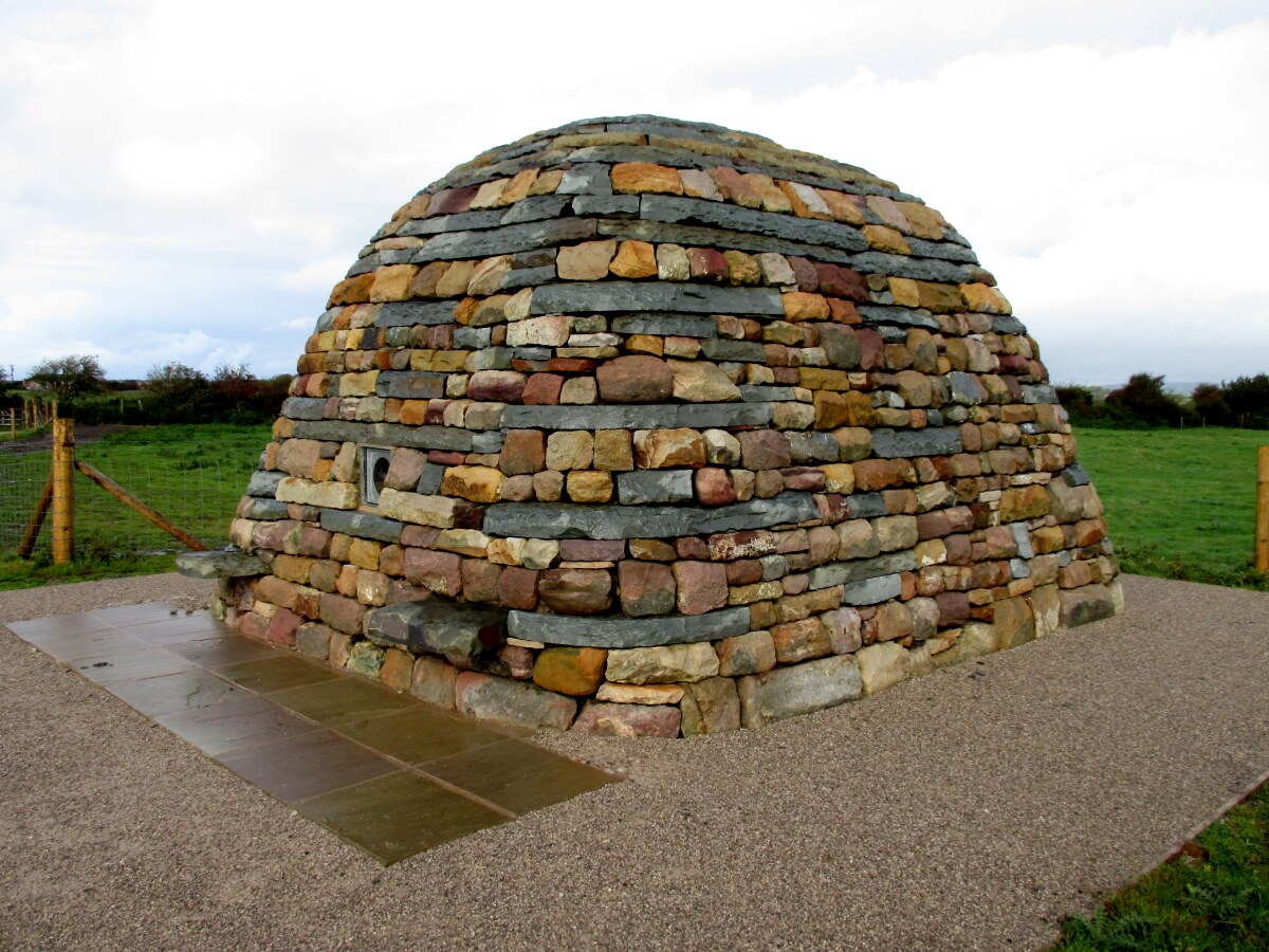 Horizon Line Chamber by Chris Drury
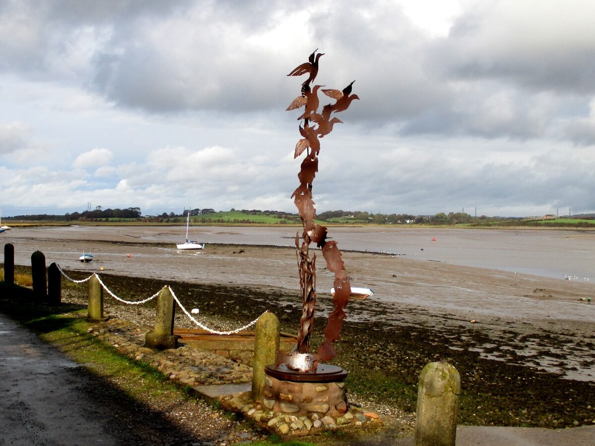 Ray Schofield's 'Birds' sculpture
A little distance along the sandy track that runs between the estuary marshes and fields, a wooden signpost marks Sambo, which points to a field where you find Sambo's Grave, marked by a plaque. Sambo was a black slave who accompanied his master, a sea captain to England. Soon after they arrived at Sunderland Point in 1735, Sambo died, probably from a fever that he had contracted earlier.
On the walk you may come to some sculptures, one of which has been quite controversial. Ray Schofield's 'Birds' sculpture is a beautiful piece of work, but it was apparently installed without planning permission. After an anonymous complaint, the sculpture was removed by the local council. Many locals petitioned for its re-installation, so whether you see it or not depends on the decision of the hearing.
Another piece of outdoor art, approved from the start, is the 'Horizon Line Chamber'. A conical stone chamber remade from hundreds of reclaimed building stones unearthed at the former port settlement of Sunderland Point, the sculpture resembles an upturned boat and holds a surprise inside. A self-contained lens inverts the outside world onto the chamber’s lime-plastered walls, capturing the sea and its changing conditions, our rich bird life and the unique light of the Bay in a transformed perspective. The sculpture encourages us to meditate on Morecambe Bay’s evolving environment. (Source: ArtUK)
Acknowledgments: Text derived from the Out and Out Series; Discovering the Countryside on Foot. Pictures courtesy of Wikipedia.


