Hartside, Medieval Village and Linhope Spout
Prehistoric, Roman and medieval remains in wild fell country
Google Maps Open Source Maps| Statistics and Files | ||
|---|---|---|
| Start: Hartside Farm | Distance: 5.6 miles (9.0 km) | Climbing: 243 metres |
| Grid Ref: NT 97637 16204 | Time: 3 hours | Rating: Moderate |
| GPX Route File | Google Earth File | About Linhope |
| Statistics | |
|---|---|
| Start: Hartside Farm | Distance: 5.6 miles (9.0 km) |
| Climbing: 243 metres | Grid Ref: NT 97637 16204 |
| Time: 3 hours | Rating: Moderate |
| GPX Route File | Google Earth File |
Ordnance Survey Explorer Map (1:25,000)
The Walk: The valley of the River Breamish, its broad glacial river-bed flanked by steep hills, is one of the most beautiful in Northumberland, although there are only a few farms on the hillside today. It was not always so deserted. The landscape bears evidence of many different settlements. On the hillside above Linhope Spout is rare evidence of the earliest type of unenclosed settlement, dating from 4,000 years ago, when farmers cleared the woodland to grow crops. As the climate grew colder, livestock replaced crops. Herders lived in groups of houses on hilltops surrounded by wooden palisades or strong stone ramparts. The Romans made an impact on this way of life. The peacekeeping forces they brought made some defensive settlements redundant. Roundstone houses were built outside the ramparts. The walk passes many of these remains on the sheltered south-east slopes, including those of Grieves Ash.
 Grieve's Ash
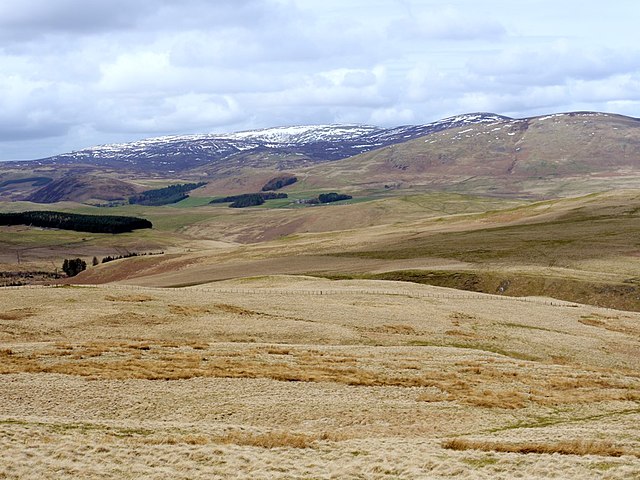 Cheviot Hills
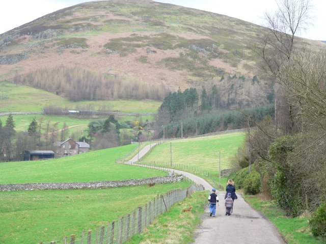
The person you are most likely to meet in the hills today is a shepherd in his four wheeler. But the slopes are crisscrossed with ancient tracks and informal drove roads. At Hartside, where the walk begins, a silver cross was found in 1861 and is said to have been dropped by an eighth century Pilgrim.
On the left of the road are curious slatted fences. These prevents snow from drifting onto the road, a necessary precaution, as Linhope can be cut off for weeks in winter. The hut on the hillside above Greensidehill is another defence against the weather. Hay from the lower slopes is stored here to feed livestock - sheep and a few cattle - when the grass is under snow.
Below Cat Crag, curlews called plaintively, and you might hear the strange hum of the wind rushing through a male snipes tail feathers as he dives into his courtship display. Foxes and rabbits are common here and hares also live on the hillside.
The route leads to a deserted medieval village. In the 14th century, a combination of border raids and the Black Death led to the abandonment of many villages in the Cheviot Hills. The remains of several houses are still visible among the grass and bracken on the fellside.
You descend towards Grieve's Ash, a large settlement occupied from the Iron Age to Roman times. The sunken path by which you enter is part of its extensive ramparts. The dwelling places spill outside the walls, evidence of more settled times in the valley's history.
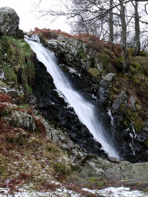 Linhope Spout
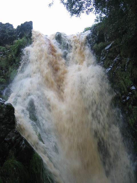 Raging torrent
Down the hill beyond an attractive strong bridge is the entrance to Linhope Lodge, built in 1912 as a hunting lodge. After a brief interlude as an old people's home, it reverted to its original use of being a lodge during the grouse shooting season.
A broad track climbs above Linhope Burn. In summer the steeps valley sides are purple with foxgloves; and siskins and linnets sing in the woods. The wheatear flashes back and forth across the path on the more open land.
Take care if exploring away from the main path. Adders are common, and though they slither off at the sound of someone approaching, they can be taken unawares in cold weather when they are slow.
Wild goats, descended from domestic beasts, have bred for hundreds of years on the hills but are rarely seen, except in winter when they graze on the lower slopes.
When the woodland ends, a track through bracken leads to one of the loveliest waterfalls in the Cheviot Hills. Dropping 56 feet into a basin 15 feet deep and seven feet across, Linhope Spout used to be called 'Roughting Linn' from an old word for the lowing of cattle, referring to the sound of the water as it pours over the rocks. From here you return to Grieve's Ash and follow a private road along the hillside back to Hartside Farm.
Acknowledgments: Text derived from the Out and Out Series; Discovering the Countryside on Foot. Pictures courtesy of Wikipedia.


