The Bullock Smithy Hike
The Bullock Smithy Hike is a challenging 56-mile circular hike within the Peak District National Park, starting and finishing in Hazel Grove. Follow Adam Gallimore's attempt to complete the challenge here.
Google Maps Open Source Maps| Statistics and Files | ||
|---|---|---|
| Start: Hazel Grove | Distance: 56 miles (90 km) | Climbing: 2,790 metres |
| Grid Ref: SJ925861 | Time: Within 24 hours | Rating: Strenuous |
| GPX Route File | Google Earth File | About Hazel Grove |
| Statistics | |
|---|---|
| Start: Hazel Grove | Distance: 56 miles (90 km) |
| Grid Ref: SJ925861 | Time: Within 24 hours |
| Climbing: 2,790 metres | Rating: Strenuous |
| GPX Route File | Google Earth File |
Ordnance Survey Explorer Map (1:25,000)
Hey there thrill seekers it's me again The Great Galleymo with another story of high adventure and daring do. It must be 4 months since me and Lenny took part in the Bullock Smithy so I thought that with a few days to kill and dire weather; rather than polish the arm chair with my backside watching 'Come Dine With Me' I would get it all down on paper for you lovely lot. And as its Christmas; call it my present to you all. So before I start my waffle I thought (there I go thinking again; I have already done it twice and were still only on the first paragraph) It might be nice to head down memory lane. Mmmmm Memory Lane, Ooooo cakes. I like cakes too. Sorry I started to daydream then. What I meant was a bit of history about Hazel Grove.
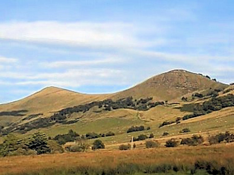
Bullock Smithy is the original name for what is now Hazel Grove. A Richard Bullock leased in 1560 some land from a John Torkington to establish a smithy. Thus Bullock Smithy came into existence and eventually became the name of the village and was used in deeds, maps and books of those times. Villagers came to dislike the name and officially changed it to Hazel Grove in 1835, although there is evidence that the name Hazel Grove had been used earlier in 1790. There are numerous reasons given for this choice of name, one was the predominance of Hazel trees, but it is likely that the name was chosen from Hassel Grove, an area of sand and gravel pits towards High Lane. Around 1750, Bullock Smithy became an important posting hall and John Wesley described it as 'One of the most famous villages in the country for all manner of wickedness'. It is thought he was referring to gambling, cock fighting and bull and dog fighting. The village still has wicked people who amongst other wicked deeds, devise tortures such as a 56 mile hike and call it the 'Bullock Smithy' (Adam Gallimore, December 2012)
The Walk:
The objective of this little soiree is to complete a 56 mile circular course starting and finishing at Hazel Grove, visiting and registering at 14 specified checkpoints in the correct order –
0) Hazel Grove (SJ925862) – (280 ft) - 0 miles
1) Bowstones (SJ974813) – (1300 ft) - 5 miles
2) Chinley Churn (SK037843) – (1400 ft) - 10 miles
3) Edale Cross (SK077861) – (1800 ft) - 14 miles
4) Edale (SK124853) – (770 ft) - 18 miles
5) Castleton (SK149830) – (600 ft) - 20 miles
6) Peak Forest (SK113792) – (1200 ft) - 24 miles
7) Millers Dale (SK142735) – (850 ft) - 28 miles
8) Chelmorton (SK118692) – (1270 ft) - 32 miles
9) Earl Sterndale (SK091669) – (1040 ft) - 35 miles
10) Brand Top (SK044685) – (1400 ft) - 39 miles
11) Cumberland Cottage (SJ994699) – (1150 ft) - 43 miles
12) Walker Barn (SJ955737) – (1170 ft) - 47 miles
13) Whiteley Green (SJ927789) – (520 ft) - 51 miles
14) Hazel Grove (SJ925862) – (290 ft) - 56 miles
All within 24 hours beginning at 12:00hrs noon on the Saturday and finishing at 12:00 hrs noon on the Sunday when all checkpoints will be closed down……. Bish bash bosh, home for tea and a dozen or so pints of Erdinger down the Turks Head.
Reet then guys time for the main feature. There is still time to grab a Pepsi and some popcorn from reception but hurry cause we are about to get this show on the road and if you haven't already been to the toilet I'd go now cause this story is gunna take a while.
Preparations for this years Bullock Smithy started way back last year. In fact I can remember the exact time and place and even what I was wearing. Well it would be hard to forget as myself and fellow extreme rambler, Lenny Brennand were heading back to Hazel Grove on the "Bus of Shame" after failing to complete the 2011 event. Yes whilst on that bus we vowed that as soon as we got home we would register for the next years event and that's how we ended up with tally cards 2 and 3. It would be easy to make excuses for why we failed to complete in 2011 but the simple fact is we hadn't done our home work and got beat by overgrown footpaths and blocked off fences not to mention the electrified ones and the nettles. Oh yes, also the blistered feet and chafed arse cheeks (oooooouch). This year with the later sections reccy'd only weeks before so as not to hit major problems, we were as ready as we could be and confident that we would complete the event.
Arriving at Hazel Grove Scout HQ in good time I was able to get the pre walk business of kit check out of the way and relax a little. Sitting outside awaiting the grand entrance of one Leonard Brennand I chatted to a few old friends from the previous year who where also hoping to fair well this year. The atmosphere was great, everyone was laughing and joking but deep down I bet they were as nervous as me. I mean come on this is 56 miles after all and with it being a Saturday I was going to miss Dancing on Ice. Lenny turned up a little later than expected with his daughter Flo and girlfriend Karen and went straight in to kit check while I chatted to Karen and Flo and ten minutes later emerged from the scout hut big smiles kit check complete.
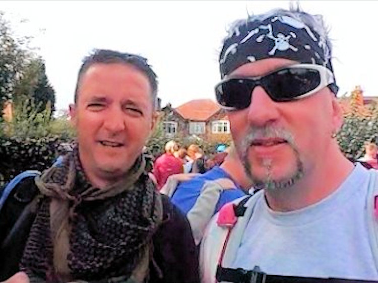 Lenny and The Great Galleymo ready to go
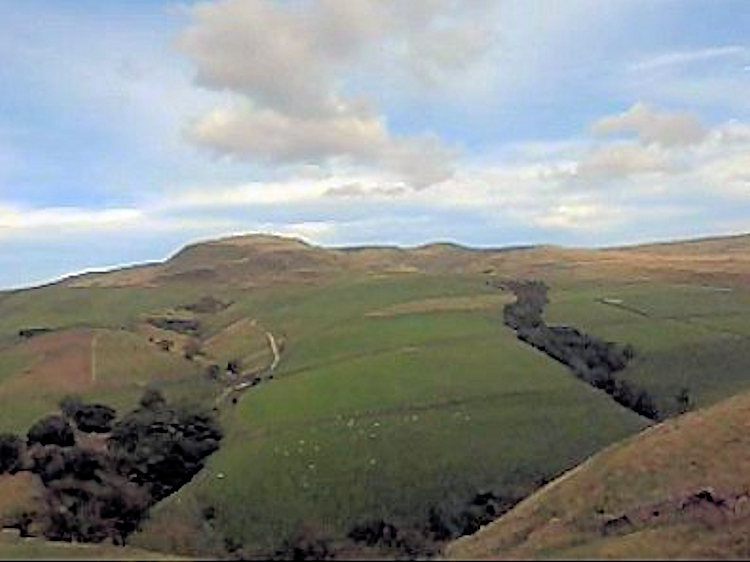 Answers on a post card
At 11.30am we walked over to the park on the opposite side of Macclesfield Road and the start of the event. To late to back out now, well we wouldn't even if we had the opportunity as we were looking forward to it. As we waited for the off we looked round at the competition, I saw a familiar Face, Luiz Broz off of the Long Mynd last year and then another familiar face, only chuffin Anthony Audenshaw or Bob "Emmerdale" Hope to you lot. To be honest seeing Anthony Audenshaw was not really unexpected as he is quite a good (understatement) fell runner which he proved with an 11 hour 8 minute finish in seventh place.
With a bash on the anvil or what ever it was that signalled the start we were underway. We were so excited we headed in the wrong direction (oops) at first but quickly realised our mistake. Out of the park and along Devonshire Road, spirits where high, whooping and hollering as we went which in turn set off the odd car alarm or two. Turning left at Mill Lane we continued to Old Mill Lane past some disused workings, Rabbit Burro Farm and on to Anson Road. Me and Lenny hadn't seen each other in a year and had a lot to catch up on. Even though we chatted by text and Facebook it was not the same. I would probably go as far as to say we were that busy catching up as we walked the first stage that we did not take much notice of our surroundings. Through Elms wood past Haresteads Farm and on to the Gritstone Trail and finally through Knightslow wood to Bowstones. Stage 1 done and 25minutes ahead of last year.
Check Point 1 (Bowstones) – 5 miles: With five miles done we were already asking ourselves the same question as last year. Why are we doing this? Only in jest though because to be honest we were feeling great and the sun was shining which made the whole thing much more enjoyable. I cant imagine walking 56 miles in the pouring rain as by the end of it I would either be a dithering wreck or totally insane. Mind you that's usually how you feel after walking that distance in good weather. Not a great deal of selection on the refreshment front at the first check point but as ever the banter and encouragement was fantastic and really spurred us on. So with a quick slug of orange cordial we were soon walking on our way again. Down the road to Cock Knoll, crossing Mudhurst Lane we entered the grounds of The Moorside Grange Hotel and Spa (It looks very POSH… ooo did you know that POSH is an analogy? Its what all the 'well todo' people used to have stamped on their luggage years ago when they went on cruises and means Port Out Starboard Home) and up and around Whaley Moor. On reaching Whaley Road we turned left, only for a short time before turning right through the fields again and into Furness Vale. Across the A6, over the train line and down to the bottom of the road bearing left then following the footpath right at the junction. Across fields and under another train line we went heading towards Beardwood Farm across some severely boggy ground. Along Shedyard Clough turning right onto Laneside road still we continued and as it was getting warmer we were starting to feel like we were on a challenge walk at last. At the end of the road we then hit our first serious climb, not very far but steep and enough to get your heart beating and with almost 10 miles done we were well and truly into the Bullock Smith.
Check Point 2 (Chinley Churn) – 10 miles: Well this is a bit of a funny one to be honest because after you have almost broken your neck getting down to the tally clip via the steep embankment (reflecting back on last year I think a pattern is starting to emerge with Lenny falling over) you then have another three quarter mile walk to the refreshments just off Hayfield Road. By the time we reached the refreshment stop which by the way was tea, cordial, crisps and penguin biscuits (just a note to the organisers – please can we revert back to club biscuits in future….preferably the fruity ones) we were well in need of some fuel as the heat and the sun was beginning to take its toll.
Battery cells replenished and our core reactors back up to full power we crossed the road and headed along a footpath past Higher Hayes Farm and down to Coldwell Clough. The route to Coldwell Clough once again had been marked out for us using pegs and red ribbon. However, this was a treacherously steep decent which last year saw one of the competitors fall and seriously fracture her jaw so we took our time. As I crossed the footbridge at the bottom I turned to see Lenny brushing the back of his trousers. Not being one to pass up the opportunity of a roll about in the grass he had fell over once again bringing his tally so far to five times. Emerging on to the road from the footbridge we were greeted by a flock of sheep being herded by the farmer who was driving a rather snazzy quad bike. We asked for a lift to the top of the hill. Unfortunately he told us he was in a rush to get home as Jeremy Kyle was due to start at any moment and therefore, myself and boy wonder would have a long hard slog on our hands all the way to the top of the hill. After only a short time we were off the road again, through a gate and on to a foot path heading for Edale Cross. With Kinder Scout to our left up and up we went and then the inevitable happened. Yes the walking legend that is Dave Green passed us. Now I don't think that Dave will mind me saying that he is getting on in years but jeepers he is one fit fella. He has this pace that just does not alter. Uphill, downhill, sunshine or rain it's the same pace. I don't know how he does it. So with a quick hello Dave was past us and we thought we wouldn't see him again. Eventually after a gruelling accent we reached Edale Cross but no refreshments. Booooooo
 Lenny on Jacob's Ladder
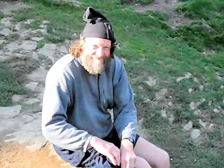 Dave the Baptist
Check Point 3 (Edale Cross) – 14 miles: A quick tally clip was all we would get here and some words of encouragement from the marshals that we were doing well with a 4mph pace. All down hill now to only reason I do this walk. Rice pudding and fruit cocktail mmmmmmm. It was not long until we reached Jacobs Ladder a steep decent made of stone. I would imagine that in wet weather this can be quite difficult to negotiate but as the weather was warm and dry it was a piece of cake and in no time at all we were at the bottom. Now then how many of you read your Bible? Well for those of you that don't, Jacobs Ladder or to be given its Hebrew name Sulam Yaakov, was a ladder to heaven that the biblical Patriarch Jacob dreamt about during his flight from his brother Esau. It is described in the Book of Genesis if you want to get the full low down. Anyways just imagine my surprise when at the foot of the ladder we encountered a gentleman with large bushy beard bathing his feet in the waters. I asked his name hoping that he would have replied Jesus but alas the answer came back as Dave. I told him I had a mate called Dave to which he smiled and said that now I had two mates called Dave. Its only now when I think about it; perhaps he was a disciple. Well after all Dave the Baptist and all that, or was his name John. Oh I can't remember. On we continued and yes you guessed it, it was not long before Lenny was down again. An almighty scream and a thud as he hit the grass. "Bloody cramp" he said "Whats up with him?" asked a few walkers who were in front of us. "Ninja grasshoppers" I replied "Gotta watch out for the pesky critters, there bloomin leathal, hiding in the grass just chopped him and had him off his feet"
There's nothing wrong with bending the truth a little sometimes. I mean come on Lenny is ex military so how embarrassing is complaining of a little cramp. Back on his feet and eyes peeled for more surprises we continued once more. On reaching Upper Booth there is a farm house and I have it on good authority that they sell the best ice cream around so in 2013 I plan on giving my expert opinion on that. Past the farm we went opting to stick to the road rather than through the fields. It's a slightly longer distance but we knew this route better. Turning left at Barber Booth we followed the road up to Edale station and the much awaited delights it had in store for us.
Check Point 4 (Edale) – 18 miles: Mmmmm. Edale. Now then this has got to be my favourite of all the check points as you get rice pudding and fruit cocktail. If desert was a supermodel rice pudding and fruit cocktail would be Gisele Bundchen. At 18 miles down with the prospect of another 38 to go this stuff is just what the doctor ordered which is why I had three of em. Energy Levels fully recharged we headed out on to the road once more. Five minutes and we had turned right and were heading along a track to Peter Barn. Shadowed by Mam Tor this was gunna be one hell of a leg tickler up to the top. The best thing me and Lenny have found is to split it up, in to three parts. The first up to a tree a third of the way up, then to where another track joins at about two thirds the way up and then the summit. Well that's what we did and in no time we were at the summit of Hollins Cross. Wow what a view and such a clear day. As we took our time to admire the scenery and create video footage with a bit of a history lesson on how Hollins Cross acquired its name we were joined by Christopher Thompson who then became known to us as Irish Chris. My self and Lenny were so overawed by the breath taking scenery we were seriously considering getting naked and asked Irish Chris if he would like to join us. Unfortunately he declined and with the unexpected arrival of a group of walking nuns we decided that it was probably now not the best time to get our kit off so on our way we continued through Mam Plantation on to Hollowford Road and the jam butty stop at Castleton car park which was our next check point.
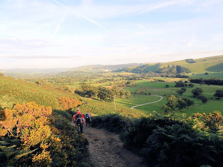
Check Point 5 (Castleton) – 20 miles: If any of you have visited here before I needn't say anymore. Its one of my favourite places. A real nice village, nice pubs and a place of some outstanding walks; just a pity that this would only be a flying visit really. Out of the car park bellies full of tea and jam butties with two penguins stuffed in my pockets. No not the feathered variety you muppet, the chocolate bar type. Honestly! We turned left to walk the short way along Cross Street before turning right in to Castle Street. Past The Castle and The George public houses thinking we could have murdered a pint right now up to Bargate and onto Cave Dale and the Limestone Way. Above us Peveril Castle, its imposing ruins standing high above the pretty village of Castleton in the heart of Derbyshire's Peak District. Mentioned in the Domesday survey, Peveril Castle is one of England's earliest Norman fortresses. The keep was built by Henry II in 1176. Along the Limestone way we rambled past Cow Low and Hurd Low before branching right along Oxlow Rake and onto Old Darn lane. We were doing well as at this point last year the head torches were out and for the moment it was sill light. Down to the bottom of Old Darn lane, left and check point 6 was only a cock stride away at the cross roads with the A623
Check Point 6 (Peak Forest) – 24 miles: At last Peak Forest and it was still light. This was what me and Lenny classed as half way even though technically the next check point was really. As we arrived three familiar faces were there to greet us. Flo, Karen and Lenny's mum who were all manning this refreshment stop. Hey did I tell you it was Lenny's birthday the previous day and there was birthday cake on the menu. Fruit cocktail, rice pudding and now birthday cake you can probably guess why I love this walk. So after taking more time than usual at the refreshment stop; fuelled up, wearing fresh sock and not forgetting a fresh application of udder cream we were ready to go again. "Hang on a minute lads, you need to go in groups" the marshal instructed. Bloomin heck with all the talking we had been doing we hadn't realised it had gone dark. Looking round we saw two others studying a map. "Do you know where you are going?" I asked. "Yes" they responded. "Fantastic, so do we" I replied. And that is how we teamed up with Chris Wigley and Rachel Woodman and I bet you won't guess who else? Only bloomin Irish "Top O the Mornin" Chris. Setting off Along the A623 head torches on full beam we hit our first technical casualty. Yes, my trusty camera which had been documenting the adventure had concked out. Classic school boy error of using a 4gb memory card instead of a 16gb when in video mode (mental note to pack a larger memory card next year). Undeterred by this little setback we forged ahead deciding to stick to road up to the Limestone way rather than get lost negotiating the fields in search of the wall steps and fences. We followed the Limestone way past Bottom Farm, Wheston Hall, Monksdale House running parallel to Monks Dale walking through at times quite deep mud until we reached Monksdale Farm and check point 7.
Check Point 7 (Millers Dale) – 28 miles: Vegetable soup at this checkpoint. Hmm? Think I'll swerve that one. After a short refreshment stop where Rachel inspected the damage done owing to walking through deep mud in only fell running trainers (well of course she had clothes on, you know what I mean) we were on our way again. Last year we opted to take a short cut through a little wood to reach the main road. However, this year we decided to follow the easier path and to be honest ended up on the B6049 much quicker. Our bodies were all saying the same thing by now just after midnight and that was "Go to bed" but we still had another 28 miles to go, and with our heads down we continued along the road in the direction of Blackwell. After about quarter of a mile which seemed more like two we turned off on to Long Lane and another long slog past Highcliffe Farm to the cross roads with Priestcliffe Road. Turning right on to The Limestone Way we crossed the A6 and past the Waterloo Hotel to Sough Lane, turning right at the T junction with Moor Lane before eventually turning right on to
The Pennine Bridalway and the short drag up Highstool Lane to check point 8.
 Back Tor and Lose Hill
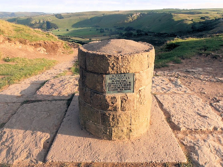 Hollins Cross
Check Point 8 (Chelmorton) – 32 miles: What a little gem. Rising out of nothingness on Highstool Lane stood a tent. And not just any old tent. For inside this tent were delights that would make even Homer Simpson happy. Jam and custard doughnuts (doh). Now I don't know about loosing weight but with all this food I swear I put on an extra stone by the time I had finished. Out of the five of us the last four miles for Irish Chris were probably the hardest and when he eventually joined us at the tent he was not looking the best and to make matters worse the other Chris was now complaining of sore shins which I think was due to his choice of footwear. To be honest how he got this far wearing four season mountaineering boots is beyond me, but he did. Regrouped and in relatively good spirits we set off in to the dark once more. It was not long before Irish Chris started to fall behind but with a bit of encouragement from the rest of us he seemed to perk up a little and was even keeping up with the pace. However, the look on the other Chris's face said it all, he was in pain and not just a little. As we rounded the final bend approaching check point 9 he told us that he would be going no further this time.
Check Point 9 (Earl Sterndale) – 35 miles: On entering check point 9 we were amazed to see how many people there were. Sadly the majority of them had also decided that 35 miles was more than enough for one day and they eagerly awaited the bus to ferry them back to Hazel Grove Scout HQ. I know I call it "The Bus of Shame" but that's only jokingly. In truth just completing the first two check points is a feat in itself, so even though people were calling it a day they had still walked a distance to be proud of. To be perfectly honest I don't think we were meant to walk long distances, that's why rollerskates and suchlike were invented. It takes a special kind of loon to do these long distance challenge walks and the lack of sleep certainly does not help.
I can't remember any of us bothering with refreshment at Earl Strendale, all I remember is saying our goodbyes to Chris and then we were gone. Unfortunately Irish Chris was not to continue with us either.
"Come on Chris, were going." I shouted to him as he sat in a chair.
"I think I will wait a little longer, you go ahead without me. " he replied.
As we left, Lenny, Rachel and myself all thought the same, that Irish Chris had jacked too. However, on reading through the results I was happy to see that he had managed another four miles and reached Brand Top before finally calling it a day (Sterling effort dude).
Heading out of Earl Strendale slightly behind another group we headed towards Upper Edge. The group in front had decided to go the long way round following the road however being the extreme rambling types that we where decided to go cross country baby and take on the bogs and elephant grass of the peak district. On seeing that we were heading a different route we were joined by Christine Usher from the other group. A lady getting on in years but an amazing walker and a real asset to our group. Heading around Dowel Dale then back on to the road for a short time before heading through fields, skirting Stoop Farm and finally emerging in front of a quagmire of mud at the bottom of a rather large hill. Oh heck I thought as this was not what it was like a week or so ago when I had reccy'd it, mind you we had torrential rain and flooding since then. Christine saved the day though "Follow me" she said "There are stepping stones just bellow the mud" and across she went feeling her way with her walking pole as she went. Next to cross was Rachel, who if she had miscalculated them it would have been disastrous in those fell running trainers. Again no problems whatsoever. I was up next and after a few tense seconds was also across safe and sound. Now then that leaves Lenny, poor old Lenny, And if anyone was destined to cock it up it was Lenny. So off he goes whoosh straight in the mud up to his shins. Classic moment just a pity my camera was dead. Eventually all across the first obstacle it was just up this bloomin steep hill past Booth Farm and then the nice leisurely walk past Brand End Farm to Brand Top and the next check point. Oh and it had started to rain (Poncho out)
Check Point 10 (Brand Top) – 39 miles: Our Nemesis. Last year myself and Lenny said "Stuff this for a game of soldiers" at this point after it took us almost three hours to get here from Earl Strendale. Tiered and dejected we got on the "Bus of Shame". Well that was 2011 and this was a whole year later and there was no way we were giving up this time.
Exiting via the rear of Brand Top we eventually got our bearings and picked up the track down to the road. Now when I reccy'd this earlier I noted that the walk through the fields up to the A53 was rather boggy and the farm house had a big dog that just loved fresh rambler meat so feeling relatively unbrave at stupid o'clock in the morning we continued along the road instead. On reaching the A53 we crossed and followed another road past New Lodge Farm and Oxenstich down to where we turned right for Knotbury Farm. Feeling tiered and exhausted it was just walking, left foot followed right foot followed left we were all knackered, Lenny's feet were smashed and still we had a long way to go yet.
At the end of the road we followed a path to a stream. As I turned right Christine said "Your going the wrong way" I was a little unsure a first and then realised she was correct so bowed down to her better judgement and continued following Christine and her trusty Sat Nav this time in the correct direction. Turning right at Panniers Pool we headed up along the path to a farm and after a while trying to negotiate the walls and fences we eventually found the gap we were looking for leading to the tall ships ladders that would be our escape on to the A54. Crossing the A54 heading towards Sparbent I remembered what Rachel had said earlier, that just before dawn it gets really dark and as now it was starting to get very dark indeed that could only mean one thing, and by the time we had turned to follow Cumberland Brook down to the cottage Sunday morning was breaking.
Check Point 11 (Cumberland Cottage) – 43 miles: At long last we had reached Cumberland Cottage; no one more than Lenny was as relieved for a sit down. As we went in side we were greeted by a large roaring fire and as there were no others in the cottage except for the marshal and 3 scouts, (all asleep in front of fire) there where plenty of space for us all to sit down. It was decision time for Lenny and as he removed his socks to inspect the damage to his feet the whole room fell silent but after a few tense moments he asked
"Adam, can I borrow your spare socks dude?" It was then I knew that nothing was going to stop us and we would nail it this year. Throwing Lenny the socks, he then tapped up his battered feet and put on the fresh socks followed by his boots. As Lenny was fastening his laces a few more competitors entered the cottage. And who do you think one of them was? You don't know? Well it was only bloomin Dave Green, Dave the racing snake.
"Dave? Where the heck have you been?" I asked, as the last time we had seen him was at Edale and had naturally assumed that he was way out in front.
"I took a wrong turn out of Brand Top, got lost in a field and spent 45 minutes trying to find my way out"
Hahahahah, I laughed and so did Lenny as last year the same thing had happened to us. Even Rachel had a story to tell about her experiences of getting lost on route to Cumberland Cottage last year.
Soon we were ready to go but were missing one of our group. Christine? The marshal told us that she had just left on her own and as now it was light we could ungroup if we wanted. We were a little sad to loose Christine as she had been a real asset to us. Even though I had reccy'd the route the previous week her GPS still stopped me from leading us in the wrong direction a few times and saved us valuable time.
On leaving the cottage we gained our new team member, Valerie Byrne. She was originally with a group which had somehow come undone on route to the cottage and as she was unsure how far behind they where and wanted to join us as we knew the route. So now the three who were four were four once again followed Cumberland Brook down to Clough House where we turned right and followed the road for about a mile. The suggested route to Walker Barn from here is through Macclesfield Forest which can be a bit knarley on the feet so we decided that as Lenny's feet were already in a bad way we would take the longer route on the road eventually exiting on to the A537, Buxton New Road and check point 12.
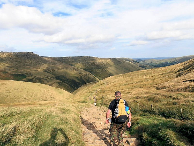
 Heading down to Castleton
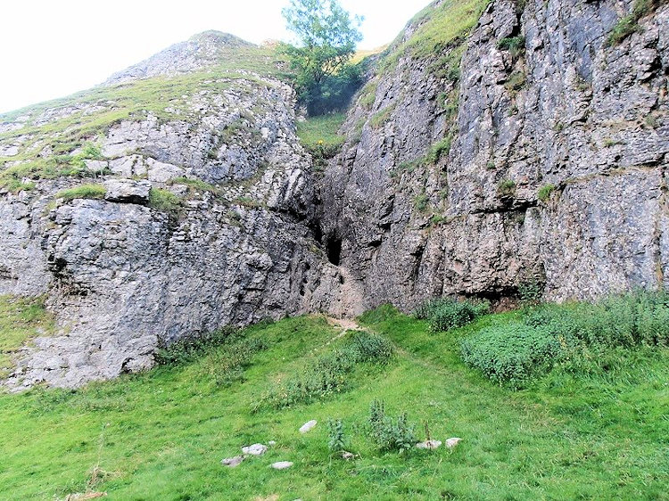 Cavedale en route Peak Forest
Check Point 12 (Walker Barn) – 47 miles: Just time for a wee and some quick refreshment and we were off once more. As we headed down the path to Gulshaw Hollow Valerie (who sounded just like Sarah Crowe off of the Philadelphia Cheese advert of the 90's and even looked like her too) asked Lenny only for about the 100th time since leaving Cumberland Cottage,
"Lenny, are you all right Lenny?" followed by "Aww, Lenny, I feel terrible, do you think I am terrible? I keep moaning about my blister and poor Lenny does not say anything." To which me and Lenny just looked at one another whilst Rachel shook her head in disbelief. I must admit at the time it got a little much but to be honest she was like a breath of fresh air to us. Past Horden Farm and along the grassy ridge atop of Berristal Road we wandered until we reached the B5470 at Rainow. Crossing the road we continued along the side of Tower Hill and Kerridge Hill in to Bollington. Result the paper shop was open and while Rachel went to use the Ladies I took opportunity to bob in for a well earned ice lolly. Mmmmmm Fruit Pastel ice lollies are the future de – flippin – lish – ous. Through Bollington we strolled turning left on reaching the B5090 up to the traffic lights then right again up to the mill, over the foot bridge on the left and we were on the tow path of The Macclesfield Canal and the mile or so trudge to bridge #25 and check point 13.
Check Point 13 (Whiteley Green) – 51 miles: Tally's taken care of we were at last on the final stretch. Five more miles and that's it but looking at our watches we would have to get a move on otherwise we would be timed out. Valerie was still asking the same questions as before but to be honest it was just noise now. Lenny was in agony and Rachel well she was just getting it done with out any problems at all. This final stretch saw us walk a fair old part of the Middlewood Way, a disused train line that runs from Macclesfield to Marple. Offering a mostly level and traffic-free route for walkers, cyclists and horseriders. It follows the line of the former Macclesfield, Bollington and Marple Railway through picturesque Cheshire countryside and between historic mill towns, running parallel with the Macclesfield Canal, providing easy circular walk options. Both the railway and canal were formerly used for transport for local industries, the railway operating from 1869-1970 carrying cotton, silk, coal and passengers. Both are now multi-user leisure routes. Reet then with that bit of TRUE history out of the way on we continued until we were to leave the Middlewood Way. Up the side steps of the embankment turning left on to Shrigley Road and then Coppice Road. I have a little admission of guilt to make. As we made our way along Coppice Road a car pulled up along side and we were asked (not by the car as cars cant talk, but by the driver) if we knew where the tip was. Now not wanting to sound unhelpful I thought quickly and responded that I did; made up a string of left and right directions and then waved them on their way. Well gotta have a bit of a laugh now and again aintcha? So after all that merriment we decided it might be a good idea to get a move on and in a short time we were turning in to Towers Road at the junction with Hockley Stores Post Office on the corner. As it was all pretty straight forward now I gave my marked up map to Rachel and with Valerie the two ladies strode out on their own. Walking the mile or so down Towers Lane me and Lenny laughed and joked to take his mind off his feet but to be honest I think the knowledge that we were going to complete it was enough and soon we were turning right to follow the A523 back to the scout hut and victory. With only a hundred yards or so Flo and Karen met us on the main road you could see that they were proud of him and we all walked in to the scout hut and our final tally clip. After setting out on this adventure at 12 noon on the Saturday we were back 23 hours 11 minutes later - Job Done.
Check Point 14 (Hazel Grove) – 56 miles: As we entered the scout hut we saw Rachel and Valerie who had arrived just minutes before us. Dave and Christine were there also as well as a lot more. Most were happy. However, some were like me and Lenny the previous year saddened that they failed to complete, but everyone had given it all they had and that's what counts.
So, the big question? Will we be doing it again year? Well to be honest with you, as me and Lenny walked that final mile back to the scout hut we asked ourselves the same question and the answer is. Hell yeah bring on the 38th Bullock Smithy and within two weeks of finishing we had already booked on.
I hope you guys enjoyed my little adventure. Yeah I know it's a long read, but to be honest I have left loads out. Like the guy we met at around 52 miles who told us he had thrown his rucky away a few miles previous to lighten things up a bit but had forgotten that his wallet and car keys were still in it so he was going to have to walk back and find them later. Guys this is what it's like so why not get your names down for it and make some memories of your own. Until next time – Happy Rambling.


