Belstone Cleave, Rowtor, Yes Tor, High Willhays, Meldon Reservoir and Black Down
While most of my walking is confined to northern England I have a special affection for the landscape of Devon and Cornwall and walking on Dartmoor was an objective for a long time. Previously, my experience of walking in the south west was when I had walked on the coast of Cornwall but this was first time inland. I had planned crossing Dartmoor as part of my 1,000 mile walk down the length of Great Britain and this walk includes my crossing of the famous moorland.
My trail took me from Sticklepath to Belstone before ascending the moor and walking to Yes Tor and High Willhays via Scarey Tor and Rowtor before I continued on my way west off the moor. This walk is designed as I did it to Meldon Reservoir and then by following moor roads and tracks to Scarey Tor before retracing my track back to Sticklepath.
Google Maps
Open Source Maps
| Statistics and Files | ||
|---|---|---|
| Start: Sticklepath | Distance: 15.4 miles (24.8 km) | Climbing: 927 metres |
| Grid Ref: SX643940 | Time: 6-7 hours | Rating: Hard |
| GPX Route File | Google Earth File | About Dartmoor |
| Statistics | |
|---|---|
| Start: Sticklepath | Distance: 15.4 miles (24.8 km) |
| Grid Ref: SX643940 | Time: 6-7 hours |
| Climbing: 927 metres | Rating: Hard |
| GPX Route File | Google Earth File |
Ordnance Survey Explorer Map (1:25,000)
The Walk:
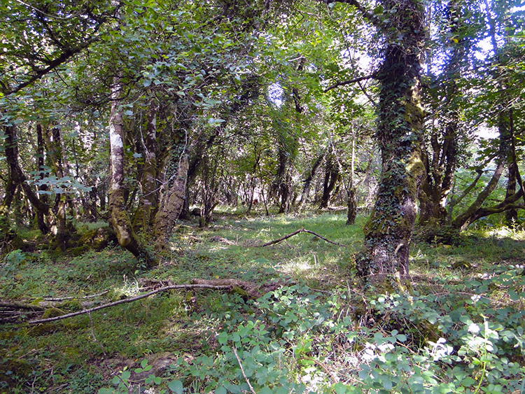 Skaigh Wood
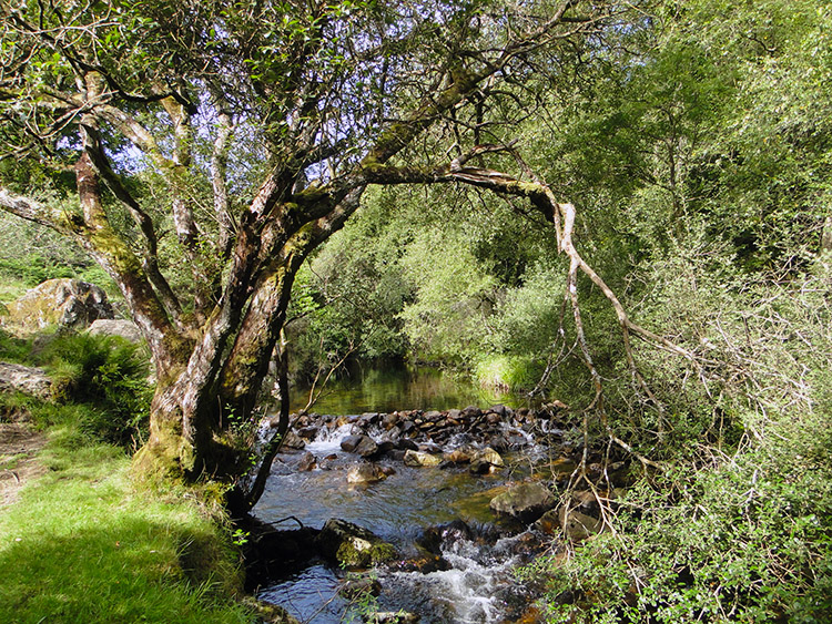 River Taw in Belstone Cleave
I could have designed this walk to be four miles shorter by starting the trek onto Dartmoor from the isolated village of Belstone but that would be remiss of me for by starting the walk in Sticklepath you are provided with a fabulous start to the walk and a warm up before the climb onto the moor by taking a wonderful woodland walk through Skaigh Wood and Belstone Cleave by following a path which keeps close to the River Taw. Skaigh Wood is home to many ancient trees and when I walked through it in the company of my friend John Lister we saw deer scurrying in the distance. Had we walked in the wood two months previously we would have walked amidst white elderflowers, red campion and purple foxgloves whilst during the spring we would have had the company of wood anemones, wild garlic and bluebells. Still we had rich verdant greens and sweet smells a plenty to enjoy which continued into Belstone Cleave.
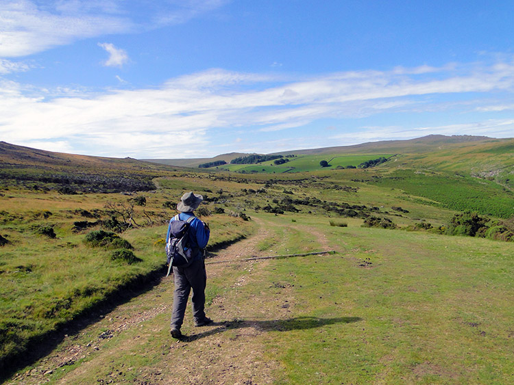 Walking onto Dartmoor at Watchet Hill
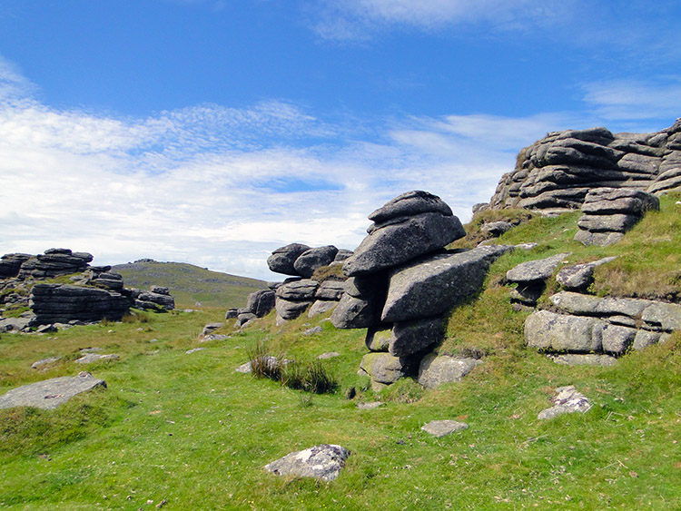
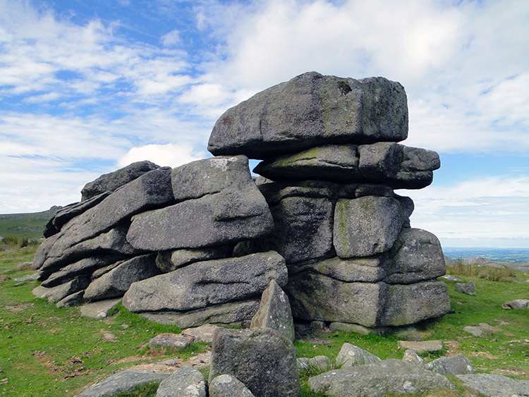 Stone outcrop on Rowtor
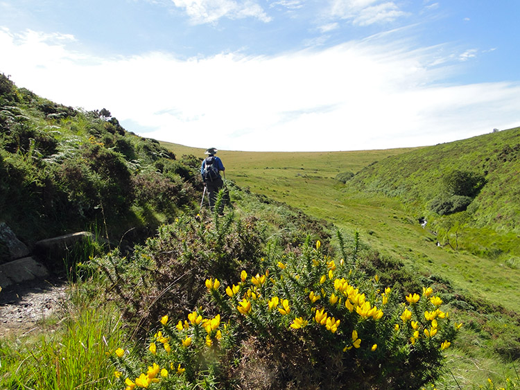
From Belstone Cleave John and I crossed over the infant River Taw by a footbridge before climbing up a bank to Belstone village, a quiet place on the sunny summers day we walked by on our way onto Dartmoor. The only activity was a group of pony riders with their trainer, a Post Office van picking up mail from a postbox and delivering to the houses and a small brewery wagon delivering fresh supplies of ale to the village pub. We observed and passed courtesies before continuing on and accessing Dartmoor by skirting the north side of the crest of Watchet Hill. We were immediately entranced by the moor. The weather helped us of course, with sunny skies and clear visibility giving us a long range view of the beautiful moorland. We could see for miles to the north over the plains of of Devon beyond Okehampton. We could also see all the way west over Dartmoor to Yes Tor and High Willhays which made navigation inconsequential. We could see where we were going without a problem. First objective was Scarey Tor one kilometer to the north west. It was not scary at all, becalmed by the weather and John and I walked nonchalantly past aiming for Rowtor, a neighbouring hill to the high two we had our sights on. The map showed us walking over marshy ground but there was none of it, the ground was parch dry and our boots throughout the whole crossing of the moor stayed dry. The final ascent to Rowtor was a job, especially with my 16 kilo backpack strapped to me but single short paces and a couple of short breathers saw me up onto the rock strewn summit of Rowtor alongside John.
 Yes Tor as seen from Rowtor
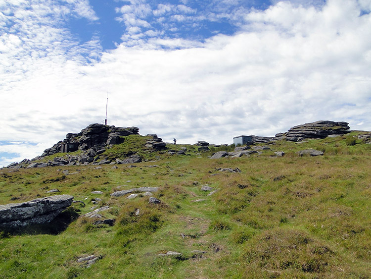 Approaching Yes Tor
We took a short break for a drink on Rowtor, nothing more because we had a deadline to meet Strolling Steve on the other side of the moor (he had chosen to follow the Granite Trail, a lowland route around the north edge. He would meet us on the other side of the moor at the village of Lake). After our break we walked from Rowtor to skirt round the south side of West Mill Tor and ten ascend to Yes Tor which we did with ease. The ground underfoot was excellent, as mentioned not wet at all, not springy either but firm and forgiving thus providing perfect walking conditions. The weather was perfect too, sun shining, little breeze and not too hot but it was getting hotter as we approached Yes Tor towards midday. When we got there we took another break to take in the views and this time to have a bite to eat too.
 At the trig point on Yes Tor
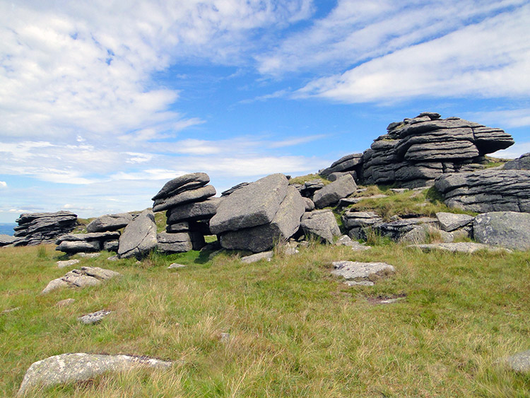 Scattered rocks on Yes Tor
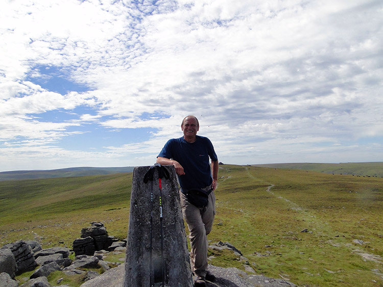
The only snag by taking a break on Yes Tor was that on our visit it was home to a swarm of wasps who kept harassing us. On the photograph of me at the trig point, were you to see the large version of the photograph, you would see wasps buzzing around my head. Fortunately they restricted their annoyance to buzzing around and not landing or biting but they were still an irritation uncalled for. Even they could not spoil the day though and after our time on Yes Tor we took our leave and paid a quick visit to High Willhays, by a mammoth two metres beating Yes Tor as the highest point on Dartmoor, before we took a nice gentle course due west to descend to Black Tor before we tracked north west to Shelstone Tor and then by keeping the same course to Vellake corner. By doing this we had made a safe easy descent of the moor by rounding the west side of Homerton Hill and now we were at the south west edge of Meldon Reservoir. Here John and I happened on some other walkers and ramblers also enjoying the beauty and isolation of Dartmoor.
 Near Homerton Hill
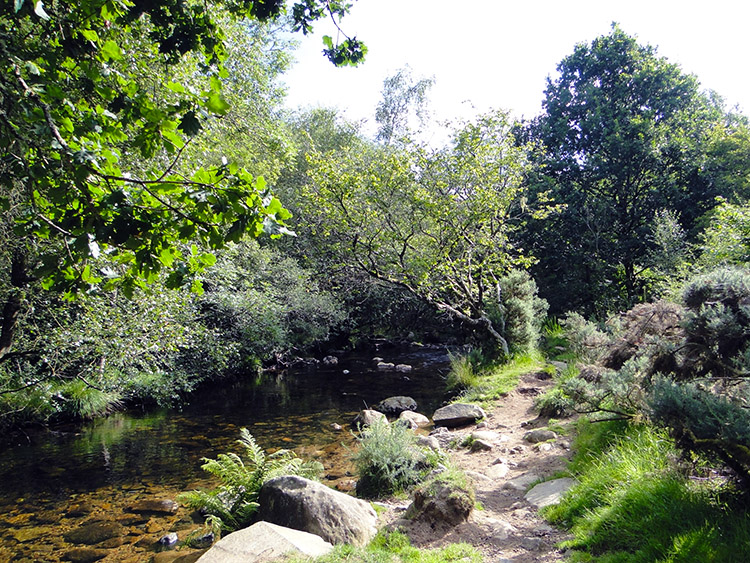 Belstone Cleave
From Meldon Reservoir John and I took a west course off the moor as part of my 1,000 mile walk. However were I doing a circular walk this is what I would have done: - I would follow the south side reservoir track to Longstone Hill and then take the right hand fork on a course due east and away from the reservoir to leave the track and cross Red-a ven Brook before rejoining a track still on a course east and then north east to Black Down. Then I would have chosen the track to East Bowden, which is one of a few tracked options back to Scarey Tor. From Scarey Tor I would simply follow my original course back to Belstone and then back to the start at Sticklepath.


