Foel Drygarn Hill Fort
Russ Jones of Property Workshop outlines what to expect from a visit to a Bronze Age fort, high in the Preseli Hills of west Wales. At the heart of the Pembrokeshire Coast National Park, the Preseli Hills form one of the county’s literal and metaphorical high points. Soaring to over 500 metres in height, they provide 360-degree panoramas across the Welsh countryside towards the distant coastline. This is the setting for the ancient Golden Road track used by historic merchants and traders, while Foel Eryr offers views towards Ireland on a clear day. Yet perhaps the richest delight in the Preseli Hills is found at the top of Foel Drygarn – an Iron Age hill fort with a trilogy of burial cairns contained within rings of ramparts and ditches.
By definition, hill forts are always situated on high ground, but Foel Drygarn is surprisingly easy to navigate. Indeed, it’s a walk you could undertake with a baby in a carrier, or even with an energetic toddler at your side. The hilltop is less than three kilometres from the nearest parking area, making this a great walk for families keen to explore the great outdoors without embarking on a Tolkienesque quest – though the dramatic scenery wouldn’t seem out of place on an unexpected journey.
Google Maps
Open Source Maps
| Statistics and Files | ||
|---|---|---|
| Start: Crymych | Distance: 3.0 miles (4.7 km) | Climbing: 160 metres |
| Grid Ref: SN 16671 33221 | Time: 2 hours | Rating: Moderate |
| GPX Route File | Google Earth File | About Crymych |
| Statistics | |
|---|---|
| Start: Crymych | Distance: 3.0 miles (4.7 km) |
| Climbing: 160 metres | Grid Ref: SN 16671 33221 |
| Time: 2 hours | Rating: Moderate |
| GPX Route File | Google Earth File |
Ordnance Survey Explorer Map (1:25,000)
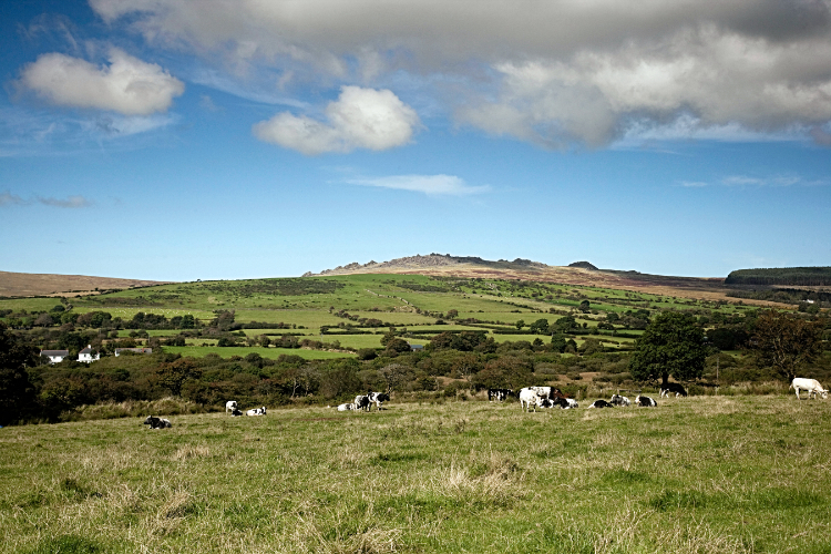
The Walk: Your own journey starts just outside the sleepy village of Crymych, with its assortment of stone-fronted bungalows and colourfully-painted houses. A side street meanders into unassuming countryside, with an unmarked layby opposite a discreet timber post with a footpath marker on it. The path itself is initially hidden from view behind foxgloves and campion, though you can hardly miss the Preselis, with Foel Drygarn Hill Fort capping the easternmost hill. Having left the warmth of the car and passed the footpath marker, the path towards Foel Drygarn is obvious amid the countryside, snaking its way towards a clearly visible summit. This isn’t one of those frustrating hill walks where the peak remains hidden behind a succession of ridges, providing false hope to the tired climber. At the base of the hill, and under its shadow, lush farmland is sprinkled with trees and liberally populated by cattle. Higher up, the hillside becomes gradually more rugged, with lush grazing land giving way to heath and moorland. Craggy outposts seemingly emerge from the peat and moss that clings to the hillside, almost like turtles poking their heads out of the ground. They’re joined by the remains of the Foel Drygarn hill fort – stone boulders from its former embankments pepper the hill with increasing frequency as the ascent steepens.
 Overhead picture of Foel Drygarn
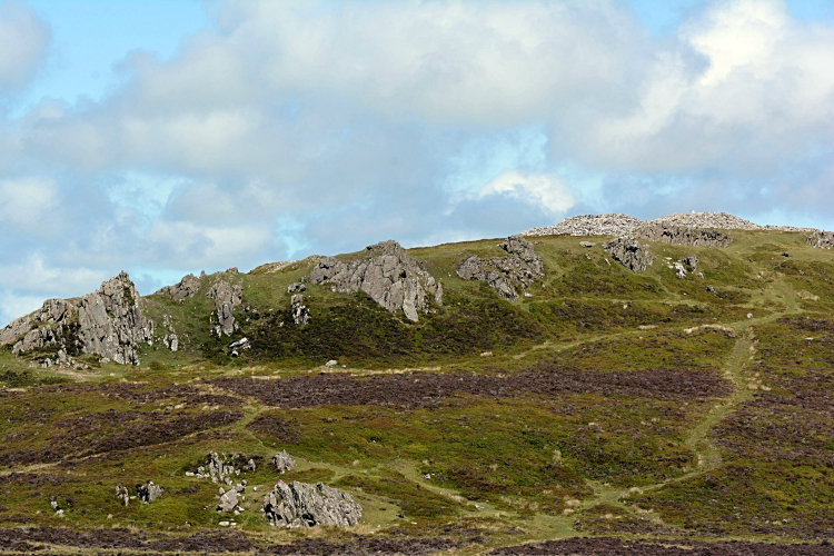 Footpath to Bronze Age Cairns on Foel Drygarn
Although you can see the grassy path’s incline increasing from the road, the first leg of your journey is across relatively flat and benign terrain, with a track leading from the road to a gate. Beyond it, the path begins its winding ascent up the hill. Conditions underfoot tend to be good at any time of year – this isn’t a treacherous mountain pass best avoided in bad weather. Indeed, some of the most stunning photos of Foel Drygarn have been taken in winter, when the contrast of boulder against snow is particularly dramatic. In warmer but overcast conditions, it can appear as if the clouds are skimming the top of the hill, while bright sunshine highlights the richly varied palette of green and brown hues in this little-visited corner of Wales. As you climb the hill, you pass the first of several former fort defences, with concentric rings of dry stone and earth indicating where ramparts once stood to ward off enemy invaders. The innermost (and highest) defence encloses a three-acre circle of hilltop, capped by a trio of stone cairns. These are believed to be Bronze Age burial mounds, and 19th century archaeologists found a wealth of sling stones buried in the ground alongside Iron Age and Roman pottery. People lived and died here, with the former protecting the latter’s right to undisturbed rest.
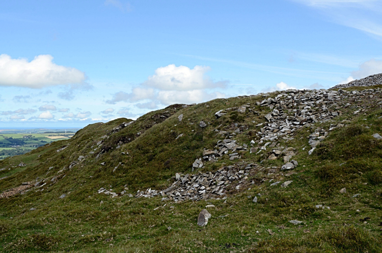 Embankment remains on Foel Drygarn
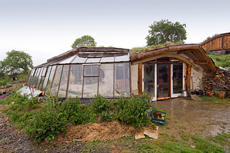 Lammas Eco Village House
The cairns themselves remain largely intact, undisturbed through the millennial despite the harsh weather that can strike the Preseli Hills. It’s also partly because visitors are soon distracted from the burial site by the rolling majesty of the surrounding views. From one of the highest points in Pembrokeshire, 363 metres above sea level, there are panoramic aspects in every direction. With little in the way of human habitation to block the skyline, you can see north towards the coast, as birds wheel across the horizon. Ironically, this was a densely-populated hub thousands of years ago – the inner defence accommodates the remains of over 220 hut platforms, which would have been occupied by the residents of the hill fort in its heyday.
The summit of Foel Drygarn is indicated with a concrete triangulation pillar, known by seasoned walkers as a trig point. As well as providing a natural focus for orienteering, the trig point is the best place to appreciate the views while you catch your breath following that relatively steep final ascent. Surrounding rocky outcrops provide a better place to settle down and relax with a picnic, since the wind whips over the exposed hilltop with little to deflect it. It’s also worth being aware of gusting winds if you want to look out towards Snowdonia – there are some relatively steep drops along the western outcrops, which could catch out unwary visitors or playing children.


