Betws-y-Coed, Gwydyr Forest, Llyn Elsi and Sarn Helen
What do you do on a wet day with hanging low cloud when on a walking trip in Snowdonia. A walk of course, and for me the obvious choice is to choose one of the many low level options available. Why climb a mountain and see nothing? So, with a few walks below the clouds saved as routes on my GPS unit I banked for this one. I was pleased I did, thoroughly enjoying it from start to finish. The twisting and turning paths and trails in Gwydyr Forest were fun to negotiate. Good job I had the route file to keep me on track. Being at Llyn Elsi was atmospheric on such a grey day. As for the finale, the recent rainfall made my viewing of the rushing waters of the Betws-y-Coed waterfalls into a dramatic show.
Google Maps Open Source Maps| Statistics and Files | ||
|---|---|---|
| Start: St Mary's Church | Distance: 3.8 miles (6.1 km) | Climbing: 295 metres |
| Grid Ref: SH 79336 56411 | Time: 2-3 hours | Rating: Easy |
| GPX Route File | Google Earth File | About Betws-y-Coed |
| Statistics | |
|---|---|
| Start: St Mary's Church | Distance: 3.8 miles (6.1 km) |
| Climbing: 295 metres | Grid Ref: SH 79336 56411 |
| Time: 2-3 hours | Rating: Easy |
| GPX Route File | Google Earth File |
Ordnance Survey Explorer Map (1:25,000)
The Walk:
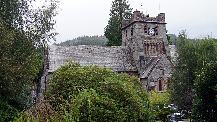 St Mary's Church, Betws-y-Coed
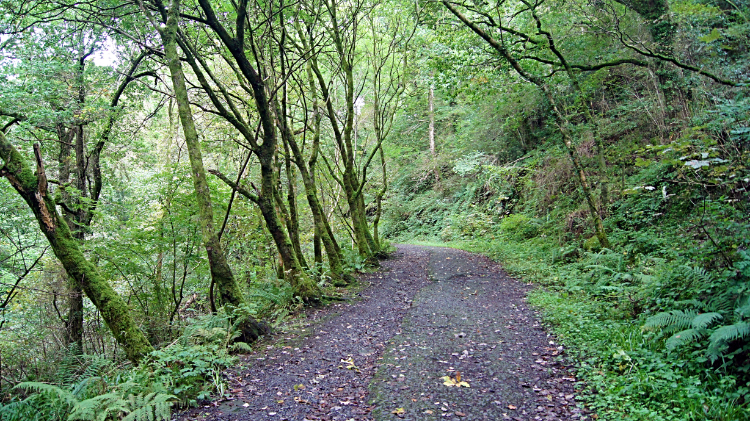 Climbing the trail through Gwydyr Forest
On the crescent at the back of St Mary’s Church I found the sign for 'Eglwys Santes Fair' which marked the starting point of the walk, leading into the mixed fir and broadleaf woodlands of the Gwydyr Forest. It was raining; I was glad to get into the cover of the trees. The forestry track, marked with sporadically placed black and white foot way markers led the way, meanderingly, on a steady climb into the forest. The first kilometer sees 200 metres of altitude gained, so though you do not notice it in the confines of the forest, you are climbing a pretty big hill. I was not alone in doing so, there were plenty of people on the trail with me. But most of them seemed to disappear on the climb to Llyn Elsi, bearing off in a different direction to me at one of the many intersections on the way. There are lots of paths in the forest, numerous junctions and plenty of crossroads. Make sure of your bearing. Sure of my line with my GPS unit adding reassurance, I enjoyed the climb in the company of the trees. Many were old, gnarly and unstraight. Just how I like a forest to be.
 Following the path beside Llyn Elsi
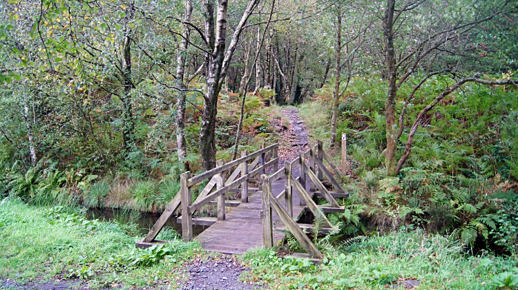 Footbridge over stream near Llyn Elsi North Dam
Eventually I topped out of the climb, after one kilometer and half way to Llyn Elsi. Now could relax and enjoy the sights and sounds of Gwydyr Forest without huffing and puffing. At height the thick forest dispersed, the larger firs and broadleafs giving space to smaller trees and shrubs such as Rowan (Mountain Ash) which were in their full array of colour, thick with the red berries of Autumn. It was 28th September, all the autumn fruit and nuts were on show and the resident wildlife were happily harvesting them. The forest is home to a variety of birds, amongst them plenty of Raptors including Buzzards, Peregrines, Merlins and Goshawks. So I hope the seed, fruit and nut eaters were taking care eating their seasonal bounty without getting eaten themselves. I did see plenty of small birds scuttling about in the trees as I walked along but soon my attention was drawn to Llyn Elsi. I had arrived at the lake.
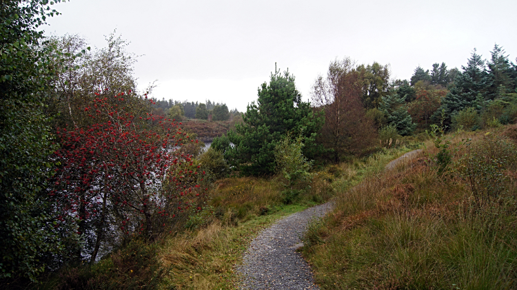
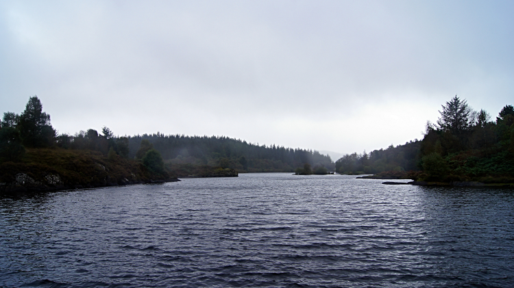 Llyn Elsi
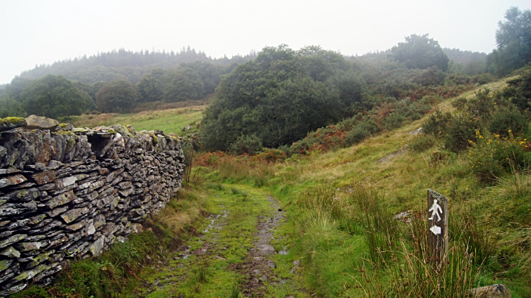 Following the path to Rhiwddolion
Gwydyr Forest is home to numerous lakes, nearly all of which were created to serve the mineral mines of the forest. Llyn Elsi at 26 acres and holding 110,000 square meters of water is the third largest. The scene I enjoyed over, looking from north to south was very atmospheric in the gloom of the day. In the distant south a lighter sky seemed to show promise for later but now over my head the cloud remained thick and dark. And they still leaked precipitation though I was enjoying a brief respite from heavier rain. It was not to last. I walked to the North Dam and briefly went off track to follow a path around to the west of the lake, across the pictured footbridge. But I soon returned, finding the path petered out to nothing. It may have led to quiet fishing spots. Trout are stocked for anglers in Llyn Elsi. So back at the dam I headed off and away from the lake, following a path to Rhiwddolion.
 The trail at Rhiwddolion
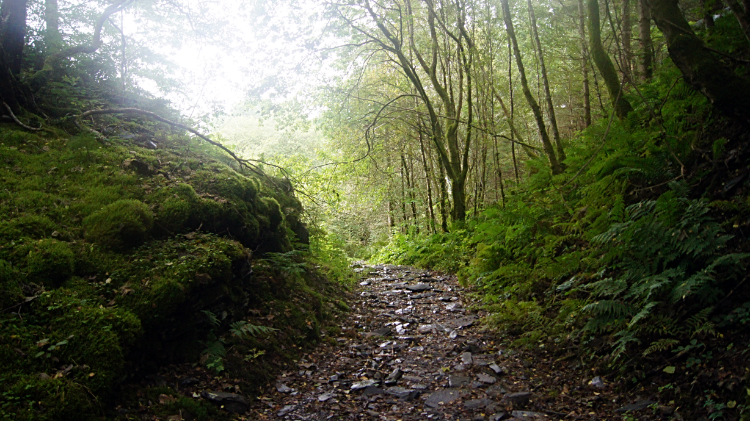 On a stretch of Sarn Helen Roman Road
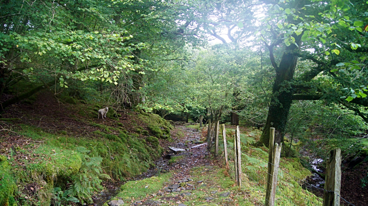
The next phase of the walk was very enjoyable. For two reasons. First because I got back into the cover of high tree lined trails just as the heavy rains returned. And secondly because these trails were set thorough some of the oldest and wildest of woodland. Fall of feet over hundreds of years had sunk holloway paths in many stretches of the way, causing my walk to be at head height to the surrounding ground. I wondered when these paths had first been walked, when the early walkers would have had their feet where I now had my head. I know some will have been here two thousand years ago at least and surely much before that. Confirmation of that idea came when I joined the course of Sarn Helen, a Roman road. The Roman road which stretches through central and north Wales is 160 miles long. I just walked one mile of it, from Rhiwddolion to Miner's Bridge on Afon Llugwy. During that mile I descended the 200 metres or so I had gained on the climb at the start of the walk.
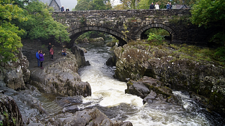 Betws-y-Coed Waterfalls
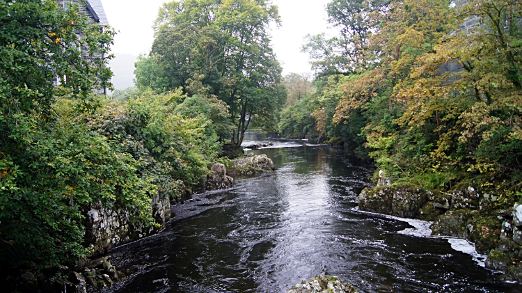 Afon Llugwy
From Miner's Bridge, after safely crossing the A5 just west of Betws-y-Coed I followed an easy path along the north side of Afon Llugwy. It was a gentle uneventful, scenic and peaceful walk and a direct contrast to what I was to experience downstream. In the center of Betws-y-Coed the river narrows and plunges dramatically, just at the point the lovely Pont-y-Pair stone bridge crosses the river. I noticed a lot of people stood on the bridge looking down to the falls and more stood on the rocks close beside the river. Most had smart phones pointing their cameras at the rushing white waters. Some more had professional cameras pointing the same way. "What are they looking at?" I thought. Only when I got up close did I see. A Heron was precariously stood on sloping rocks at the waters edge and jabbing its beak into the surging waters. The chaos of water must have been throwing up tasty morsels for the Heron. It did put on quite a show. Watching the Heron and watching the amazing water show was a fitting finale to my walk. It had been fun in the rain.


