Wales Coast to Coast
A record of the Walking Englishman's 246 miles Coast to Coast journey from Conwy in North Wales to Cardiff in South Wales. With maps, statistics, pictures, gps files and personal journals for each stage of the walk.
Stage Nine: Ponterwyd to Devil's Bridge
Google Maps Open Source Maps| Statistics and Files | ||
|---|---|---|
| Start: Ponterwyd | Distance: 6.4 miles (10.2 km) | Climbing: 595 meters |
| Grid Ref: SN 74899 80843 | Time: 3-5 hours | Rating: Hard |
| GPX Route File | Google Earth File | About Ceredigion |
| Statistics | |
|---|---|
| Start: Ponterwyd | Distance: 6.4 miles (10.2 km) |
| Grid Ref: SN 74899 80843 | Time: 3-5 hours |
| Climbing: 595 meters | Rating: Hard |
| GPX Route File | Google Earth File |
Ordnance Survey Explorer Map (1:25,000)
Summary: A short stage today, just six and a half miles and designed so with a purpose. The plan was to walk from Ponterwyd by skirting around Bryn Bras to Ystumtuen and then to follow the Borth to Devil's Bridge to Pontrhydfendigaid Trail as far as Coed Rheidol National Nature Reserve which I would explore during a walk through to Devil's Bridge, hoping to arrive around lunchtime. That would give me time to enjoy an afternoon exploring the trails and waterfalls of Devil's Bridge Gorge, including the famous road bridge over Afon Rheidol, Mynach Falls and Devil's Punchbowl.
The Walk:
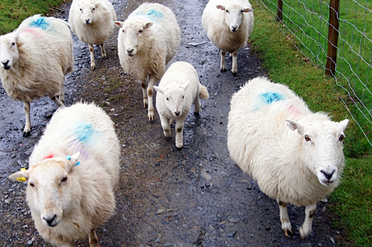 The friendly bunch
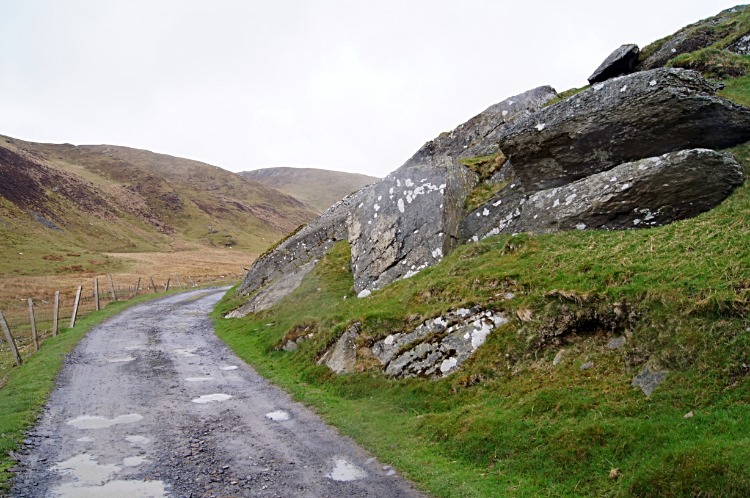 The road to Bryn Bras
It was not the best of days and already raining as I set off from Ponterwyd. I think it had rained all night and would probably rain all day too. I could not complain, having enjoyed a fine run of weather all last week in the north of Wales. Now in hinterland country the wild and gloomy conditions were appropriate for a land associated with the hardiest of folk. No one was around as I made my way by paths, lanes, fields and a little bit of roadside to cross Afon Llywernog and track south to Bryn-bras farm. On the way a flock of sheep corralled me as I crossed their field. I expect they through I had their breakfast with me. Alas I had to disappoint them. Still no one was seen to be about as I reached Bryn-bras but the farm dog barked ferociously as I walked through the farmyard. I was glad he was chained up.
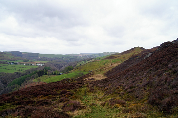 The view from Bryn Bras
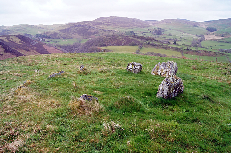 Bryn Bras Stone Circle
From the farm I climbed the south side of Bryn Bras Hill steeply making 70 meters height by huffing and puffing in short time to reach an unmarked stone circle on the south facing slope of Bryn Bras. It was a surprising find as there is no indication of the stone circle on the Ordnance Survey Explorer map. Viewing and admiring the stone circle in its elevated position allowed me to catch my breath. I admired the views of the wild Ceredigion countryside as I rested too.
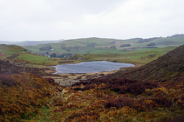 Llyn Bryn Bras
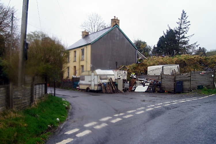 Ystumtuen
From the stone circle I tracked north-west through a slice in the middle of the hill to reach Llyn Bryn Bras. That is what I christened the water anyway, it is found in a quiet location at 300 meters elevation on the edge of the hill. Beyond the water I passed on the south side of a small hill and then passed through a small local quarry which while looking disused also had recent tracks leading up to it. The locals have to get their building and field wall materials from somewhere so why not use the resources at hand. I would. I descended from the site of the small slate quarry reach a road leading through the village of Ystumtuen which looked forlorn. It most likely enjoyed more prosperous times when lead and slate mining had been actively pursued. Walking through the seemingly deserted village I was surprised to pass a youth hostel. Nothing stirred from the youth hostel either. Whether it still used or not the building appeared to be well maintained. I continued on my way beyond Ystumtuen by following the Borth to Devil's Bridge to Pontrhydfendigaid Trail which led me on a slight descent along a ridge and by field sides to reach the entry point to the Coed Rheidol National Nature Reserve. From here the descent would get much steeper.
 Coed Rheidol National Nature Reserve
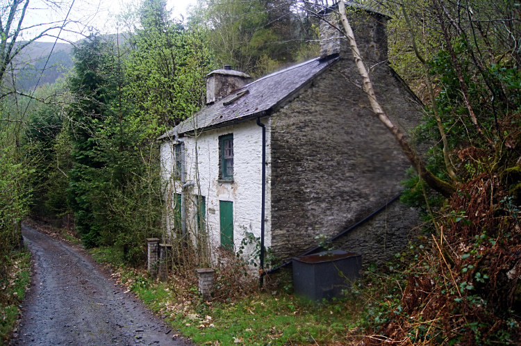 Pant-y-ddwyriw
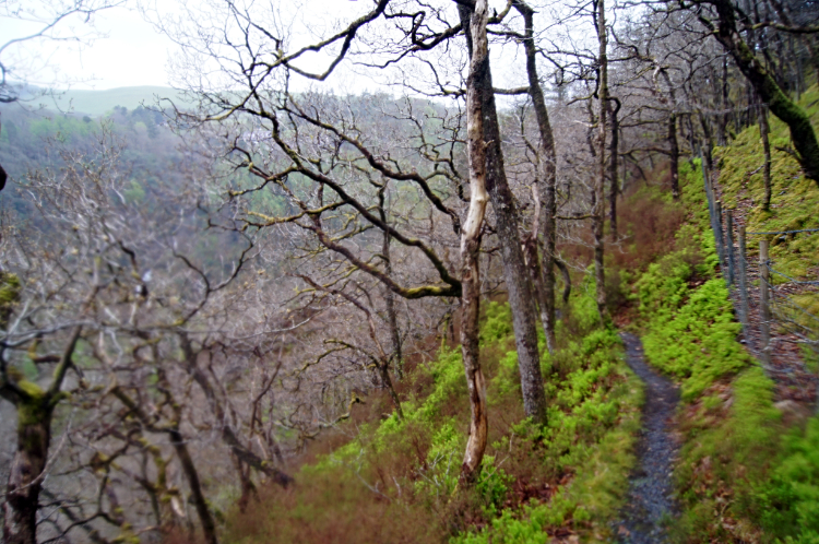
The path had been a wide one from Ystumtuen to the nature reserve but once I had climbed over a stile to access the wooded reserve things immediately changed. The path was now foot wide narrow so steps had to be made in one in front of the other fashion. And the going was slippery in the wet conditions which if anything were getting worse. It was raining heavily now. Carrying on regardless, the path wound in meandering fashion down into the Rheidol Gorge around gnarled Birch trees. I took my time and concentrated on where I put my feet on the way down the precarious path which took me fifteen minutes to negotiate safely. In that time I had descended 100 meters. I had noticed the famous waterfalls of Devil's Bridge on the descent but not paid them too much notice as my attention had been on where I had put my feet. And I knew I would get up much closer to them at the end of the walk anyway. The walk eased on reaching the gorge bottom as I followed a ranger road to the Cottage at Pant-y-ddwyriw and then a metalled road to the point where I would cross Afon Rheidol.
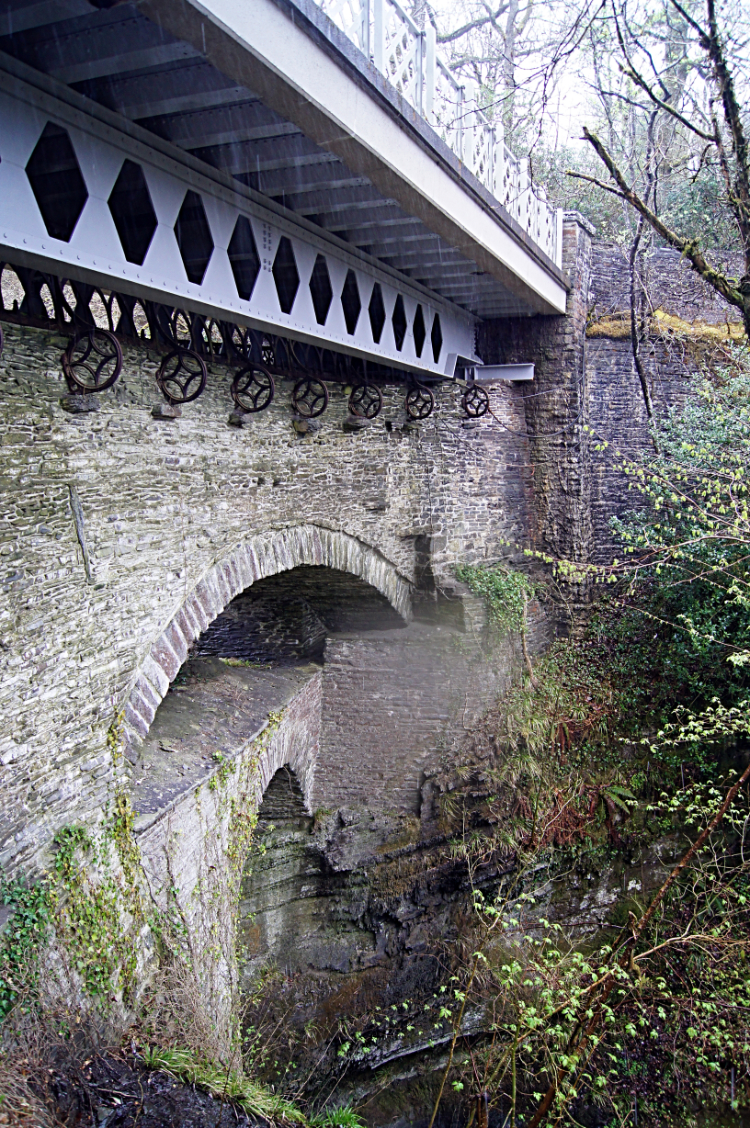
 Vale of Rheidol Railway
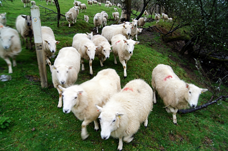 The Wild Bunch
Afon Rheidol was flowing fast under the feet as I crossed the concrete footbridge. I expected eye-popping displays from the Devil's Bridge waterfalls later on. On the far side of the footbridge I read a sign telling me of what to expect on the continuing walk through the reserve. It said "The Rheidol Valley has some of the most spectacular views in Mid Wales. Coed Rheidol is an ancient Oak woodland, so typical in Wales. But the woodland's richness also lies in the great variety of plants and animals that can be found here". It added "Coed Rheidol was particularly important for mosses, liverworts and lichens which carpet the trees, rocks and soil." That was clearly evident as the path I followed was swathed in lush green mosses on either side. And the trees were festooned with green moisture loving plant life, none of which appeared to be causing any harm to their hosts. It was a gorgeous stage of my walk along this age old woodland trail which followed a line parallel to Afon Rheidol. The sign I had read also told me there were 70 bird species which have been seen in the reserve. It said "The pied flycatcher, redstart and wood warbler breed on the reserve, and look out for the red kites hovering above". I could not miss the red kites, one and then another appeared in the sky at regular intervals, each performing their gracious effortless aerobatics. After a while I began to climb from the gorge. As I did so the erratic nature of the ancient woodland ceded to the military formation of spruce plantation. At least the mosses clung on to the sides of the paths where sufficient light got through the density of plantation trees. Inside the plantation it was a drab lifeless place.
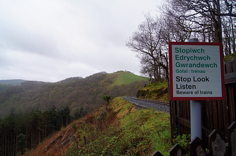
I climbed as quickly as I could out of the plantation and indeed out of the depth of Rheidol gorge to reach a 'Stop, Look, Listen' sign which informed me I had reached the point where I would cross the Vale of Rheidol Railway. I crossed the railway safely and followed the path running close to the line and on the edge of more moss festooned picturesque woodland. The path led me away from the line and through the lovely woodland, duly leading me across a stream by way of a lovely footbridge to a point where I climbed from the wood and into a lush grassy field. I sensed something.
I stepped into the field and began to find the path across it. It seemed quiet for the first few steps but then I realised I was not alone in the field. All of a sudden a great stampede of feet was hurtling towards me. The field was full of sheep and I guess they mistook me for the farmer who shepherds them. It was clear they expected me to have brought something for them as they corralled me, sniffed me and even nudged me in expectation of goodies. I said "Sorry, I have nothing for you"." as I shuffled my way along the path and out of the field. It was the second time I had let a flock of sheep down. I was quite relieved to get out of the push and shove. Into the next field I went which was empty of sheep. Suddenly it was peaceful again. The next field led me to the road leading into Devil's Bridge. The countryside and nature reserve chapters of my walk were over. Now for the next part.
 Devil's Bridge
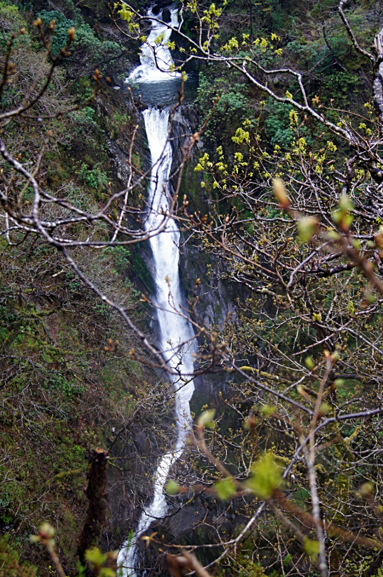 Waterfall in Devil's Bridge Gorge
I walked along the roadside and down into Devil's Bridge, passed the delightful restored AA rescue box and crossed the famous Devil's Bridge to join a queue of people waiting to access the falls. People, they do exist! I was excited as I waited my turn to visit the falls. It looked a long way down. Once in the visitor attraction and on my way I paused. There was a precarious descent by way of a steep stairway. The steps, titled Jacob's Ladder are steep and slippery in the wet and it was very wet. Metal bars are set across the path at regular intervals and they need to be as a slip would probably cause serious harm. I found the descent of the stairs more scary than I found climbing Tryfan and the Glyders and the crossing of Crib Goch earlier in the walk. Much more scary. I took it very slowly and stepped down as carefully as I could. Safely down, the rewards for the effort were immense. There seems to be waterfalls everywhere. Mynach Falls is not just one waterfall, it keeps on going, a plunge down a sheer gorge. In fact Mynach drops 90 meters in five individual five waterfalls in a practically sheer descent. They are dramatic and they are awesome.
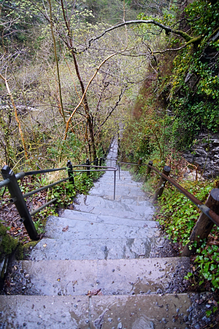 The scary steps of Devil's Bridge Gorge
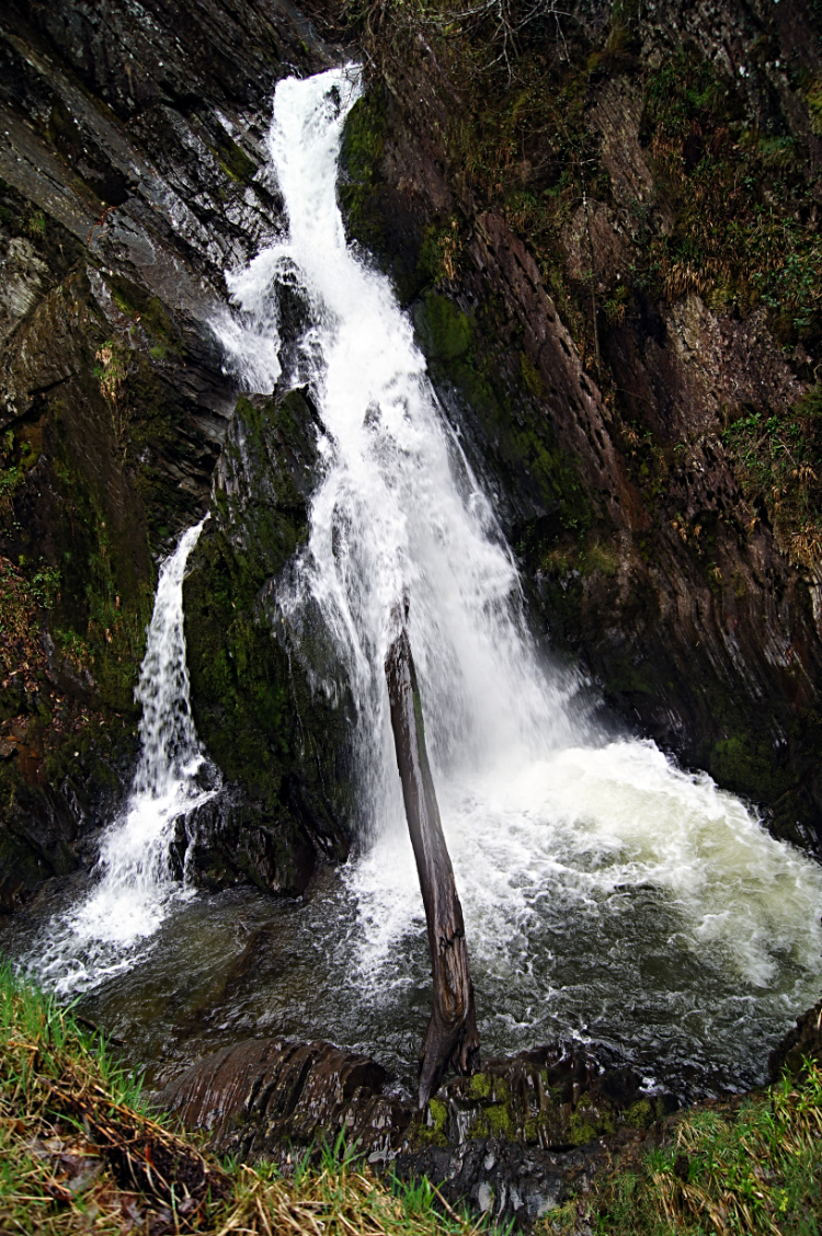 Another beautiful waterfall in Devil's Bridge Gorge
The walk around the trail is linear, in that it starts on the bridge and ends by exiting to the roadside outside Hafod Hotel by way of a turnstile. In between there is the steep descent into the gorge and a steep climb out of the gorge. And many places to stop and view the spectacles all the way around too. I was on the main trail for one hour, enjoying it all and taking it all in as much as I could. Each waterfall was as spectacular as the last and every moment a joy. Not only were the waterfalls are thrill but much more too. Including the lovely arched bridge over Afon Mynach and including more gorgeous mossed woodland set deep within the ravine. There was Robber’s Cave to explore too where the geology was striking. One hour of delight it was. I emerged from the turnstiles as much in awe of the gorge as I had been the first time. And still there was more to come.
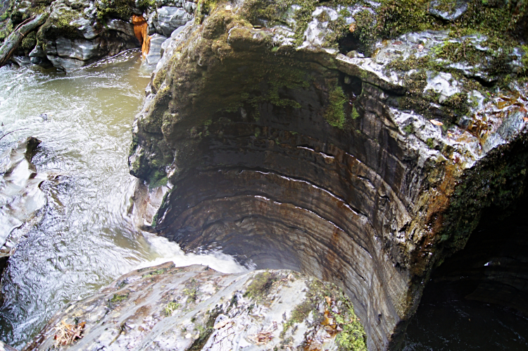 Devil's Punchbowl
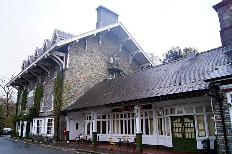 Sanctuary
I went back on to Devil's Bridge and stood atop of the topmost of the three bridges before descending into the gorge again, this time on the south side so I could pop down to the Devil's Punchbowl. Here Afon Mynach has carved beautiful, large pot holes into the rock and in such natural symmetry. Breathtaking they are. From the steps leading down to the punchbowl is the best view of the three bridges too. The most recently built is an iron bridge (1901), which was built over a stone bridge (1753), which was built when the original bridge was thought to be unstable. The builders of the 1753 bridge used the original bridge (built 1075–1200) to support scaffolding during construction. So I was stood looking down to the Devil's Punchbowl and by raising my head and looking to my right I was looking at Devil's Bridge. Natural wonder and man-made wonder all in one. What a finale.
From my Facebook post in the evening: "Today was windy and cold from the outset and raining as well after just one mile but the walk, as with every walk on this wonderful journey down the spine of Wales was a tremendous joy. Of course I grumbled about the weather, especially when I struggled to get my poncho (which resemble s a bin liner with hood and arm holes) on in the driving rain. It was wafting about as furiously as a sail on the Golden Hind in high seas as I made at least three attempts to get it on right! I set off from Ponterwyd heading south and climbed Bryn Bras and then descended the hill to where I unexpectedly came across a small stone circle. I continued to a small tarn where I had my poncho comedy show and then to a disused lead mine near Ystumtuen. After walking through the village I followed the Borth to Devil's Bridge Trail which was fantastic. Views to deep valleys below and hills above we're stunning and ever changing as I walked from southwards round to a northwest direction while entering the sublime beauty of Coed Rheidol Nature Reserve. Deep narrow gorges with exquisite waterfalls, fast flowing rivers, tree lined banking slopes of Birch, Hawthorne and some pine plantations provided a varied shifting landscape. Descents were steep, ascents hard work. In open areas fields were filled with sheep, most wary of me but one flock was intimidating. Then came Devil's Bridge and I hope my photographs represent my feelings of how much I enjoyed myself exploring the area. I am ecstatic about today, all the weather problems dismissed into oblivion. The only sad note, I have now reached half way - after I leave on my walk tomorrow I will have less to do than what is done. If part two of my Wales Coast to Coast is half as good as part one then I will enjoy myself. Tomorrow I walk from Devil's Bridge to Tregaron."


