Wales Coast to Coast
A record of the Walking Englishman's 246 miles Coast to Coast journey from Conwy in North Wales to Cardiff in South Wales. With maps, statistics, pictures, gps files and personal journals for each stage of the walk.
Stage Thirteen: Llandovery to Cray Reservoir
Google Maps Open Source Maps| Statistics and Files | ||
|---|---|---|
| Start: Llandovery | Distance: 17.9 miles (28.8 km) | Climbing: 1,570 meters |
| Grid Ref: SN 76813 34357 | Time: 8-11 hours | Rating: Strenuous |
| GPX Route File | Google Earth File | About the Brecon Beacons |
| Statistics | |
|---|---|
| Start: Llandovery | Distance: 17.9 miles (28.8 km) |
| Grid Ref: SN 76813 34357 | Time: 8-11 hours |
| Climbing: 1,570 meters | Rating: Strenuous |
| GPX Route File | Google Earth File |
Ordnance Survey Explorer Map (1:25,000)
OL12 Brecon Beacons/ Bannau Brycheiniog: Western Area
Summary: One hundred and fifty miles done done and less than one hundred to go. I was into my last week of the Wales Coast to Coast as I left Llandovery in the company of Strolling Steve who was the accompany me for the first three of the final six days. With my chum alongside me this was going to be fun. Today we were heading into the Brecon Beacons National Park to rejoin the Cambrian Way and also join with the Beacons Way on the crossing of the Black Mountain area in the west of the National Park. We had six miles of Welsh countryside to cross first on a constant climb to the Brecon Beacons. Let's go shall we.
The Walk:
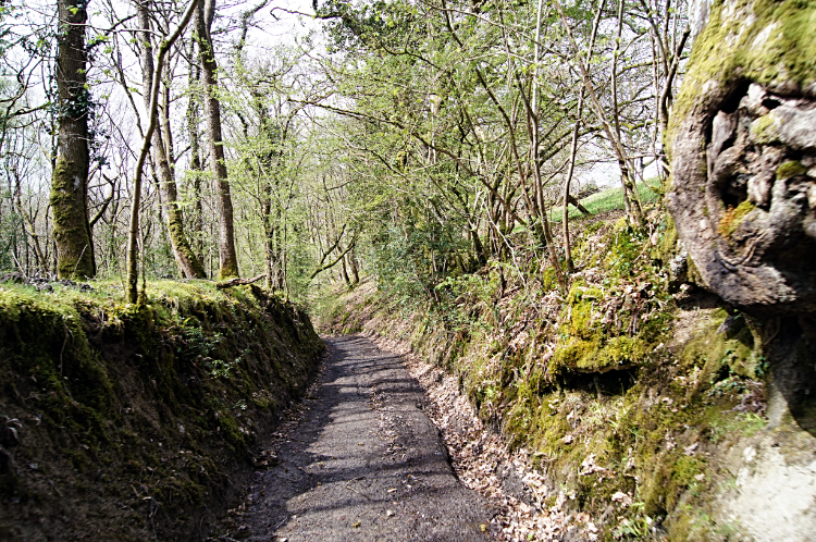 Holloway path in Llwynywormwood Park
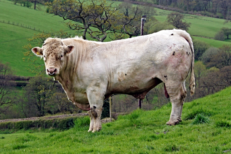 "Keep you distance lads"
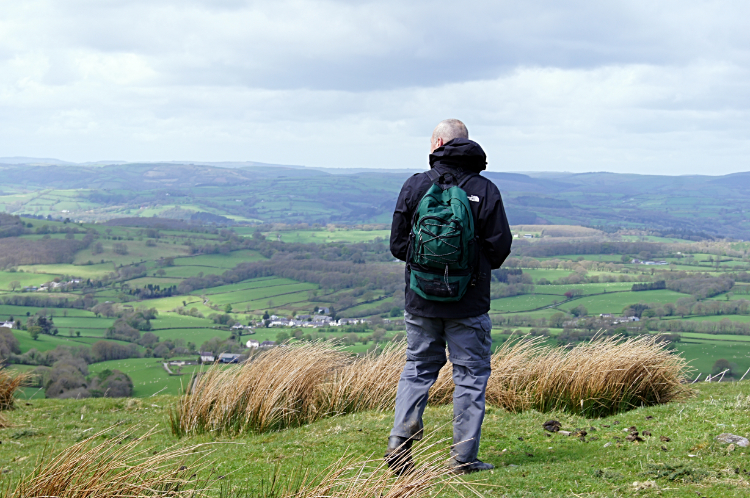
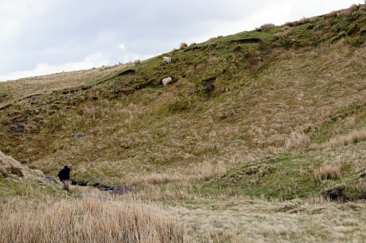
"What is this? The sun is shining. I have not seen it for almost a week" I said to Steve on the start of our walk from the car park at Llandovery Castle. "Because I am here to look after you now" he replied. We had enjoyed a good night in Brecon catching up and after a debacle of buses and taxis in the early morning we were happy to be off at last. All the better for having some sunshine on our faces. The weather forecast was fair enough with a decent morning and the chance of showers in the afternoon. Oh, logistics had been planned too, we had arranged with the taxi driver for a pick up at a lay-by on the A4067 near Cray Reservoir for 5.00pm, giving us six and a half hours to get the walk done. We were cutting it fine but Steve and I usually kept up a good pace. The start of the walk was good with not too much climbing for the first four miles to Myddfai. With a mix of field crossings, country lanes, tracks and short sections of road the walk was very interesting with its diversity. And it was on this stretch I first noticed an acceleration into Spring. Here, today on 13th June 2013 many of the local trees were budding and some showing fresh green leaf. And Bluebells were breaking out in the woodland. Welcome colour I had not seen further north and in the week of gloom in mid Wales. With the smile of new season colour we enjoyed a walk on a Holloway, cut two meters deep by years of foot and cart traffic. Some of the fields were stocked with Sheep or Cattle. One field had a ferocious looking Bull in it but to our relief he stood still and watched us as we passed him. I do not think approaching him was a proposition though.
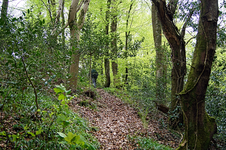 Woodland path near Myddfai
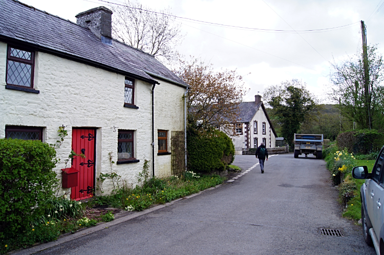 Myddfai
More of the same, fields, woodland paths, tracks and roads led us to the pretty village of Myddfai. Everything was quiet as we walked past the well kept buildings within the village. Some paint washed cottages were very appealing. Some white, some cream and some light blue. St Michael's village church was impressive too. After Myddfai we continued on our way and having picked up the course of the Cambrian Way once more we stayed with it up on our way into the hills. After following tarmac road for a mile from Myddfai the tarmac ended at Sarnau and then the real climbing started. We were soon on a one in three ascent and making height quickly.
 Admiring Carmarthenshire from Mynydd Myddfai
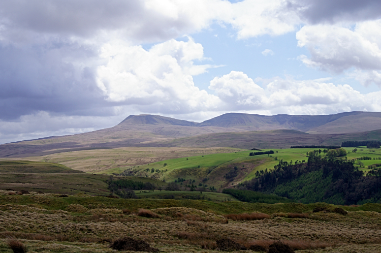 Black Mountain country
Just one mile of walking, or climbing, saw Steve and I ascend two hundred meters. We had arrived in the Black Mountain region of the Brecon Beacons. For clarity the national park can be attributed as three parts. West = Black Mountain, Center = Brecon Beacon, East = Black Mountains. Black Mountain and Black Mountains are entirely different in nature. While the Black Mountains are in the main a line of whale-back ridges in line with other and separated by parallel valleys, Black Mountain, which Steve and I were now about to cross, is a vast area of open upland moor. There are distinct hills in the Black Mountain and we were heading directly towards them. But the general and dominating factor is the openness. And consequently the feeling of wildness. As we paused after our first climb on the west side of Mynydd Myddfai and looked at the scene, including a grand look back over the fields of Carmarthenshire, I noticed the clouds of early afternoon were building. It was still fine, still sunny now and then, but some malevolence was definitely brewing.
 Fedw Fawr near Usk Reservoir
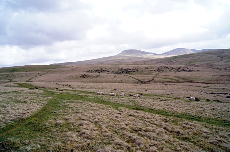 Following the Cambrian Way
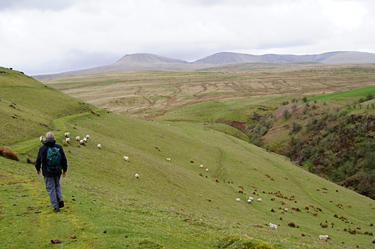
We cracked on. We had a schedule to keep and a taxi to meet. First the going was okay. Good in fact as we skirted across Fadw Fawr and then continued onwards with good pace following the line of the Cambrian Way towards a set of hills on our agenda and which we could see across the moor. They seemed close and we felt we would be on them in short time. A misconceived thought. They were in fact five miles distant in the south and between us and them were some hidden pitfalls. Literally.
 The big dip down to Afon Clydach
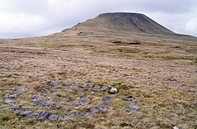 Stone circle and Fan Foel
What we had not taken into account when planning the pick-up with the taxi driver at the end of today's walk was the amount of climbing we would do to get there. At 1,570 meters of climbing and with just a tad short of eighteen miles to cover my Walk Time Calculator would have told me the walk would take around eleven hours. With a break, over eleven hours. We had given ourselves just less than seven. We talked about it. "We can still do it" one of us will have said and the other will have agreed. Then came the obstacles. The dips down to cross fledgling rivers such as Afon Clydach and the numerous feeder streams crossing our path followed by the climb ups from them were a hindrance. They slowed our progress and drained us of energy. Still we cracked on regardless. A nice distraction from the effort was finding a spiraled stone circle in the middle of the moor.
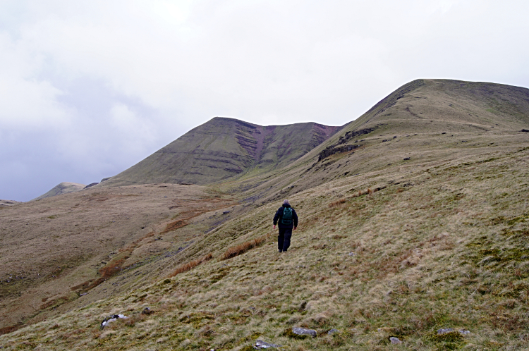 Climbing the Beacons Way to Picws Du
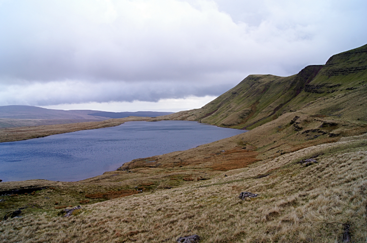 Llyn y Fan Fawr
Eventually Steve and I reached the point where we met with the Beacons Way to climb the hills we had been focusing on. We walked past the glacial tarn of Llyn y Fan Fach on the way up. Our luck was out, the Lady of the Lake did not produce Excalibur for us. Llyn y Fan Fach is reputed to be the lake of the lady after all. "A different lady of the lake" I hear. So many legends, it is hard to keep up with them all. Up a bank went Steve and I to reach the summit line of Picws Du and Foel Fach. Named subsidiary peaks on the mass of Fan Brycheiniog we wandered the top. But not for long. The storms we had sensed and which we had seen coming arrived quickly. One minute we were in sunshine, the next we were been buffeted in a hailstorm. The ice stones hurt. We clambered down the north-east facing bank of Fan Brycheiniog to find some shelter. We found some on a bank overlooking Llyn y Fan Fawr, the sister lake to Llyn y Fan Fach. We took a quick lunch through the worse of the storm. Not a long lunch mind you.
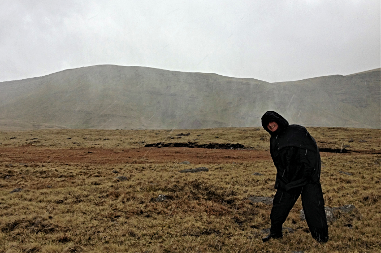 Battle with the storm
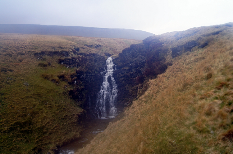 Waterfall on Afon Tawe
We could not stay long in shelter as time was pressing and we had to get a move on. We had an hour to cover three miles and head off the taxi. There was not much talking now. More hailstorms struck us as we tracked south east following Nant y Llyn and then a bloody heck sight hit us in the chops. There was one final descent and climb we had not accounted for. Well, we had overlooked it when inspecting the map last night. There we were, stood looking down to the River Tawe. Beyond the river was a road but not our road. And beyond the road was a 200 meter climb. "Bloody hell, we're jiggered" was the least of it. Steve was tired. He is usually the stalwart of our walks but had not been out on a long one like this for ages. I was hardened by the last couple of weeks. So I said to him "Make it as quick as you can. I will run down and climb up the other side as quick as I can". From the top I could scout for the taxi and wave to it. So I thought.
And so I went down and over the river. I got across unscathed by use of my walking poles for balance. Strolling Steve wasn't so lucky and due to the recent lack of exercise he fell in. Not having time to rescue him I crossed the minor road and climbed the 200 meters to the top of the hill on the other side. From my vantage point I could see the meeting point on the 4067 but it was still a mile away. And I saw a car parked. At distance like a Corgi toy but a car all the same. I waved and star jumped as i rushed down the hill to the rendezvous but no response from the car. And then gloom. The car left. It drove away and out of sight. I sat down and waited for Steve. Thirty minutes later we were down by the meeting point, one hour late. We had taken eight hours. Fortunately after a short time the taxi drew up beside us and offered two bedraggled walkers sanctuary.
From my Facebook post in the evening: "Today began with comedy. Yesterday I had asked in the tourist information about bus times from Brecon to Llandovery. I was told there would be one waiting at Brecon Interchange at 9.55 and arriving at Llandovery 10.35. Strolling Steve and I checked on the timetable at the bus stop last evening; corroboration. So we went to the bus stop at 9.45. 9.55 came and went, 10.00, 10.05, 10.10. Not only were Steve and I sat at the bus stop by ourselves, the whole interchange was deserted. We gave up and walked back into town for a taxi and eventually got to Llandovery a little before eleven. It was a late start to the walk. The start was a pleasant passage of varied paths through woodland, across green fields, on quiet lanes and a short section of in trafficked road to Myddfai. During this section of the walk we enjoyed lots of sunshine which was unexpected. The walk to Myddfai had enabled us to gain some height without really noticing. Soon after the village by walking on a road to Sarnau we were walking up to the Brecon Beacons. A sign told us we were walking up a hill to the Physician's Well. Which we never found. As we climbed the terrain changed. First past gorse banks and then above the tree line. The green grass was now below us and now we reached a light brown landscape. As we climbed further we reached the top of Mynydd Myddfai, our first Brecons Beacon hill. From the top we were greeted with stunning views of a vast rolling landscape, somewhat flat in our immediate surroundings, inviting us to walk across it. Also on the hill I spotted a Red Kite just over the brow of the hill. It was hovering at approximately the same height we were and as such a beguiling sight. After our avian adventure we crossed sumptuous moorland to Fedw Fawr which gave us views to Usk Reservoir, then on to Bryn yr Wyn, Mynydd y Llan and then on a slightly tough undulating course to Waun Dwyd and then to Cefn Diagwyla. On our course across the Beacons moorland we avoided some heavy rainstorms which we watched rush over from west to east just behind us. One particularly heavy one rushed through Llandovery and into the Rhandirmwyn and Llyn Brianne valleys which I had walked across over the last two days. Back to our course ahead we had been drawn for some time to the impressive glaciated shapes of Cefn Bryn y Fuwch, Picws Du, Fan Foel and Fan Brycheiniog and now we were very close to them. We were also at 800 meters height and the wind was picking up. Soon it was howling and becoming uncomfortable to walk in. We got to the tops but did not stay long, instead heading for the shelter of the lee side of the hills and rounded the water of Llyn y Fan Fawr. As we did the wind picked up further and howled. And as it howled it brought an end to our dry walk by barraging us with a storm of painful hailstones. They really did hurt and we were forced to turn our backs to the sweeping charged storm. It was extremely uncomfortable for about fifteen minutes until the hailstones turned to rain as we hastened our descent from 800m to 400m at Fforest Fawr. During the descent in grim conditions we came to a river crossing over the Afon Tawe. I got across unscathed by use of my walking poles for balance. Strolling Steve wasn't so lucky and fell in. He was not amused. Moreover after the river we came to a road which we crossed to be faced with a climb up Cefn Cul. It was a steep climb and in the fatiguing conditions we did not need it. Steve grumbled, moaned and exclaimed all the way up but up we had to go to reach the topmost edge of Cray Reservoir where we were to finish and where we hoped a pre-arranged taxi was waiting for us. Fortunately after a short time trying to find it the taxi drew up beside us and offered two bedraggled walkers sanctuary.
Despite the desperate weather at the end of our first day on the Brecon Beacons the walk was a brilliant introduction to the fabulous moorland and hills of the National Park. The route was brilliant and I only wish we had more time to make the crossing. Alas the walk had been hastened by the late Llandovery start and the 5.00pm finish we had arranged with the taxi before the bus no show mishap. The haste though at least got us to the highest point before the storms set in.
Today the weather forecast is looking very grim with rain due to set in all day. Do we stick to my intended route over the tips or to we revert to a vector course across the lower foothills? Time will tell".


