Marsden Moor, Oldham Way and Pule Hill
From Marsden a short walk along canal side to Standedge Tunnel End leads to paths accessing the wild Pennines. Thereafter open moorland is the theme of the day including a refreshing climb of Pule Hill before returning back to Marsden. The views are tremendous throughou
Google Maps Open Source Maps| Statistics and Files | ||
|---|---|---|
| Start: Marsden | Distance: 9.0 miles (14.4 km) | Climbing: 488 metres |
| Grid Ref: SE047116 | Time: 4 hours | Rating: Moderate |
| GPX Route File | Google Earth File | About Marsden |
| Statistics | |
|---|---|
| Start: Marsden | Distance: 9.0 miles (14.4 km) |
| Grid Ref: SE047116 | Time: 4 hours |
| Climbing: 488 metres | Rating: Moderate |
| GPX Route File | Google Earth File |
Ordnance Survey Explorer Map (1:25,000)
The Walk: A visit to Marsden and a walk on the moor named after the village on the edge of the Pennines had been in my mind for a long time. Marsden has always been a popular walker’s destination and in 2010 the village gained ‘Walkers are Welcome’ status in recognition of its well-maintained footpaths, facilities and information for walkers and ramblers. More than enough reason for me to add to my personal bucket list and take a walk from there. The one remaining question, once I knew my starting point, was where to go? Peering over maps I looked for Marsden Moor but could not find it on either Ordnance Survey Explorer or Landranger series maps. Where was it exactly? An internet search led me to discover while not a named moor it generally covered a series of moors to the west and all within the Marsden Moor Estate. I was sorted.
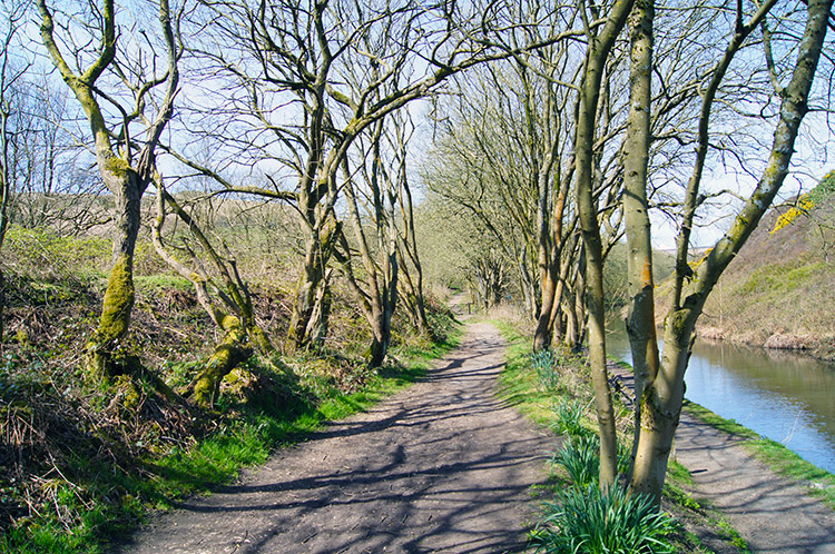 Pleasant woodland trail beside the canal
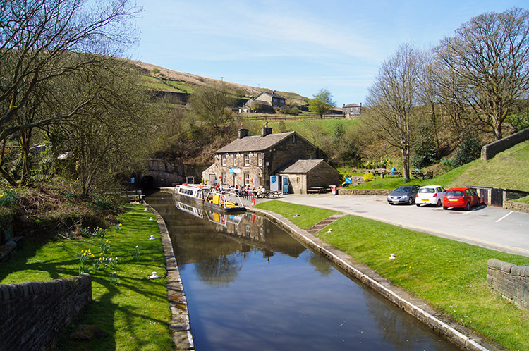 Standedge Tunnel End, Marsden
I found a convenient place to park on Church Lane, a wide road in the west of Marsden beside St Bartholomew’s Church. It was a good starting point too as I only had a short walk heading north up the hill to reach Huddersfield Narrow Canal. While only 20 miles in length it is a feat of major engineering, passing under the Pennines via Standedge Tunnel to link Huddersfield with the Ashton Canal and giving access to Manchester. It was a major business route during the heyday of the wool and textiles trade. I followed the canal west for a half mile, part of the way on the towpath and part of the way on a delightful woodland park trail next to the towpath. The pleasant half mile of walking on the supremely sunny and warm spring day I was enjoying seemed to pass very quickly although I ambled along at no real pace. Before I knew it I had reached Tunnel End where the canal disappears underground for its five mile long dark journey under the Pennines. No darkness for me, I stayed in the light by turning northwards and away from the canal by heading uphill on paths which led me to the hamlet of Berry Greave.
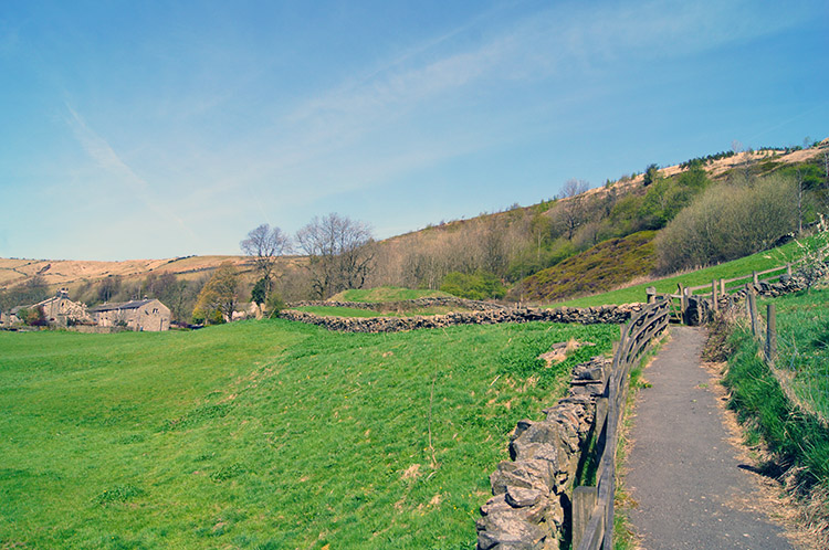 The path to Berry Greave
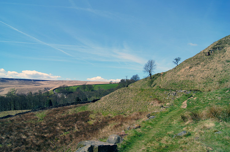 Approaching Lower Green Owlers
I had set off wearing a light sweater; it was just mid-April but after five minutes of climbing I had already shed it. This was the warmest day of the year so far and I was loving it. After passing the few pretty houses which constitute the hamlet of Berry Greave I could see my first sight of the Pennine moors. It was an easy task to identify the moor line, parched light brown grasses spread on top of the lush green canvas of lower lying pasture. I was keen to get high and walked briskly on very pretty moor access paths for the next mile of the walk to the Dean, a house beyond Lower Green Owlers from where my access to the moor proper was made. The light seemed to get brighter immediately I set on my way over the harsher ground.
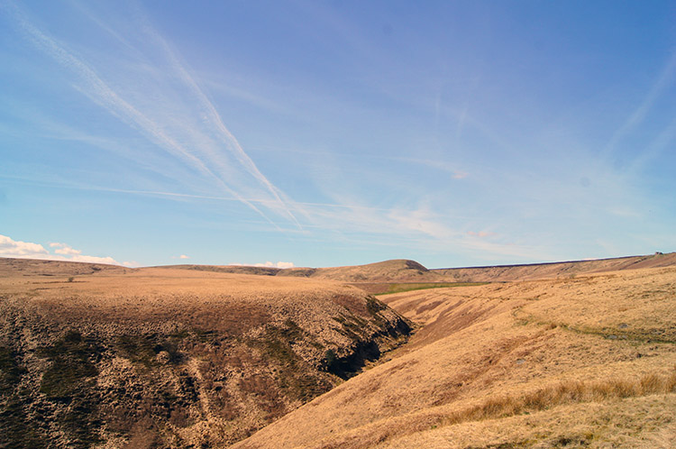 Haigh Clough
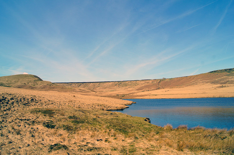 March Haigh Reservoir
It was a bright day and the daylight had been strong from the start of the walk but as soon as I began crossing the open moor the light became markedly glaring. Down in the valley and on the low pastures the blacks and greys of the tarmac roads and paths and the vivid shades of green on the pasture fields had absorbed some of the light. Now though the light brown colour of the parched moorland grasses did little to help share the load of the suns rays. It was a much brighter day on the moor. Keeping it in mind to not look into the direct sunlight I bounced across the forgiving path running besides Haigh Clough. Water in the clough trickled gently off the gentle slopes towards Marsden as I made my way directly towards the dam of March Haigh Reservoir. Having climbed almost 150 metres since setting off I took a short break beside the reservoir. As I rested I noticed four people with heads down walking across the moor. I was curious to find out what they were doing so after my short rest I headed off in their direction.
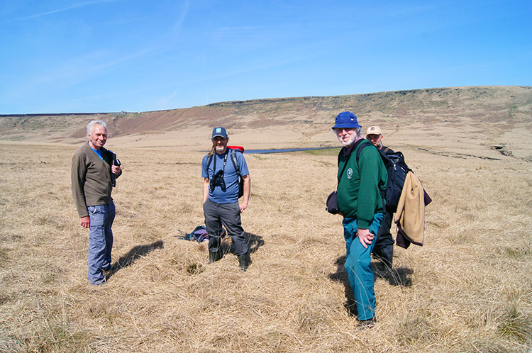 National Trust volunteers looking for Molinia
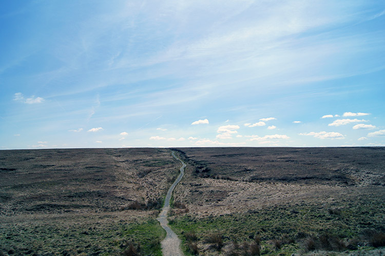
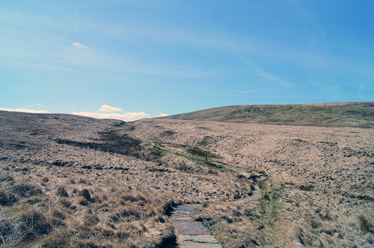 Path across the Pennine Moors
They were crossing a section of the moor called Berry Greave. (Was the moor named after the hamlet I passed after leaving Marsden or was the hamlet named after the moor?) Fortunately for me the four chaps acting strangely on the moor were just off the line of my walk so it was just a short detour off the path for me to reach them. On reaching them and making their acquaintance the leader of the group told me they were National Trust volunteers sweeping the moor and looking closely at the extent of the spread of Molinia (Purple Moor Grass). Continuing on, the lead surveyor, who is pictured on the left in the photograph above, told me aerial photographs taken of the moor 30 years ago proved it was invasive and accelerating its spread. As a result it would need to be controlled. Evidence also showed moorland management through controlled fires was actually encouraging the growth of Molinia as the tussocky roots could survive over native species. So a different approach to the usual moorland management practice would be needed in this case.
Furnished with my further education, it is always interesting to learn, I bid the gentlemen a fond farewell and went on my way by skirting south around Berry Greave Moor and heading due west on a well maintained stone path running closely alongside Willmer Green Clough. I was alone now and the vastness of the open moor excited me as I walked on.
 The Pennine Way
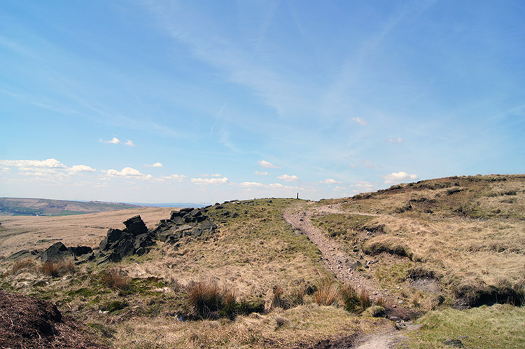 Northern Rotcher
The refreshing feeling of being alone in wide open spaces stayed with me as I reached Little Moss and turned from westwards to southwards by following a stretch of the Pennine Way. It was the second time I had walked this particular section of the famous long distance footpath, the first being during my 1,120 mile long Great British Walk in 2011. Then it had been a much different day, pouring down with rain. Not needing the waterproofs this time gave me a much greater sense of freedom as I enjoyed the walk to Northern Rotcher. Here the Pennine Way was joined by the Oldham Way and the old Yorkshire/ Lancashire border had been reached. Now it is the Yorkshire/ Greater Manchester border but despite the unitary changes it will always be the White Rose/ Red Rose border to Yorkshire and Lancashire people.
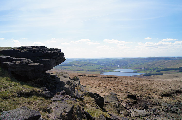 View from Northern Rotcher to the Castleshaw Reservoirs
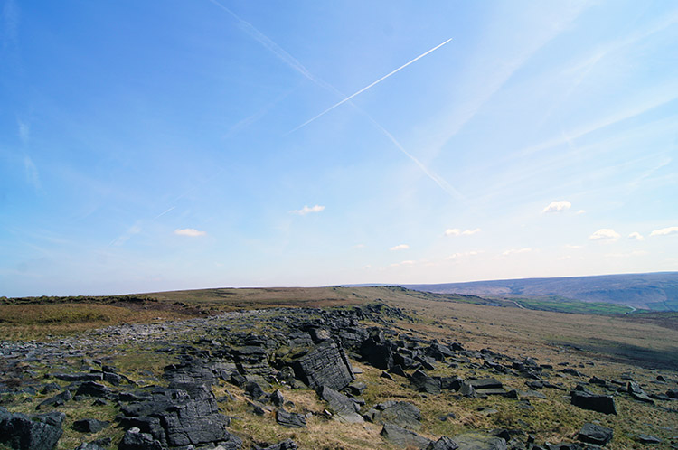 Standedge
The view to Lancashire in the west was better than looking back to Yorkshire in the east from Northern Rotcher as the land fell away gently for a 100 metres loss in height from the gritstone edge I was now standing on to the Castleshaw Reservoirs in could see below me. While looking at the majestic scene I looked forward to the one mile walk along the gritstone level to Higher Standedge and appropriately named Millstone Edge. On the mile long walk I could enjoy a series of remarkable weather shaped gritstone outcrops and more thrilling views down into Red Rose land.
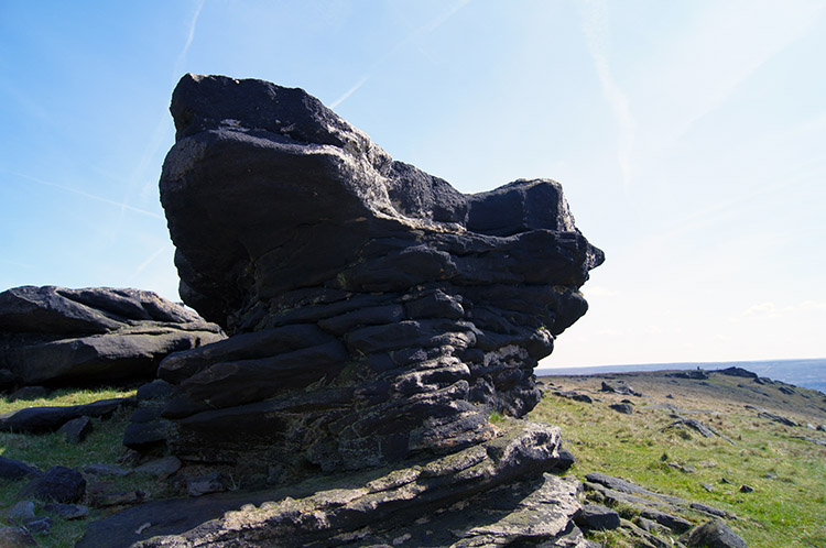 Dinner Stone
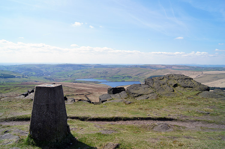 Looking to Lancashire from Millstone Edge
I was not disappointed. For the entire mile I could look down upon the sweep of land below me to the west, to the reservoirs, to the tiny Dinky traffic trundling along the A62 motoring to and from Delph and on regular occasions I could stop and marvel at the natural shapes sculpted into the gritstone. The most prominent is the huge layered Dinner Stone and there were many similar impressive outcrops besides. After the mile of joy I reached the trig pillar at Millstone Edge. At 448 metres high it looks over one of the best views around. I stopped for a short breather to look over it myself before turning from the spectacular mile and from the Pennine Way/ Oldham Way by following what was now the Standedge Trail towards Thieves Clough Bridge. On doing so I had left my route of 2011. I was covering new ground once again.
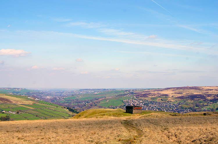
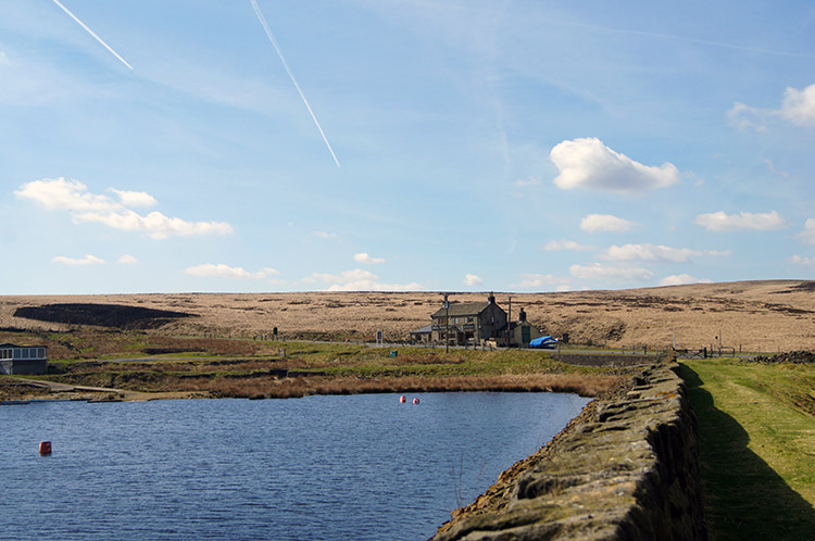 Redbrook Reservoir and the Great Western Inn
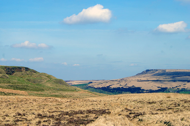 Pule Hill and Black Edge
I now centered my attention on a hill I had seen first during my break at March Haigh Reservoir and which I kept looking to immediately before and after my chat with the National Trust volunteers. It was Pule Hill and while the Standedge Trail path I had originally planned to walk passed along the western edge of the hill I knew I would be climbing to the top of it. After Thieves Clough Bridge I emerged beside the A62 next to the Great Western Inn. I crossed the road after adhering to Tufty's Highway Code, the one I was brought up with, and then followed the Pennine Way on the north edge of Redbrook Reservoir. I then followed paths which naturally brought me to the point crossing Mount Road which led directly to the path leading up the south side of Pule Hill.
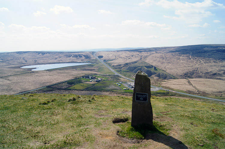 View from Pule Hill to the A62 crossing the Pennines
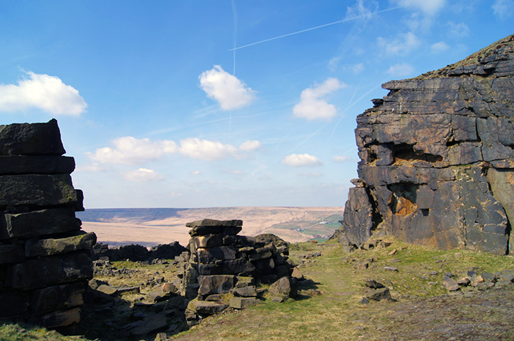 Pule Hill Quarry
The steepest climb of the walk followed. The haul up Pule Hill was just 70 metres from Mount road to the summit but it was a tough 70 metres all the same. I stopped on two or three occasions to catch my breath, on each break thinking "Blooming heck, I hope the top is over the next crest". I knew it was not far but in the heat of the unbroken sunshine filled hot day I was being a wimp. Climbs up Lakeland mountains have seemed easier. I got there though, albeit with a bit of a sweat, but the effort was more than compensated with the satisfaction of the hilltop view. The best of these was south west, along the line of the A62 and past Redbrook Reservoir as the horizon crossed over the Pennine Watershed. The view round to the east on the moorland I had walked across was also lovely. I would have to walk someway around the hill to see the east though.
I took my final break enjoying the summit view before following a path down the west facing edge of Pule Hill which led me directly into a disused quarry. A scattering of spent disposable Barbecues and three abandoned sleeping bags in a sheltered nook within the quarry laid bare evidence this is a natural playground, probably for local youths. A younger me would have likely done the same though I would have camped and tidied up before leaving.
 Standedge Tunnel air vent on Pule Hill
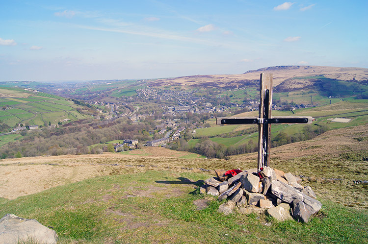 Memorial dedicated to the Duke of Wellington's Regiment
From the quarry I followed a path which led me across Pule Hill in a direction true north towards Firth Pule. The course of the path led me directly over the line of Standedge Tunnel. I reached one of the tunnel air vents and standing besides it I wondered if a Narrow Boat was passing below my feet. I could not hear anything though they do run almost silent so perhaps I would not hear one anyway. Soon after the air shaft I noticed a small cross on the hilltop. It was looking directly over Marsden which was now appearing into view for the first time since I accessed the moors earlier in the day. The cross had a memorial reading "7th Battalion 2nd/7th Battalion. In memory of The Duke of Wellington's Regiment 1939-1945 "All who gave their all". I observed the wording with respect.
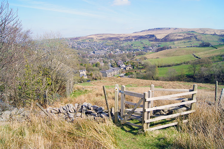 Marsden
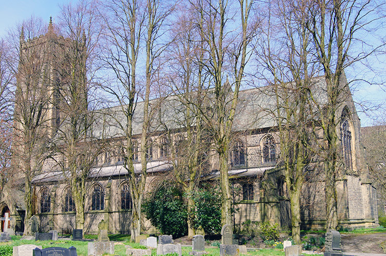 St Bartholomew's Church, Marsden
The finale to my walk was brilliant. I looked directly down on the sprawling rooftops of Marsden, a splendid setting on the edge of the Pennines with Netherwood Heys to the north-east and Black Edge/ Holme Moor to the south-east providing the perfect frame. It was the most gorgeous sweet course for the walk which accompanied the canal towpath/ moor approach starter and the Pennine Moors/ Pule Hill main course. To complete my wonderful walk I followed a series of paths from Firth Pule to the south side of Marsden before crossing the A62 to Clough Lea and through the grounds of St Bartholomew's Church back to the car. A brilliant walk was completed on the most gorgeous of Spring days. Another of those unforgettable days I will treasure and look back on for as long as I can.


