Holmfirth, Holmbridge, Upperthong, Netherthong, Brockholes and New Mill
This walk is unusual in the way that it frequently uses roads to link some of the highlights throughout the route. The roads used are very quite though and I was not bothered by traffic at all in this extraordinary exploration of the villages and hamlets spread out to the north and south of the Holme valley. Apart from the settlements, all rich in character, I enjoyed following footpaths, bridleways and trails across the lovely countryside of the Holme valley which lies between each village and hamlet. There were plenty of other people out walking during my round of the valley, it seems to be a tradition for the locals. And why not, it is a wonderful valley with great views from the precious countryside.
Google Maps Open Source Maps| Statistics and Files | ||
|---|---|---|
| Start: Holmfirth | Distance: 12.4 miles (20 km) | Climbing: 720 metres |
| Grid Ref: SE 14292 08221 | Time: 5-6 hours | Rating: Hard |
| GPX Route File | Google Earth File | About the Holme Valley |
| Statistics | |
|---|---|
| Start: Holmfirth | Distance: 12.4 miles (20 km) |
| Climbing: 720 metres | Grid Ref: SE 14292 08221 |
| Time: 5-6 hours | Rating: Hard |
| GPX Route File | Google Earth File |
Ordnance Survey Explorer Map (1:25,000)
The Walk:
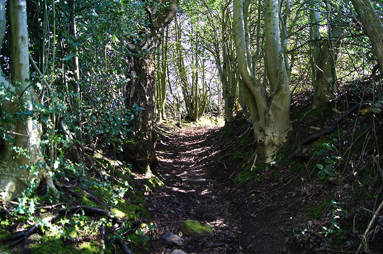
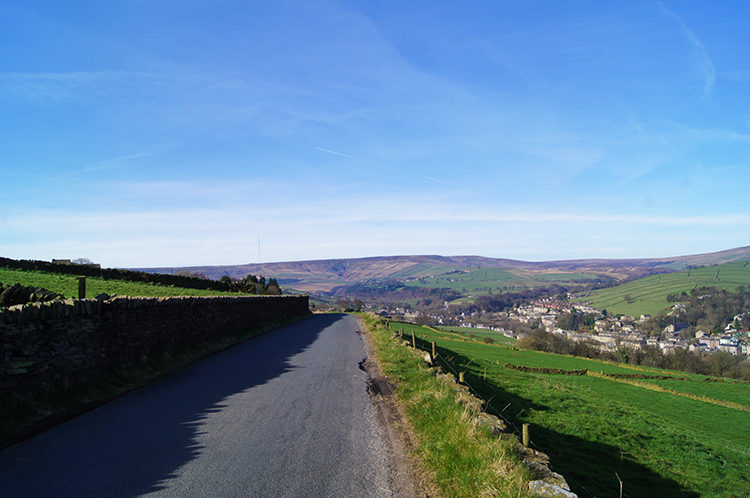 Royd Lane
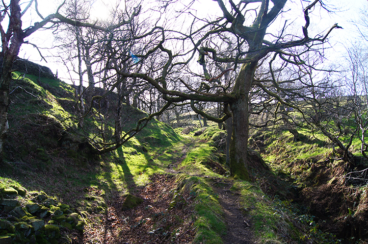 Bank Clough
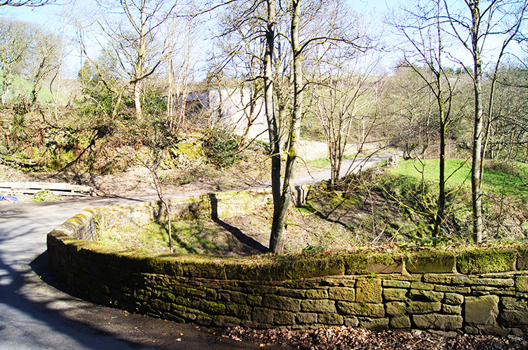
Bright Spring sunshine on the last Saturday of March was already welcoming visitors to Holme valley when my wife dropped me off in the centre of the Holmfirth, showpiece village of the valley. It was 9.30am and rather than hang around with the visitors I set off from Holmfirth to follow the roads, lanes and cross the countryside familiar to fans of Last of the Summer Wine. I was off exploring, just as Compo, Clegg, Foggy and friends did in the popular TV situation comedy which had been set in the Holme Valley. My route led west bound and uphill along Cemetery Road. I soon gained 100 metres of height along with a good dose of fresh Holme valley air on my walk on the full length of Cemetery Road. Staying on tarmac, I continued west and up the course of the valley while losing half of the height I had gained when walking along Royd Lane to the hamlet of Dobb. I knew I would be climbing again soon enough though. And right enough, after leaving the tread of tarmac to walk on unmade ground and grass I began my steepest climb of the walk while turning in course from west bound to south bound and up the course of Bank Clough which was steeply banked on either side and lined with a detachment of trees.
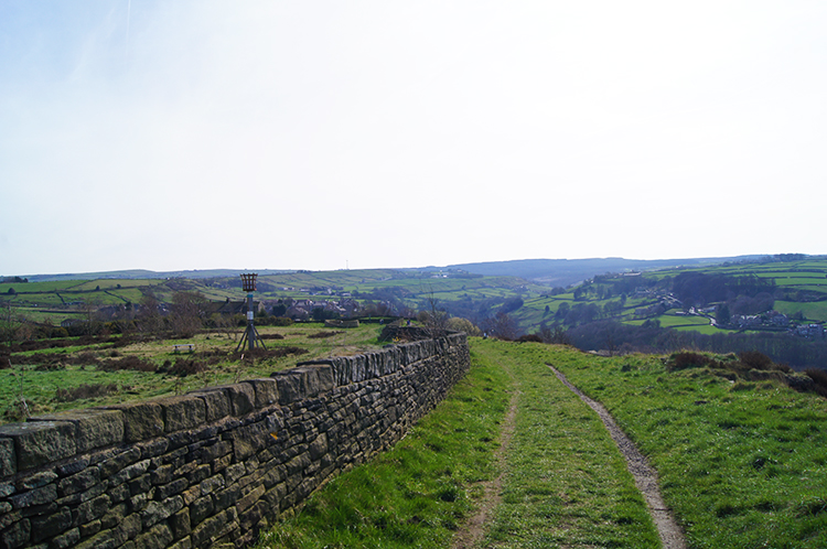
 Crow Hill
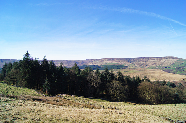 View to Holme Moss
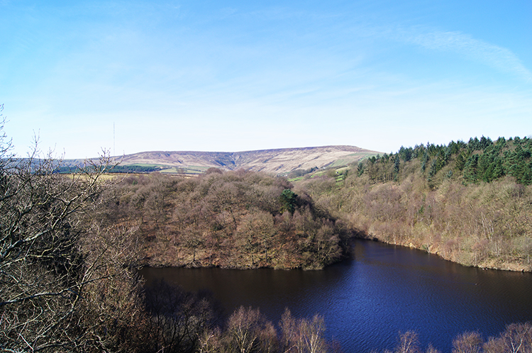
While walking on the high roads from Holmfirth to Dobb I had worked out the Upper Holme valley, that being from Holme to Mytholm Bridge, to be perfectly sized for a complete circumnavigation. I could see almost all of it as I had walked along Cemetery Road, indeed the circuit I would be walking including the climb from Holmbridge to Upperthong and the high moor crossing to Netherthong. Just the south-east section to New Mill and back was hidden from view. And what I could not see of my walk was not exactly in the Upper Holme valley anyway, New Mill Dike a tributary watercourse flows from New Mill into the River Holme at Mytholm Bridge. I continued my climb from Bank Clough to Crow Hill. I reached the highest point of my undulating walk, at around 320 metres on Crow Hill. The sky was blue, the day warming well. My viewpoint from Crow Hill was magnificent, Holme Moss being the obvious draw on the eyes with the Transmitting Station to focal point. It was a marvellous feeling being high up on the origin hills of the Holme valley. I stood up on Crow Hill for quite a while and looked, fixed on the view.
 Ramsden Reservoir
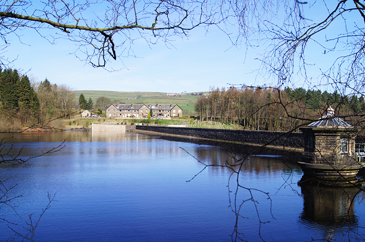 Brownhill Reservoir
Down from Crow Hill I went, descending via Tinker Well to a line of three reservoirs, namely Riding Wood, Ramsden and Brownhill. It was past 11.00am and I was 90 minutes into my walk. Plenty of walkers were ambling at the reservoirs, all enjoying the day just as I was. Everyone I passed and greeted as I walked the line of reservoirs towards Holmbridge greeted me with a smile. Good weather invariably brings out good feelings in people. Especially those walking on a warm Spring day after enduring a long dark and dank winter. Adults were chatting freely while walking on the reservoir approach roads while children were playing. Family dogs ran about, free to explore and sniff each other when meeting. Cars which came along the road were all slow and drivers carefully attentive. All was good with the world in the Holme valley. With a smile and a spring in my step I followed the road down into Holmbridge.
 St David's Church, Holmbridge
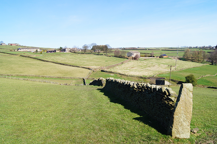 Countryside north of Holmbridge
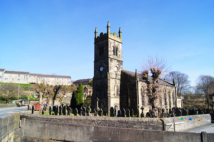
Reaching Holmbridge marked the point when I crossed from the south side to the north side of the Upper Holme valley which runs south-west to north-east before the Lower Holme valley continues northwards from Mytholm Bridge into Huddersfield. Before crossing the A6024 valley road I reached St David's Church, a particularly impressive looking edifice. After carefully crossing the road, using the Tufty code I was taught at school, I climbed from the valley, first by a steep series of steps and through the hillside lines of houses at Long Walls. It was hard work but it did not take too long to clear the urbanisation and reach the fresh green grass of open fields again which began the task of leading me up to the north side of the valley and on to Carr Green. I was on my third short and slightly steep climb of the walk, excelling my mind and working my lungs well once more. The fresh growing grass, recently woken from winter limbo, spurred me on.
 Black Sike Lane
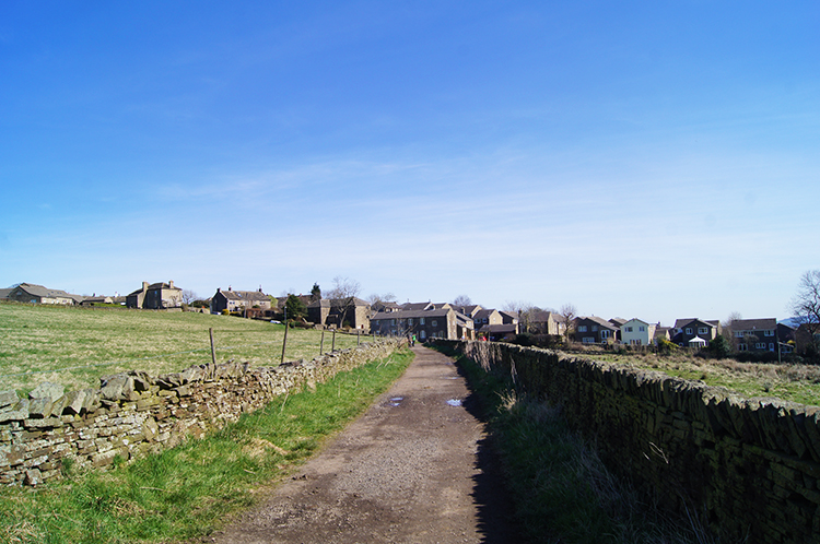 Upperthong
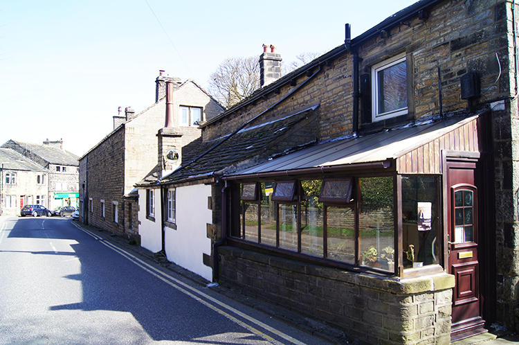
The walk from Holmbridge to Carr Green and then further to Hogley Green was a pleasant mix of field-side paths, bridleways, quiet lanes, and farm access tracks. Though I could have encountered cars on the winding metalled roads on the links between paths, fields and bridleways all I met were horse riders. Quite a few of them, equine pursuits appeared to be popular up here. It was now around midday and I was meeting other walkers too. All of us enjoying footfall were a happy bunch, enjoying a chat as we met up. "Where have you come from?" and "Where are you going?" were often parts of the conversation as were "great day isn't it?" and "a pleasure to be out in such lovely countryside on such a wonderful day". Before long, willingly interrupted by such encounters, I came to and then carefully crossed the A635 Holmfirth to Oldham road. A short walk afterwards I arrived in Upperthong. I walked through the village, really the north-most outlier of Holmfirth and a higgle piggle of pretty natural stone buildings.
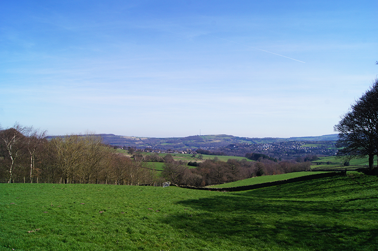 View to Huddersfield and Emley Moor
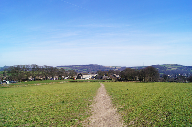 Field crossing to Netherthong
From Upperthong I climbed, dipped and climbed once more to Wolfstones Heights. Here I was rewarded with the best views of my day north towards Huddersfield. The crisp bright day also afforded me cracking views of the Castle Hill monument and of the Emley Moor TV Transmission Tower beyond Kirklees premier conurbation. From the heady altitude of Wolfstones Heights, at around 300 metres I began a long steady descent towards Netherthong. I met more walkers as I crossed the last long field into the village. They were a couple, more interested in each other than in the views and certainly more interested in each other than in me. I did not get the chance to say hello, no eye contact was made as they passed me by, heads down in a tight cuddle.
 Netherthong
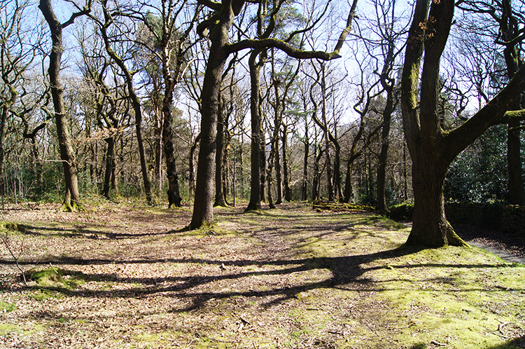 Hagg Wood
I reached Netherthong at just before 1.00pm. A few people were walking through the village as I did but a larger crowd of people were stationary. They could be heard at the Clothiers Public House, the noise of revelry most pitched as I walked by. It was Sunday lunchtime after all. And probably the first time in the season people could enjoy themselves in the beer garden comfortably. Good for them. I continued on past the pub, down Giles Street and on to Dean Brook Road which I would follow on its full length north-east to Lower Hagg.
Upperthong and Netherthong are both quaint villages with houses of natural materials built wherever they could be between the meandering roads of each village. There is no particular order to the build of roads or houses. no road is straight, no two houses alike. Brilliant in my mind. Their names derive from Viking origins, the Viking word 'thong', meaning a strip of land. Personally I could happily live in a place such as Upperthong or Netherthong. (....and everyone I saw in the villages seemed content there).
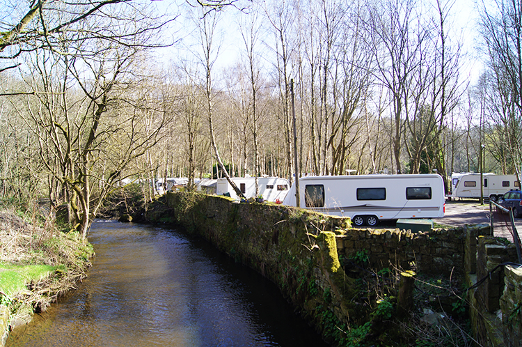 Holme Valley Camping and Caravan Park
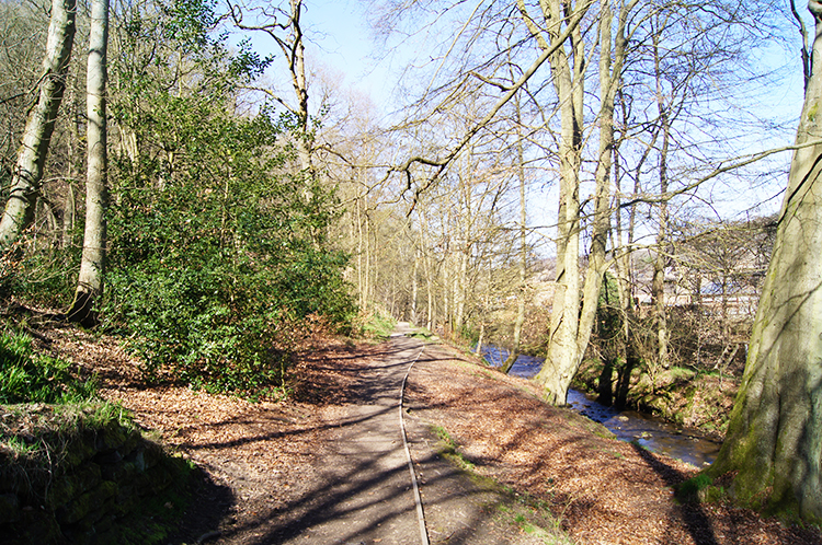 Path following the River Holme
I made my second full descent to the floor of the Holme valley by walking from Netherthong to Lower Hagg and then through the short but pleasantly scenic Hagg Wood to reach the A6024 for my second time. again I crossed it carefully before walking down the Holme Valley Camping and Caravan Park access road to the River Holme. Rather than enter the caravan park I turned onto a path on the north side of the river and followed a path running parallel to the Holme, heading downstream on a course due north. I was following the Holme Valley Riverside Way. A chap with his dog were relaxing on a small island in the middle of the river. The chap was snoozing, the dog was waiting. It was a nice walk alongside the river though some litter stuck and wafting in the riverside trees and some more litter on the riverbank and in the water did detract from the scene. Sigh. I left the riverside walk by crossing a bridge over the Holme and leaving it on its northwards course towards its end by flowing into the River Colne in Huddersfield while I crossed the A616 near to the Rock Inn at Brockholes from where I climbed through the village via Brockholes Lane and Oakes Lane.
 Lane above Brockholes
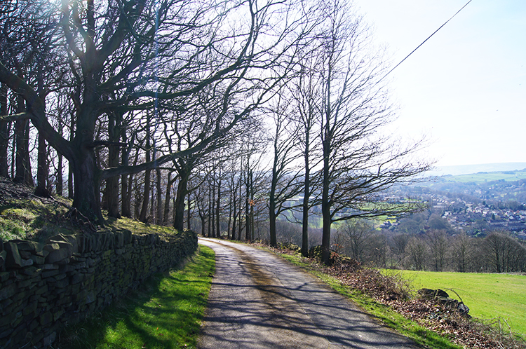 Near Biggin
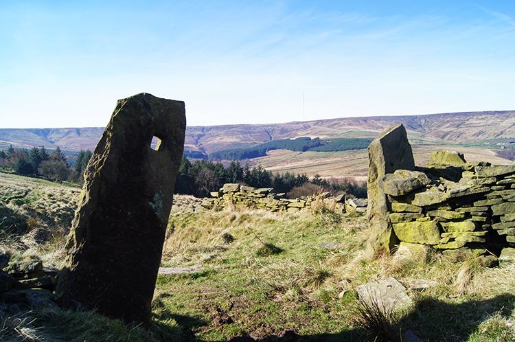
I continued climbing from Brockholes via the Hills and Hamlets Walk path on a south-west course towards Biggin. I initially climbed on narrow Holloways through dense sweat inducing wooded avenues, thick with Hazel, Hawthorn and Holly. It was hot work climbing for about 150 metres of ascent in the shade, hot and without a waft of breeze to cool me. It was the hottest part of the day and I was relived to leave the confines of the Holloways when I reached Bank End, at around the half way point between Brockholes and Biggin. Here, at about 200 metres high I was gaining great views of the Holme valley once more, this time from a different aspect, looking south-west towards Holmfirth. Good as it was, the best was yet to come though. But I did not know it at the time.
 New Mill
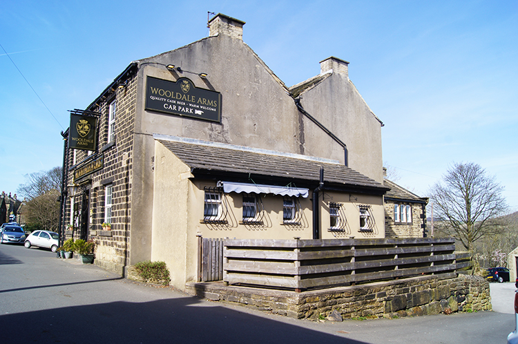 Wooldale Arms
I reached my fifth of six tops on this roller coaster walk at Biggin from where I made a 100 metre descent by road into New Mill. The village is notorious for motorists these days as it lies on the crossroads of the Huddersfield - Sheffield A616 and Barnsley - Manchester A635 roads. Indeed I had to wait for pedestrian crossing lights to show the green man before I could cross the A635 road which I needed to for access to Greenhill Bank Road which was to lead me westwards from New Mill towards Wooldale. I did this, first by crossing fields adjacent to Royds Avenue and then by following woodside lanes and past the site of old works before emerging on Little Lane near to the Wooldale Arms. Afterwards I followed an unmade bridleway south-west towards Holmfirth Cliff. The bridleway, taken on a slight ascent, my last of the day, was providing yet more tremendous views of the upland countryside but still I did not know what lay ahead. The best was yet to come.
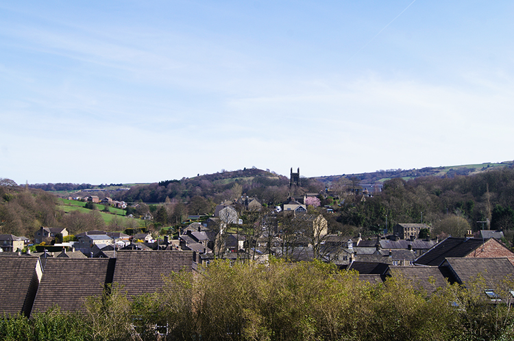
 Holmfirth Cliff
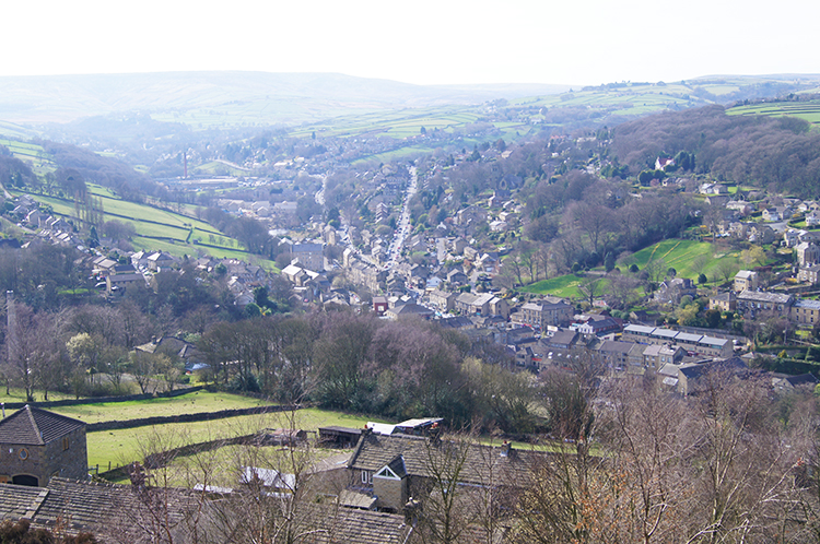 View to Holmfirth from Holmfirth Cliff
I arrived at Holmfirth Cliff. First I spotted a memorial bench and then I spotted a Beacon. I though "Obviously I have reached a site of note". But why. soon found out when I walked a little further and looked over the cliff to behold the most fantastic view of Holmfirth. Looking down the rooftops of Holmfirth were all spread out in lines which revealed the lines of the road and the alleyways. Clearly in view and lined with traffic on its full length was the A635 Oldham Road I had crossed earlier on in the day. I could see crowds milling around outside the shops on the main street too. It was quite a view. As I had earlier on in the day when on Crow Hill I stopped for a while and took it all in. I captured Holmfirth in my mind as I had never done before. Then I descended the steep road into Holmfirth, finishing my walk at precisely 3.00pm. Dead on time, I met my wife as arranged and enjoyed an afternoon tea. Thanks to the gorgeous delights on my Upper Holme valley walk I had earned it.


