Avebury Stone Circle, The Sanctuary, West Kennett Long Barrow and Silsbury Hill
This walk which can be completed in a half day visits all of the four sites in the area of Avebury which help to tell the remarkable story of the ancient settlement of this archaeological rich area of England. Many visitors to Avebury will just be aware of the stone circle as it is spread all around the near confines of the village but go a little further and there are three more sites of special interest which help to fill in the gaps about the story of settlement in the area, these being a timber circle, a long barrow and an enigmatic hill which remains a mystery.
Google Maps Open Source Maps| Statistics and Files | ||
|---|---|---|
| Start: Avebury | Distance: 5.4 miles (8.7 km) | Climbing: 96 metres |
| Grid Ref: SU102699 | Time: 2-3 hours | Rating: Moderate |
| GPX Route File | Google Earth File | About Avebury |
| Statistics | |
|---|---|
| Start: Avebury | Distance: 5.4 miles (8.7 km) |
| Grid Ref: SU102699 | Time: 2-3 hours |
| Climbing: 96 metres | Rating: Moderate |
| GPX Route File | Google Earth File |
Ordnance Survey Explorer Map (1:25,000)
The Walk: Avebury and the area that surrounds it is covered with ancient archaeological sites and I have always been fascinated with them, as I am by all of Britain's historical sites. I determined to cover as much as I could in a half day walk while on the way for a long weekend with friends in Bath. And so before I left home I got out the maps, identified the sites and planned a circular. Four in close proximity to each other, all achievable in a circular walk of around six miles. Job done.
 Avebury Stone Circle
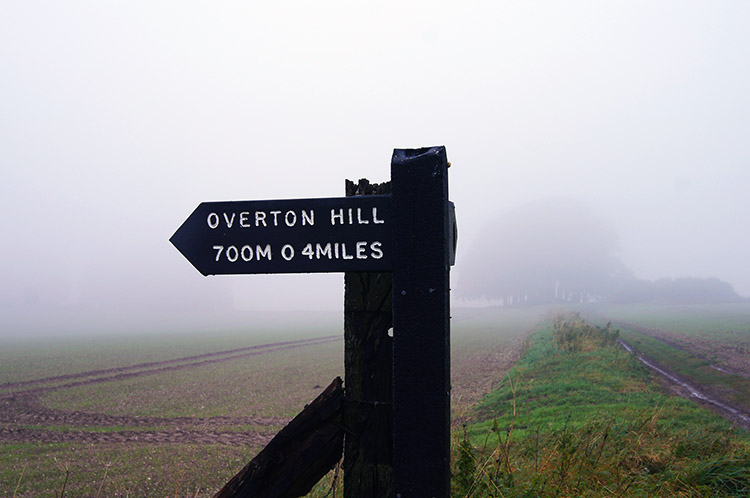 Ridgeway near Overton Hill
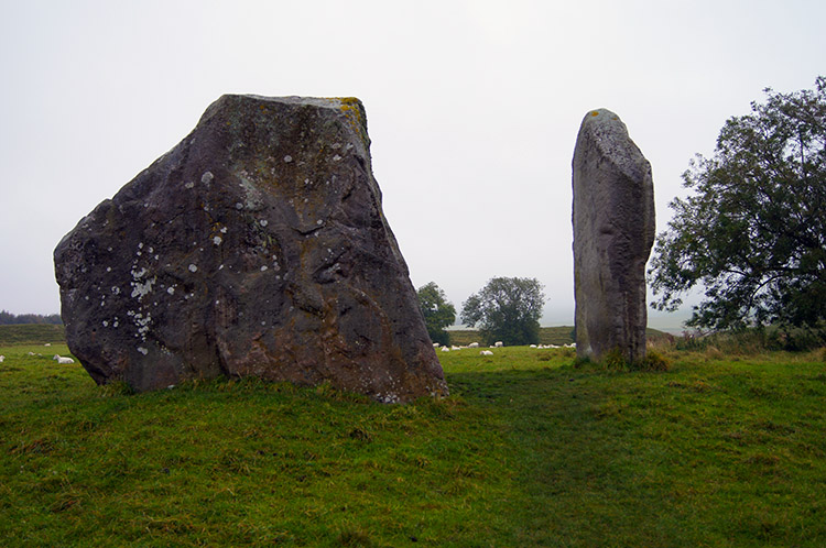
Not being privileged enough to influence the weather, as some of the people who built these ancient wonders may have thought they were, I set off in late morning clag which had descended to ground level in places and settled as a thick grey blanket over much of England. Still I could see where I was going and armed with GPS and backed up with map and compass, which I doubted I would need, I set off walking from outside the Red Lion Pub in Avebury and headed east following the Wessex Ridgeway, Herepath or Green Street; a road cum bridleway with three alternative titles towards Manor Farm. The first couple of hundred yards were not walked quickly, nor were they walked in a straight line as I meandered from the track to various stones of the inner stone circle which are enclosed within a circular bank around 400 metres in diameter. After the aimless beginning I reverted to the path on the eastern edge of the inner circle and walked past a few buildings and then Manor Farm from where I made a right turn and headed south on a grassed bridleway between fields towards Overton Hill.
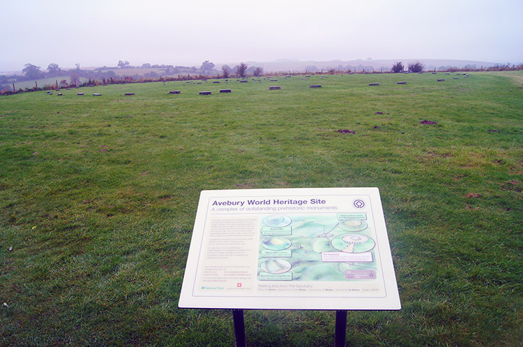 The Sanctuary at Overton Hill
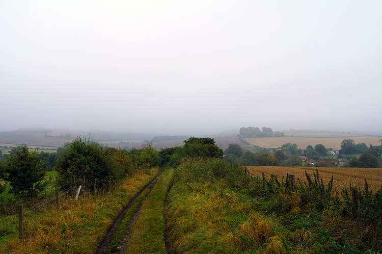 Track from Overton Hill to East Kennett
After passing around half a dozen fields either side of me I came to reach the Ridgeway Path which I had walked the year before. I was now on familiar ground and I retraced my steps to the south west end of the Ridgeway at Overton Hill where there are more ancient archaeological sites. There are several round barrows (burial mounds) on Overton Hill and across the A4 road from the barrows is the site of a wooden circle known as The Sanctuary. There is not much to see at the site now, just a recreated ring of timber posts. Still, the story is fascinating.
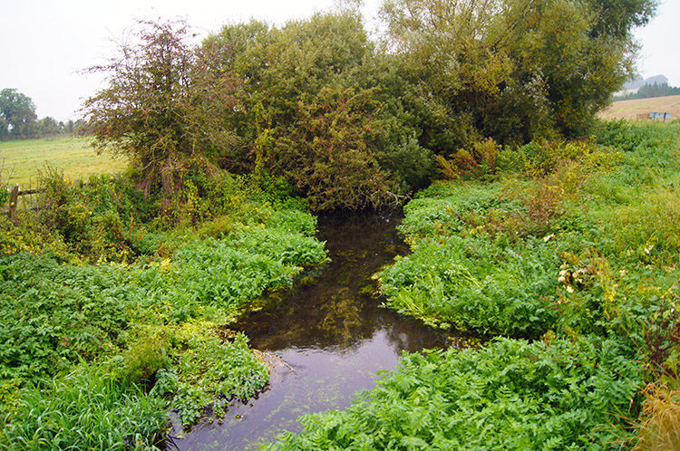 Beck near East Kennett
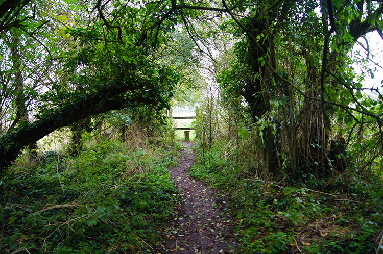 Woodland track to West Kennett Long Barrow
From the site of The Sanctuary I followed a path straddled with thick dense hedge on either side of me which descended from Overton Hill to just north of East Kennett. At the bottom of hill the path came to a tee junction and I took the right fork to head west across a road which took me over Swallowhead Springs and soon after I came to a crossroads of paths from which I took the right fork to track first north and then west again past the south side of West Kennett Farm and then across a tarmac road to nowhere. On crossing the road I spotted my next ancient site, the long barrow of West Kennett.
 Not giving up
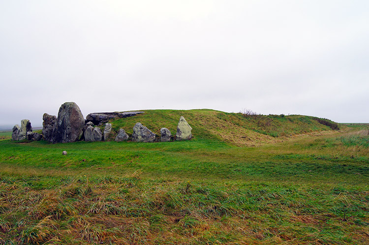 West Kennett Long Barrow
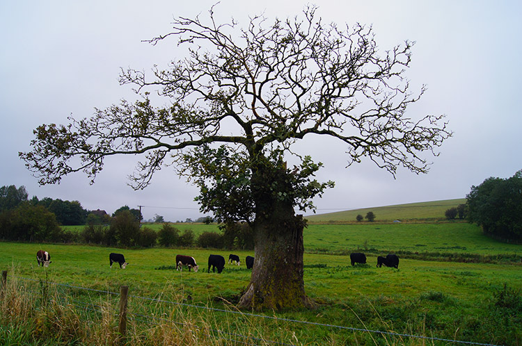
The feeling of being in the middle of ancient Britain was very palpable as I walked along the side of a field which drew me closer to the path leading to West Kennett Long Barrow. As I approached I looked slightly to my right and caught my first view of Silbury Hill, another indicator than I was walking with the very very old. I passed close to an old Oak Tree ravaged by lightning bolts which almost mystically refused to die. A slender trunk sprung out from the smashed larger host trunk and leafy branches sprung from it. Was it Merlin's work I wondered?
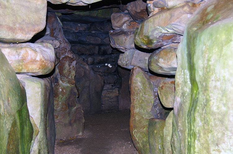 Inside West Kennett Long Barrow
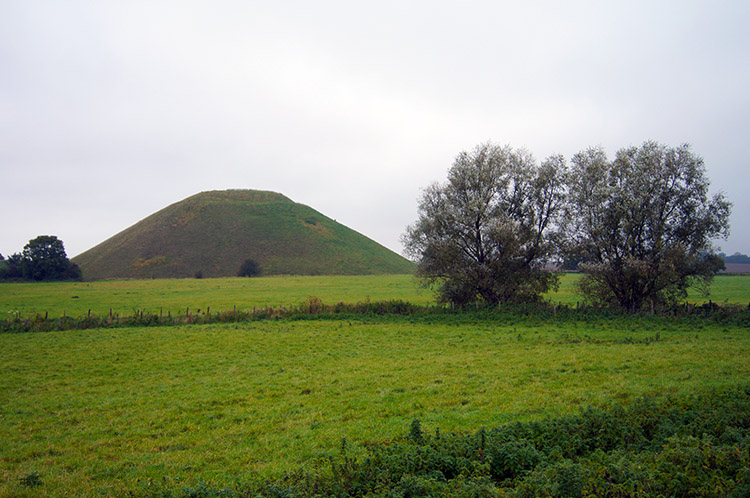 Silbury Hill
I reached the field where West Kennett Long Barrow stands in the midst of and after skirting the edge I followed the wide path provided by the landowner to access the ancient wonder. I walked all around the magnificent structure and the ducked my head and entered the confines of the hallowed space. West Kennett Long Barrow was constructed about 3600 BC, which is some 400 years before the first stage of Stonehenge, and it was in use until around 2500 BC. Archaeological excavations in 1859 and 1955-56 found at least 46 burials, ranging from babies to elderly persons who died within 20 - 30 years of each other suggesting the barrow was dedicated to the dead of a local community. From West Kennett Long Barrow which had a clear purpose I walked down the field, then alongside another, across Pan Bridge and then across the A4 once more to a field near Silbury Hill which has confounded experts on its purpose to this day. Maybe the ancients were bored and just wanted something to do. Or maybe a hill to run up and down for exercise.
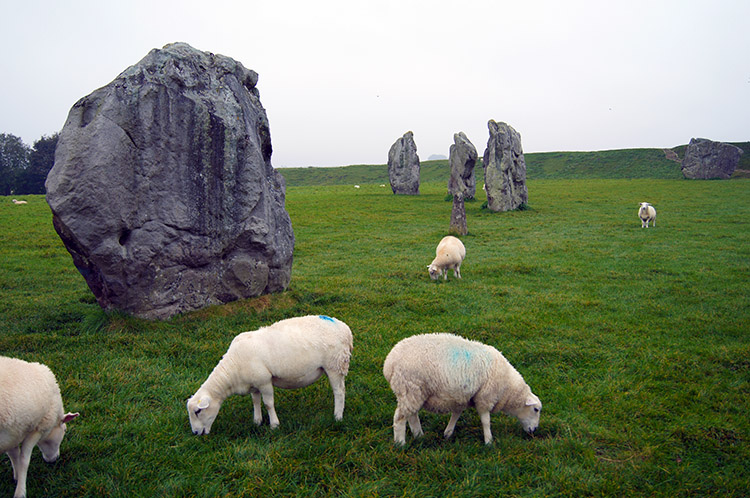 Sheep graze beside ancient stones
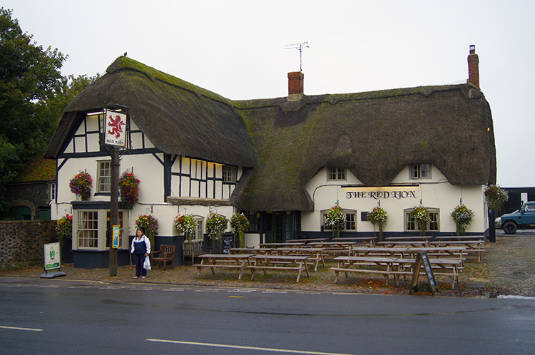 Red Lion, Avebury
From the field closest the Silbury Hill I continued north across two more fields which brought me back to Avebury. After crossing the A4361 Beckhampton Road I followed a path beside the large village car park which led to a gate. once through the gate I was beside a field with more impressive standing stones just within the inner bank. As I had done at the start of the walk I deviated from my course and wandered amongst the stones. I so enjoyed it, I do feel Avebury is a much more impressive site than Stonehenge and being in the circle just felt good a proper. It was the perfect end to the walk with the ancient.


