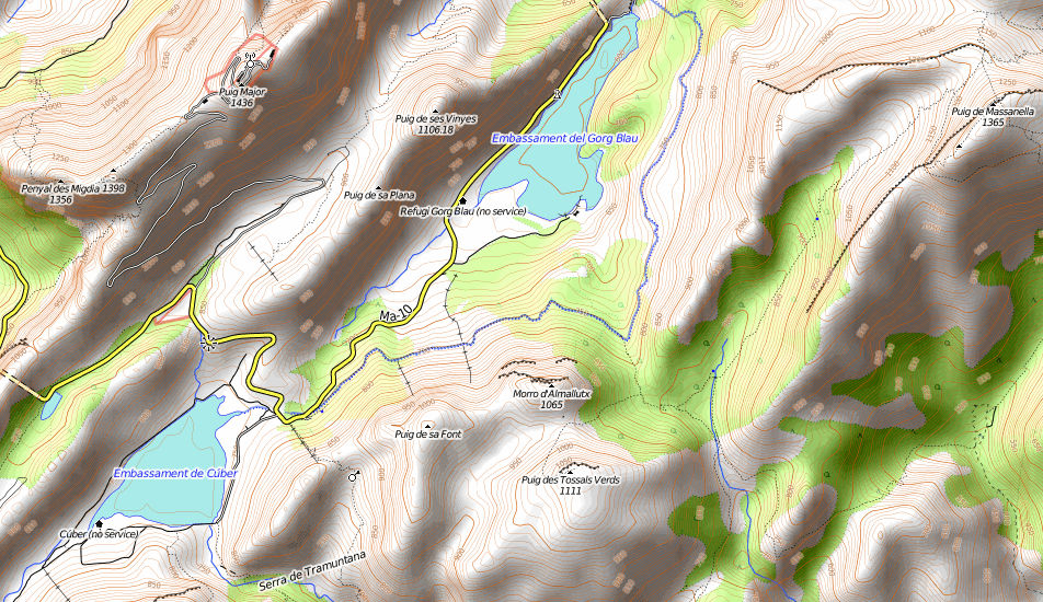
Puig de Massanella from Cuber Reservoir, Mallorca
| Statistics and Files | ||
|---|---|---|
| Start: Embalse de Cuber | Distance: 13.65 miles (22.0 km) | Climbing: 1,297 metres |
| Grid Ref: N/A | Time: 7-9 hours | Rating: Strenuous |
| Statistics | |
|---|---|
| Start: Embalse de Cuber | Distance: 13.65 miles (22.0 km) |
| Grid Ref: N/A | Time: 7-9 hours |
| Climbing: 1,297 metres | Rating: Strenuous |
Map
Summary:
Jill and I walked from Cuber reservoir to the Puig de Massanella, the second highest peak on Mallorca, in the Serra de Tramuntana Mountain Range. 1365m tall, an amazing walk amongst breathtaking scenery.
(Note: This walk is kindly contributed by Mark Dunn)
The Walk: This walk begins at the car park area of the Cuber reservoir (Embalse de Cuber), just a few minutes’ drive from the popular seaside resort of Port de Soller on the MA10 road. The drive around here is worth a trip in itself, as the scenery in this part of the island is stunning. The car park is at around 800 metres so by the time you set off, you are already surrounded by giant mountains. We started our walk with Mallorca’s largest peak, Puig Major behind us. It’s taller than Ben Nevis at 1445 metres, but sadly off limits to civilians as it houses a military installation.
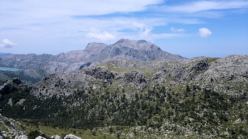 At 1,445m Puig Major, Mallorca's highest mountain is higher than Ben Nevis
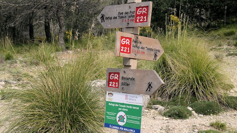 Wayposts on the Mallorca hiking trails are both informative and accurate
We were headed instead for the 2nd highest mountain on the island, the Puig de Massanella at 1365 metres. Unlike the UK, in Mallorca there are signposts along most of the hiking routes and we were using the GR221 Long Distance Path for most of our walk. At our first signpost, visible from where we parked, we headed east towards the Refugi des Tossals Verds which we read was 1hr 50mins away. The timings on the signposts were surprisingly accurate throughout our walk. We stayed on the path up and over the Coll de Sa Coma des Ases and much to our surprise, in the next valley, we came across the body of a light aircraft of all things.
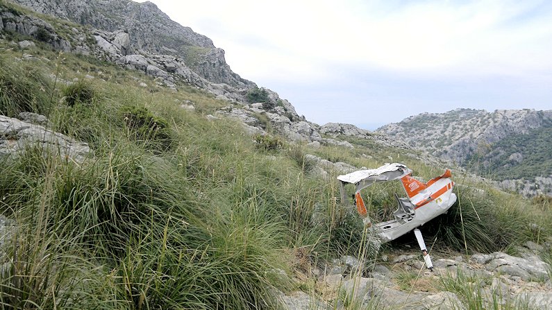 Light aircraft wreckage in the Mallorca mountains
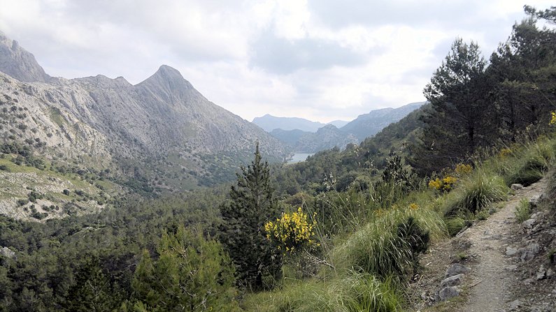 The amazing scenery of Mallorca unfolds
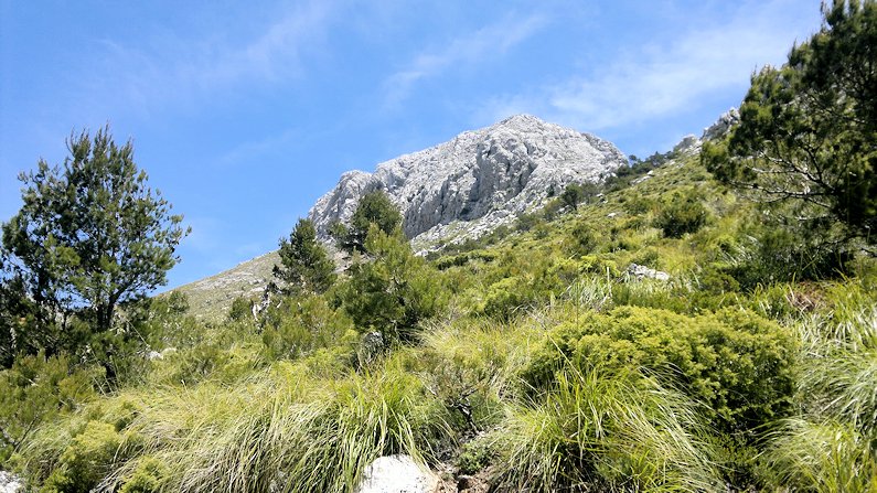
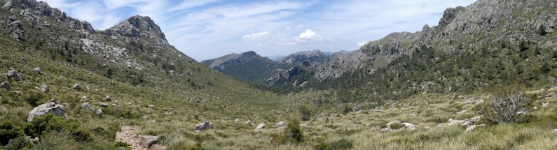
Soon after we had passed the scene of aircraft wreckage we followed the path which was easy to navigate. As we climbed the walk provided some jaw dropping scenery, each corner turned seemed to reveal even more amazing views. Most of the terrain was easy to manage yet one small section was steep and rocky, however there were chains bolted into the rock as handrails, so no problems there.
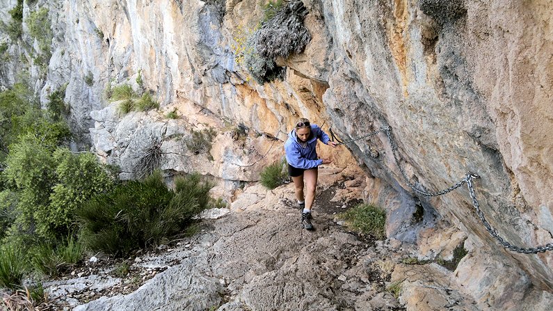 A section of Via Ferrata in the Mallorca mountains
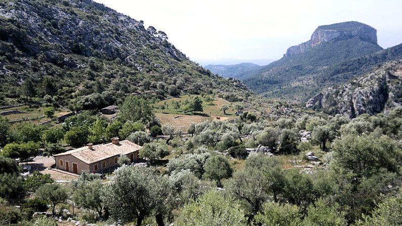 Refugi des Tossals Verds
Throughout the route there were cairns and signposts so navigation wasn’t really an issue, but needless to say, a map and compass are essential. We stayed on the path for about 3 miles until the Refugi des Tossals Verds, where we decided to stop for lunch. This refuge or hostel can be booked in advance if you wanted to stay the night. Not a bad spot for a picnic either. Our route had skirted around the base of the Puig de sa Torre, 1049 metres and Puig des Tossals Verds, 1118 metres. After the refuge, we continued into a beautiful, dry stone wall terraced valley with olive trees and a surprising amount of friendly donkeys. Mountains towered above us on both sides, and the views all-around of the rocky promontories, caves, blue skies and lush vegetation were amazing.
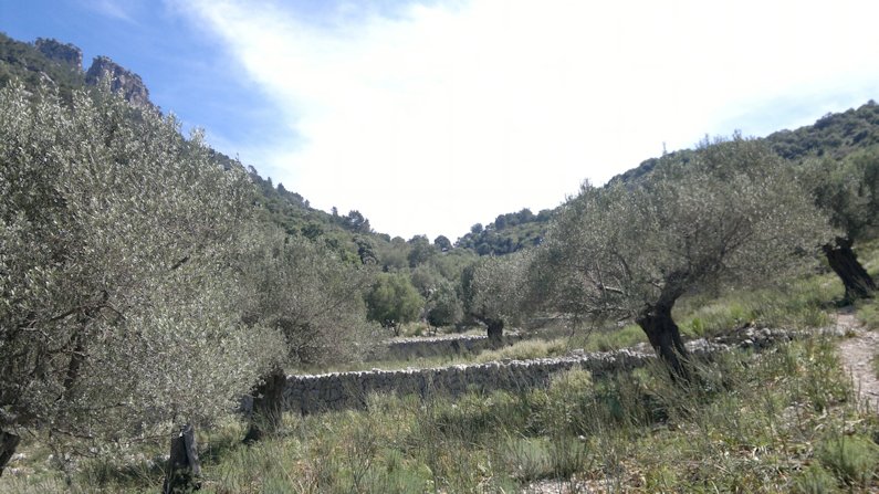 Olive trees groves
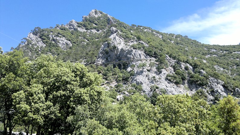 Avenc d’en Ferre viaduct
We gradually gained height and the path continued on until we saw a beautifully built viaduct, the Avenc d’en Ferre, to the right of the path. Staying on our path, we soon came to the wooded pass of the Prat de Cuber (no, I’m not kidding!) and we turned right towards Font des Prat and right again over a small foot bridge and onto the path that would lead us towards the summit of Massanella.
 Towards the summit of Massanella
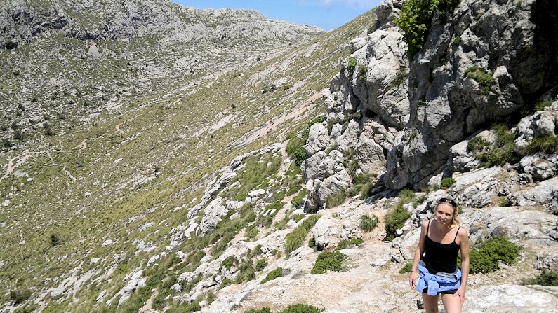 Climbing to the summit of Puig de Massanella
The shade of the trees was welcoming and the walk up through the woods past springs and streams was magical. This path was straight as an arrow and about two miles long, again, no navigational issues to worry about. When we exited the wood, about a mile in, our objective was straight ahead and bathed in sunshine.
 The summit ridge of Puig de Massanella
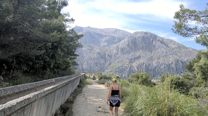 Following the trough!
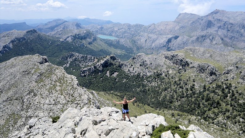
We walked a few hundred yards further and took a sharp right onto a smaller path following the cairns, which traversed towards the summit. There was then another steeper path all the way to the top with just the tiniest amount of steadying with the hands needed, from time to time. Not a scramble in anyone’s book! Once on the summit plateau we headed passed the first cairn to the true summit marked with a metal plaque. Very near here is a 20 metre deep snow hole, so don’t fall in! After a sandwich, and many photos of the incredible views over the whole of the island and even to Menorca on a good day, we headed down. We walked back on the same path we’d come up on, back to the Prat de Cuber.
 Walking back via Prat de Cuber
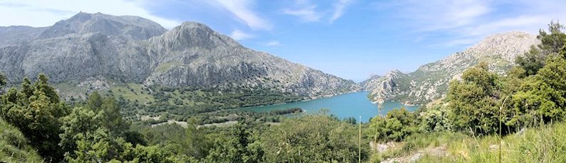 Gorg Blau reservoir
Turning right here we followed the path only to find a 4 foot high water trough that was 3 miles long and basically followed this all the way gently downhill, back to the car. The views on this stretch looking over the Gorg Blau reservoir were surreal. If you think you know Mallorca, think again as the scenery on this walk was a cross between South America, Canada, Switzerland and Sir Arthur Conan Doyle’s The Lost World. I would recommend this beautiful walk to anyone. Next time you are there, try and get there, you won’t regret it.


