Dow Crag, Old Man of Coniston, Swirl How, Great Carrs, Grey Friar, Seathwaite Tarn and Wallowbarrow Gorge
This walk begins in the hamlet of Seathwaite, near to Wallowbarrow Crag in the Duddon valley area of the south-west Lake District. The route climbs to Dow Crag via Walna Scar Road, Brown Pike and Buck Pike. After attaining Dow Crag there follows a series of high level walks to four more Wainwright fells before the route descends from the high ground to Seathwaite Tarn. A lowland walk to the spectacle of Wallowbarrow Gorge follows. The gorge and Wallowbarrow Crag make a fitting finale to the day out.
Google Maps Open Source Maps| Statistics and Files | ||
|---|---|---|
| Start: Seathwaite | Distance: 12.0 miles (19.3 km) | Climbing: 1,324 metres |
| Grid Ref: SD 22774 96016 | Time: 6-7 hours | Rating: Strenuous |
| GPX Route File | Google Earth File | About Seathwaite, Duddon |
| Statistics | |
|---|---|
| Start: Seathwaite | Distance: 12.0 miles (19.3 km) |
| Grid Ref: SD 22774 96016 | Time: 6-7 hours |
| Climbing: 1,324 metres | Rating: Strenuous |
| GPX Route File | Google Earth File |
Ordnance Survey Explorer Map (1:25,000)
The Walk: Sometimes things do not turn out as you wanted them to. I had gone to bed all excited after the weather forecaster has promised a day of sunshine only to wake up in the early morning and find the view from my bedroom window obscured by cloud. The outdoor enthusiasts dilemma. Still, I was into day three of four of an autumn break in the Lake District and I was not going to waste it. And as the previous two days walks of first Great Gable and secondly the Scafells had been in gorgeous sunshine I could not really complain. I did though. I grumbled and grouched to myself as I took breakfast and I continued to mope as I travelled from my stay hotel in Eskdale over Hardknott Pass to Cockley Beck and then through upper Duddon to Seathwaite. The cloud was as thick as my sombre mood.
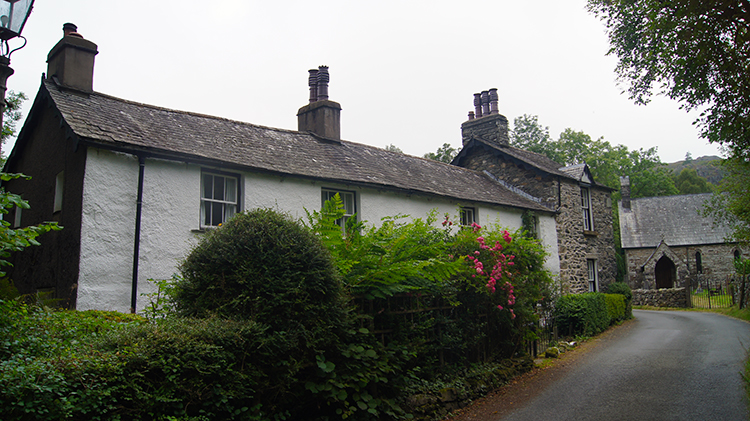 Seathwaite in the Duddon Valley
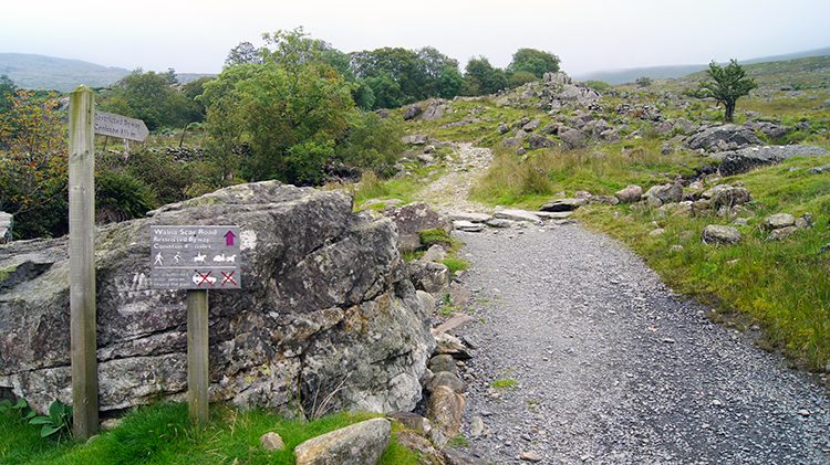 Walna Scar Road
I arrived in the quiet hamlet of Seathwaite and parked up in the small car park next to Seathwaite Parish Room. The morning was still and all was quite except for the trickling sound of water in Gobling Beck and the chirrup of the local birdlife. As I walked north-east up the road I had driven down I was heartened by the sounds of nature. I was walking and the mood was gone. I still hoped for improved conditions though as I reached my turning point off the road which led me on the access lane to Turner Hall Farm. Soon I passed the dead quiet farm and crossed a couple of fields to reach a tarmacadam road at Hollin House Haw. I turned right on reaching the road to walk east. The tarmacadam soon ran out and the road degraded to track. I had reached Walna Scar Road.
 Climbing on Walna Scar Road
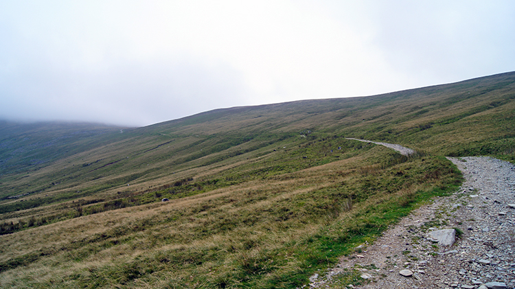 Walna Scar Side
A couple of months earlier I had reached Walna Scar Road, at the other end in Coniston. I had been laden with backpack and tent on a mission to walk from Coniston to Keswick over a few days while wild camping overnight. Then, as now, I had been promised decent weather conditions as the primary objective then had been to see starry skies on the high ground at night. Then the weather completely routed me as a front came in just as I set off from Coniston. I persevered to climb to just below Brown Pike and camp near Blind Tarn. It was an awful night under canvas and with no improvement the next morning I had abandoned my quest, turned tail, walked back to Coniston and on the same day returned home. The weather did not improve for a week so then I had made the right decision. Now though I was committed to staying in the area for another couple of days. I was not stopping this time. I climbed steadily up Walna Scar Road and towards the cloud line.
 Path to Brown Pike
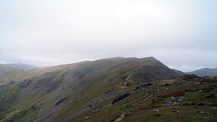
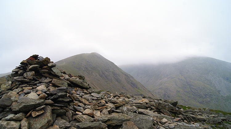 Cairn marking the summit of Brown Pike
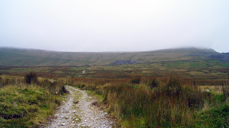
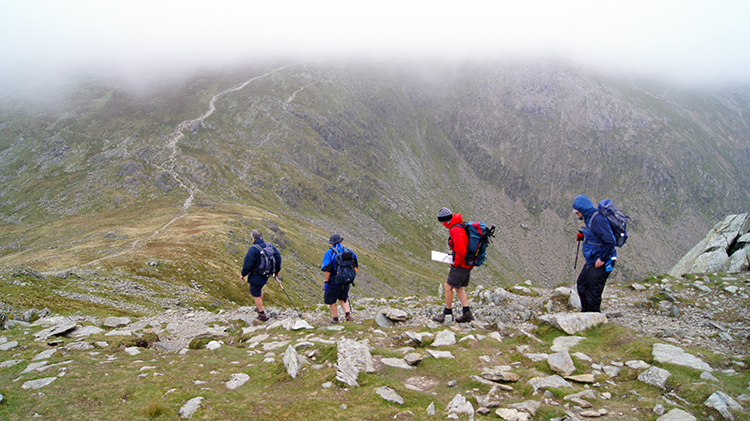
As I climbed Walna Scar Road I kept stopping, turning my head, and looking north-west to Harter Fell. Occasionally a handkerchief of sunshine kissed the fell and crossed it before being overtaken by cloud. This happened a few times and I watched in the hope the regularity in sunlight would increase. The bright spots faded away. No improvement. Then patches of sunshine hit the ground on the Seathwaite Fells which were much nearer to me . It could not breach the tops though. I looked to Brown Pike as a gauge of optimism. Cloud streamed across the top of Brown Pike, obscuring the highest ground completely. At just over 400 metres I came to a gate. Rather than open it and walk through I huddled down by the wall and decided to sit and wait for a while. The morning weather forecast had not said I would be in cloud and thus I hoped for an improvement in conditions. I sat for 45 minutes. 45 hopelessly forlorn minutes. The weather improved not one jot. I returned to the gate, opened it, and walked through. I closed the gate, ambled up Walna Scar Road as slowly as I could to the point I left it where a crossroads in the path led to White Maiden to the right, Coniston straight on, and Brown Pike to the left. I saw two walkers ahead of me disappear into cloud on Brown Pike. I followed them up and reached the cairn on Brown Pike. On doing so I stopped for another break. As I began the break I could not see my next goals of Buck Pike and Down Crag. Then thankfully the cloud lifted and I saw them haze into view. At last. My spirits lifted too.
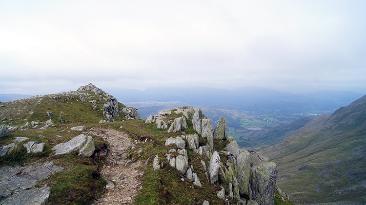
 Walking from Buck Pike to Dow Crag
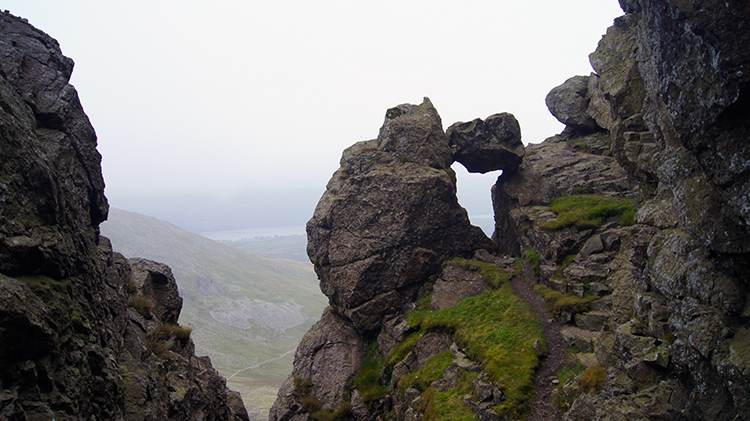 A gully on Dow Crag
There is nothing worse than walking to a new series of mountains and walking them in cloud so thick that you cannot see them. I cannot see the enjoyment in that. And as I was now walking to Dow Crag which had been the primary objective of this new walk in the Coniston Fells I was pleased the cloud had sufficiently lifted for me to appreciate it a little better. I had first been beguiled by Dow Crag when I had looked across Goat's Hawse to it while on my first Coniston Fells walk many years back. It is such an impressive and shapely mountain to view from the path between the Old Man and Levers Hawse. And I had read Wainwright say of Dow Crag "Second only to Scafell Crag in the magnificence of its rock architecture.... The fell is extensive, and in marked contrast to the near-vertical eastern face is the smooth and gentle contour of the western slope descending to the little valley of Tarn Beck". The airy path from Brown Pike to Buck Pike and on to Dow Crag is an exciting one. As I walked along it I looked left to that gentle slope as it disappeared into the mist of thin low cloud below me. I was more thrilled looking right though to the plunge of Goat's Water more than 200 metres down. lefts and gullies appeared regularly and I stepped out onto one to give closer inspection to a boulder which once free, was now wedged between mountain bulk and upright pinnacle. Dow Crag is exciting. Even though I could not see across to the Old Man of Coniston clearly I could make it out. And I could see all the way due west across Goat's Water and Old Man Breast to Coniston village and Coniston Water. It was a great sight to enjoy.
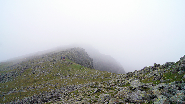
 Walkers descending to Goat's Hawse
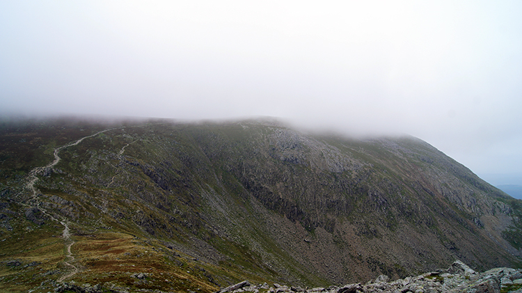 The Old Man with a cap on
As I continued on my thrilling walk of the top of Dow Crag from south to north I passed the summit point and glimpsed a group of four walkers in front of me. caught up with them at the beginning of the descent from Dow Crag to Goat's Hawse and after saying hi four times I had left them behind. My dawdling of earlier in the day was now well behind me. I could not care less what the weather did. I was so enjoying myself. I bounded down to the low point of Goat's Hawse which is the saddle linking the Old Man of Coniston to Dow Crag. It bottoms out at 649 metres so on reaching it I dropped my personal engine down a couple of gears and climbed the 150 metres towards the highest point of my walk. I looked ahead. "Back into the cloud" I thought.
 Old Man of Coniston
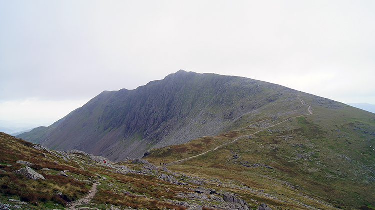 Dow Crag
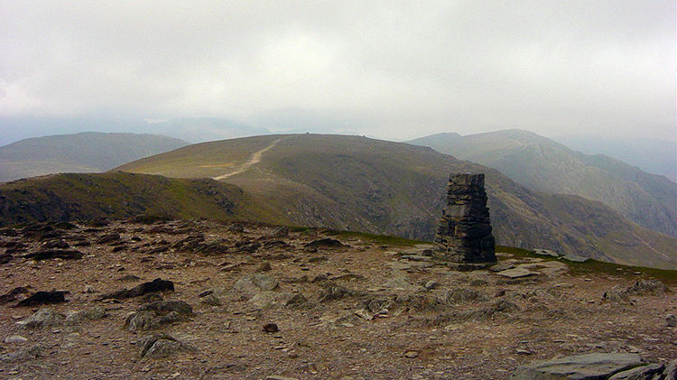
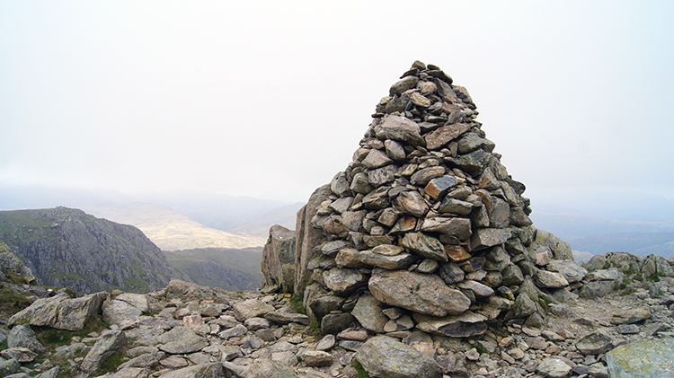
And so from the curved bottom of Goat's Hawse I climbed back towards the cloud hanging on to the very top of the Old Man of Coniston. It played a trick with me. As much as I tried i could not touch the cloud. made the height to the line it leveled off and just as I seemed to reach the point it disappeared. Just like the end of a rainbow. Untouchable. It was as if the weather of the day was playing with me and performing tricks. Rather than taking it personally I was actually loving it. As much as I had complained to myself about the bank of cloud settled on top of the mountains I had chosen to walk to I had not actually got myself into the thick of it. Now I was on top of the Coniston Fells the weather was improving for the better. I could see my way and as I reached the milestone which is the trig point at 803 metres on the summit of the Old Man of Coniston I looked in awe at the path I would take across the majesty of the Coniston Fells to Great Carrs which in my opinion is one of the greatest paths in all of the Lake District. And I also looked across to Dow Crag which I could now see more clearly. The magnificent east cliffs I had walked past earlier on now showed all their precipitous pomp.
 Brim Fell Rake
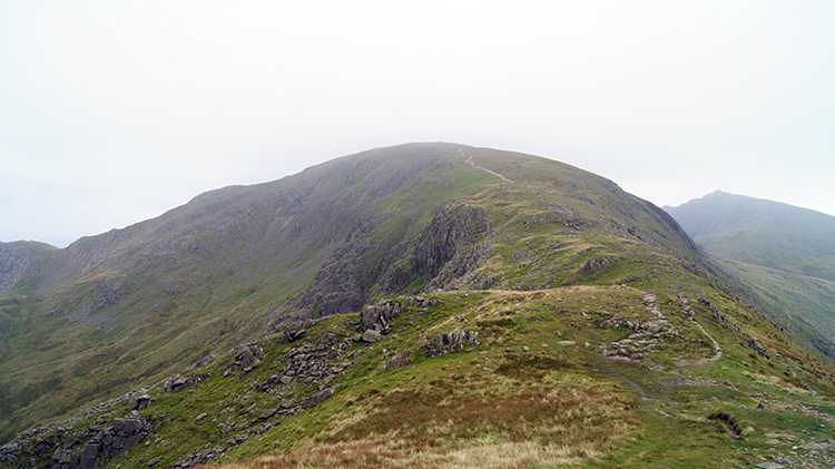 The saddle of Levers Hawse
Having seen off the highest point of my walk I bounded along the high way from the Old Man of Coniston to Brim Fell Rake. Though I had done all the climbing, bar a few short ups to my remaining Wainwrights, I had still about seven miles to go. I could not dilly dally all day. I continued walking at a good pace from Brim Fell Rake on the steady walk down to the saddle of Levers Hawse before continuing on an unbroken climb to Great How Crags. Then I walked across Swirl Band to Swirl How. As I walked I noticed other walkers on the band edging in from the east side of the path to the west side as a stiff breeze whipped up over Prison Crag. I noticed it was a strong cold gust and after being bitten by it I did the same.
 View from Swirl How to Great Carrs
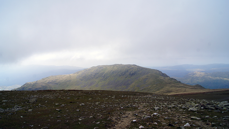 Looking back to the Old Man of Coniston
I reached my interim target of Swirl How and took a short breather. I took in the atmosphere of the place. I love Swirl How. It is the geographical centre of the Coniston Fells and it has four attractive ridge walks heading from it on each of the four cardinal points of the compass. I had just walked the one which heads south. The one heading east across Prison Band to Wetherlam is spectacular and one I took on my first walk of this area. The one going north heads to Great Carrs and beyond drops by Hell Gill Pike and West Side Edge to Wrynose. I will do a little part of that in a minute. The one heading west heads to Grey Friar and then down to the Duddon valley. I will pick that one up as well. First I took one final look to the Old Man of Coniston which looks awesome from Swirl How. Especially when the sun kisses the top of it as it was for me now.
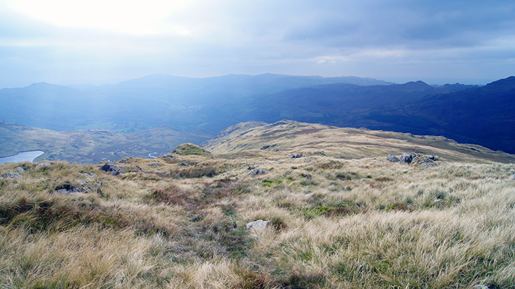
 Exposed path to Great Carrs
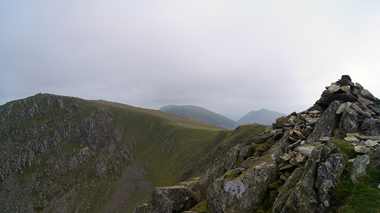 View from Great Carrs to Swirl How
The path from Swirl How to Great Carrs is stunning. If you are brave enough to keep close to the edge of the path the reward of views straight down east to Tilberthwaite and north to the Wrynose Pass are brilliant. There is also an impressive view of the Scafells and Bowfell from Great Carrs. As I looked north and east from Great Carrs across the Lake District I noticed that while the sun was breaking though on my location in an irregular and hazy way it was beaming unrestrictedly on the rest of the National Park. I was beginning to realise that while conditions were never too bad in this part of the National Park today and that they were now improving I was still in what broadband seekers may class as a 'local blackspot'. I realised why as I set off on my walk across Fairfield and Black Spouts to Grey Friar.
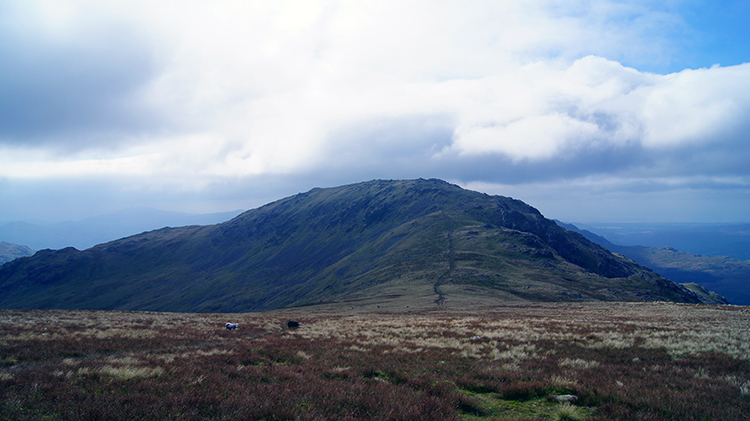 Grey Friar
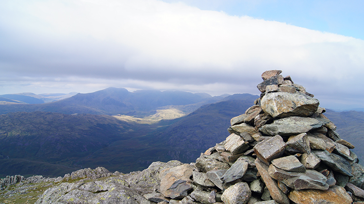 Summit view from Grey Friar
The Coniston Fells are the first high fells of the Lake District to be encountered by weather conditions coming from the south-west. While the national weather was set fair with a humid breeze coming from south-west any cloud that formed would on the first high ground it met. The fells I was on. While the coast was clear clouds formed as soon as air rose and dissipated when dropping over the top of them. So, as I found out when talking with other walkers in my accommodation later, I had been in the only part of the Lake District where cloud had hung around so long which was well into the afternoon. I had set off walking just after 9.00am. It was after 2.30pm by the time the sun began to win the battle. I walked across the lovely terrain between Great Carrs to Grey Friar in intermittent bouts of sunshine and shade. I reached the summit of Grey Friar and sat at the top for my final break of the walk in gorgeous warm sunshine. It was great. And the view I enjoyed was great too, a view of which Wainwright said "Outstanding in the panorama is the splendid eastern wall of the Scafell range". He added it was best view from the north-west cairn of Grey Friar which is exactly where I was sat. It could not be better that that.
 Descending Grey Friar to Seathwaite Tarn
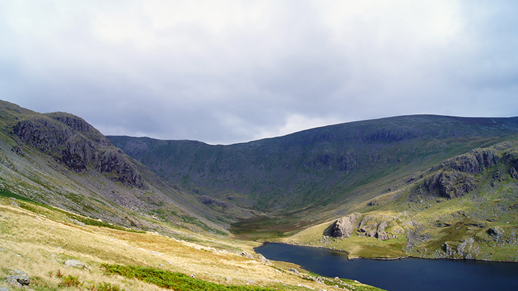 Looking across Seathwaite Tarn to Dow Crag
I descended from Grey Friar to Seathwaite Tarn in a sea of warm light greens and greys of the grasses cushioning the south-west slopes of Grey Friar. I passed Sheep Crag and crossed Troutal Fell on a steady inviting descent with the waters of Seathwaite Tarn drawing me towards them. The walk down was sun kissed all the way, a gorgeous interlude of bright warmth. My walk was ever spectacular, this great day of mountains and fells in the Coniston and Duddon areas, and all the better for a ray of sunshine. I descended to Seathwaite Tarn safely and I descended to Seathwaite Tarn happily.
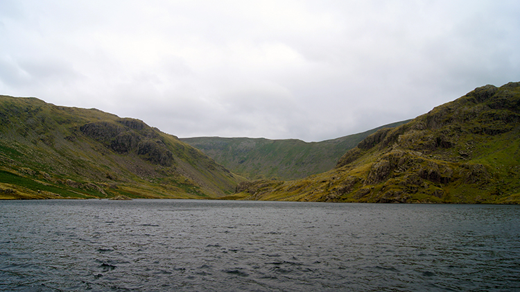 Seathwaite Tarn
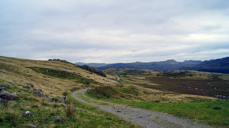 Track from Seathwaite Tarn to Tongue House
I was quite alone now. I had been for most of the day through after reaching Brown Pike and all the way to Swirl How I had other walkers around me and sharing the paths. Now, more so than on isolated Grey Friars, I felt very much the only person around. "Nobody comes here very often" i though through the discernible path of Grey Friar to the tarn dismissed that fact. It just felt so remote while I was at Seathwaite Tarn. It is that kind of place with the kind of atmosphere where I more expected to see a Golden Eagle that a person. The kind of feeling I experienced in the remote places I walked on the Cape Wrath Trail in the far north-west of Scotland. It was just a feeling I suppose but a very real feeling to me. I loved it at the still of Seathwaite Tarn. Even the waters were dead quiet. I left with the familiar reluctance I do from a place which evokes so much thought and awe from me. I turned from the dam wall path which I had crossed over the harnesses tarn cum reservoir and followed a track not unlike a Cape Wrath track towards Duddon Dale.
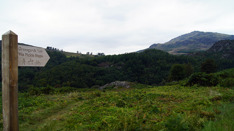 To Fickle Steps
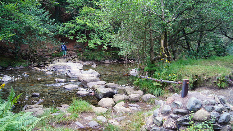 Crossing the Duddon by Fickle Steps
I enjoyed some excellent and thrilling walking from Seathwaite Tarn to Tongue House, especially when walking past the crag of Tongue House Close. It was quite steep descending at times and it required some care. Hard work but good fun. And with such steepness it got me down into the lushness of pastured valley quickly. The haphazard lines of drystone walling took to more formal lines at Tongue House. still there was plenty of wildness though, it is clearly tough living out here. Even the paddocked farmstead fields were fringed by course low fells with bracken threatening to break across the walled lines and invade at any time. The path I took from Tongue House following a sign towards Fickle Steps took me across a wetland which required me to sidestep onto dry patches and to hop across duck boards. Only when I got to the short climb across the south side of High Tongue could I walk without consciously thinking of where to step in order to keep my feet dry. Crossing streams and rivers is sometimes easier in the effort of keeping feet dry than walking across bog land. At least with stream and river crossings you can see where you are putting your feet. Fickle Steps proved that point. From High Tongue and after crossing the Duddon Road I descended a short scrub fell side to the River Duddon at Fickle Steps. The stepping stones across the river were regularly sized, perfectly spaced and very stable. I found the hand-line which is provided as further security of crossing the river by Fickle steps unnecessary though I might think differently in a deluge when the steps were being washed over. To me though and in the conditions experienced Fickle steps are not fickle at all. After crossing the river I set off walking downstream towards my last objective of the walk. I walked to Wallowbarrow Gorge.
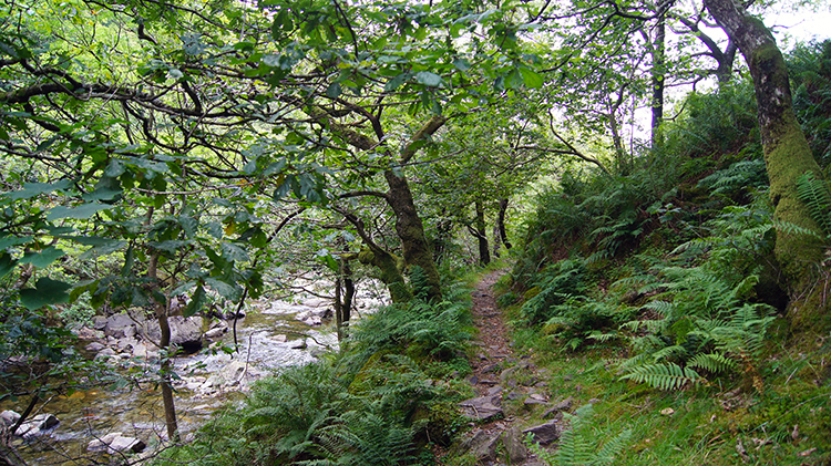 Wallowbarrow Gorge
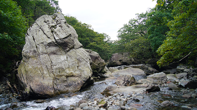 Huge boulders in the River Duddon
The finale of my walk complemented it perfectly. After the thrills of the high places on some of the best walking in the Coniston Fells the walk on the thrilling path through Wallowbarrow Gorge was a delight. Sometimes the path took me up to the edge of the steep crags enclosing the gorge. And sometimes the path took me down to the bottom of the gorge. The walk across the boulder field caused by natural forces which have sheared away the cliffs had to be taken with care in order to avoid twisting my ankles, especially after over ten miles of tiring walking. I was tired but I was also exhilarated by what had gone before and when I reached a point in the gorge where a number of huge boulders sat in the middle of the developing river I stopped my walk for one final time and looked upon the scene in awe. Wallowbarrow Gorge ticked every box in what I had wanted as a final flourish to the walk. When I walked to where the gorge opened out and when I crossed over Wallowbarrow Gorge Bridge I relaxed and contemplated as I made my final steps through a lovely stretch of woodland back to Seathwaite. All was good with my world.


