Silverdale, Warton Crag and Leighton Moss
Starting in the picturesque village of Silverdale this route compliments the diverse natural landscape of the Silverdale and Warton area of north west Lancashire. The first half of the walk follows coast, village roads, scenic promontories, woodland and wetlands and then roadside on the Lancashire Coastal Way to Warton Crag. After climbing the limestone hill follow woodland and fields to Leighton Moss Nature Reserve and then roads and paths into Silverdale. There is much to enjoy throughout.
Google Maps Open Source Maps| Statistics and Files | ||
|---|---|---|
| Start: Silverdale | Distance: 11.1 miles (17.9 km) | Climbing: 396 metres |
| Grid Ref: SD460749 | Time: 4-5 hours | Rating: Hard |
| GPX Route File | Google Earth File | Arnside and Silverdale |
| Statistics | |
|---|---|
| Start: Silverdale | Distance: 11.1 miles (17.9 km) |
| Grid Ref: SD460749 | Time: 4-5 hours |
| Climbing: 396 metres | Rating: Hard |
| GPX Route File | Google Earth File |
Ordnance Survey Explorer Map (1:25,000)
The Walk: Please note the coastline is tidal and that some of this walk may not be possible at high tide. Indeed there are some signs warning walkers of this. Check before attempting it - however I walked at a time of approaching or receding high tide and still the route was safe to follow. Best to pick a period of low tide to be sure though and to make your own determination.
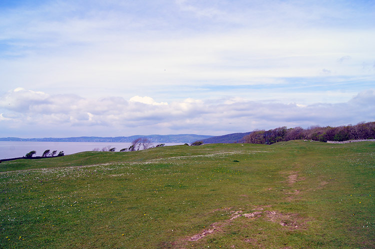 Crossing The Lot in Silverdale
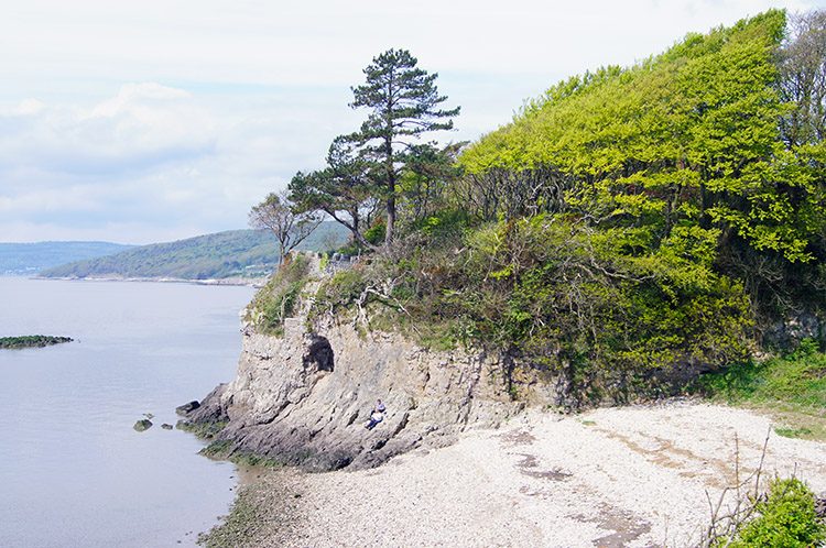 Secluded cove and Silverdale Cave
After parking my car down by the beach in the parking area at the end of Shore Road I walked back up to the junction of Shore Road and Stankelt Road and left the road by a gate into open fields which are denoted by a National Trust post as 'The Lots'. From this slightly elevated vantage point I could see across the Kent Estuary to Grange over Sands in the south most extremity of Cumbria. I was not crossing counties though, just the couple of fields comprising The Lots for now to the secluded cove of north Silverdale and to find a cave indicated on the map. It did not take much finding, I could see the cave clearly halfway up the white cliff sheltering the north side of the cove as I reached the end of The Lots.
 Red Rake, Silverdale
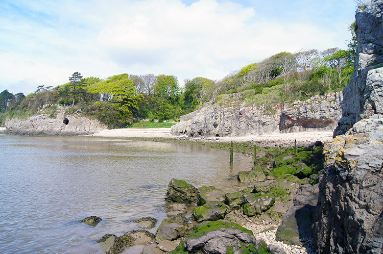 Lancashire Coastal Way, Silverdale
A couple were enjoying bathing themselves in the near lunchtime sunshine on the outcrop of rocks below the cliff. As I made my way past them to look inside the cave I said "Great day for relaxing and taking in the view" They agreed and wished me a good day. After returning the compliment I made the easy scramble up to the cave and entered. It was just the right height to stand up in and about 20 feet deep. From inside I enjoyed a perfectly framed picture of Know End Point and Morecambe Bay. After enjoying the cool conditions of the cave for a short while I re-emerged into the heat of the day and stayed by the side of Morecambe Bay by following the Lancashire Coastal Way south and back towards the car park at the end of Shore Road.
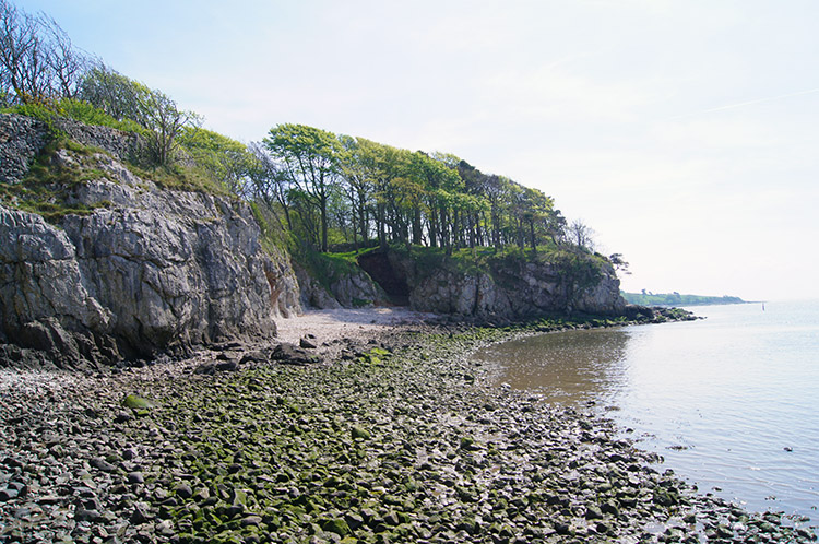
The first 400 metres of walking on the Lancashire Coastal Way was not easy. I had to scramble over rocks that were very wet and slippery and was relieved when I could leave the rocks to cross shingle and irregular patches of sand. Signs warn this section is dangerous at high tide. However, it was not high tide and with care the walk could be done. I made it more difficult because of my haste. (Note: This section can be avoided if there is high tide by crossing The Lots again - it would be a shame to do so but necessary).
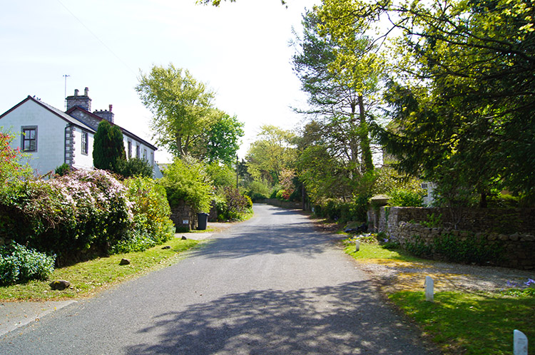 Lindeth Road, Silverdale
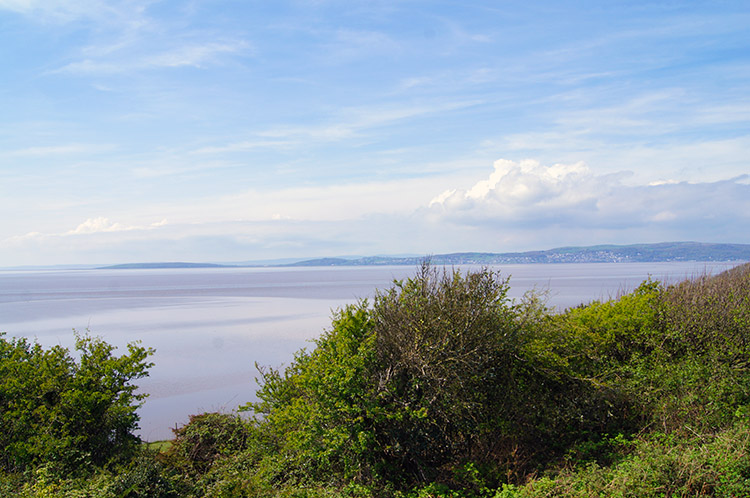 View of Morecambe Bay from Jack Scout
After reaching Shore Road and passing my parked car I walked up Shore Road and accesses a back of houses path to the right which cut through south and east to reach Lindeth Road. I ambled along Lindeth Road and while doing so passed courtesies with householders tending their gardens. A warm and sunny day in Spring often brings people out of their homes and into their gardens; as it did here. Wide and leafy Lindeth Road continued to be a pleasant walk as I passed the junction with Woodwell Lane before it took a turn left at which point I left it by carrying on walking down a lane past Lindeth Lodge Farm and Lindeth Tower on my way to Jack Scout. Some way along the lane I reached a gate where a National Trust sign indicated I had reached Jack Scout. I left the road and followed a lovely path across short green coastal grass and past a fine example of a restored Lime Kiln. Then I passed a cracking bench made from local stone. I looked out from near the structure confirming the seat was a perfect spot for taking in the views.
Jack Scout promontory is owned by the National Trust and gives a superb view of the Morecambe Bay area in particular and by looking north to the south Lakeland hills and fells. It is also a good point at which to watch the Arnside Tidal Bore, a wall of water which signifies the advancing tide rushing up the channel and into the Kent Estuary. I did not exactly view the bore from Jack Scout but I could clearly see rushing water spewing along the Kent channel. I was also destined to see a similar sight soon on this walk. From Jack Scout I headed to Jenny Brown's Point, a line of shingle-clad boulders which were to be part of a House of Commons approved scheme to reclaim Silverdale Sands. In their wisdom the Lord's did not agree and the scheme was abandoned but the first set of man-made protective boulders still remain in place and the sanctuary they provide seemed to attract plenty of coastal dwelling birds when I looked out over the scene.
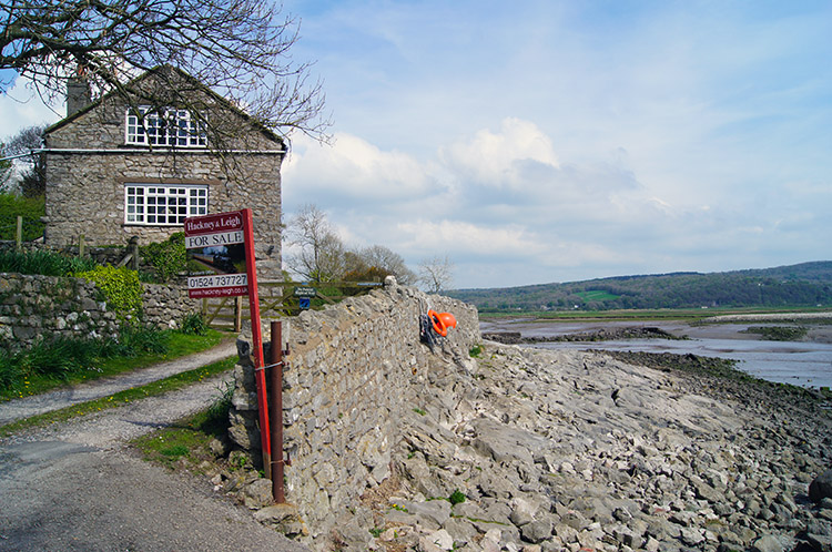 Brown's Houses, Silverdale
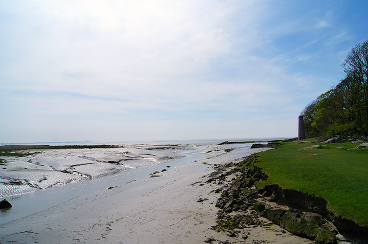 Warton Sands
After leaving Jenny Brown's Point I walked from the National Trust site and back to the leafy shaded metalled road leading south and east around the coastline to Brown's Houses. At the houses the road abruptly ended and at this point I was forced to walk off the track and around the house wall by clearly marked No Entry signs. Fair enough but I thought there would be a sign indicating the way around. After all I was on the Lancashire Coastal Way. despite this there was no indication of which way to go around the private dwelling and only by looking was it clear I would have to clamber down collapsed concrete ramps to the shore. I clambered around and then climbed back up the bank when beyond the houses and the land they occupied - note it says Brown's Houses but as far as I could see there is only one. After Brown's Houses I followed the coast past an old Lime Kiln chimney near the expanse of Warton Sands and it was here I saw my second gushing watercourse as water spewed quickly from appropriately named Quicksand Pool into the bay. I stayed well clear of the quicksand.
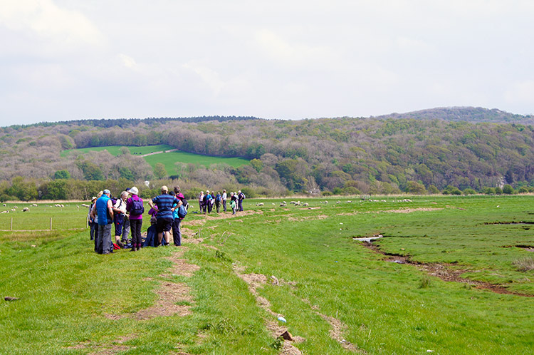 Ramblers in Silverdale
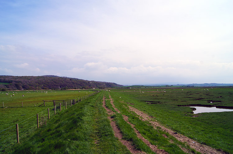 The embankment across Quaker's Stang
By following the path a little further I reached the start of the raised embankment crossing of Quaker's Stang. As I crossed I ran into a gang of Ramblers, mostly elderly. All were enjoying their day out bar one who was sat on the embankment taking a rest. Some of the large group were patiently waiting for their resting colleague while others grumbled. I could clearly hear the discontented grumbles from a group of four ladies who clearly wanted to get moving. Glad I walk alone most of the time and when I do walk with others I make sure it is with friends of similar fitness. Walking is not for conflict.
The least attractive part of the walk came after my crossing of Quaker's Stang, a road walk all the way to Warton Crag. There is one and a half miles of road between the car park and the crag and though road walking is not the most desirable at least this road walk was quiet. There was precious little traffic before I took the left hand fork at Crag Foot to follow the uphill road to Warton Crag and after the junction just two cars past me in the twenty minutes it took me to walk up the road. That allowed me to listen to the birds chirruping in the hedgerows and roadside trees along the route.
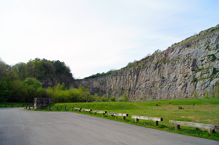 Warton Crag
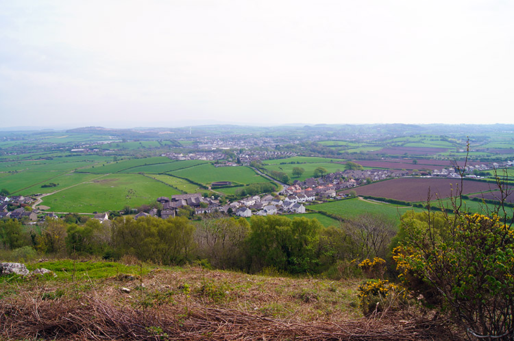 Warton and Carnforth
After half an hour of road walking and listening to birds I reached Warton Crag. As soon as I turned from the road into the car parking area I could see the huge vertical cliff which was obviously once a quarry. Mans activity may have shaped this aspect of Warton Crag but it sill looked striking beautiful and the ominous presence that a vast vertical cliff evokes captured my attention. It has apparently reaped benefits for local wildlife too. Peregrine falcons use the cliff to manoeuvre prey. If fact the area around the cliff and Warton Crag is now managed by the local wildlife trust, something which I support being a member of my local Yorkshire Branch. After taking on the enormity of the cut face of the quarried limestone I walked to the right hand side of the cliff and followed a path up through woodland. The path was easy for just a few steps until I took the left hand branch at a fork of paths which led to the beginning of my steep ascent. After some hauling and puffing and passing over a stile I eventually reached the top of the cliff which I walked along at a safe distance from the edge for a few yards before hauling, heaving and puffing my way up again to reach the exposed natural limestone face of Beacon Breast.
As I climbed from Beacon Breast towards the top of Warton Crag which was done in stages of fairly even ground and almost stair like steps up the limestone blocks I looked out occasionally. Views were opening out for me. To the south I could see to Warton, Carnforth, Lancaster and Morecambe on the Lancashire coastline. I could clearly see the towering buildings of Heysham Nuclear Power Station too. I turned from it and looked west and north over the Arnside and Silverdale Peninsula. In fact I could see the entire expanse of Morecambe Bay. I turned from the view, headed on up further and soon reached the trig point and signal beacon on the summit. Apparently a beacon has been on this site since the Spanish Armada attempted an invasion of England in 1588. I saw no ships on this day though.
I took lunch near the trig point on Warton Crag, admiring the blanket of Bluebells in the neighbouring woodland as I rested. Then after lunch I headed on a path into Strickland Wood and absolutely enjoyed myself gambolling along the paths with exquisite views of trees showing light green spring leaf growth which contrasted with the Bluebells perfectly. Being on a slight downhill gradient as I did so it was perfect. The woodland was a real pleasure to be in on such a lovely day.
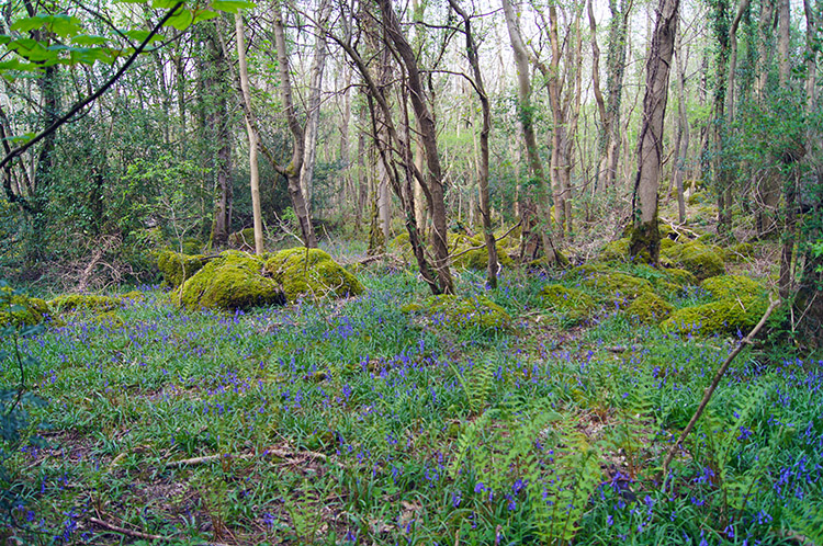 Woodland on Warton Crag
 Leighton Moss Nature Reserve
I continued through the woodland of Stickland Wood and then through more woodland past two small rounded hills, Three Brothers and The Belt respectively. After The Belt my course north off Warton Crag became a easterly heading which led me out of the woods by crossing the road linking Warton and Yealand Conyers. After the road crossing two fields and a woodland path led me skirt the village of Yealand Conyers before I tracked from north to west and then followed the path past Leighton Hall Home Farm. After walking closely by the impressive building I carried on walking on the road between open fields to Grisedale which led me to Leighton Moss Nature Reserve.
(Note: The route I took through Stickland Wood and Brothers Wood has been closed since July 2018. The alternative route of bridleway and Coach Road is shown on my maps and is included in the files available to download on this page. I hereby express my thanks to Phil Robinson for pointing out these changes)
It is reputed that Leighton Moss Nature Reserve contains the largest area of reed beds in north-west England, which are managed to prevent them drying out and to prevent saline intrusion from the coast. I could not argue with that, for much of my crossing of the wetland all I could see on either side of the path was reed bed, high enough to blot out the view beyond. The reed beds provided habitats for many species of wildlife, including many birds and even red deer. I am sure I saw one.
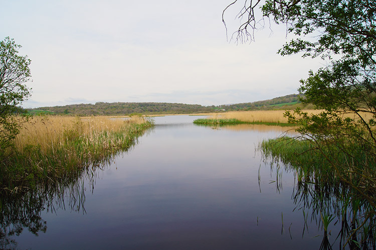 Open water on Leighton Moss
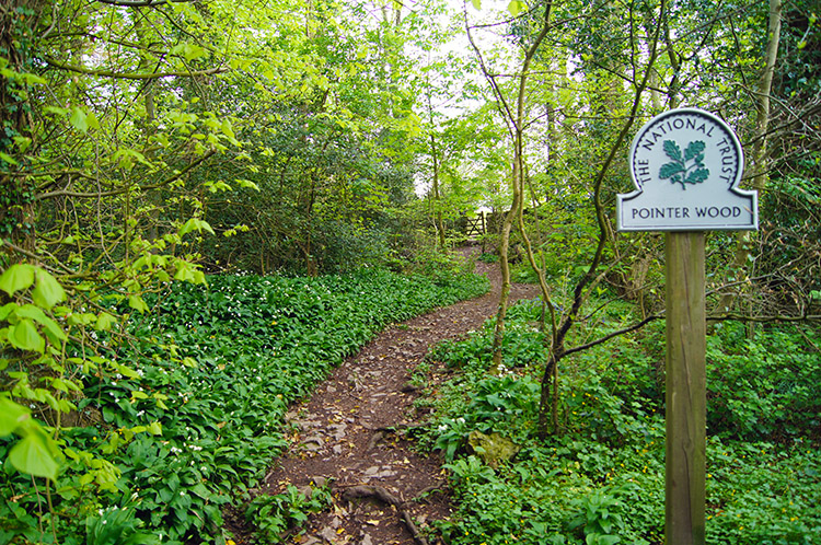 Pointer Wood, Silverdale
There is no chance of leaving the direct line path crossing Leighton Moss Nature Reserve, there is water everywhere either side of the path. Birdwatchers who are drawn to this place use the hides which are situated about halfway along the path. There were private hides and public ones too so I could have taken a peek but I declined, still having some walking to do. I was satisfied to listen to the noises coming from the reed beds and open water all around me and imagine. After a half mile walk across the nature reserve I climbed the final few yards of the straight line path and turned left onto the Yealand Storrs to Silverdale Green Road. This led me over a bridge from where I could look in on Silverdale Railway Station.
After passing over the railway I came to a road junction and took the right fork and then at two more junctions went left and left which brought me to Fleagarth Wood which I walked through, amidst yet more Bluebell carpets to skirt Heald Brow and reach the crossroads of paths I had been at a couple of hours earlier. I took the right hand fork at the crossroads and walked steeply up a rise of 50 metres though Heald Brow woodland to follow a path beside fields and behind houses to Scout Wood and back into Silverdale village. A superb walk had been enjoyed and after finishing I sat down by the coast at the end of Shore Road and looked out across the bay fully satisfied with my day out in the Silverdale and Warton area.


