Whalley, Spring Wood, Read Park, River Calder and Whalley Banks
This walk takes you through gorgeous Lancashire countryside and along the banks of the majestic River Calder. From lush Spring Wood it circles the north side of Whalley Golf Club before crossing fields to Read Old Bridge. Then the walk continues through Read Park and across the A671 to descent to the River Calder at Cock Bridge. The next stretch beside the river is lovely and after the walk climbs to Horse Bowers and Whalley Banks before dropping into Whalley. A walk through the town with a visit to the abbey finishes off a great walk round.
Google Maps Open Source Maps| Statistics and Files | ||
|---|---|---|
| Start: Spring Wood | Distance: 5.8 miles (9.3 km) | Climbing: 278 metres |
| Grid Ref: SD741360 | Time: 3 hours | Rating: Moderate |
| GPX Route File | Google Earth File | About Whalley |
| Statistics | |
|---|---|
| Start: Spring Wood | Distance: 5.8 miles (9.3 km) |
| Grid Ref: SD741360 | Time: 3 hours |
| Climbing: 278 metres | Rating: Moderate |
| GPX Route File | Google Earth File |
Ordnance Survey Explorer Map (1:25,000)
The Walk:
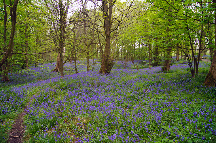 Bluebells in Spring Wood
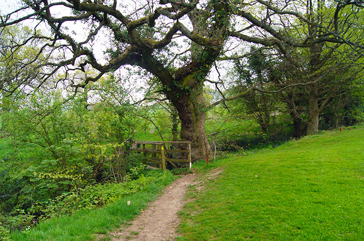 Path near Whalley Golf Club
Spring Wood is a lovely place to start a walk in the Whalley area. There are various tracks and paths through the woods and there are also several picnic areas throughout the woods for your enjoyment. Spring Wood is particularly noted for its carpet of Bluebells in spring and the beauty of the display was the first thing that struck me as I set off on my walk. I actually walked around the wood a little to enjoy the display some more before setting off on my walk by leaving spring wood, walking a few paces along Accrington Road and following a footpath into the grounds of Whalley Golf Club which ran parallel to Spring Wood. Continuing east beyond the line of Spring wood I climbed Clerk Hill which gave me a lovely view back to Whalley Banks where I would be later. Then I doubled back and crossed the field above the golf course in a south east direction to reach a road beside the entrance gate to the golf club. I followed it downhill a short distance until I reached a footpath sign.
 Flower meadow near Read Old Bridge
 Sabden Brook flowing under Read Old Bridge
The footpath sign pointed me across fields via Portfield towards Read Old Bridge. The fields were beginning their springtime change from drab dark green of dormant grass to a lighter green of growth and the grass was heightened by patches of yellow early Buttercup. I just adore springtime, everything in nature is stirring. Across the fields I went, all in a gradual descent to Read Old Bridge which spanned Sabden Brook. I took my leave of the path to walk down a track and stand at the brook side for five minutes, just to take it all in and wonder. Then after my fill I returned up the track and crossed the bridge.
 Read Park, Whalley
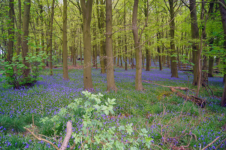 Coppy Plantation
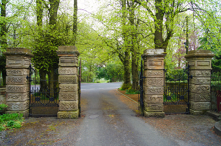
A few paces up the road after the bridge brought me to another footpath sign beside a gate which led me into Read Park. The permissive path took me across a field to the edge of Coppy Plantation and when I reached the plantation I was once again struck by the beauty of woodland bedecked in a carpet of Bluebells. The trees had fresh lime green leaf above the carpet of colour making a magic scene. Surely there is no better woodland than ours? I peered into the woodland for the whole time while I walked alongside it before reaching the entrance to Read Hall.
 Entrance from the A671 to Read Park
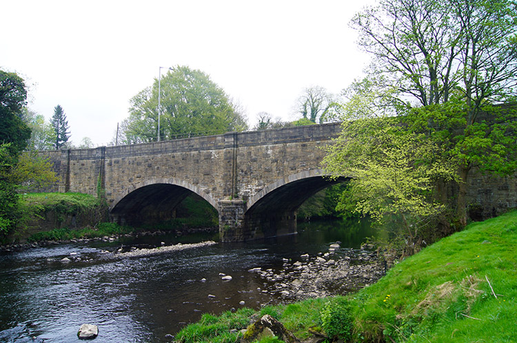 Cock Bridge and River Calder
I was not allowed to follow the road in to the grounds of Read Hall but I could continue on my path down the road to exit Read Park by crossing the A671 to follow a bridleway down towards Cock Wood. Yet another tremendous display of Bluebells showed itself as I walked alongside the wood and down past a garden centre before I emerged at the end of the bridleway at the A680. I followed a path beside the road for 100 yards due north to cross Cock Bridge. A proud sign welcomed me to Great Harwood but I could not visit this day as immediately on crossing Cock Bridge I left the road to follow a path heading west across fields and adjacent to the River Calder.
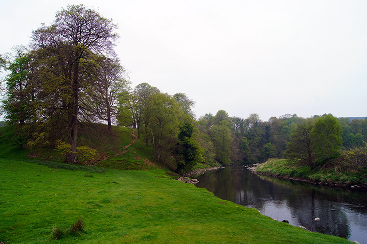 River Calder
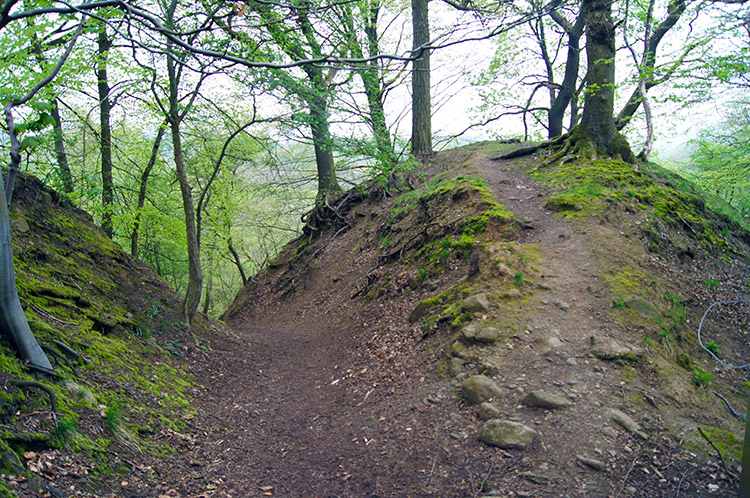 Raised bank near Dean Brook
This section of walking from Cock Bridge was gorgeous. Soon I came to a bank which I climbed lifting me about 10 metres above the level of the River. It swept round from a course west to a course north while I headed north west, angling more away from the river as I progressed. As I continued I noticed sounds behind me and on looking back I saw a group of about 20 walkers heading my way. As I continued on my walk I left them behind but it was not the last time I would see them.
 Footbridge over Dean Brook
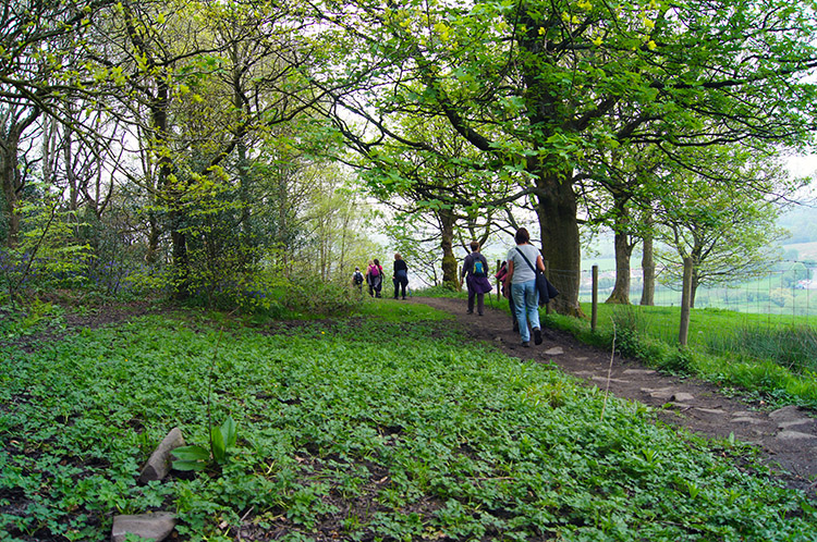 Ramblers at Whalley Banks
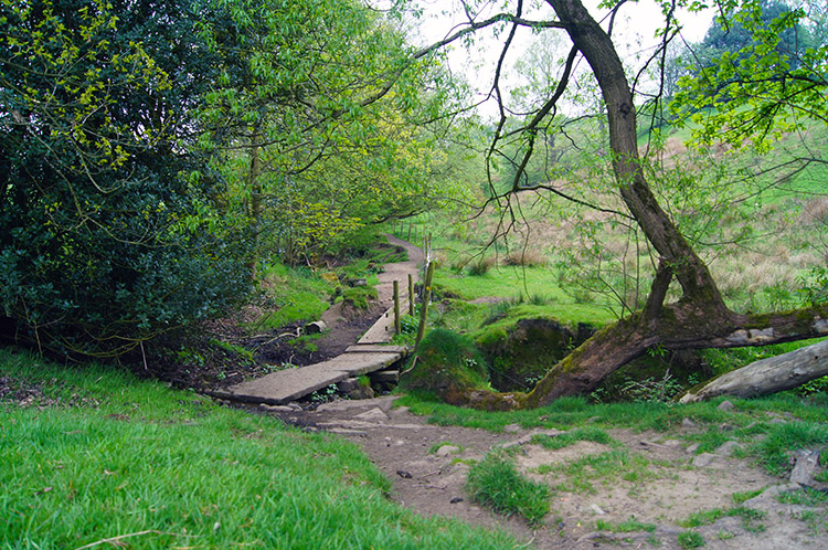
After losing my tail I crossed a board acting as a footbridge over Dean Brook and then followed the path along narrow paths enclosed by farmers fencing on one side and hawthorn scrub beside a brook on the other to reach a bridleway which I crossed over before climbing a field steeply to Horse Bowers. A confusing sign beckoned me to walk a certain way through a small managed wood but the path it pointed to was not clear. I checked my map and GPS and realised I should be slightly to my right so I backtracked a little and left the wood by GPS assurance. This took me into a field on the right of the wood which I walked up to reach a gate. I climbed over the gate confused to where the path was. A few steps up the road gave me my answer. The real path goes through the garden of a house. The sign at the topside and a stile into the garden proved it but from the bottom up past the house it was hidden. The house is Woodhaven and they have not blocked the way; it is just confusing.
After my confusing diversion I found the right track again skirting around Whalley Banks and as I reached the point on the hill when ascent then level walking became descent I spotted the group of walkers that had been behind me by the River Calder now directly ahead of me. I reached them at the point where they began a descent down a narrow path with banked woodland on one side and a wall on the other. They could not be overtaken on the narrow path so I followed them down.
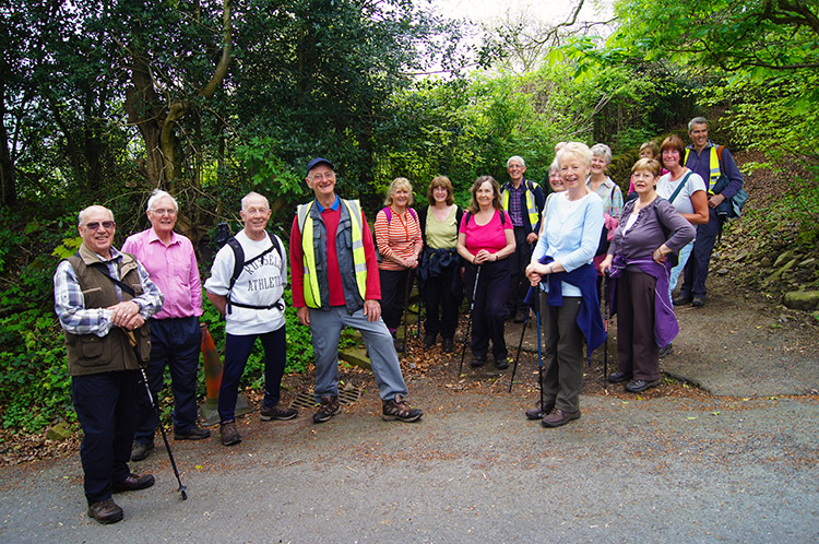 Burnley Walk for Life Rambling Group
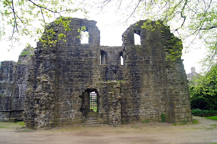 Whalley Abbey
At the bottom of the narrow path the group of walkers assembled so when I reached them we chatted. They were the Burnley Walk for Life Ramblers Group and they were lovely. On speaking with them I found out they had avoided the steep climb to Horse Bowers and short-cut my route. Not by design though, that had been their plan all along as some of them would have struggled up the hill. we continued to talk about the love of being outdoors and when they found out my origins they even forgave me for being a Yorkshireman. No Wars of the Roses here, just mutual respect for being out walking an enjoying the splendid Lancashire countryside. I left them as we walked into Whalley for after crossing Whalley Bridge they turned right from King Street towards Spring wood while I turned left to visit Whalley Abbey.
I am a glutton for historic buildings and I could not miss out on the opportunity to visit Whalley Abbey. It is a former Cistercian abbey and after the dissolution of the monasteries, like practically all the others in England, it was largely demolished and a country house was built on the site. In the 20th century the house was modified and it is now the Retreat and Conference House of the Diocese of Blackburn. The ruins of the abbey are now managed by English Heritage as a Grade I listed building and as I am a member of English Heritage I took my time to have a good look around.
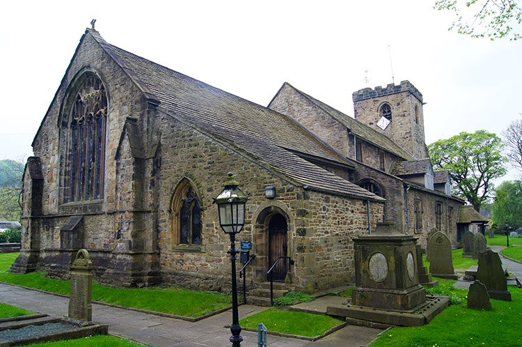 Whalley Parish Church
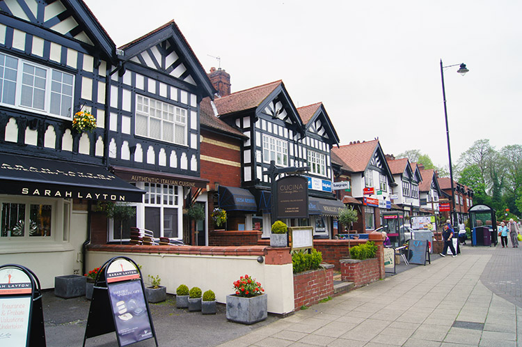 King Street, Whalley
No less impressive than the ruins of Whalley Abbey is Whalley Parish Church which stands nearby. It dates back as far as 628AD. And not to be outdone by the architectural splendour of church ruins, old or new, is the buildings on King Street which is the main thoroughfare through the village. Lots of them have period wood facades and many are listed buildings. Whalley is certainly a pretty village and a perfect place to unwind after the walk. I popped into a cafe for a coffee and a bun before finishing my walk by leaving King Street at the north crossroads and following Brooke's Lane to its end which led me to a lane which took me to a bridge under the A671 and back into Spring Wood. I had a Bluebell fantasia at the start of my walk and I had a Bluebell fantasia at the finish. And in between it was not half bad either.


