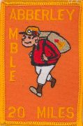
Abberley Amble
A 20 miles long distance challenge walk which begins and ends in Bewdley, Worcestershire. With map, statistics and gpx route file.
Google Maps Open Source MapsStatistics and Files
Start: Bewdley
Distance: 20.5 miles (32.9 km)
Grid Ref: SO785752
Climbing: 748 metres
Walk time: 10 hours
Days: 1
Ordnance Survey Explorer Map (1:25,000)
204 Worcester and Droitwich Spa
218 Wyre Forest, Kidderminster and Bridgnorth
219 Wolverhampton, Dudley, Stourbridge and Kidderminster
218 Wyre Forest, Kidderminster and Bridgnorth
219 Wolverhampton, Dudley, Stourbridge and Kidderminster
Summary: The Abberley Amble which begins in the centre of Bewdley is a 20 mile long distance walk. The walks follows the Worcester Way from the town and continues over various terrains which includes walking through woods and valleys along its diversified course. Towards the latter end of the walk it includes a stretch of walking alongside the River Severn. On the route the Abbeley Amble crosses Abberley Hill passes Glasshampton Monastery, the Burf Cider House and Grubbers Alley.
Useful Links:
Long Distance Walkers Association


