Yorkshire Wolds Way National Trail Directory
A long distance path and National Trail of 76 miles in East Yorkshire which travels south to north over the chalk hills and through the chalk dales of the Yorkshire Wolds. Maps, statistics and gpx route file for the walk are included.
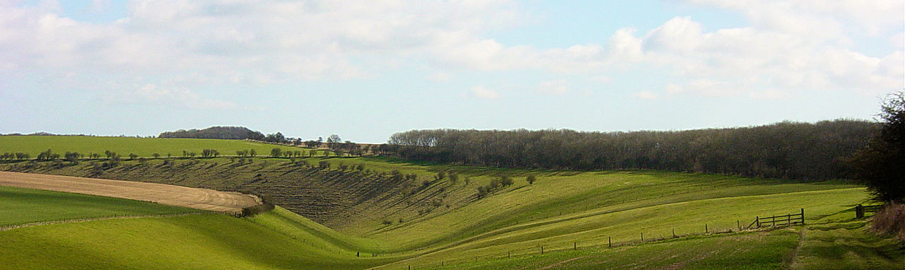
The Wolds Way National Trail is a long distance footpath that follows a natural chalk escarpment which runs from Hull to Filey. At just over 76 miles long the walk crosses beautiful East Yorkshire countryside. The walk begins near the Humber Bridge and ends at Filey Brigg. During its 76 miles you walk through lots of lovely woodland, cross or walk through numerous delightful dales and visit a number of delightful villages, one of them deserted. Oh, and you see a lot of white stone on this unique chalkland walk.
Google Maps Open Source MapsThe best web sites for General Information and Planning:
National Trails of Great Britain Comprehensive site providing details on the route. Includes an accommodation guide, booking service providers, maps required.The best web sites for Guided Walking:
None available at present.The web sites that organise accommodation and/ or baggage transfer:
Discovery Travel Offers a full range of guided walking services for the Wolds Way.Coast to Coast Wolds Way accommodation booking and baggage transfer provider.
The best web sites for you to plan your accommodation:
S H Systems Excellent range of accommodation. Just type in the location to bring up a list of accommodation in the area. You can sort by price, postcode or rating.The best personal journals of the walk:
Mike Brockhurst Comprehensive journal of the walk. Includes statistics, elevation details and photographs of each stage.
The essential sites for safety advice and emergency services:
Ramblers Association Practical walking advice on keeping safe including a guide to map reading, navigation and a detailed list of the essential gear required on a long distance walk.Mountain Rescue UK You may need them so take their advice.
Add a service to this Directory
Feedback and Suggestions:
I am always pleased to received feedback on the structure and content of the website. I also welcome suggestions on how I can improve the website which may include new areas to cover, new walks or route alterations to existing walks. To get in touch with feedback and/ or suggestions please contact me on one of my social media links. Thank you.
(Note: Walking without proper preparation can be dangerous. Information and downloads on this website are provided free of charge; it is each walker's responsibility to check the material and use accordingly. Postscript: My walk reports are not route guides and should not be treated as such. They are written with personal reflections of my walks)