Kirkby Malzeard Moor, Grewelthorpe Moor and Carlesmoor
Kirkby Malzeard Moor is often overlooked because of it lies between Nidderdale and the North Yorks Moors. The apparent disadvantage leaves it a solitary moor which is heaven to discerning walkers who wish to avoid the crowds. Another strength of the moor is the utterly fantastic views it provides for miles in all directions and even to the east coast 50 miles away. Breathtaking indeed.
Google Maps Open Source Maps| Statistics and Files | ||
|---|---|---|
| Start: North Gill Beck | Distance: 7.1 miles (11.5 km) | Climbing: 266 metres |
| Grid Ref: SE162730 | Time: 3 hours | Rating: Moderate |
| GPX Route File | Google Earth File | About Kirkby Malzeard |
| Statistics | |
|---|---|
| Start: North Gill Beck | Distance: 7.1 miles (11.5 km) |
| Grid Ref: SE162730 | Time: 3 hours |
| Climbing: 266 metres | Rating: Moderate |
| GPX Route File | Google Earth File |
Ordnance Survey Explorer Map (1:25,000)
The Walk:
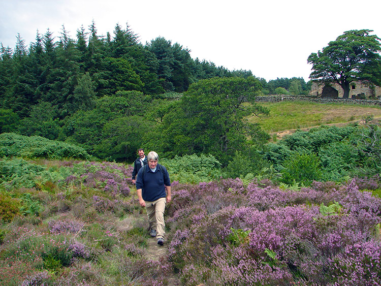
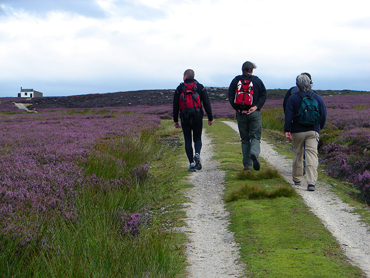 Striding onto Kirkby Malzeard Moor
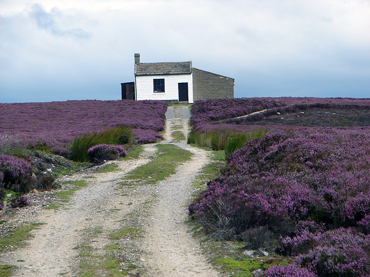 Shooting Lodge on Kirkby Malzeard Moor
One of the great joys of late summer is when the heather blooms on moorland. It is always an exciting time for me and I just know I have to get out and walk amidst the glorious purple colour which carpets the ground. And it is so much more appealing when sunshine provides an enhancement to the colour. A little breeze is another welcome characteristic as it provides a shimmering effect making for an even more special enjoyment of the whole experience. And then, as on this occasion, the topping was the company of Deke, Jez, Kenny and Stuart, the Knaresborough contingent of walking buddies. I had all the ingredients for a super day out.
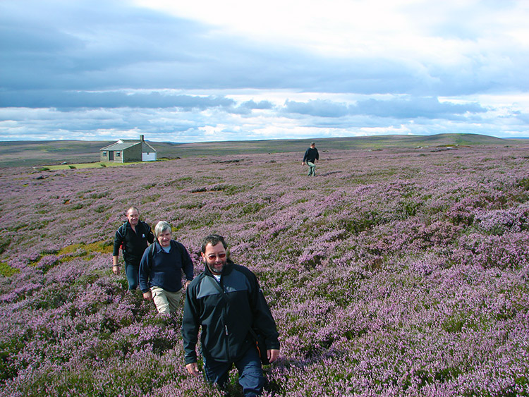 Heather in bloom on Kirkby Malzeard Moor
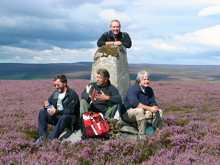 The boys take a break at the trig point
There was no one on the moor but us, it was eerie quiet. Even grouse were not to be seen which was a surprise seeing we were walking on the eve of the glorious 12th. I expect the next day wouldn't be so quiet up here but the shootists would have to work. the grouse did not appear to be playing today. Our walk started by following a bridle path north from the roadside at North Gill Beck to a well maintained shooting lodge. There were even sprigs of heather planted in pots inside. A touch of housekeeping to delight the gunmen. The lodge was barred to us though, entry only by permission. Not that we wanted in, not with the beauty with us on our moorland crossing.
 Walking near Stock Beck
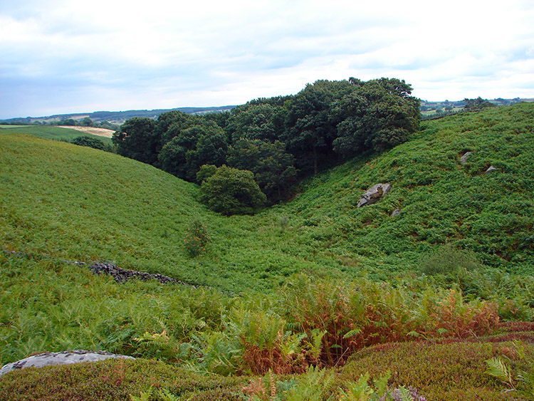 Spectacular scenery near Carlesmoor
After the shooting lodge Deke located a trig point on the map and from it I took a bearing. It led us across virgin moorland and through thick heather on the edge of Haylands Bank towards Shortlick Hill. It was a fun trudge for about 20 minutes until we arrived at the said trig point and relaxed a while. The views from the trig point were absolutely fantastic for it was a clear day and we could easily see the line of Ferrybridge, Eggborough and Drax Power Stations to the east. All were spewing out their noxious clouds. Beyond them the North Sea was also clear to see. Better views were gained as we turned our heads North East to the magnificent lined profile of the North Yorkshire Moors and even to Roseberry Topping and Middlesbrough. About turn to the North and the North Pennines we standing proud and to the west were some of the prominent Dales mounts including Great Whernside. What a superb viewpoint it was.
 In the thick of it
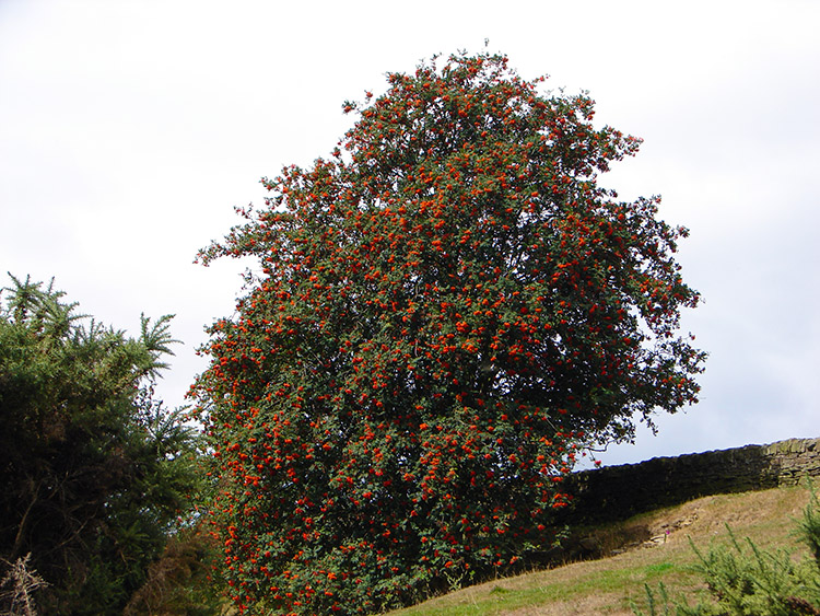 A Rowan swelled with berries
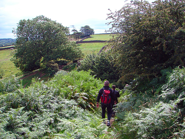
After our break at the trig point we walked off the virgin moor and onto a bridle path which intersected Kirkby Malzeard Moor and Masham Moor. Deke tried to find a couple of crosses marked on the map close to the path. They were long gone. Sensing his disappointment Jez and I went ahead and hastily constructed a stone one. He was not fooled. Soon after we temporarily left the moor and tracked down to Newlands House and past to Stock Beck where we joined the Ripon Rowel Footpath. Now we were lower the ground around was really lush. The greenery was brilliant and a complete contrast to the purple moor before. I dwelt to peer over a Rowan tree which was sated with berries. It was really healthy, that's for sure. And after the tree we walked to an interesting structure.
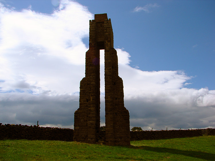 What is the purpose of this sighting tower?
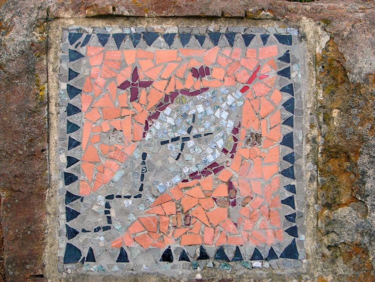 A quirky ceramic sign points us on our way
The structure was indicated on the map as a sighting tower. But for sighting what? I found the answer by trawling the Internet. The answer is:
"Roundhill reservoir is overlooked by a strange stone tower. This is Carlesmoor sighting tower used to triangulate the end points of a water tunnel from the reservoir to Harrogate." And it was close to a water pumping station. Not anything military from the second world war as we assumed at the time. After a survey of the tower we continued on past Carlesmoor Farm and back onto the moor by following Carlesmoor Beck upstream. On doing so we passed some ceramic mosaics, some of which we on rocks with arrows pointing the way. I'd seen similar before but couldn't recall where. Once we got back to the moor we trudged across tough ground to Owset Well and then back to our starting point. What a lovely start to my relationship with Kirkby Malzeard Moor. I'll be back for sure.
(Later someone read this walk and pointed out the significance of the mosaics. They are part of the Crackpots Mosaic Trail, a route which visits all 22 mosaics in the series)


