County Tops of England: Cheshire
Shining Tor: 559 metres (Grid Ref: SJ994737)
Google Maps Open Source Maps| Route Statistics and Files | ||
|---|---|---|
| Start: Cat and Fiddle | Grid Ref: SJ 99467 73754 | Distance: 2.8 miles (4.5 km) |
| Climbing: 117 metres | Time: 1 hour | Rating: Moderate |
| GPX Route File | Google Earth File | Map: OL1 The Peak District - Dark Peak Area |
| Statistics | |
|---|---|
| Start: Cat and Fiddle | Grid Ref: SJ 99467 73754 |
| Distance: 2.8 miles (4.5 km) | Time: 1 hour |
| Climbing: 117 metres | Rating: Moderate |
| GPX Route File | Google Earth File |
| Map: OL1 The Peak District - Dark Peak Area |
The Walk: A straightforward there and back walk along the well made and much used footpath linking the ever popular Cat and Fiddle Inn with Shining Tor. It is as simple as could be.
The Walk I Would Do: I would enjoy a full day out, in fact I did in a walk of Lamaload Reservoir, Jenkin Chapel, Pym Chair, Cats Tor and Shining Tor. Here is the walk with statistics, pictures and full walk report.
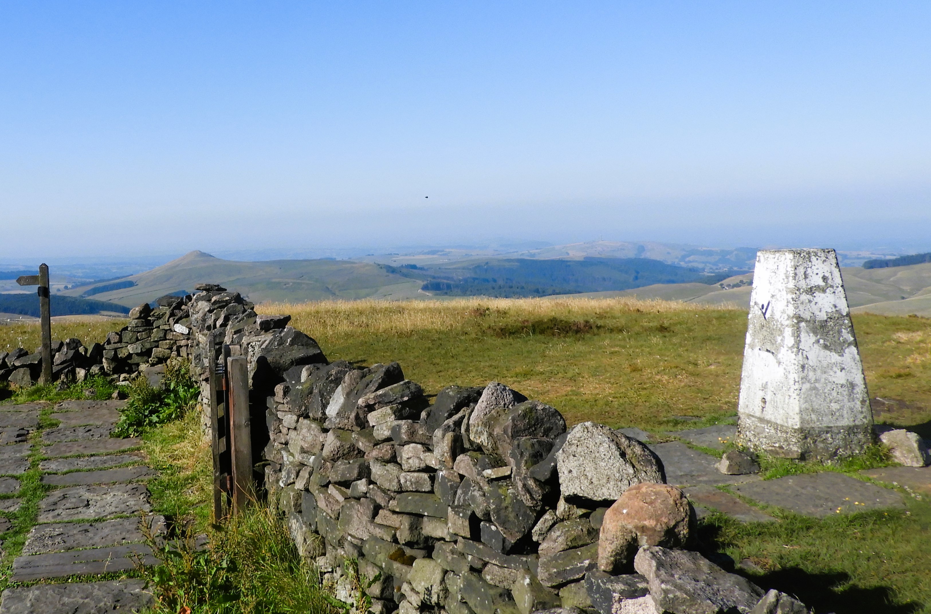
Information: Shining Tor is a wonderful hill. As it is the highest point around (it is some 8 metres higher than the summit of Axe Edge Moor above Buxton), the views are pleasant, though the relatively flat uplands mean they are not extensive in all directions: the view to the southwest of the peak of Shutlingsloe above Wildboarclough is particularly notable, and in clear conditions Winter Hill near Bolton, the city of Manchester and much of the Cheshire Plain can be seen, including the radio telescopes at Jodrell Bank 12 miles to the west. In very clear but not unusual conditions North Wales and even Snowdonia can be seen. (Source: Wikipedia)


