Church Minshull, River Weaver and Shropshire Canal
Walk is along the middle reaches of the River Weaver and the Middlewich Branch of the Shropshire Union canal. There is some road walking on the quiet lanes. Church Minshull is really the only start and finish point so if you are tempted to use The Badger car park please ask. The village is easily accessed by bus service 31 from Crewe, Winsford and Northwich.
(Note: This walk is kindly contributed by Ken Brockway)
Google Maps
Open Source Maps
| Statistics and Files | ||
|---|---|---|
| Start: Church Minshull | Distance: 7.0 miles (11.2 km) | Climbing: 117 metres |
| Grid Ref: SJ665605 | Time: 3 hours | Rating: Moderate |
| GPX Route File | Google Earth File | About Church Minshull |
| Statistics | |
|---|---|
| Start: Church Minshull | Distance: 7.0 miles (11.2 km) |
| Grid Ref: SJ665605 | Time: 3 hours |
| Climbing: 117 metres | Rating: Moderate |
| GPX Route File | Google Earth File |
Ordnance Survey Explorer Map (1:25,000)
The Walk:
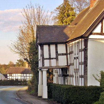 Church Minshull
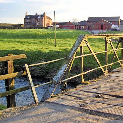 Crossing the Weaver at Old Hoolgrave
When I tackled the Great English Walk (GEW) from Chepstow to Berwick upon Tweed in 2010-11 I made a few mistakes along the way and did not retrace my steps to correct them. I also missed out a short section of the 600 plus mile route because the authors had said in 1996 when they wrote the guide "This road is too narrow for the traffic level, so take care". In 2009 I feared for my life so took the easy option of being driven between Church Minshull and Cross Lane. I was therefore interested in trying to devise a safe off road route and this walk explores that diversion.
Taking the lane opposite the recently refurbished Badger Inn, I soon make my first crossing of the river Weaver which starts life near Cholmondeley Castle. It is already a significant water course and the bridge used to cross it looks as if it started life elsewhere carrying a railway. The path diverts from that shown on my map passing through a pleasant paddock keeping clear of the track that passes Old Hoolgrave but then rejoins the track and continues to Hoolgrave Bridge. Although two public paths cross here the link is poor so take care down the bank onto the canal towpath.
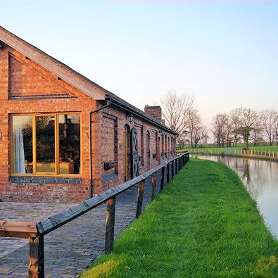 Converted stables on the Shropshire Union canal
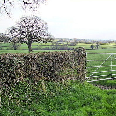 Views from the quiet lane at Lea Green
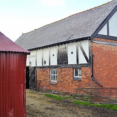
The building at Minshull Wharf is pretty and impressive, now a smart house it's difficult to imagine that it was perhaps built as a warehouse. Here I have walked a very short section of the Crewe and Nantwich Circular walk, it leaves here and offers the remaining detour for the GEW avoiding that busy country lane. Today I press on along the towpath which is the Weaver Way, "taking you deep into some of Cheshire's finest countryside" so the guide tells me. On the way I pass a former stable block, converted to a home but retaining the original stable doors to the canal frontage. At bridge 19 another footpath crosses the canal but here is a better link as I return to field paths and tracks.
 Lea Green Villa Farm
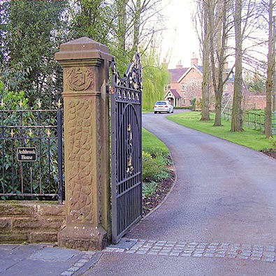 Ashbrook House
Most of the fields are of pasture in this area of milk production. The path soon skirts a wood that drops down to the Weaver on a steep bank unsuitable for cultivation. The path winds around to a footbridge to again cross the river and then joins a hedged green lane. This path is hardly a direct route between settlements so why is it here? Study of the map suggests the green lane crossed the river, perhaps by a ford to join a track, no longer public, passing through Twelve Acres Farm.
The green soon gives way to tarmac but no traffic so I have ample opportunity to look around over the hedges unconcerned that my feet will trip in a rut or rabbit hole. The land drops away to either side and offers pleasant views of fields and hedgerows with mature trees still leafless in early April. Two pairs of farm cottages are set like stately home lodges either side of the road as I approach the crossing of the only road with any traffic.
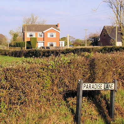 Paradise Green
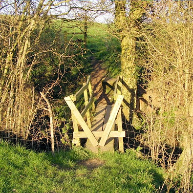 Footbridge over Eel Brook
On my way to Paradise, with it's farm, green and wood, there is a view to the right of a radio telescope, not Jodrell Bank but perhaps it's little sister. At Paradise Farm I meet the GEW but there are no hoards of folk trudging the route, it's a hidden gem of a walk but not for the faint of heart. It was soon after this that I thought it had been raining wood blocks. A field was littered with noggins of wood just the right size for my wood burner so I filled my empty rucksack and enjoyed an evening of free heat on my return.


