The Belvoir Castle Circuit
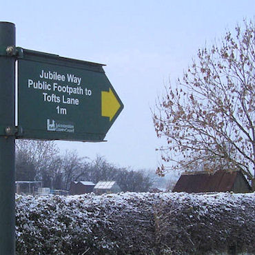
This route, which I first walked back in 1990, makes a circular tour of 21 miles mostly through Leicestershire around the Duke of Rutland's ancestral home, Belvoir Castle. The walk can start in any of the delightful villages along the way. I started at Croxton Kerrial on the A607 between Grantham and Melton Mowbray where a good sized off road lay-by just to the west of the Peacock Inn offers convenient parking.
(Note: This walk is kindly contributed by Ken Brockway)
Google Maps
Open Source Maps
| Statistics and Files | ||
|---|---|---|
| Start: Croxton Kerrial | Distance: 21 miles (33.8 km) | Climbing: 385 metres |
| Grid Ref: SK834290 | Time: 8-10 hours | Rating: Strenuous |
| GPX Route File | Google Earth File | About Belvoir Castle |
| Statistics | |
|---|---|
| Start: Croxton Kerrial | Distance: 21 miles (33.8 km) |
| Grid Ref: SK834290 | Time: 8-10 hours |
| Climbing: 385 metres | Rating: Strenuous |
| GPX Route File | Google Earth File |
Ordnance Survey Explorer Map (1:25,000)
The Walk:
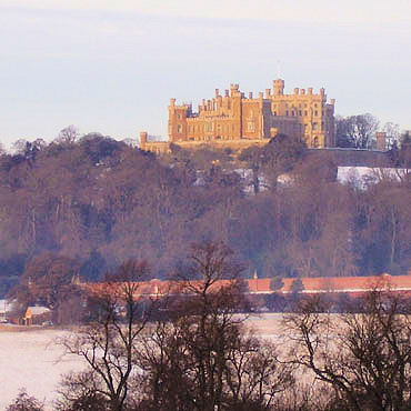 Belvoir Castle
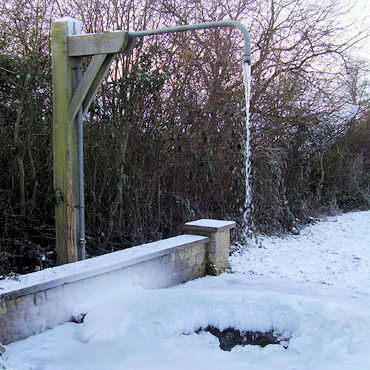 Croxton Kerrial water spout
On this cold morning Croxton Kerrial offered sight of free sculptural art provided by the ever flowing spout. The splashing water and hard frost had created wonderful shapes and patterns in a large doughnut of ice surrounding the outfall. The first point of interest along our walk is Croxton Park from where, before the dissolution, the monks held sway over a large area. In 1925 J.B. Firth wrote in his book 'Highways and Byways in Leicestershire' "....on the road to Waltham is Croxton Park, through which runs a private road of the Duke of Rutland - open to foot passengers.... " this allowed Mr Firth to view and comment upon the grounds through to the racecourse. Today any remains of the abbey are out of bounds as the public footpath only skirts the park so little can be seen.
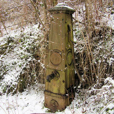 Branston pump
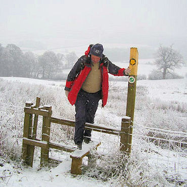
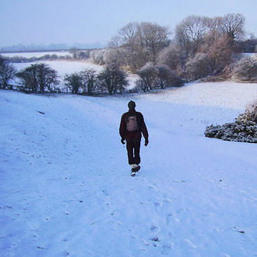 Walking in the snow
As we drop down into the valley the ground is usually wet, today it's frozen solid but very uneven and not an easy passage. After crossing the extended ditch board the ground becomes much lighter with evidence of the rock that made this area a hive of activity until the mid 1960's when the extraction of ironstone ceased. Crossing the A607 we have reached the high point on the walk 155M or (540 feet) above sea level. On a bright day the descent along this little used path is a delight, today the grey clouds and snow flurries obscure views over Knipton reservoir to Belvoir Castle. In Branston The Wheel Inn offers good beer and food but with only three miles completed it's too early for refreshment. To follow the route you must force yourself to pass close by the door and continue along the path through the car park.
 Eaton allotments
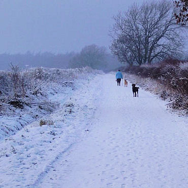 Dog walking on Tofts Lane
You might imagine that the remains of Ironstone workings would tarnish this countryside but after fifty years the scars are unnoticed by the casual visitor. On our way to Eaton the path crosses an abandoned working face where a ladder takes us down to the level after extraction. Later in the walk our path will be raised from the surrounding ground where the orange stone has been taken away and the top soil replaced at a lower level. Eaton is well off the track of passing traffic, unfortunate for The Castle Inn perhaps but the network of quiet narrow streets with the church overlooking all offers an ideal location for a short, interesting and clean boot walk. From Eaton we use the Jubilee Way. This twenty mile path links the Leicestershire Round near Burrough Hill to the Viking Way at Brewers Grave, passing through Melton Mowbray along the way. The sun made a brief appearance as we passed Sherricliffe Farm, a derelict shell when I first passed this way. We then join the direct route from Branston to Stathern, shown on older maps as a footpath but recently upgraded to Byway after a thorough search of historical records by staff at the County Council. Note the elevated track here where ironstone has been extracted from the fields and taken for smelting at Holwell, Scunthorpe and Corby. The railways that served these quarries have been researched and recorded in a book by Eric Tonks should you thirst for more information. Just before Tofts Lane takes us down into Stathern a path goes off right and follows the wooded ridge to Belvoir. A very pleasant walk which could be used to split this walk into two sections.
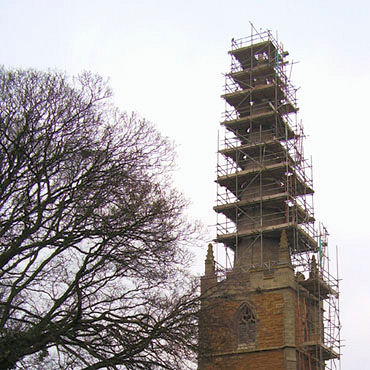 Barkestone church
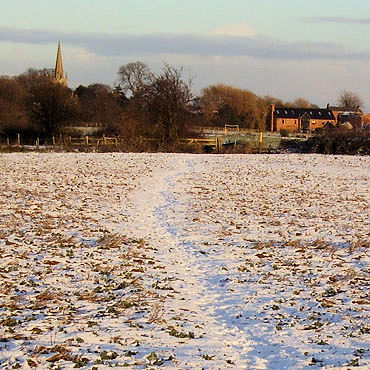 The Path to Redmile
Stathern has a well stocked shop, Post Office and two pubs. We still have 14 miles to go, so a chocolate bar might help us on our way. Now in the flat Vale the ground can be claggy, this may not be a real word but it conveys the message of boot clinging clay, hence our choice of a frosty day. The Grantham canal skirts Plungar so we could take this route to Redmile and beyond but we'll keep to the field paths, today's walk is a ramble, not amble. The spire of Barkestone church clad in scaffolding, for repairs in 2010 following damage caused by the earth tremor in February 2008. Barkestone le Vale often confused with Barkston Lincolnshire has grown considerably with new build on old farm yards, barn conversions and general infill, sadly this did not save the school, shop or pub from closing. (Latest news - the pub could reopen in April 2011). Stand on the path between Barkestone and Redmile and note the ancient waymark posts. No need for the yellow topped wooden posts here, the church spires clearly show our path and destination. Redmile is half way and offers a choice of two Inns or, if you prefer, picnic tables in the small but well equipped children's play park.
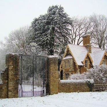 Castle entrance at Brewers Grave
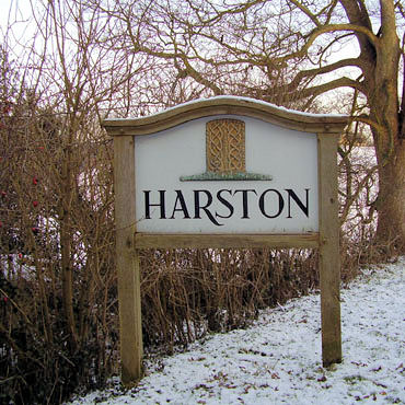 Harston village sign
The exit from Redmile reminds us of the services once available in these villages, we first pass Bakers Lane then take Post Office Lane. The layout of fields around here is all the result of man's intervention and his requirement to organise the natural landscape. Until the end of the 18th century there were large open fields but these were swept away when the Enclosure Commissions carved up the land, setting out field boundaries, roads and footpaths. After Muston we enter Lincolnshire and soon join Sewstern Lane, an ancient highway for driving cattle and perhaps used to avoid paying tolls on the Great North Road. Now part of the Viking Way, sections remain as green lanes and are regrettably the playground of those who prefer motorised two or four wheels rather than two feet for their countryside enjoyment.
 Climbing from Harston Wood
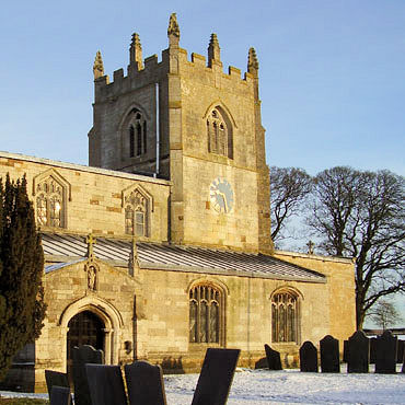 Croxton Kerrial church
Our route takes us onto the Grantham Canal towpath passing the disused locks and another refreshment stop, the Rutland Arms or Dirty Duck. Leaving the canal at the pleasing brick arched bridge we rejoin Sewstern Lane and climb to the castle drive gates at Brewers Grave. From here to the Harston road the lane is lined with Sweet Chestnut trees and just before joining the road we cross the former mineral railway that served the quarries and pass a row of cottages built to house the miners. If you take this walk in the spring Harston wood will delight with a blanket of Bluebells and delay you before the final climb into Croxton Kerrial. On our visit in late December the village paddocks and surrounding fields were bereft of their normal attraction, free range Geese which have become celebrities as they are herded through the village streets from farm to field each day.


