Milburn, Great Dun Fell, Little Dun Fell and Cross Fell
Google Maps Open Source Maps| Statistics and Files | ||
|---|---|---|
| Start: Milburn | Distance: 14.4 miles (23.2 km) | Climbing: 912 metres |
| Grid Ref: NY 65658 29403 | Time: 6-8 hours | Rating: Hard |
| GPX Route File | Google Earth File | About Milburn |
| Statistics | |
|---|---|
| Start: Milburn | Distance: 14.4 miles (23.2 km) |
| Grid Ref: NY 65658 29403 | Time: 6-8 hours |
| Climbing: 912 metres | Rating: Hard |
| GPX Route File | Google Earth File |
Ordnance Survey Explorer Map (1:25,000)
The Walk:
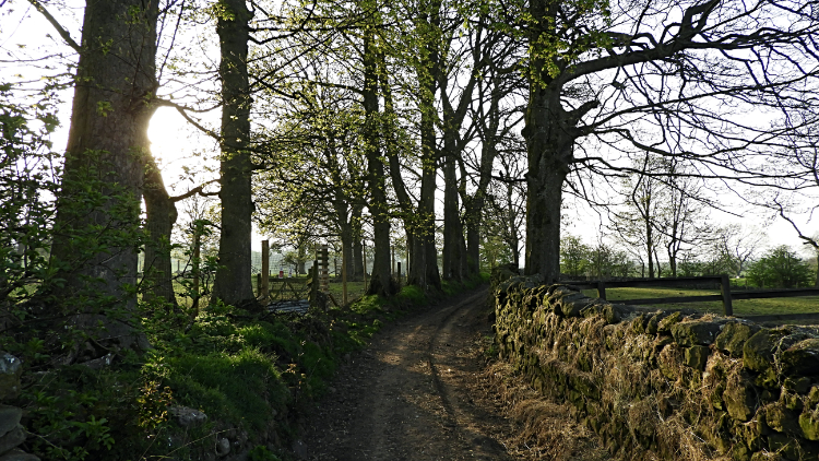 Following the track leading from Milburn
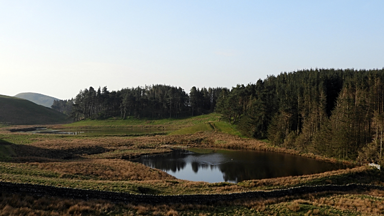 Dammed ponds of Mudgill Sike
Some say the North Pennines are bleak, sparsely inhabited and a tough place to live. Anyway, I can question that assertion in one respect. The wild animals like it up here, as evidenced by some of the pictures in this walk. Possibly it is the lack of human footfall which attracts them here. Anyway, we will come to that. First of all, lets get walking. It was a lovely early morning in mid April when I arrived in Milburn, having set off in the dark from Harrogate two hours earlier. Keen to get on my way, I put on my boots, checked my provisions were in the backpack, and set off walking. I had been waiting a long time to do this walk.
I had been on Cross Fell once before, on a sunny and warm summer's day in the 1990's when staying with pals in Dufton on a weekend walking break. More chatty than taking notice that day, this time I wanted to take it all in. Climbing from the start, gradually at first, then more markedly uphill as I moved on, I crossed a series of fields after leaving the track to reach Hill Plantation at the west edge of Burney Hill. Skirting the north edge of the plantation led me to the Mudgill Sike ponds, a pair of small dammed reservoirs. I have no idea why they are there and I could find nothing out on investigation. However, a few Ducks were loving a swim in them.
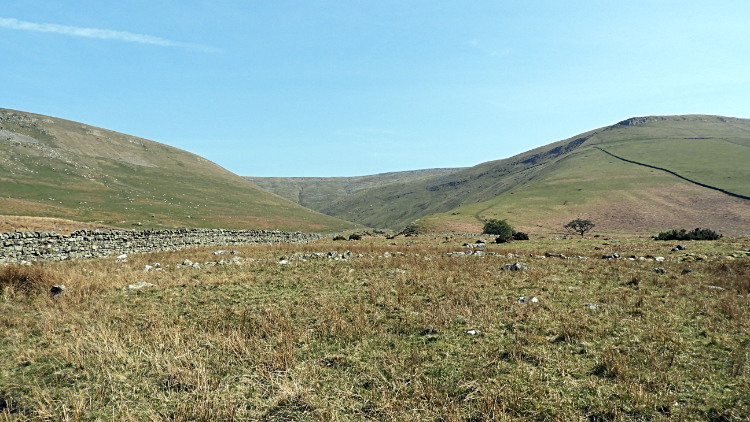
 Crossing the north side of Burney Hill
 Old workings of Silverband Mine
Climbing further towards the Silverband Mines and with the sun climbing strongly into a cloudless sky I soon had a sweat on. Still April but hot it was. Forced to stop to shed a layer I was soon down to a t-shirt. "Great". Climbing slowly and stopping for short breathers now and again, I gradually made my way up the uneven and steepening bank of the south-west face of Great Dun Fell. At the redundant mine workings I made an ascent of 240 meters in just a kilometer and a half of arduous progress. It was the hardest part of the entire walk. Still I took time out to inspect the old workings including looking over old pulley derricks and spoil heaps which resembled giant molehills.
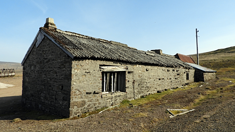 Hut at Silverband Mine
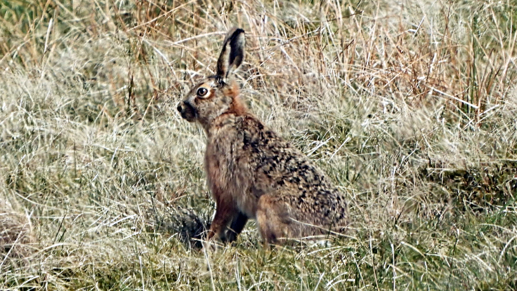 Beautiful Hare on Great Dun Fell
I was relieved to reach the access road leading to the mine. Temporarily turning from the course of my walk I turned left instead of right to inspect the old mine works hut. Decayed chairs, tables, desks and filing cabinets were still in place, abandoned in time. Plaster was crumbling from the internal walls. Doors hanging in some places, gone from others. More abandoned mining machinery was strewn about outside the building. Eerie it was. Walking back to the course of my walk I passed a couple of mall mine works reservoirs. Sings said 'Danger. Deep Water', which were clear enough to me. Walking south-east from Silver Band to Green Castle I looked south to the impressive conical twin peaks of Knock Pike and Dufton Pike. Under my breath I said "I have got to climb the pair of you on a walk one day". I really have to. At Green Castle I was stopped in my tracks by the most marvellous sight. In the corner of my eye I spotted something hopping about in the grass bank just above me. Standing silently the object of my attention stopped too. The Hare possibly though if it stood still I might move on and disturb it no more. Cautiously ad carefully I moved for my camera, focused in and got this shot. Such a privilege. Then I moved off slowly and let the Hare be to enjoy the rest of its day.
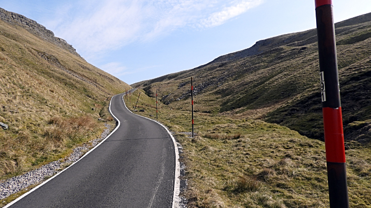 Climbing the road of Great Dun Fell
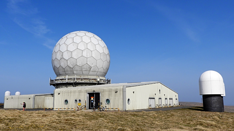 Great Dun Fell Radar Station
The next stage of my climb led me from the mine access track to the radar station access road and to my final push up Great Dun Fell. Still with 160 meters of climbing to the station but now on hard tarmac I slowly eased up the road. As I climbed I could see cyclists approaching from lower down the road. None were hurtling towards me, all struggling up the steep hill. Looking back now and again I watched them aching their way up, bikes swaying from side to side. Eventually the first bike rider passed me. "Hi, nice day" I said "yes, phew, it... is...". Another passed in much the same manner with the same passage of dialogue and then a third neared me. Before he got to me though was off the bike. Puffing and talking in the same strained breaths he said "Can't make it, I'll walk up this bit like you". We chatted for a while and I heartened him by saying "At least you will get a cracking freewheel back down". He added "That is the best bit about it". Near Dunfell Hush the road levelled a bit and he got back on his bike. Next time I saw the group they were up in the grounds of the radar station taking refreshments. Here I had summited Great Dun Fell and headed onward. After waving a farewell to the cyclists.
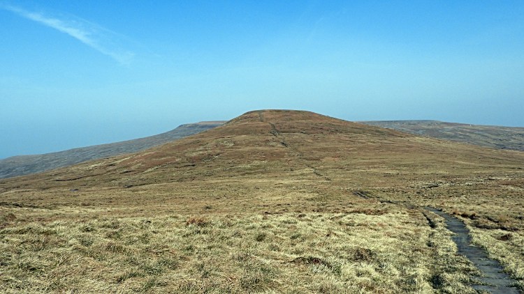 Following the path to Little Dun Fell
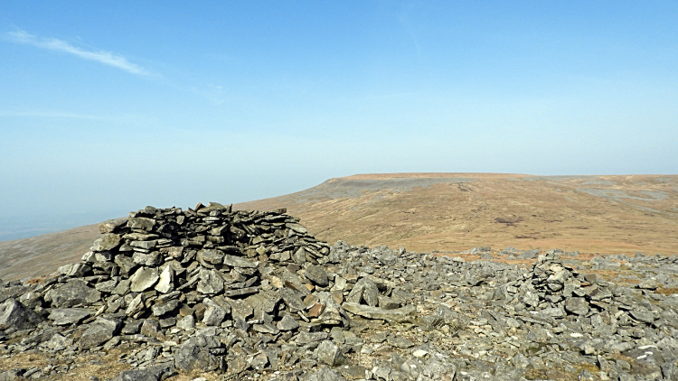 First view of Cross Fell
The next phase of my walk was a delightful roller coaster of a ramble from Great Dun Fell to Little Dun Fell. The Pennine Way path which I was now on was made good by hard flagged stones and the up and down transit was no more than a roll. It was an enjoyable and refreshing walk with nothing more than a fresh breeze at the lofty heights I was now walking, all over 800 metres above sea level. Great Dun Fell is 848 metres high, Little Dun Fell 842 metres high and the dip in between just 780 metres. Nothing but a stroll. Looking around I could see a vast body of water shimmering in the heat haze to the east. Surely I was looking at Cow Green Reservoir, seven miles east of me. Te very first time I had seen it. That was a bonus. Then at the summit of Little Dun Fell I took in my first high level view of Cross Fell. Again I was thrilled to see no significant climb, just a gentle slope up to the high point of my walk.
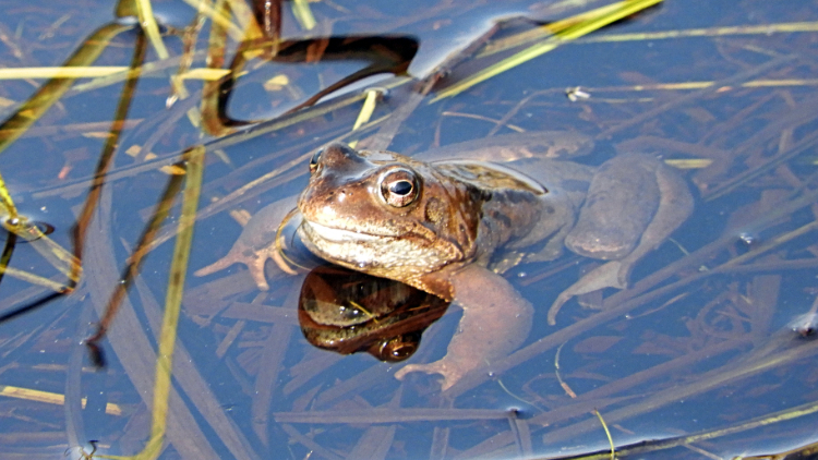 Inhabitant of Cross Fell
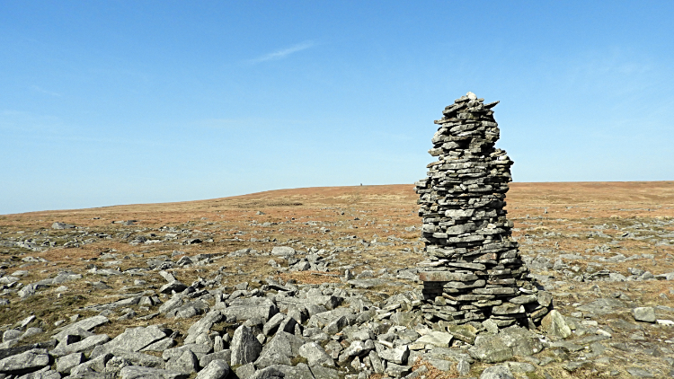 Cairn on Cross Fell
It seemed lonely on my jaunt from Little Dun Fell to Cross Fell but was not alone on this piece of high ground at all. The low point between the two is Crowdundle Beck Head and here in the nascent waters I could sense movement. Just as I had sensed earlier on with the Hare I suspected something was watching me and lo and behold as I looked down into the clear spring waters I could see this big pair of eyes focused on me. Looking directly at me was a mature Frog or Toad. sorry, cannot tell which but the amphibian was a right character. Usually as soon as such animals spot me they plop down into the depths of the water. Not this time. Instead it keep a close eye on me and so after the obligatory photograph I sidled around the waters, disturbing it as little as I could, and moved on. Climbing a little from Crowdundle Beck Head I came to a cairn and rested a little, preparing for the final push to the top, just fifty metres higher.
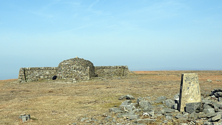 Summit trig point and Shelter on Cross Fell
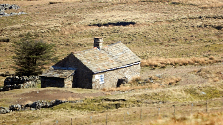 Greg's Hut
After ten minutes of walking I arrived at the summit of Cross Fell and consequently at the highest point of the Pennine Range. Chuffed with that I sat down to lunch on the four points summit shelter, so shaped so that walkers can shelter from any course of prevailing wind. As I lunched another walker approached from the north. He sat don for a chat and told me he was walking the Pennine Way from north to south in stages. Not all at once but over a period of a few years. Though if the weather stayed as good as it was now he might extend the present effort beyond his schedule which was to end the current piece after tomorrow. Retired like me he had no rush beyond the capability to walk into old age! I wished him well. Before heading off I cast an eye down to Greg's Hut, the most famous Bothy on the Pennine Way. Heading off west from Cross Fell I would not be visiting it today.
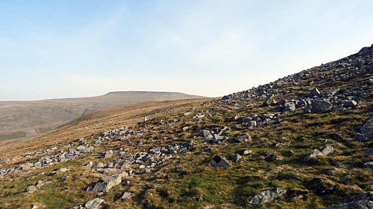
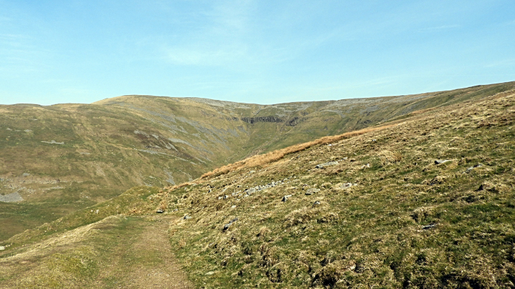 Cocklock Scar
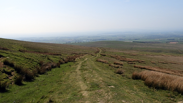 Descending towards Kirkland
It was all downhill for me now, not that the climb had been anything particularly difficult. Bar that bit up to the mines of course. And that was because I had left the path to explore the mine workings. Now I kept to the path leading down from Cross Fell to the intersection with the Kirkland path though I did slightly cut the corner to look over a couple of small cairns. Then it was steadily downhill I went with the hazy view of the Eden Valley enticing me on. The midday haze was so thick now it had blocked out the view of the Lake District mountains beyond. As I descended further a couple of groups of walkers passed me on their way up. One of the groups, about six in total, asked how far Greg's Hut. "Not far, just up another couple of hundred metres and over the brow. Half an hour or so". I reassured them. Thanking me one of the group explained they were heading there for an afternoon picnic. Nice I thought.
 Looking back to the source of Kirkland Beck
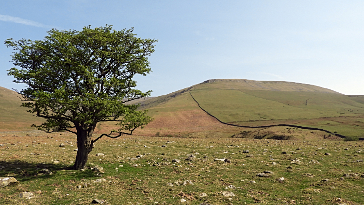 Lovely Pennine Picture
Further on I stared to level off at the bottom of the Kirkland bank though at around 300 metres I still had just over 100 metres of descending to do. That surprised me as it looked flat pan now. The scenery around this part of the walk was just so luscious. I was taken in by the beauty of it all and despite my attention to detail in getting back to the car and then home by a certain time I could not help myself in slowing down and letting myself tarry. Ambling along I met more people including a couple who were on a short stroll from Kirkland village. They were stood for ages as I neared the and wondered if they were lost. Not so. Something had caught their attention.
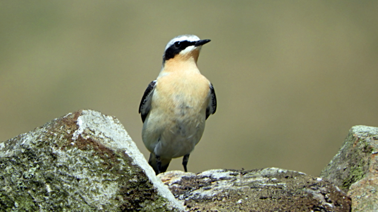 The entertaining Wheatear
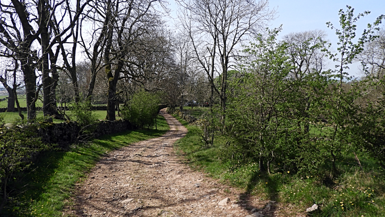 Path leading to Kirkland
And it caught mine too. "What is that bird?" the lady of the couple asked and on glimpsing it for the first time myself I had to say I was not sure. I have subsequently looked it up and I can now safely say that we were being entertained by a male Wheatear. The bird was quite a character, just as the Hare and the Frog, or toad, were earlier on. This time though I did not need to be so wary as the Wheatear bobbed along a drystone wall as if to perform a show and entertain us. It was quite something. He was clearly showing off and the three of us were smitten. I took plenty of photographs of our feathered friend and still I was reluctant to leave. But leave I must and after ten minutes or so the couple went one way and I went another. "That was good. Very good." I said to myself.
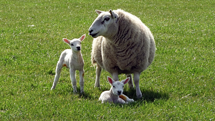 Newborn at the Hanging Walls of Mark Anthony
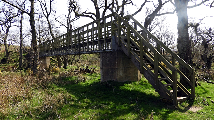 Footbridge over Crowdundle Beck
At Kirkland Hall I began the final stage of my walk. Now at the height from which I started I had a two mile finale across fields and along farm lanes back to Milburn. On the way I passed a field of sheep with new born lambs, some virtually born within the last 24 hours. I crossed the footbridge of Crowdundle Beck... remember I met the bold amphibian well upstream and then I followed a few more fields to a lane which led me back into Milburn. I rejoiced all the way having finally accomplished Cross Fell on a solo walk. This is one walk I shall never forget such was the spectacular of it and such were the chance encounters along the way.


