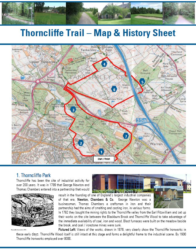
Sheffield Heritage Walk - The Thorncliffe Trail
August 23rd 2007 was the date a few brave volunteers from Balfour Beatties Utility Solutions and a few local ramblers marched around the Thorncliffe Trail. Just as well it was done in August and not a month earlier for the participants would not have been walking. They would have been in boats because this area of Sheffield was one of those affected by the extraordinary floods due to Blackburn Brook being in full spate and not able to cope with the amount of water without spilling out into the Thorncliffe Business Park. Most businesses were closed for a few days due to the damage caused. Luckily the walkers had a super evening's weather and as a consequence enjoyed a lovely walk.
Google Maps Open Source Maps| Statistics and Files | ||
|---|---|---|
| Start: Thorncliffe Business Park | Distance: 5.5 miles (8.8 km) | Climbing: 168 metres |
| Grid Ref: SK343976 | Time: 2-3 hours | Rating: Easy |
| GPX Route File | Google Earth File | Area Information |
| Statistics | |
|---|---|
| Start: Thorncliffe Business Park | Distance: 5.5 miles (8.8 km) |
| Grid Ref: SK343976 | Time: 2-3 hours |
| Climbing: 168 metres | Rating: Easy |
| GPX Route File | Google Earth File |
Ordnance Survey Explorer Map (1:25,000)
The Walk:
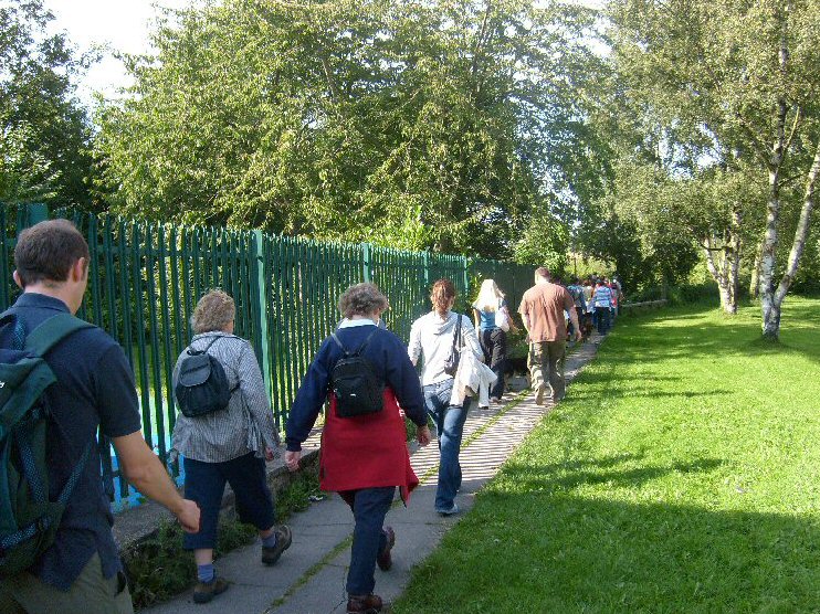 Walkers on the Thorncliffe Trail
Copyright © 2003-2026 Walking Englishman. All rights reserved.


