A walk on the Isle of Grain
Margate, Whitstable and Ramsgate all classic seaside destinations in Kent and yet for me, Grain beach beats them all. It might be small and it might not have much going for it compared to more accessible locations but it is a personal favourite and that is why I have included this short walk around the beach of this tiny Hoo Peninsula village in my selection of favourite Kent walks. This short walk around Grain beach contains some very interesting sites that are far out of proportion to its size. Be ready to get your feet wet and muddy is all I can say.
Story by Steven Spall
Google Maps Open Source Maps| Statistics and Files | ||
|---|---|---|
| Start: Chapel Road, Grain | Distance: 2.4 miles (3.8 km) | Climbing: 24 metres |
| Grid Ref: TQ 89007 76209 | Time: 2 hours | Rating: Easy |
| GPX Route File | Google Earth File | About the Isle of Grain |
| Statistics | |
|---|---|
| Start: Chapel Road, Grain | Distance: 2.4 miles (3.8 km) |
| Grid Ref: TQ 89007 76209 | Time: 2 hours |
| Climbing: 24 metres | Rating: Easy |
| GPX Route File | Google Earth File |
Ordnance Survey Explorer Map (1:25,000)
The Walk:
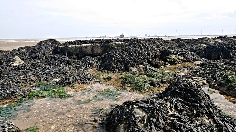 Piles of seaweed at the site of Grain Fort
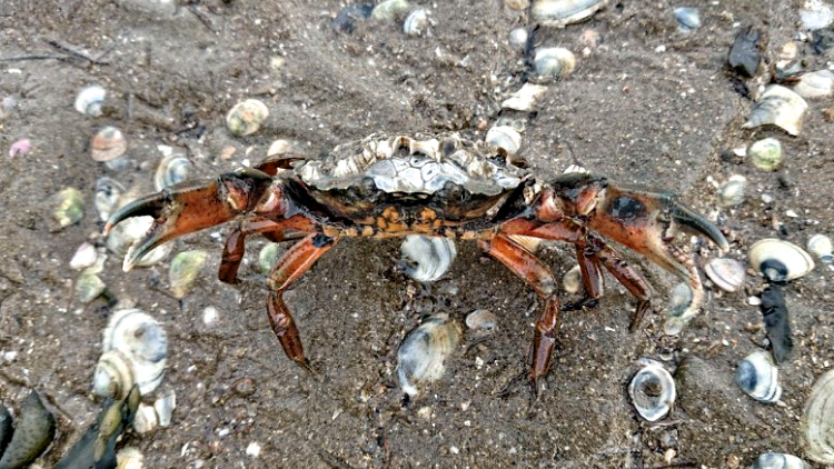 The locals can be grumpy
Following past the church leads to a small road where an ample and free car park provides a start to this walk. Heading to the left there is a high route that will keep you out of the water but the pleasure of Grain is its beach. The beach is essentially made of the broken shells of the creatures that call the Roas bank home and a great variety of cockles, oysters, mussels, clams, urchins and cuttlefish bones can be found on the beach as well as some interesting marine detritus. Be sure as you walk out to spot Southend Pier, the longest pleasure pier in the world, which can be seen across the estuary. Grain is an excellent crabbing spot with many rocks and hiding spots on the mud banks. A note of caution: while I personally have never been in any difficulty and often see people out on the flats, do use caution and common sense on the banks and always keep an eye on the tides.
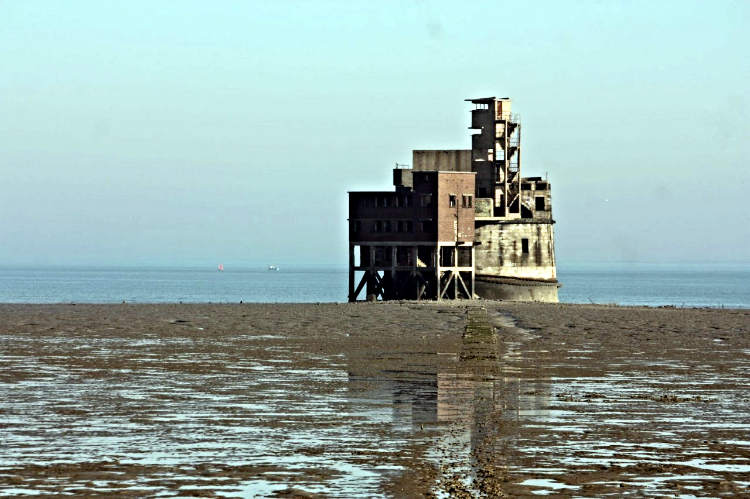 Grain Tower
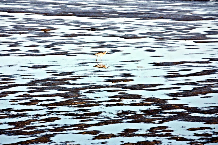 Curlew on the Roas Bank
A large and obvious wall blocks the route along the beach to the north – do not proceed past this point as this area is home to the Yanlet firing range on the Lees Marshes and is marked as a Danger area. Do follow back along the beach until you reach the concrete sea wall and where, if you look into the distance, you can easily see the masts of the wrecked Liberty Ship SS Richard Montgomery and her cargo of 1400 tons of unexploded ordinance.
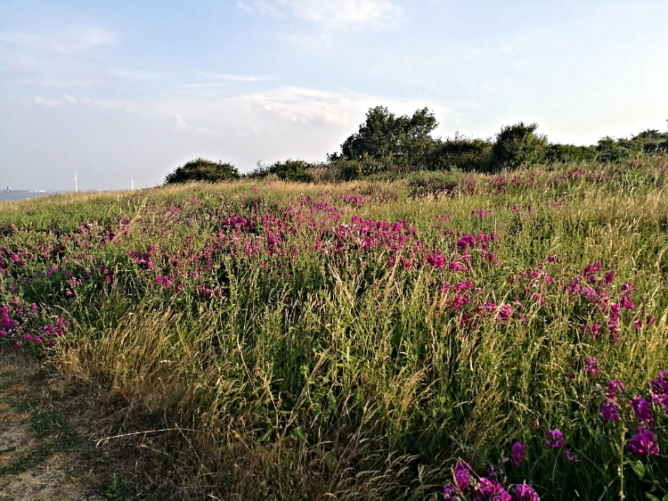 Wonderful Wild Flowers by the path
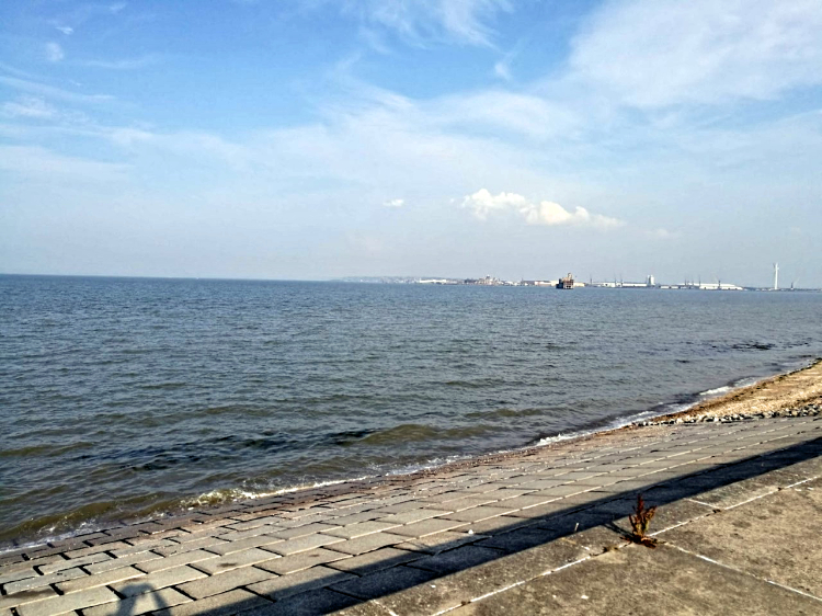 River Medway Estuary
Continue along the route to the spectacular Grain tower which has served since 1857 to guard the important dockyards in the Medway (can’t let those Dutch get away with it a second time dank je wel) alongside the Sheppey Fort on the opposite bank (watch for one of the Medway’s resident Steam Ships which can often be seen). The tower is officially off limits although an obvious if muddy path leads up to it. A word of caution is needed here: this tower is an island at high tide and is cut off completely from the mainland. Following the path next to the water treatment works leads to the woods in which the remains of Grain Fort are found with many paths to explore. A short walk leads back to the car park although easily done in half an hour or so, I don’t think I’ve spent less than 3 hours exploring this tiny but hugely rewarding walk.
Pictures courtesy of Kate Cash.


