Wales Coast to Coast
A record of the Walking Englishman's 246 miles Coast to Coast journey from Conwy in North Wales to Cardiff in South Wales. With maps, statistics, pictures, gps files and personal journals for each stage of the walk.
Stage One: Conwy to Llyn Ogwen
Google Maps Open Source Maps| Statistics and Files | ||
|---|---|---|
| Start: Conwy Castle | Distance: 17.7 miles (28.4 km) | Climbing: 1,855 metres |
| Grid Ref: SH783773 | Time: 8-10 hours | Rating: Strenuous |
| GPX Route File | Google Earth File | The Welsh 3,000's |
| Statistics | |
|---|---|
| Start: Conwy Castle | Distance: 17.7 miles (28.4 km) |
| Grid Ref: SH783773 | Time: 8-10 hours |
| Climbing: 1,855 metres | Rating: Strenuous |
| GPX Route File | Google Earth File |
Ordnance Survey Explorer Map (1:25,000)
Summary: A spectacular walk. This epic of almost 18 miles starts at sea level and climbs into the heights of Snowdonia with six of the fifteen Welsh 3,000 feet mountains completed along the way. Despite the length of the walk and the total amount of climbing the walk is not as difficult as it seems. This is because the climbing is steady throughout from the sea level start in Conwy to the highest point on Carnedd Llewelyn. Throughout the walk the views are scintillating with Conwy Mountain providing fantastic views of Great Orme and soon after from Tal y Fan to the mountains of Snowdonia. Follow me on this fantastic journey which was just the first of eighteen stages of a longer linear walk I took from the north coast of Wales to Cardiff Bay on the south coast.
The Walk: I was so excited as I set off from Conwy Castle on the walk, the first stage of an eighteen day crossing of Wales from north to south on a route designed to take in as much high ground as possible. Much of the walk would follow the Cambrian Way but not all as I wanted to visit some special places of interest. However this first stage followed the Cambrian Way route throughout, albeit in the reverse direction to that designed by Tony Drake who created the 275 mile route which is one of the finest long distance walks in all of Britain. Setting off from where Tony finished in Conwy I took time to enjoy the wonderful sight of Conwy Castle and the view across Conwy Bay and Conwy Sands to the Great Orme before setting off on my way.
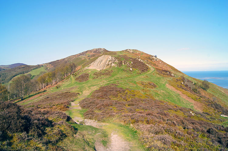 Climbing Conwy Mountain
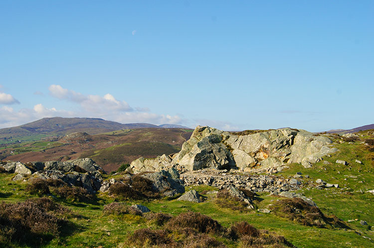 On the summit of Conwy Mountain
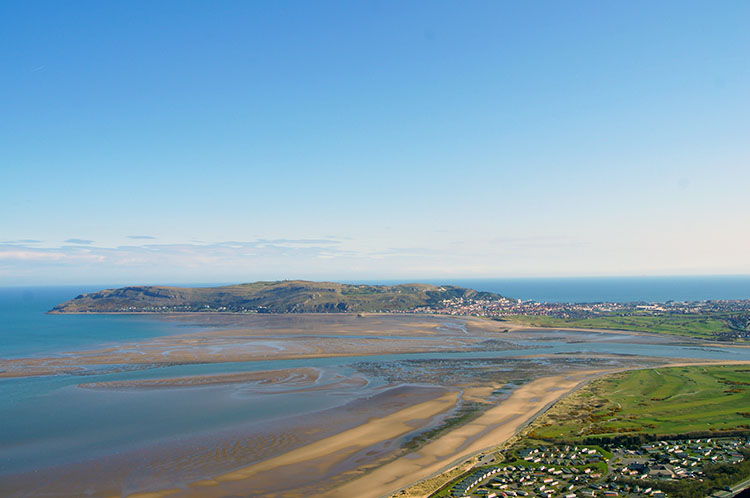
I followed the Cambrian Way and North Wales Path out of Conwy and up the east facing slope of Conwy Mountain to higher ground. I was blessed with a beautiful morning to start my journey and warm spring sunshine provided the welcome spur needed to make the first climb. I walked with enthusiasm and a smile on my face as I climbed to the summit of the mountain at 244 metres high, all the time taking short breaks to enjoy the sea view, particular the one back towards Conwy Bay and the Great Orme jutting out from Llandudno. Great Orme served the town as a natural barrier from bad weather coming from the north and west, protecting Llandudno and a factor which made the town a popular Victorian seaside resort. While I enjoyed the views to Great Orme immensely I also kept focus on the task ahead. From the summit of Conwy Mountain I fixed my attention to the view south west with the Snowdonia mountains beckoning me onwards.
 Looking back to Great Orme
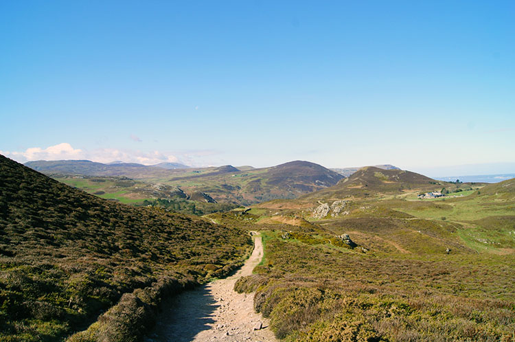 On the track to Echo Rock
After sneaking a final breathtaking view of Great Orme in the shimmering morning sunshine I walked from the summit of Conwy Mountain towards Alltwen, a small rounded mountain with a hill fort on its summit. I skirted around its eastern flank and descended to Pensychnant with an interesting feature on the map to look out for. What was Echo Rock? Following a good path and after passing a farm I found the answer. Echo Rock jutted out facing westwards beside the path as it made a short steep descent to cross Sychnant Pass which linked Conwy to the coastal towns of Dwygyfylchi and Penmaenmawr. I crossed the road where there was a small car park. A few cars were parked as I walked by and into Penmaenmawr Nature Reserve and Farm. As I walked on a winding path back to height lost to cross over the pass I met a lady walking her dog back to the car park. We both agreed it was a beautiful day.
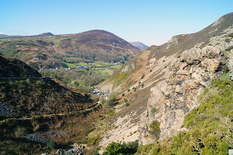 Echo Rock and Sychnant Pass
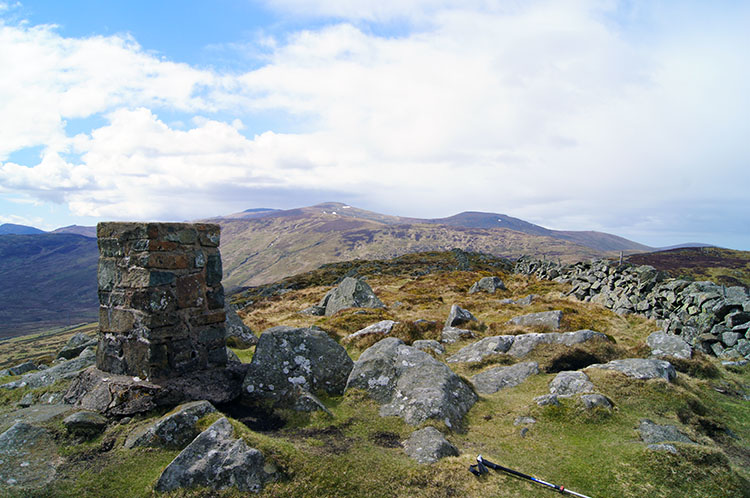 The summit of Tal y Fan
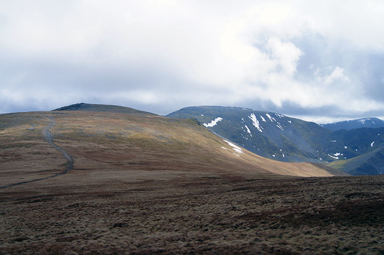
After my brief encounter with the lady I walked on alone on a south course past the west flank of Maen Esgob where I left the course of the North Wales Path and along Cefn Llenchen towards Tal y Fan. As I climbed the ridge path to the summit more exquisite views of the North Wales coastline unveiled before me with the Conwy Valley a predominant feature. I was so enjoying myself and on reaching Tal y Fan I took a short break for light refreshments. Here the views south and west to the Snowdonia mountains took more resonance. It was a magnetic attraction and I took some time taking all the beauty of it in before I was awakened from my dreaming drawn back to reality, summoned by the need to walk onwards.
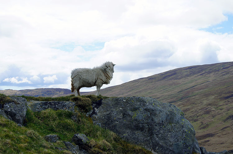 Sheep sentinel on Foel Lwyd
 On the path to Drum
From Tal y Fan the next objective was to cross over the top of Foel Lwyd and then descend to Bwlch y Ddeufaen. At Foel Lwyd I spotted a sheep looking down surveying the valley below which I had to cross. This was the first time on my walk the smile left my face as I saw a descent immediately ahead of me followed by a climb to regain what I was to lose in height and more besides. No choice but down I go so I bounded down the 175 metres it took to Bwlch y Ddeufaen, tripping up and falling into a big mass of nettles about halfway. Cursing at myself for being do foolish for a while I eventually took a deep breath to climb back up to a pile of stones at Carnedd y Ddelw. It was a tough climb beside a fence line but at least the suffering was compensated by two things; first the relief of nettle sting pain through the effort of the climb and second with the remarkable view I gained with the new height, a view of the snow clad north east face of Llwytmor with Llyn Anafon Reservoir which provided a contrasting blue aspect to the grey and whites of the mountain side. Also coming into sight was the summit of Drum, at 760 metres high the last summit on my walk before I reached the first of the fabled Welsh 3,000s.
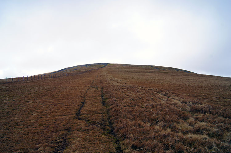 The grassy slope to Foel-fras
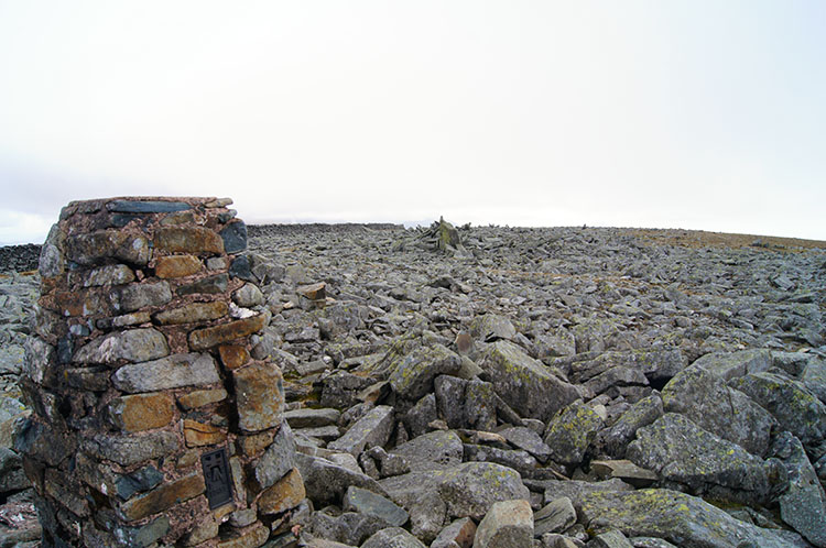 The rocky summit of Foel-fras
The brilliant early morning sunshine had given way to late morning cloud as I climbed to Drum and then as I climbed on a consistently sloped and coarsely covered brown grass track to Foel-fras. It was quite a haul up the slope, the first time during the day I did not have a clear path to follow. Tracks did lead up the mountain from Drum but they were scattered and inconsistent. I constantly changed tack from one track to another as each deteriorated into nothing but with a shortened and steady gait I climbed my way up the bank. Near to the top and just before ticking off my first Welsh 3000 I noticed the grass bank suddenly come to an end. The summit was rock strewn so instead of plodding I bounded over the loose rocks while keeping my balance until I reached the summit trig point. I had completed my first Welsh 3000 of the walk and my first for over 10 years since a short trip to Snowdonia when I climbed Tryfan and Snowdon in 2002.
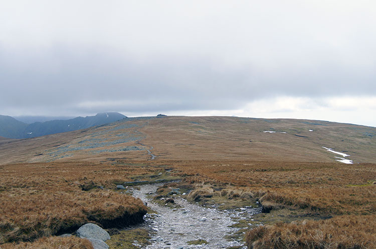 Crossing high ground from Foel-fras to Carnedd Gwenllian
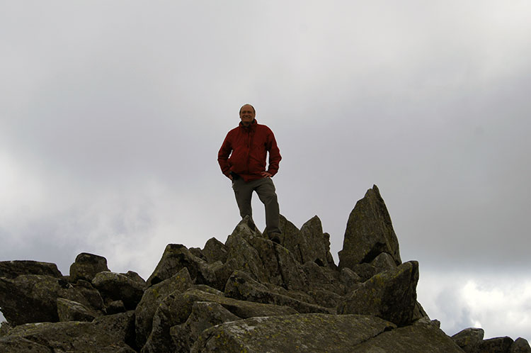 Walking Englishman on Carnedd Gwenllian
From Foel-fras I looked across the high ground towards Carnedd Gwenllian and a beaming smile returned to my face. The walk to Carnedd Gwenllian, my next objective was a delightful flat 1.5 kilometers. Like the climb from Drum to Foel-fras the terrain was once more that of brown upland grassland but this time a clear path led directly between the two named 3000s. Strictly speaking it was hardly an effort to accomplish my next Welsh 3000 but it was still a landmark I enjoyed attaining. As I neared the rocky knoll signifying the summit of Carnedd Gwenllian I met two walkers from Merseyside. After a good chat where each of us extolled the merits of Snowdonia one of the Merseysiders took a photograph of me on top of the knoll. Thank you.
 View from Carnedd Gwenllian with Foel Grach on the left
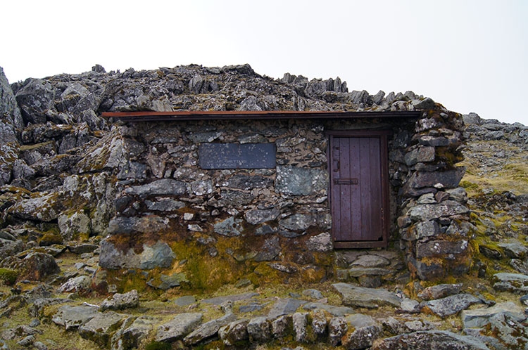 Lloches Foel Grach Refuge
From Carnedd Gwenllian the easy walking continued in a similar vein to Foel Grach. It was a 100 metre climb from the saddle just south of Carnedd Gwenllian to the knoll at the summit of Foel Grach but it was hardly noticeable. I had done all the hard work in climbing from sea level to Foel-fras, or so it seemed. Now I could enjoy myself. Just as I had met two walkers on Carnedd Gwenllian I met two more on the summit of Foel Grach. These two, both called Pete were local to the area and in search of a rare bird. "We are looking for the Dotterel. There have been sightings in the area" said one of the Petes. The Dotterel, a member of the Plover family is generally only seen in Britain on Scotland's high tops. This year they were acting like tourists. I promised to look out for one myself and wished them luck on their search. I had met the Petes beside Lloches Foel Grach Refuge, a sturdy shelter built into the rocky knoll at the summit of the mountain. I looked inside and bumped my head on the low lintel over the door as I did so. It was a painful encounter with the thick wooden support but thankfully only a temporary hindrance before the shock wore off. I had forgotten about it before I walked off towards the Carnedds.
 Crossing Gwaun y Garnedd
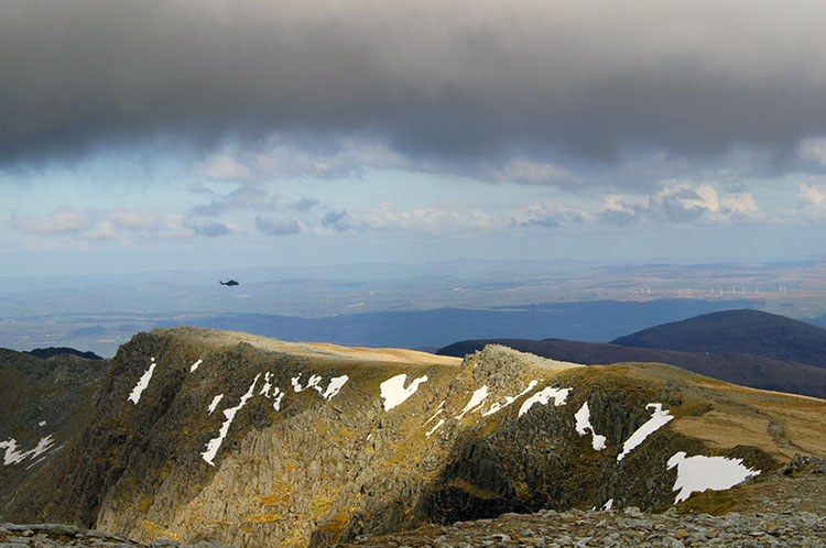 Helicopter over Yr Elen
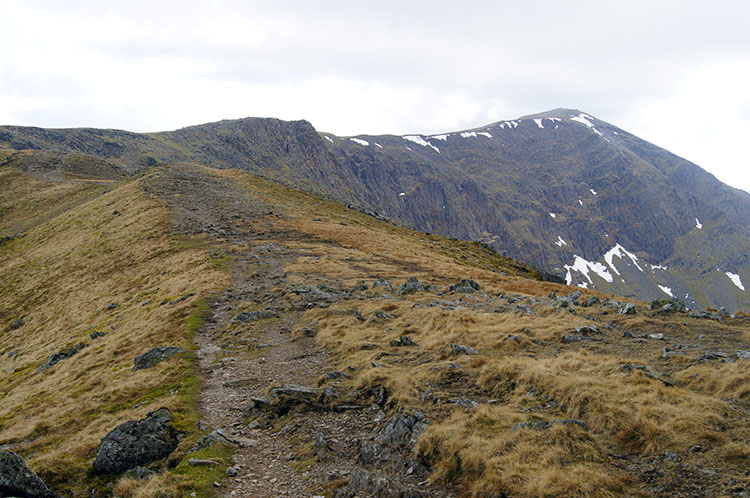
I walked south across Gwaun y Garnedd towards Carnedd Llewelyn As I crossed the land bridge between the two I looked across to Yr Elen, the only Welsh 3000 close to, but not on the route of the Cambrian Way and while looking over I noticed a helicopter closing in on the mountain summit and hovering above it. I stopped for a few minutes to watch the helicopter, presumably a Sea King as it practiced landing and take off on the mountain top. I though it could well have been Prince William practicing his flying skills. The helicopter hovered above the mountain, landing and taking off twice before it flew off in a eastwards direction towards the Vale of Conwy. After watching the aeronautics I resumed my walk towards Carnedd Llewelyn along the path which had a steep drop to my right.
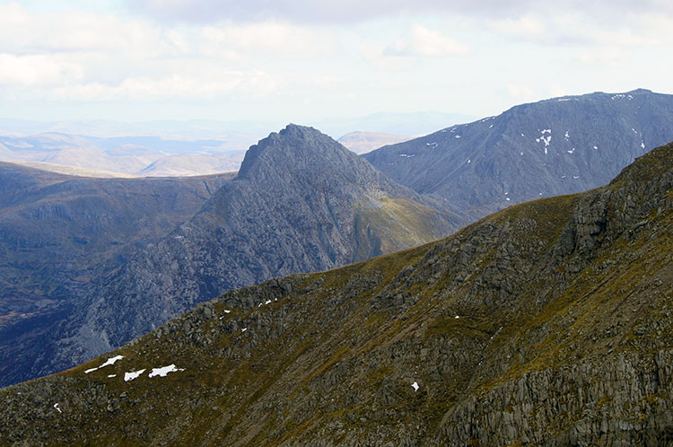 Tryfan appears over the shoulder of Carnedd Llewelyn
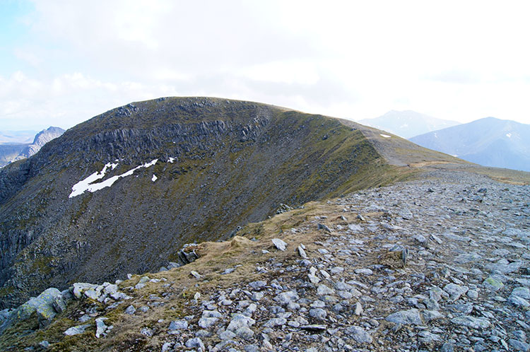 Crossing Cefn Ysgolion Duon to Carnedd Dafydd
Around the summit of Carnedd Llewelyn my attention was taken by an odd looking mountain, so much out of character than those all around. While the others were massive bulky mountains this one was slender with a long narrow serrated ridge. Unmistakably I was once more making my special acquaintance with Tryfan, one of my all time favourite mountains. Not on todays agenda I could observe it from above and from a different aspect than I had before. It was beguiling to look at, it always is. As I walked from Carnedd Llewelyn and crossed the saddle to Carnedd Dafydd I continued to be drawn to Tryfan until that is it was shielded by the bulk of Carnedd Dafydd ahead of me. Only now did the other mountains get their deserved respect. Such is the effect of attention seekers like Tryfan.
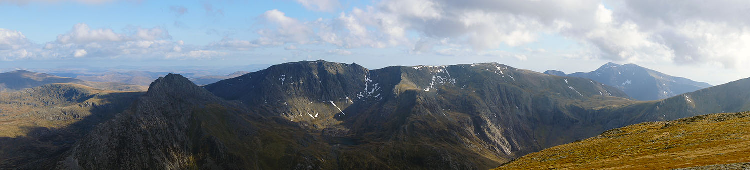 Wow! Tryfan, the Glyders and the Snowdon Massif all fill the shot taken from Carnedd Dafydd
The walk over the Cefn Ysgolion Duon saddle to Carnedd Dafydd took me to the summit of my fifth Welsh 3000 of the walk and when I reached the summit I was blessed with the most remarkable view of some of Snowdonias finest mountains. It was a WOW moment. My favourite Tryfan framed the left hand side of the upland panorama with Glyder Fach and Glyder Fawr to the near right and linked by the rolling saddle at Bwlch Tryfan. Right of the Glyders on the same ridged formation was Y Garn. Then beyond, across the Pass of Llanberis and Pen-y-pass which were shielded from view by Tryfan, the Glyders and Y Garn was the Snowdon Massif. From left to right were east and west peaks of Y Lliwedd and then Snowdon with Garnedd Ugain and Crib Goch immediately right and forward of the highest peak in Wales.
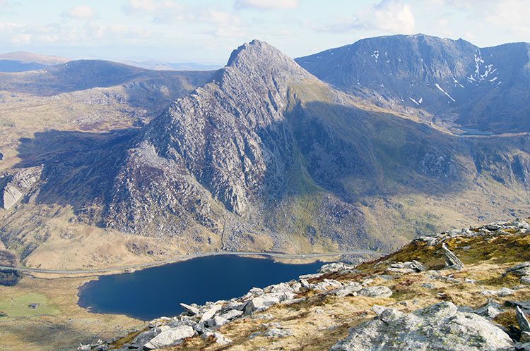 Looking down to Tryfan and Llyn Ogwen
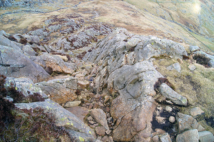 Scrambling down from Carnedd Dafydd
After fixing the awesome view into my memory banks and coming down from the high of the WOW moment I fixed my attention to the task in hand, that of making a steep and tricky descent of Carnedd Dafydd which ironically included descending to my sixth and final Welsh 3000 foot mountain of the walk. The first section was easy to Bwlch yr Ole Wen which included a short detour to the summit of Pen yr Ole Wen. It was not easy at all after that milestone step onto my sixth and final 3000 of the walk as it became quite steep descending te path from Pen yr Ole Wen to Clogwyn Mawr. Attention to the descent was paramount and made more difficult by more terrific views of Tryfan, this time with the added delight of Llyn Ogwen in the foreground. The scramble down was less easy still due to the fact I was suffering from rotator cuff injury to my left shoulder which meant any shudder or jar to the shoulder was followed by a short spell of excruciating pain. I was sure to take extra care to avoid that and so I scrambled and clambered down the steep rocky gullies to Clogwyn Mawr with the utmost care. As I descended I passed a couple making their descent. They were finding it more tasking than I and maintained a very sedentary pace. Eventually and without any slips I had clambered down by sure steps, reversed climbs and bum slides to Clogwyn Mawr with the mountain tarn of Nynnon Lloer close by. Now I could forget the thought of downward scrambling and walk normally again.
 Afon Lloer
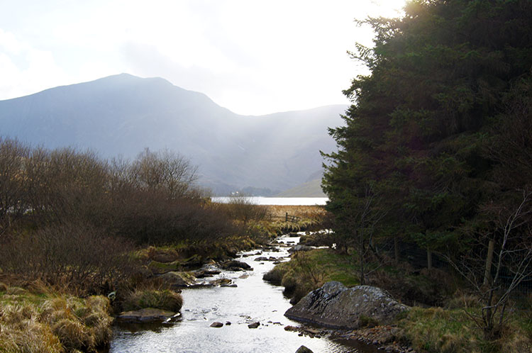 End of the walk at Glan Dena
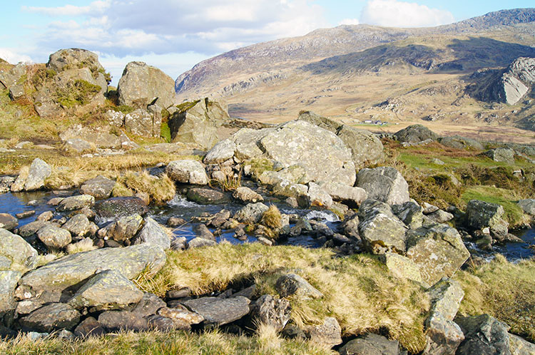
The walk from Clogwyn Mawr to the finish at Glan Dena was more or less straight forward though a series of lateral stream crossings had to be made, some by short leaps and others by wading through. All the small watercourses led into Afon Lloer which I followed on a parallel course to my finish. I had spotted my car parked at the roadside beside Glan Dena on my descent of Carnedd Dafydd from high, my wife Lil acting as driver during my first stages of the Wales Coast to Coast while I navigated my way through Snowdonia. With the confirmation of being pick up ensured I thought back to the walk from Conwy as I tramped my final few yards. I smiled consistently as I did so. It had been a cracking first day on my Wales Coast to Coast walk and before i left the scene I tipped a wink to Tryfan, my first mountain for tomorrow.
Endnote from my after the walk Facebook post: "Today was exceptional. I have enjoyed some fabulous days at high level crossing mountains and the walk into Snowdonia from Conwy ranks as one Of the best ever. Of course the weather helps and even a weakening cold front which came across midday and shielding the sun for a couple of hours didn't cause me any inconvenience; in fact it was appreciated during some if the long hauls up to mountains such as Foel Fras. In short I had an absolute ball from the start climbing Conwy Mountain, Tal Y Fan and Drum. Then came the big ones at over 900m high, three of the Carnauds? Sorry if the spellings wrong but I am out enjoying a meal now and I forgot the bring the map! One was Llewelyn and all of them will be named correctly when I post the walk on Walking Englishman. Coming down from the last mountain was interesting too with some shimmies down on my bottom through steep gullies. All in all I did just short of 10 miles and remarkably I don't feel bad at all, such was the excitement of the day. Tryfan and the Glyders tomorrow. I look forward to it."


