Holme, Digley Reservoir, Black Hill, Holme Moss and Ramsden Clough
In my opinion this is one of the best Pennine watershed walks. There is interest throughout with an early visit to the site of a Victorian tragedy before climbing to dramatic moorland. After the high point of Black Hill a site of early TV history is visited before the walk goes to stunning Ramsden Clough before returning to the start via moor and lanes.
Google Maps Open Source Maps| Statistics and Files | ||
|---|---|---|
| Start: Holme | Distance: 11.8 miles (19.0 km) | Climbing: 642 metres |
| Grid Ref: SE108059 | Time: 5-6 hours | Rating: Hard |
| GPX Route File | Google Earth File | About Holme |
| Statistics | |
|---|---|
| Start: Holme | Distance: 11.8 miles (19.0 km) |
| Grid Ref: SE108059 | Time: 5-6 hours |
| Climbing: 642 metres | Rating: Hard |
| GPX Route File | Google Earth File |
Ordnance Survey Explorer Map (1:25,000)
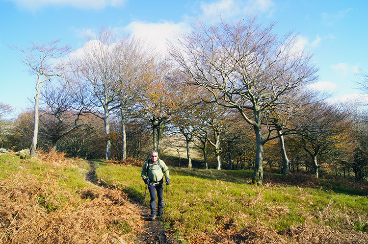
The Walk: Holme is a popular village for walkers and cyclists alike. The ones on two wheels make the effort to cycle to the village with the intention of crossing over the Woodhead Pass which links Huddersfield, via the Holme Valley and the A6024 Woodhead Road, to the A628 Sheffield to Manchester Road. Just as the professional cyclists did during the second stage of the 2014 Tour De France. The walkers and hikers make the effort to enjoy the many wonderful trails in the area including sections of the Kirklees Way, the Pennine Way and the Holme Valley Circular Walk. My walk features parts of each of these stunning trails as I enjoyed a fantastic moor and dale circular of just less than 12 miles.
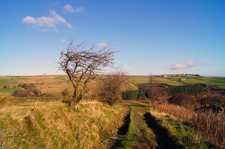 On the lane from Holme to Digley Reservoir
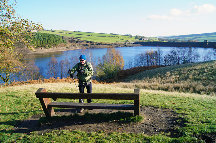 Digley Reservoir
I set out from Holme in the company of my pal Jez on a beautiful November morning. With the plan to go high to the Pennine watershed I had planned to walk on a good day as I did not want to make the effort of climbing to heights which promised remarkable views and not see them. So with the assurance that we would see what we had come to enjoy, Jez and I walked out of the village in excellent spirits. We followed Meal Hill Road north past the village school and continued north along a lane which gave us our first prominent views of the Holme Valley stretching out eastwards towards Huddersfield with a superb view of the Emley Moor transmitter further to the east. Near Upper Lumbeck we turned north east and followed a track down to Digley Reservoir which was built in 1954. It is a popular spot for local people, especially in summer where families from the Huddersfield area come to enjoy summer picnics. With such beautiful surroundings it is clear to see the attraction.
 Bilberry Reservoir
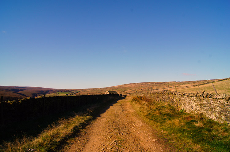 Nether Lane near Bradshaw
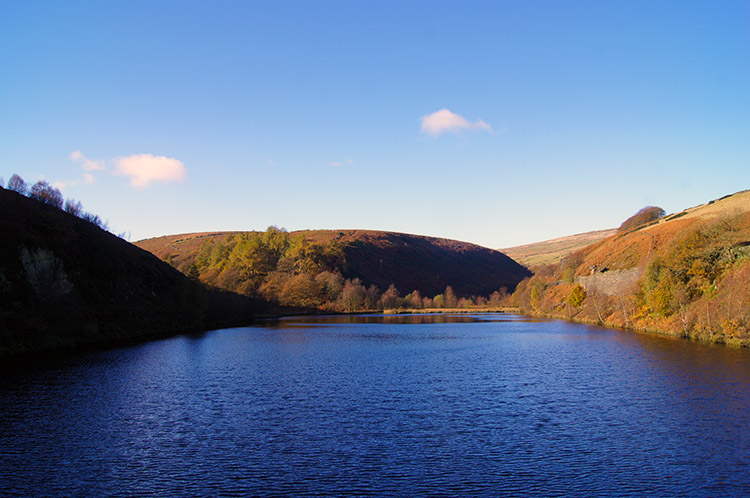
From Digley Reservoir we followed the path leading west to Bilberry Reservoir which is much older than Digley Reservoir. It was originally built in the mid 1800's and was the cause of one of the greatest disasters in the Holme Valley when the reservoir dam burst which led to the release of 86 million gallons of water which rushed down the River Holme. Much damage was caused to buildings in the valley and 81 people tragically lost their lives. The dam in question is now a much more substantial structure, in fact one of the most safely engineered dams I have come across and most unlikely to cause any worry to present day water company engineers. Bilberry Reservoir is in the most picturesque surroundings by the high banks of Hey Clough and Marsden Clough.
From Bilberry Reservoir Jez and I climbed towards the Pennine Moors by following the Kirklees Way west to Greaves Head and then continuing west to Bradshaw. On reaching Bradshaw we caught up with a group of about 20 mature walkers who told us they were members of the University of the Third Age, Barnsley Branch. We parted company with them soon after Goodbent Lodge when they left the Kirklees Way to track south towards Goodbent and Stopes Moor. Jez and I continued west on our steady uphill course towards Wessenden Head Moor.
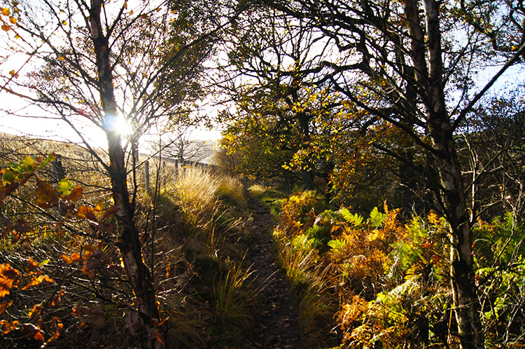
 Woodland near Reap Hill Clough
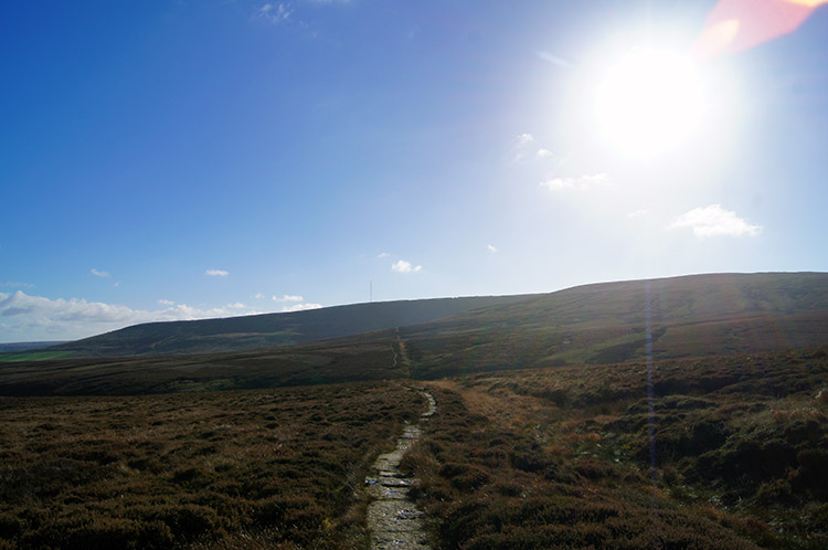 Climbing Black Hill
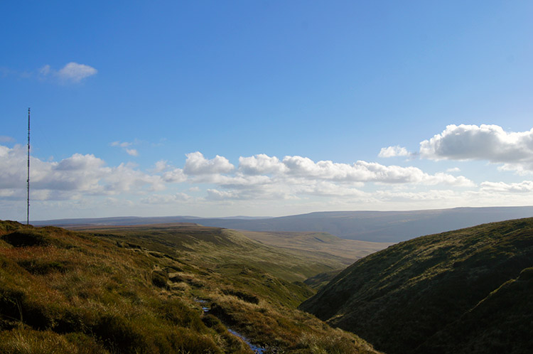
The weather continued to be as good as it could be, the sun shining low in the southern sky. Not long after leaving the aged group to plot their own course our path deteriorated a little and for the first time we had some sidestepping of puddles and troughs in the ground as the Kirklees Way track descended to a small brook leading south into Reap Hill Clough. After passing the brook we climbed a few metres to track through a delightful small wood on the edge of the moor. This way the final point for trees to establish themselves, the vast bulk of Black Hill beginning to dominate the view dead ahead of us. Soon after leaving the woodland behind we turned from a course west to one leading north-east as we reached the Pennine Way and began the climb of Black Hill. Jez recalled being here once before. As he said "On an awful day when I could not see a thing". This time he would at least be able to enjoy the views he could have only imagined the last time. He also recalled how the climb had been tough going, in and out of peat hags and across cloughs. Now the tread of thousands of Pennine Way walkers boots have led to the path being paved - too sanitised for some including Jez who would prefer it to have remained the way it was. I guess there was a need for the paving though for the popularity of the Pennine Way will have caused much widening and scarring of the original path. Whichever camp you fall into, there is no doubt the paving of the Pennine Way has made the trek up much easier. With paved way and good conditions I fairly bounded my way upwards.
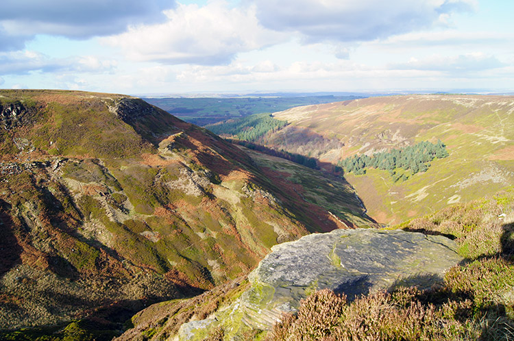
 View down the Holme Valley from Black Hill
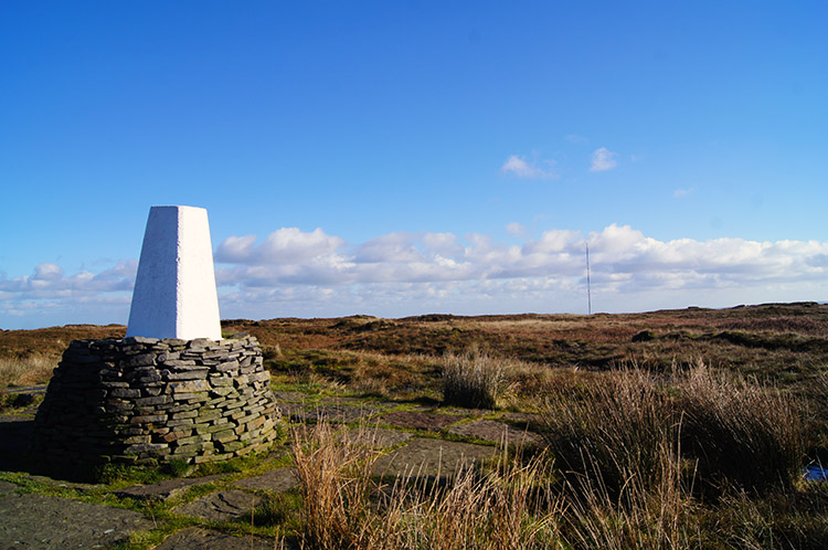 Black Hill summit point
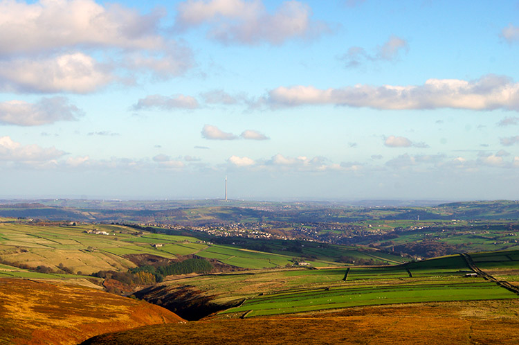
As we climbed steadily up the easy path towards the summit of Black Hill the ever more distant views unfolding caused us to stop regularly and enjoy them. To the east was a vast swathe of West Yorkshire to be enjoyed. Once more the Holme Valley, Huddersfield and the uplands around Emley Moor and the 330 metre high television transmitter tower. Behind us, to the north the mass of Pennine watershed moorland towards Marsden was beautiful to behold. Ahead of us, the lump of Black Hill drew us onwards to the summit. A little while later we were there, high point of the walk attained. We paused at the trig point for five minutes and as we did so I imagined the recent restoration work in which a grassed area has been created to replace the black quagmire scene of the recent past and which was much more indicative of the hills name and its old reputation.
 Heyden Head
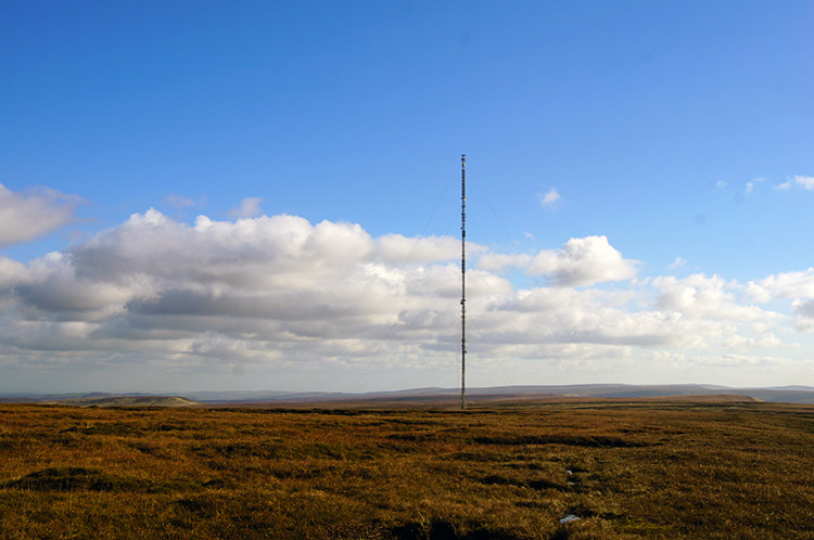 Holme Moss
From Black Hill the navigation on this walk, which had been nothing but simple, became a little more of a challenge. Indeed, had the cloud been down on the moor this next stage of the walk from Black Hill to the Holme Moss Transmitter Tower would have been a stern test of mountain navigational skills or GPS reading. As it was, the test in navigation was simple. I had been advised to head due east to Heyden Head and round the tip of the clough before tracking south-east to the tower. So I did but a track made by mountain adapted vehicles became apparent and I simply followed the track as it curved around the highest hags and deepest troughs. The track led us directly to Heyden Head which we rounded and then we followed the edge of the clough on a clear path for a few hundred metres before following a path leading straight towards the transmitter. I have to conclude it was a simple journey to make and we got barely wet on the off-route course we followed but I have to say again had it been different conditions for us up here then I am sure it would have been much less straightforward. We were exceptionally fortunate to have the best of days.
 Path from Wilmer Hill to Great Twizle Head
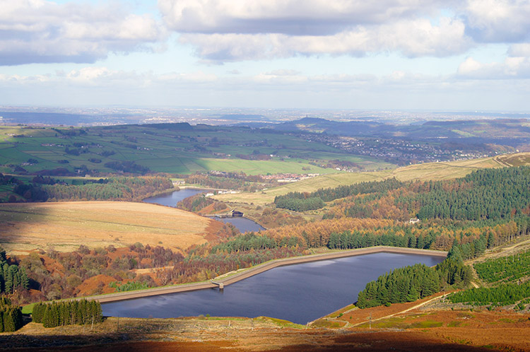 Looking down on Yateholme Reservoir
We stopped for lunch when we reached Holme Moss and while having out lunch Jez called it a day. The hard unforgiving pavement which the Pennine Way path up Black Hill is now had taken its toll on his back and he decided to head back down the Woodhead Road to Holme while I continued on the planned walk route. "I should have transferred my pain killers from my summer sack to my winter one!" he explained. Alas he had not. So, after our lunch he bade me farewell and good walking for the rest of the route. He would see me when I finished. Therefore I set off alone from Holme Moss and skirted the north side of Wilmer Hill to follow a good upland path on the edge of the moor towards Great Twizle Head. It was fantastic to follow and the views to the immediate north were stunning. I had a perfect view of the line of three reservoirs taking water from the moor, in turn they being Yateholme Reservoir, Ramsden Reservoir and Brownhill Reservoir. In a direct line beyond the reservoirs Castle Hill stood proudly above Huddersfield. I was in great form and the thrills kept coming.
 Ramsden Clough
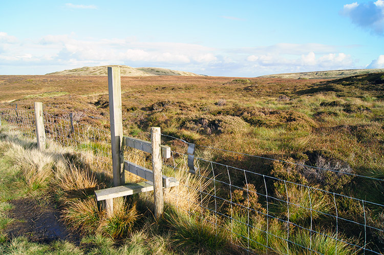 Near Ruddle Clough Head
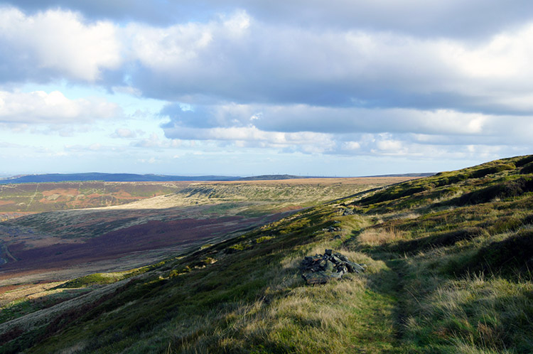
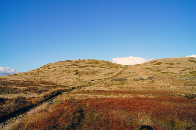
From Great Twizle Head I passed the head of Little Twizle Clough and then crossed Herbage Moss to reach the head of Ramsden Clough. WOW I thought, this is amazing and the rapture I was in continued unabated as I crossed one and then another of the time fledgling streams which the clough depended on. Ramsden Clough is quite breathtaking, believe me. I so much enjoyed walking along the east edge of the vast chasm until I reached Ruddle Clough Knoll and was forced to leave the awesome spectacle behind. I tracked up along Ruddle Clough to its head and then followed a path past a line of Grouse shooting stations towards the interestingly named area of Cook's Study Moss and Cook's Study Hill.
 Cook's Study Hill
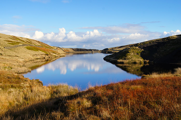 Snailsden Reservoir
No research could tell me what Cook's study exactly was, I could only assume it an area of Victorian antiquarian activity. However, if someone or some group did work up here on scientific studies then they will have enjoyed the location. Next to Cook's Study Hill is Snailsden Reservoir, the highest of a feeder group of reservoirs which supplies north west Sheffield. Snailsden Reservoir is in a very pretty location and I enjoyed a five minute sit down to take in the scene. It was so quiet I could have heard a pin drop which was perfect for me. I then climbed Cook's Study Hill. From the top of the hill the views north to the Holme Valley and east to Emley Moor opened out for me once again.
 View to Holme from Ramsden Road
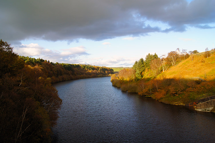 Brownhill Reservoir
Following the track down from Cook's Study Hill I reached a road which I followed west and then north for just over half a mile until I reached the Ramsden Road unmade vehicular track leading north west towards Crow Hill. I was also on the Kirklees Way once more and this section of walking provided me with super views across the valley to Holme village. I knew I was on my final stage of the walk and that I would soon by finished. However I had a few more nice surprises to come. First of them was on reaching Ramsden Reservoir where a few cars were parked in the reservoir car park. I took a final two minute sit down on a bench with table where visitors can enjoy an outdoor snack. I sat drinking the last of my hot coffee from my thermos while watching a fly fisherman cast his line from the dam path into Ramsden Reservoir. Had he studied Fly Fishing by JR Hartley?
 Lovely woodland path near Ramsden Reservoir
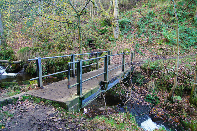 Footbridge over Rake Dike
After finishing my coffee and crossing the dam path separating Ramsden Reservoir and Brownhill Reservoir I followed a lovely woodland trail upstream of Rake Dike to a footbridge which led me over the stream and on a path back to Holme village. I have to admit I was shattered now and then final climb of the walk from the rake to the village, short though it was, was punishing. I had recently recovered from three weeks of a foot injury which had stopped me walking and I was now feeling the effort. I made it up the final 50 metres of ascent that was needed though and reached Holme. The deed was done. After meeting up with Jez once more who had enjoyed a leisurely stroll down the road from Holme Moss we went home. As Jez drove climbing from Holmfirth to Denby Dale, I sat looking out to the moors with a huge grin on my face.
I can do no more than thoroughly recommend this walk. At 12 miles and with almost 650 metres of climbing it is not for the faint hearted. But should you do it then the rewards are more than compensation for the effort. A classic.


