Great Shunner Fell, Buttertubs and Lovely Seat
A remote, airy and easy walk from Sedbusk via Hardraw to Great Shunner Fell is on well established paths while the continuation to Buttertubs, Lovely Seat and back into Swaledale is across wild moorland with some parts un-pathed. If you enjoy a challenging walk, this one will meet your needs.
Google Maps Open Source Maps| Statistics and Files | ||
|---|---|---|
| Start: Sedbusk | Distance: 13.9 miles (22.4 km) | Climbing: 780 metres |
| Grid Ref: SD 88352 91195 | Time: 6-7 hours | Rating: Strenuous |
| GPX Route File | Google Earth File | About Great Shunner Fell |
| Statistics | |
|---|---|
| Start: Sedbusk | Distance: 13.9 miles (22.4 km) |
| Climbing: 780 metres | Grid Ref: SD 88352 91195 |
| Time: 6-7 hours | Rating: Strenuous |
| GPX Route File | Google Earth File |
Ordnance Survey Explorer Map (1:25,000)
Summary: While the first part of this walk is straightforward and well known to many, across fields from Sedbusk to Hardraw and then following the Pennine Way from Hardraw to the summit of Great Shunner Fell, the second half to Buttertubs and then to Lovely Seat is mostly on un-pathed ways and across right to roam land, often akin to wilderness. While I never found the walk a problem, bar scaling a couple of temporary land management fences, the going is undoubtedly challenging in parts. Be prepared for a tough day out and you will be rewarded with a day to remember. In some remote places the views are vast and somewhat primeval making you feel you have the whole environment to yourself. For me it was a complete thrill. My kind of walk.
The Walk:
 Crossing fields between Sedbusk and Hardraw
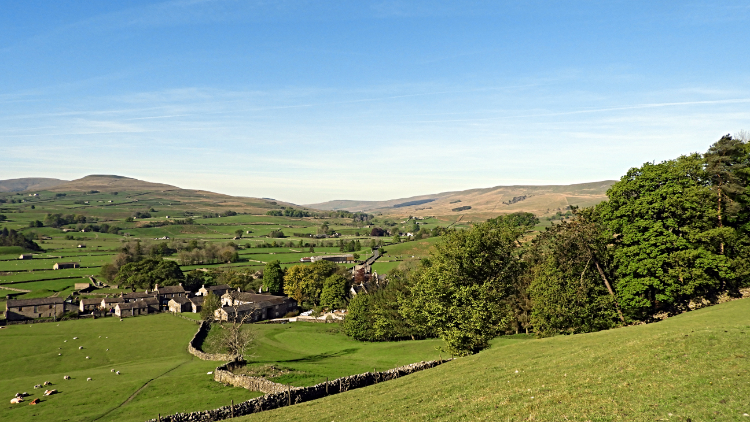 View to Hardraw from Simonstone Hotel
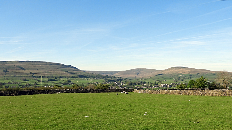
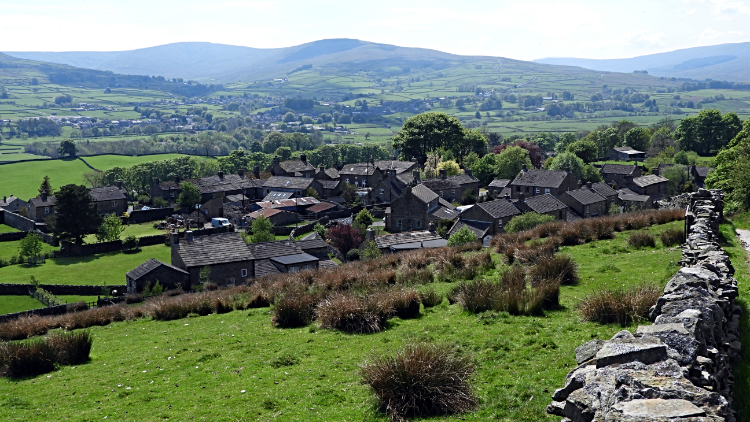
There is nothing better in a walk, in my opinion, than embarking on one which has an element of explore and discover included. It makes the walk all the more exciting and so it was with this walk. I eagerly set off, knowing the climb to Great Shunner Fell was very familiar but from thereon I would be treading new ground, much of it un-pathed and not walked by any other. No doubt some would have trod a similar route but not one person will have followed exactly the same line I would take. That thought thrilled me as I set off from the gorgeous hamlet of Sedbusk. The hamlet was still when I arrived, not a soul to be seen, and it was quiet when I left by following a gate between village green side houses to head west, across a series of paddock pasture fields towards Hardraw. Sheep quietly grazed in most. The sky was clear, the sun was shining. All was good, my face was beaming.
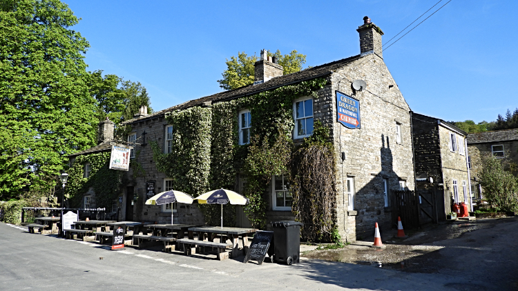 Green Dragon, Hardraw
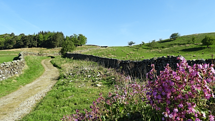 Bluebell Hill
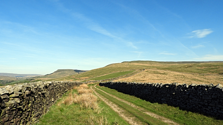
Half an hour after setting off I arrived in Hardraw, coming out of the fields and to the country road beside the Green Dragon pub. If I had planned to visit Hardraw Force I would have needed to knock on the door of the pub, pay the toll and wander along a path to see the single drop cascade. But not today, it would be a mere trickle after the dry spell anyway, and I had grander plans today. So straight past the pub I went, over the bridge spanning Hardraw Beck and to the point where I left the roadside to start the first climb of my walk, the steady, albeit long one to Great Shunner Fell. The climb of over 1,500 feet (460 meters) never deviates from a steady incline of about six percent making it one of the easiest big hills to climb. It is the third highest of all in the Yorkshire Dales, a giant in bulk but a gentle one in good weather. Like today. I eased into the climb, ascending first to Bluebell Hill where flowers appropriately coloured the track-side. The way up is a bridleway as far as Hearne Top, firm underfoot.
 Crossing Little Fell to Hearne Top
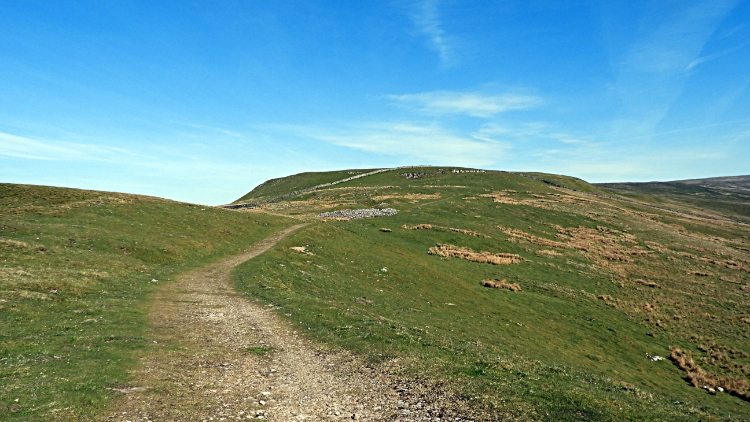 Hearne Top
After Bluebell Hill the trees are lost, open moor shapes the way ahead. Still following the bridleway and hemmed in by drystone walls on either side of me, I continued my six percent ascent of Great Shunner Fell. As I climbed I could see the great bulk of the hill opening out before me, a huge spread of moor. Wild and wonderful though becalmed today. I climbed steadily, wiping my brow from time to time in the rising heat of the day. Though there were sky high wisps of white in the sky the sun beamed relentless down. It was a hot mid May day. Continuing my climb I listened to the chirps and songs of Skylarks rising into the Springtime sky. I cannot get enough of their enchanting song. Local Crows cawed as well, they too making merry in the courting season. I watched a couple of Crows hopping about in a kind of courtship dance over a hillock by the trail. As soon as they spotted me they took to the air though I offered no threat. The songs and antics of the Avians were so diverting I soon reached Hearne Top. Leaving the bridleway, I took the right hand footpath trail, continuing on the Pennine Way toward the top of the moor.
 Pennine Way leading to Black Hill Moss
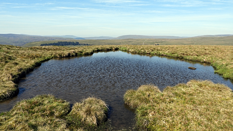 Anonymous tarn on Black Hill Moss
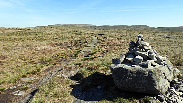
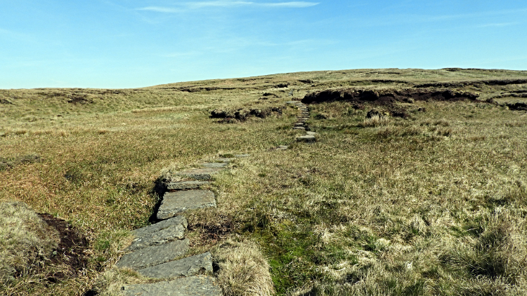
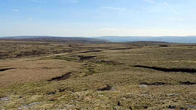
My way forward was now on a course due north. From Hearne Top I headed to Swallow Hole, then Humesett and then to Black Hill Moss. When taking breathers to cool from the blazing and fast rising sun I looked back to the path I had just walked. Due south the mass of Ingleborough was in clear view. At 723 metres it is just seven metres higher than Great Shunner Fell, making it number two in the Yorkshire Dales tall boys. The highest, Whernside, at 736 metres was hidden from my view behind Great Knoutberry Hill. And Pen y ghent was hidden from my view too, by Dodd Fell. Ingleborough was fortunate to be seen through the Widdale gap. A fortunate circumstance. After my recognition of familiar hills I turned again to my task, the climb. I reached Black Hill Moss where the terrain changed from relatively dry approach slopes to upland plateau which retained water. Small tarns were strewn about near to the path and small streams crossed my way too. Stepping stones, fashioned flat-stone clapper bridges and purposely laid flags now helped me on my way.
 Bleak Haw
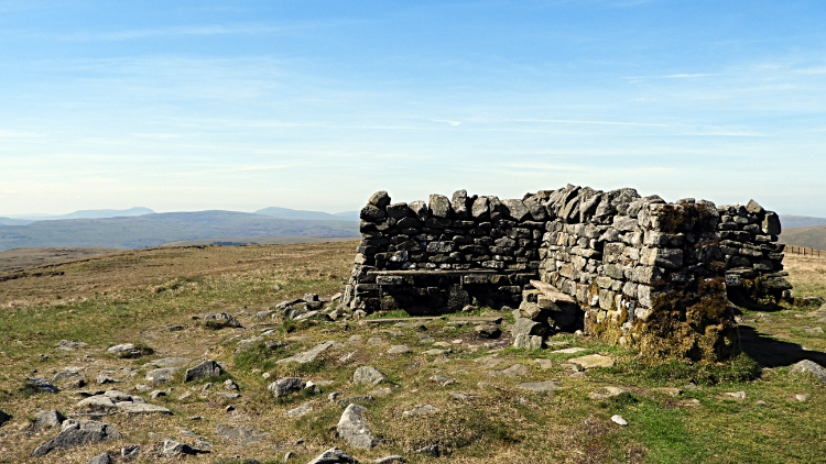 Summit shelter on Great Shunner Fell
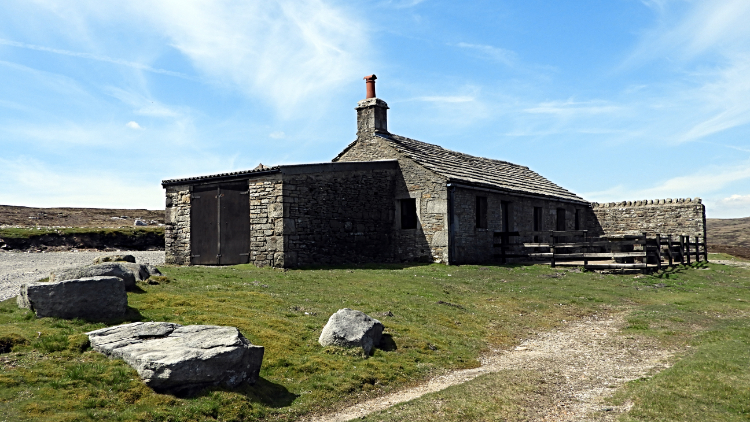
Some dry tarn beds were black with glistening stones like coal. The gritty peaty debris shone in the high sun. The path, all stone flags now, led towards the summit. It meandered like a purposeful snake to the X shaped summit shelter which sits on the very top of Great Shunner Fell. I was heartened to see it from about 400 metres away and upped my pace on doing so to get a seat. I noted I was the only one on the fell, having the shelter all to myself. It was 10.30am in the morning when I sat down to take a refreshment break at the summit. Thrilled to be here on the perfect morning; the last time had been in much different circumstances in overcast and cold conditions. It was raining and my walking pal Steve was in a foul mood, most unlike him. That day he cursed Great Shunner Fell and I moaned a bit too. Today, I rejoiced Great Shunner Fell. As I sat at the shelter I took in all the grandness of the place. The solitude was a bonus and I thoroughly enjoyed looking out over the expanse of moorland with only the slightest rush of upland air breaking the silent moments.
 Crossing Stony Hill
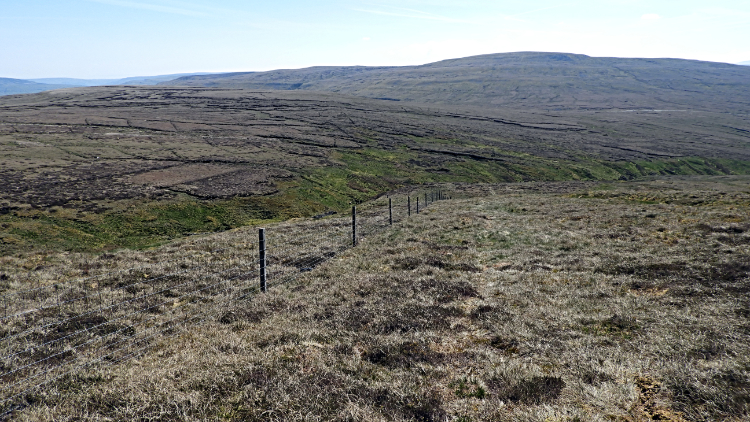 Near Little Shunner Fell
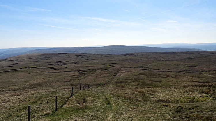
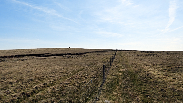
As I had been sitting and enjoying the peaceful calm while fueling up for the next stage of my walk I looked out in the direction of my chosen heading. Up until now I had been on marked footpaths and for the last five miles or so I had followed the Pennine Way. Now, as soon as I raised my backside from the summit shelter seat, I would be on unfamiliar ground. Paths would not help me, there were none to follow. My first destination was Buttertubs and I set a bearing to get there. Looking across to Stony Hill I saw a fence which I would have to negotiate around to get to Buttertubs. My course was set. Off I went, over Stony Hill and around the south side of Little Shunner Fell. The ground was good, firm in most places though inevitably spongy here and there. As peat moor is. Sinks into hollows and water squelching up my boot sides was a regular event but with care I worked my way around the water traps and kept my feet dry. Tussocks of higher grasses caused me to walk the John Cleese 'Academy of Funny Walks' at times but all was relatively fine. I stayed dry and the hardest hurdle was being forced to climb over a low wire fence. Or step over without embarrassment if you like. The alternative was a half mile down dale and back up detour which I did not fancy.
 Grimy Gutter Hags
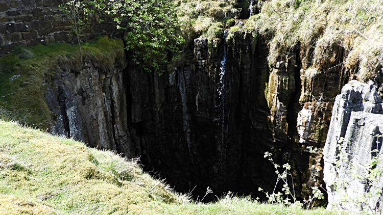 Buttertubs
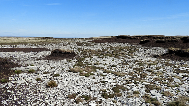
After crossing over the fence at Wofell Scar I followed another temporary fence line up to Grimy Gutter Hags. What great place names there are in the Yorkshire Dales. On my map and close to where I was stood there was also Guy Mea, Black Bank, Nattles, Grainy Gill Wikes and Pickersett Mea, all of which I could have explored. My choice of Grimy Gutter Hags was one of what I expected, that being peat hags. But around the peat hags there was a flat wide expanse of white stones. Many of the stones were flat and rough cut like tiles, resembling a crude slate quarry. I never expected to see the colour of stone, all before on my walk had been black. I left the enigma site and scaled down a quite steep bank called Howgate Edge to reach Buttertubs. Just beyond the Buttertubs was the famous Yorkshire Dales Buttertubs Pass mountain road linking Upper Swaledale to Upper Wharfedale. The Buttertubs are limestone potholes, formed of 325 million year old carboniferous limestone rock. Despite the recent dry spell water was cascading down the pots while I looked into them.
 Climbing to Lovely Seat
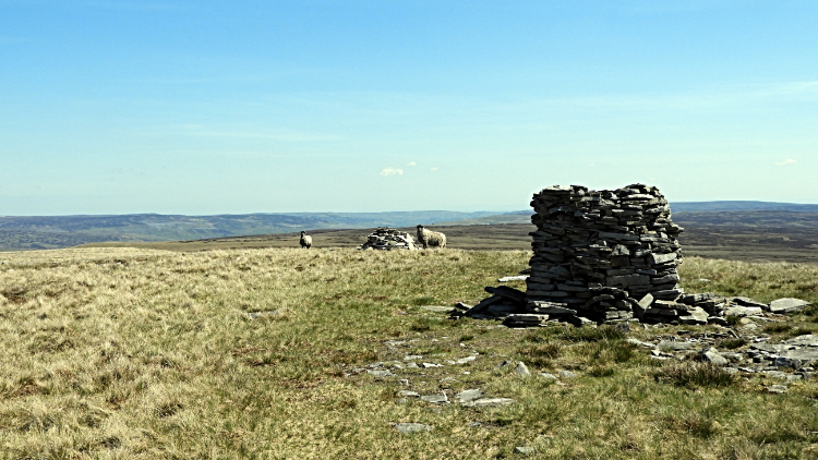 On the summit of Lovely Seat
From Buttertubs I followed the road south for about a quarter of a mile until I reached Bull Bogs and then I cut across a rather swampy corner of field to reach a distinct path line leading up eastwards towards Lovely Seat. The climb of 150 metres to the high point of 670 metres was the steepest of the day and the hardest too as it was now midday with the relentless sunshine at its strongest. I was also a little fatigued after the Shunner Fell ascent and more so by the path-less right to roaming across the desolate high moor between Great Shunner Fell and Buttertubs. I heaved myself up in thirty pace stepping sessions, standing still, hands on heels and gasping for breath between the pacing activities. Sometimes I do fifty paces, sometimes one hundred paces between breaks. I was down to thirty here. But I got there, crossing a stile over a fence to reach the summit cairn. The cairn, slightly collapsed but with a seat for the solitary walker appropriately built into it and still usable provided a welcoming pad for my dinner break.
The view from Lovely Seat was utterly breathtaking. Looking south I could see all of the Yorkshire Three Peaks, all their unmistakable profiles standing out. All the local Wensleydale icons stood proud too. To the north I could see straight across Upper Swaledale to the moors of Round Hill and those beyond Swinner Gill. North of the Keld cut stood Tan Hill Inn, all alone. This picture I was captivated by showed how remote the highest pub in these parts really is. In all, the view from Lovely Seat was a dream.
 Wilderness to cross
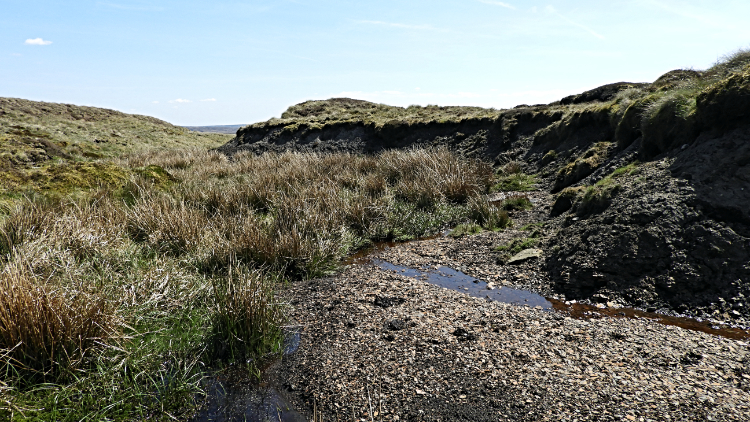 Down in the cut
My true wilderness walk was now ahead of me. Like it had been when I sat at Great Shunner Fell when I had to set a course across to Buttertubs so it was here at Lovely Seat. It just looked so more remote here, as it is. I had the GPS of course, so I could not go far wrong, but the line drawn and assimilated into the line to take, showed no sign of any previous paths at all. Just a bleak mass of peat moor to cross. Wilderness dead ahead. But I knew after two miles I would reach a Shooting Box and from there a hard shooters trail leading off the moor. Just two miles of the unknown then. Off I went and I left the safely of the summit of Lovely Seat not in trepidation but in anticipation of adventure. I was not to be disappointed.
 The heart stopped a beat moment
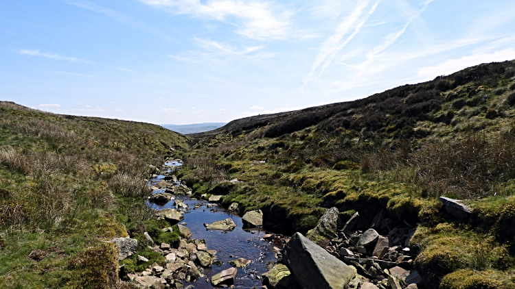 Cogill Beck
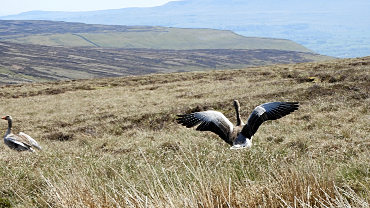
First the going was okay on a slight descent from lovely Seat on a roughly eastwards course to Cogill Head Hags. A few collapsed peat hags and dry tarns had to be crossed. easy going really if a little meandering. I have learned routes like this are never taken in a straight line. you take the course the immediate land dictates, around a collapsed peat bank rather than up and over it. Much less exhausting. From Cogill Head Hags I reached the beginnings of Cogill Beck, mostly a dry bed at first and sometimes completely isolated from the next stage of the watercourse by a raised hump of moor grasses. On one of these humps, while doing another silly walks stage it happened. All of a sudden the most exciting and most scary moment of my walk occurred. I was stepping over the tall grasses slowly, gently, quietly. Then.... Panic. Flight. Squawk. A clamour of noise, flapping of wings, sudden uproar and loud alarm calls. I had inadvertently disturbed a roost of Greylag Geese, about six to eight adult pairs. I shouted "Sorry, I did no mean to disturb you". I made sure to keep walking away from the roost, expecting eggs or nestlings to be nearby. After a few more squawks and thrashing of wings the Geese calmed down and slowly scuttled back to their hide. Meanwhile I refound Cogill Beck, now a proper watercourse and proceeded to follow its line.
 Black Bank Shooting House
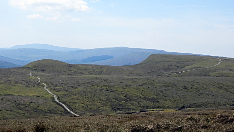 Sargill Side
It was hard staying on the line of the beck as it cut deep and narrow in parts, forcing me first upwards to deep soft moor which in turn forced me back down to the waterline. "Crossing un-pathed moor is not for cissies" I mumbled. Then, after a fifteen minute spell of the hardest arduous negotiation of beckside and wild moor I spotted the site of the Shooting Box. "Rather a grand box" I though and wished to be there immediately. However, another fifteen to twenty minutes of the hard slogging over the tough moor was ahead of me. I was really jiggered when I finally made my ground off the moor and on to hard stand. I had arrived at Black Bank Shooting House. A sign told me so. Rather a grand affair, a well built and well maintain shooting lodge it was. Locked it was but on the far east facing side of the building was a seating area of benches and tables, much like a pub beer garden area. But these benches and tables were all made of stone, probably hewn from the moor. The table tops were granite stone six foot by three foot and about four inch thick. The best made I have seen at any shooting lodge. I sat at one of the tables, took my last chocolate bar and a drink, and then set off to follow the access track home to Sedbusk.
 High Clint
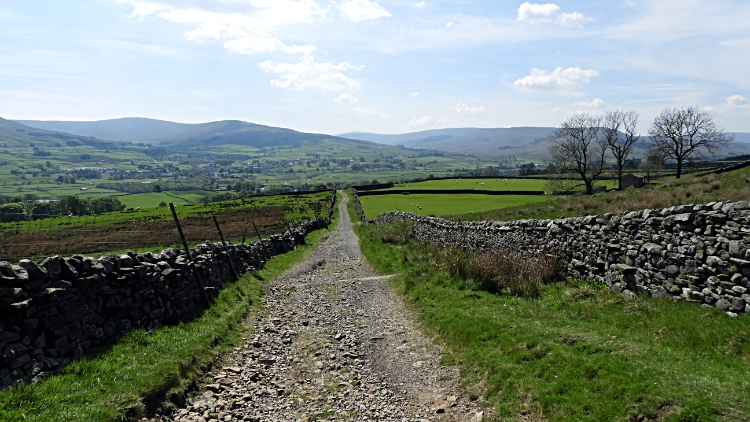 Bridleway leading down to Sedbusk
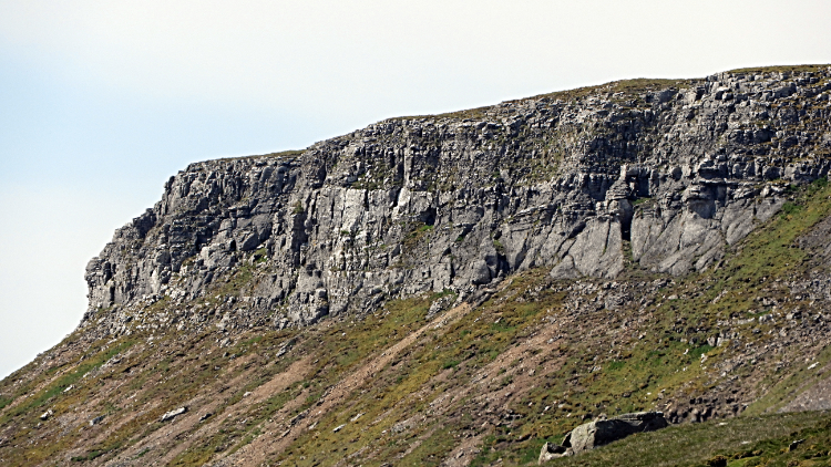
Following the track was an absolute delight. It was gently downhill all the way to Sargill Side where spoil hills revealed the evidence of long abandoned lead mines. In fact as I had walked down to Sargill I had looked across to Blackstone Edge where more evidence of olden industry was evident including collapsed buildings and scattered slag heaps. And of course the effect of hushing, scoured hill slopes anything but natural. Up here scars disappear very slowly. From the unnatural sights of the outlying moors and Sargill Side I walked further on the track and came to the beautiful natural sights of exposed limestone cliffs at High Clint and Little Fell Clint. Between the two natural outcrops was the striking small rounded Smuker Hill. An area of limestone jewels.
 Sedbusk
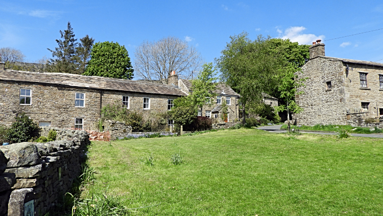 Gorgeous village green of Sedbusk
From the limestone outcrops the final descent to Sedbusk was steeper; in fact the steepest drop of the whole walk and with around thirteen miles of walking under a hot sun behind me I had to make sure I kept the brakes on. Many a time on the last stages of a walk like this I have relaxed and stumbled. I wanted no repeat performance. And good enough, I wearily ambled into Sedbusk with emotions glowing as much as that radiating from my sun kissed face. I had completed a wonderful walk. Simply awesome in fact and there was still one bonus moment to come. As I sat on the village green bench to remove my boots and socks and to air my feet a Blackbird flew down from a tree and stood on the far side of the bench beside me. We looked at each other for about thirty seconds before he flew to ground and hopped under the bench to rummage for insects. A minute later he flew back up to the bench, briefly eyeing me again and then flying back to the tree from where he had come. Now that was a fitting end to my wonderful day.


