The Great British Walk
A personal record of my three month walk of the full length of Great Britain from north to south with written journal and photographs. Tracklogs for GPS units and for use with Google Earth are available for download for each stage.
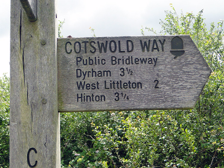
Stage 61: Hawkesbury Upton to Cold Ashton
Google Maps Open Source Maps| Statistics and Files | ||
|---|---|---|
| Start: Hawkesbury Upton | Finish: Cold Ashton | Distance: 13.5 miles (21.7 km) |
| Time: 6-7 hours | Climbing: 431 metres | Total Distance: 841.0 miles |
| GPX Route File | Google Earth File | About Dursley |
| Statistics | |
|---|---|
| Start: Hawkesbury Upton | Finish: Cold Ashton |
| Distance: 13.5 miles (21.7 km) | Time: 6-7 hours |
| Climbing: 431 metres | Total Distance: 841.0 miles |
| GPX Route File | Google Earth File |
Ordnance Survey Explorer Map (1:25,000)
Summary
The penultimate stage of my Cotswold Way walk had a very different feel to it. At 13.5 miles it was just less than the previous stage but the climbing was almost halved. Although I ascended to over 200 metres height during the walk it did not seem like it, the terrain having a much easier feel than the previous five days on the Cotswold Way. I could call the walk the 'rural villages stage' as I visited quite a few without remotely seeing a town. From Hawkesbury Upton the route took me on a downward course to the village of Horton and beyond before I gently climbed to Little Sodbury. A short ascent to an old hill fort was the only taxing climb of the day. From the hill fort I ambled to Old Sodbury and across countryside to Coomb's End and through Dodington Park to reach the time forgotten village of Tormarton. Then I crossed over the M4 motorway to high and wide open upland before descending to the village of Dyrham. From there I walked through woodland and across more even countryside to cross the A420 and finish my day in Cold Ashton.(Note: My walk of the Cotswold Way was a part of my Great British Walk from the north coast of Scotland to the south coast of England)
Stage Report
It was the second gorgeous morning in a row as I set off from Hawkesbury Upton on my last but one day on the Cotswold Way. As I walked through the village back to the start of the official route near the Somerset Monument I met just one local person, a man walking his dog. Not surprising, it was 8.30am on a balmy Sunday morning in mid summer.
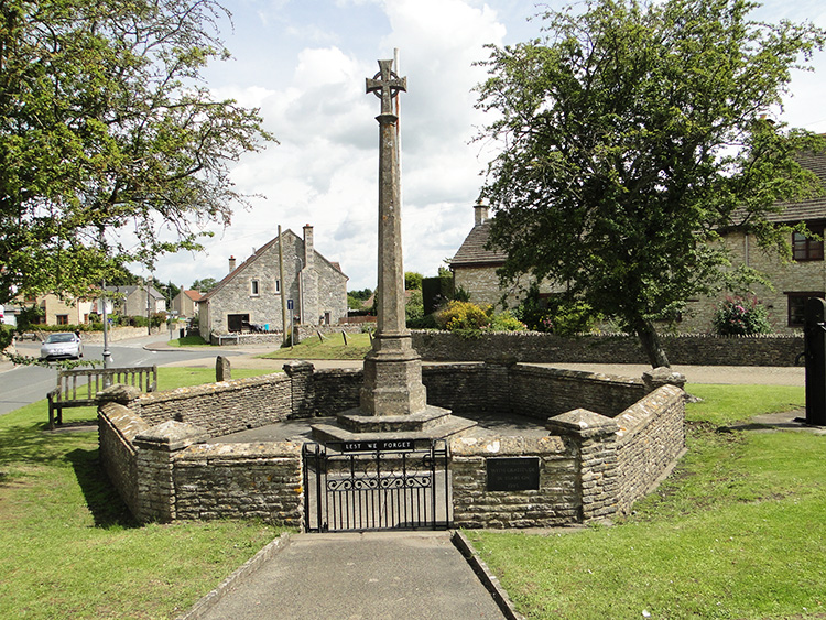 Hawkesbury Upton
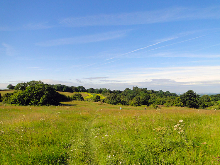 Grass meadow near Horton
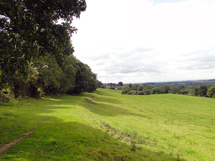
I followed Bath Lane in a due south direction from the monument. I guessed it would not take me all the way to the end point of the Cotswold Way in the City of Bath, just part of the way. Still it gave me an indication I was getting close to the end of my walk. The going was certainly different today. It seemed so easy as I walked along field sides and through luscious grass meadows as I approached Horton. While just one person had been outdoors when I had left Hawkesbury Upton there were a few people wandering in the grassland near to the path. They were staking out areas of grassland and erecting signs. I enquired as to what they were doing as I passed. They told me they were setting out the ground for a local wildflower identification exercise. More people would join them later to count and identify species. I could see plenty of varieties myself though I could offer no help at all in identification.
After crossing the grass meadows i came to a small area of woodland and began to walk through it. Just as I did so some people in exercise gear ran past. There were about a half dozen of them, each one greeting me with a "Hi" and wave or both. I walked a little further through the wood and they passed me again going in the opposite direction.
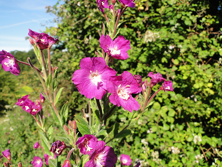 Colour near Horton Court
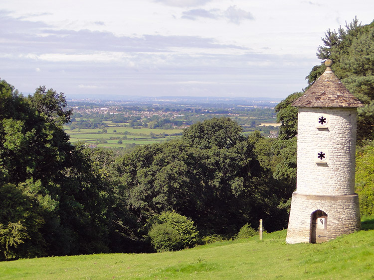 Horton Court Folly
I came from the woodland into the light and into a relative peace and quiet. It had been busy in there. Immediately after clearing the wood I entered the grounds of Horton Court. There was an interesting single round turret building in the first field within the grounds and I went over to it to take a closer look. A notice pinned to the structure said "Working for Wildlife 2000: This folly is erected as a millennium project to provide nesting places for swallows and barn owls, which are in decline due to loss of habitat. These birds only roost in buildings, so leave old disused structures or sheds for their use". The folly pleased me and I hoped it was used by those intended.
From the grounds of Horton Court the path led me into the village of Horton. Here I met the small group of active people I had met in the woods. They told me they were members of a local running and walking group from the nearby town of Chipping Sodbury. They said they were about done for the day. I told them I had a long way to go.
 Cotswold Way near Little Sodbury
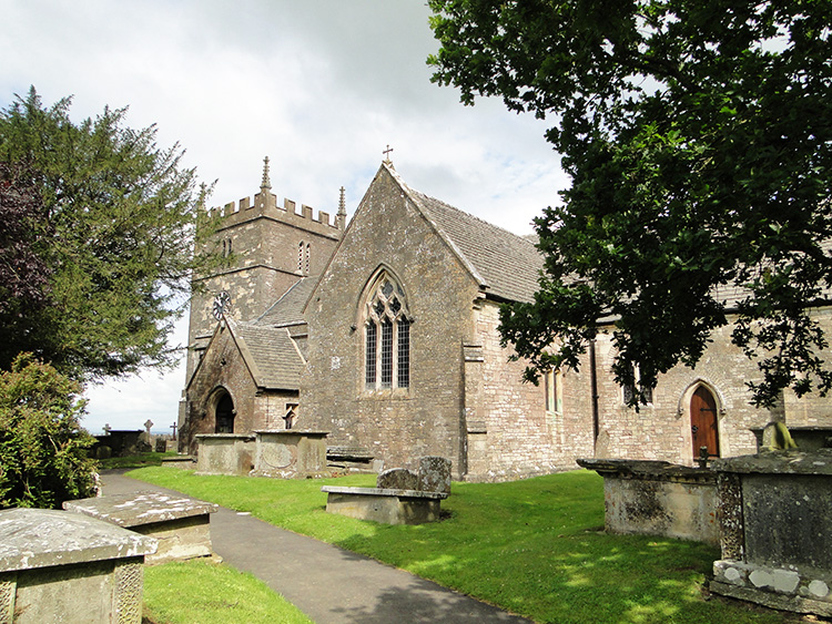 St John the Baptist, Old Sodbury
After walking through Horton which effectively involved the crossing of a road I crossed a series of low level fields to Little Sodbury. It was very easy going. I arrived in Little Sodbury at 10.00am. As soon as I had arrived in the tiny village I met a lady sat on a bench next to the church looking out over the countryside. She greeted me warmly and for the next twenty minutes we talked about all kinds of everything relating to countryside and nature. Where did the time fly? It did though and 25 minutes after meeting her I said my farewell and then I made my first significant climb of the day, all of around 50 metres through Little Sodbury Wood and up what was now the diminished Cotswold scarp line to reach Sodbury Camp Hill fort As with most old English hill forts there was an impressive raised bank all around the fort. Despite my 25 minute break talking to my fleeting friend in the village I still had time on my hands so I decided to walk all the way around it before setting off to Old Sodbury. Ten minutes later I had reached Old Sodbury and walked through.
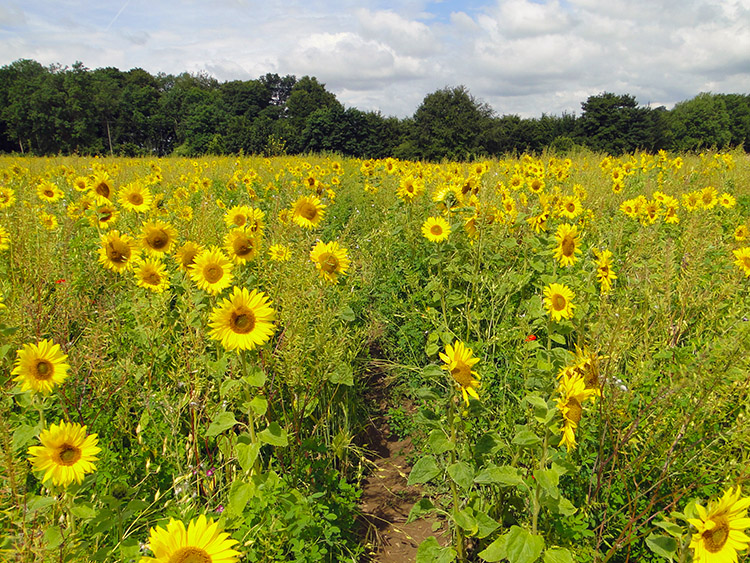 Sunflower field near Tormarton
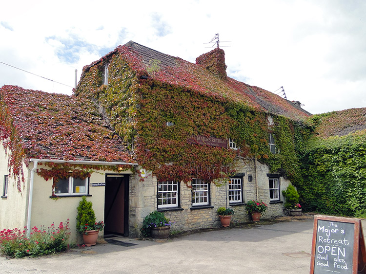 The Majors Retreat, Tormarton
Having come down from the low Cotswold Escarpment after leaving the Sodbury Camp Hill fort I had stayed just west of it through Old Sodbury and the neighbouring hamlet of Coomb's End. Straight after I climbed back up the bank, another easy 50 metre and no more climb which led me into the fields of Dodington Park. The fields in the park were big and airy. Crossing one of them I passed three walkers going the other way. They were some of the few I had met on the Cotswold Way, I had expected more. My passage through Dodington Park led me to the Cotswold Way crossing point of the A46. On the far side of the road I entered a field and had a William Wordsworth moment. "I saw a crowd, a host of Golden Sunflowers". Yes, I know his flowers were Daffodils but it was now midsummer and they were past. Sunflowers were my pleasure and it was so colourful and dazzling to walk through the field of them. In some way I did not want the field crossing to end. It was fantastic.
Crossing the field of glory led me into the village of Tormarton. It was noon and having walked for around three hours on a hot Sunday morning I hoped to find a shop in the village. I looked and looked but could not find one. I needed a drink and I wanted a break so I decided I would go to the village pub for a soft drink and a snack. Was there a pub? I looked around a little further and then I spotted a chap with a walking stick slowly making his way through the village. "Is there a pub in the village?" I asked. "Yes indeed there is, the Majors Retreat around the corner. I am going there now. Come along with me". It was about 12.10pm when we arrived. The pub was closed and I thought my hopes were dashed. "Doesn't it open on Sundays?" I asked. Yes, when I get around to it" he replied. He was the pub owner! "Things are a little different around here" he said and as he opened up a chap arrived who turned out to be his barman. "Get the lad a drink" he said and soon after, being the first and only customer at the time I got my pint of orange and lemonade, a bag of crisps and a bag of nuts to keep me going. There were no sandwiches or hot food on offer. Still I was so grateful and I went to sit on a bench in the pub garden to enjoy my refreshment break. As I did so more patrons of the pub arrived. They knew not to rush.
 The way to Dyrham
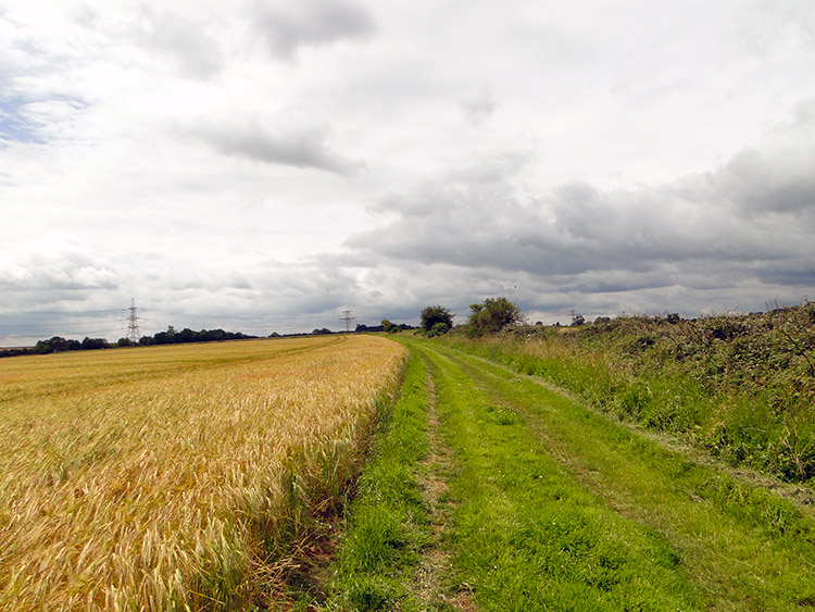 The long field lane
I continued on my way from Tormarton with a smile on my face and a warm feeling inside. The fun I had meeting the flower identifiers in the fields near Horton, the group of runners in Horton, the lady in Little Sodbury and the eccentric pub owner in Tormarton were all bonuses that made my day so extra special.
After leaving the village I crossed the Marshfield Road bridge with the permanent drone of the M4 traffic beneath me. After crossing the bridge the walk continued on a line almost parallel to the motorway which was along the edge of a series of grain fields. It was the most boring part of the walk as I passed one field after another, the long field lane being unchanging for a full kilometer. From the long drab line walk I turned onto Beacon Lane which enclosed me in from the tedium.
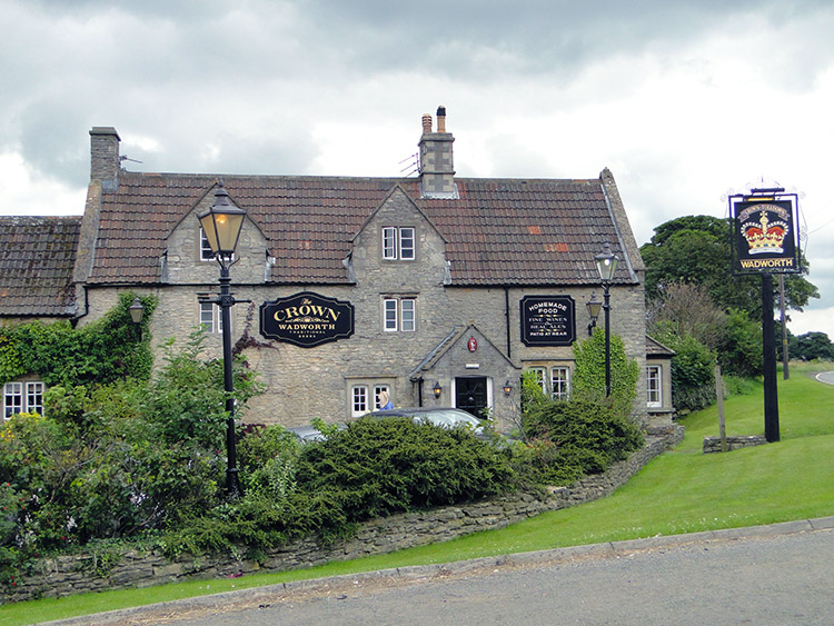 Crown Inn, Tolldown
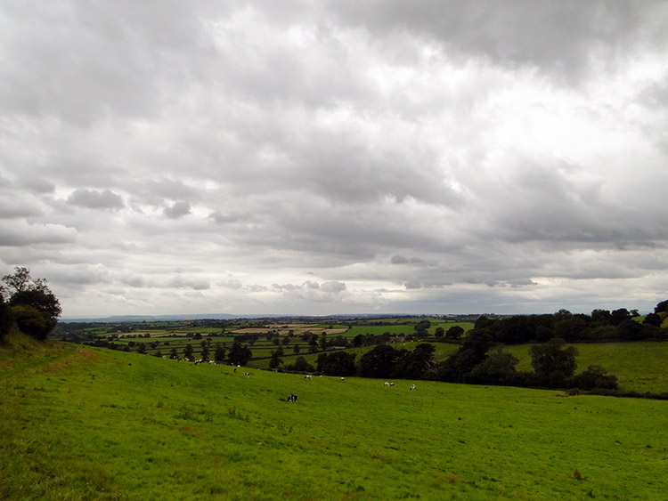 Dyrham Park
 I emerged from the lane near to the Crown Inn, Tolldown which I walked along a stretch of road to, thus making a slight diversion from the official line of the Cotswold Way. Cloud had filled the sky which had been so bright and cheerful in the morning and when I reached the pub it had its outside lights on. It was one o'clock in the afternoon in July. After viewing the pub I walked a short way down another side road to rejoin the Cotswold Way and soon after I was away from road and into the pasture fields of Dyrham Park. I descended 70 metres while walking through the fields to the village of Dyrham. Since being in Dodington Park, through Tormarton and across to Dyrham I had been walking at around 190 metres altitude on the higher ground of the Cotswold Hills. You could have fooled me. The walking had been as flat as the Vales of York and Mowbray in my native North Yorkshire. I had been walking across the top table.
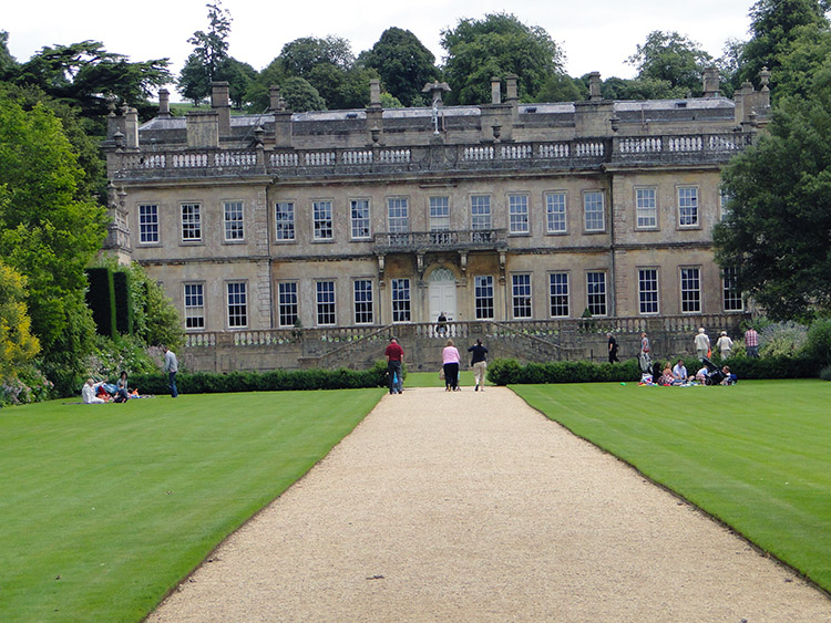 Dyrham Park House
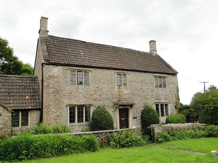 Cotswold House in Dyrham
I reached the village of Dyrham which is dominated by Dyrham Park. The grand mansion house, gardens and deer park are listed on the National Register of Historic Parks and Gardens. The estate dates back to the Domesday Book of 1086 when there were 34 households and it is now managed by the National Trust. here were plenty of visitors to Dyrham Park when I walked past.
From Dyrham I walked across a few fields before making the biggest climb of my day, up 70 metres through Dyrham Wood to level off at over 200 metres height. Once again I was on the table top of the Cotswold Hills, despite the elevation not noticeable at all. A few more field, lanes and couple of road crossings later I reached my end point for the day in Cold Ashton. It had been a joy walking across the countryside of South Gloucestershire and quite a contrast to my previous days on the Cotswold Way. The villages I had visited and the people I met within them were unforgettable experiences.


