Cadair Idris and Mynydd Moel by the Minffordd Path
In my humble opinion this is the most exciting circular walk of Cadair Idris. Beginning from the south of the mountain at Minffordd the ascent is steep from the start as the path climbs through the woodland clinging to the sides of precipitous Nant Cadair Gorge. The path gives occasional glimpses of water tumbling down the gorge where there are some impressive waterfalls. From the gorge the Minffordd Path circuits the glacial lake of Llyn Cau to the south and west, steadily gaining height as it progresses to Craig Cau and ultimately to the top of the mountain at Penygadair. From the summit of Cadair Idris the walk continues east on the lovely airy breast of the mountain while gently sweeping down to the satellite mountain of Mynydd Moel. Fantastic views are enjoyed throughout the time at height and continue to thrill on the descent to Moelfryn and back to the path walked earlier through Nant Cadair Gorge.
Google Maps Open Source Maps| Statistics and Files | ||
|---|---|---|
| Start: Minffordd | Distance: 5.7 miles (9.2 km) | Climbing: 1,019 metres |
| Grid Ref: SH 73132 11618 | Time: 4-5 hours | Rating: Hard |
| GPX Route File | Google Earth File | About Cadair Idris |
| Statistics | |
|---|---|
| Start: Minffordd | Distance: 5.7 miles (9.2 km) |
| Grid Ref: SH 73132 11618 | Time: 4-5 hours |
| Climbing: 1,019 metres | Rating: Hard |
| GPX Route File | Google Earth File |
Ordnance Survey Explorer Map (1:25,000)
The Walk:
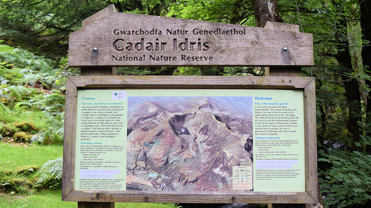 Information board showing the challenge ahead
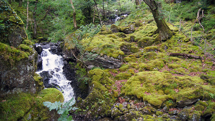 Nant Cadair
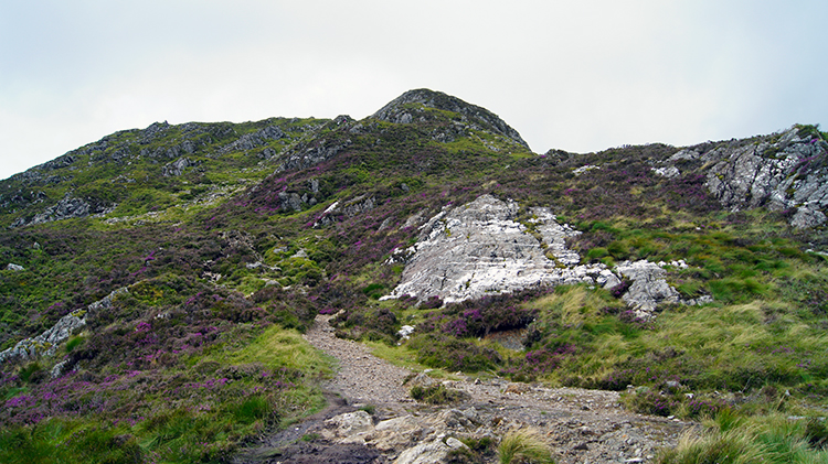
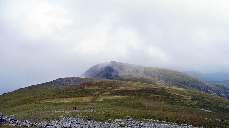
I was with Chris, Dave and Steve and after a night of conviviality in Aberystwyth and a fulsome breakfast we arrived in Minfforrd raring to go. Having crossed Cadair Idris before during my Wales Coast to Coast walk and knowing the delights in store I had bulled up the greatness of Cadair Idris. I was hoping they would agree as we set off walking which took us immediately to the steep climb up the gorge of Nant Cadair. It is a 1:5 climb as 200 metres of height are gaining in the first kilometre of walking. We needed the energy provided from the breakfasts. The hard walk on a good path, often stepped, was tempered though by the beauty of the gorge. The woodland clinging on the sheltered slopes is ancient with lots of cranky gnarled trees attracting our attention. The roar of the waters of Nant Cadair also drew us to look to the fast flowing torrent which is jeweled with tumbling cascades. Though the climb up the gorge was hard and quite often broken by breaks in progress to catch our breath it was always entertaining.
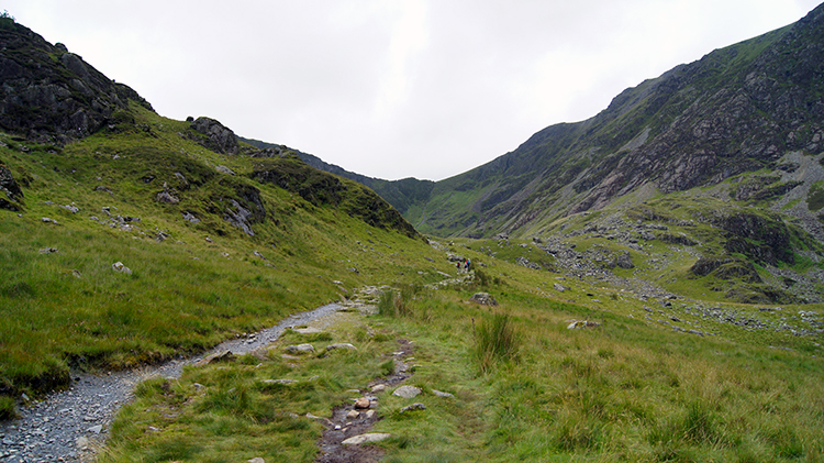 On the Minffordd Path
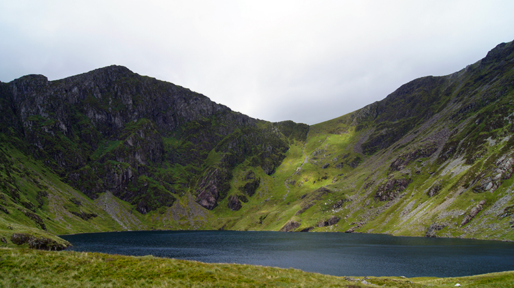 Cwm Cau with Llyn Cau as its centerpiece
We emerged from the shelter of the gorge near a clapper bridge which crossed Nant Cadair. I told the lads we would be crossing the bridge on our return. For now we stayed on the left hand/ west side of Nant Cadair and continued following the Minfforrd Path on a course turning from northwards to westwards and in the direction of Llyn Cau. As we walked my colleagues appreciated the beauty of Cadair Idris for the first time. It had been shielded from view in the gorge. First to draw their attention was the massive south facing cliffs of the mountain stretching between Penygadair and Mynydd Moel. As they admired the mass of the mountain I tempted them with an awesome sight a little further up and around the corner. About a kilometre later we came to the point of my promise. We had crested to an enclosed upland plateau and to the point where Cwm Cau appeared in view. A group of walkers who had been ahead of us were stopped at the same place and sat on a glacial rock slab taking in the view while sitting for a refreshment break. We walked across to the huge rock and did the same. Cwm Cau is a glacial hollow with Llyn Cau its centerpiece. The picture is perfect with west and south facing cliffs surrounding the hollow. Sweeping our eyes from left to right and then back again as Wimbledon tennis spectators do we admired the glorious natural sight. Cwm Cau is a sight to behold.
 Craig Lwyd
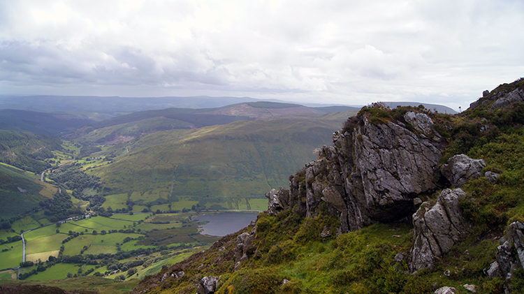 The view south to Minffordd and beyond
Though the boys were eager to continue the ascent I dallied at Cwm Cau, taking in as much of the scene to impress my memory as I could. Reluctantly I turned my eyes back to the task of climbing via the Minfforrd Path to Craig Lwyd and further. From the start, and as we had climbed, cloud had filled the sky, but as we gained height it thinned. Perhaps we would get a little sunshine on top of the mountain? Despite the cloud, it was high and thus the views allowed us were good ones. As we climbed around and over Craig Lwyd the views south to Minfforrd, Tal-y-llyn and the valley of Afon Dulas were most attractive to cast eyes upon.
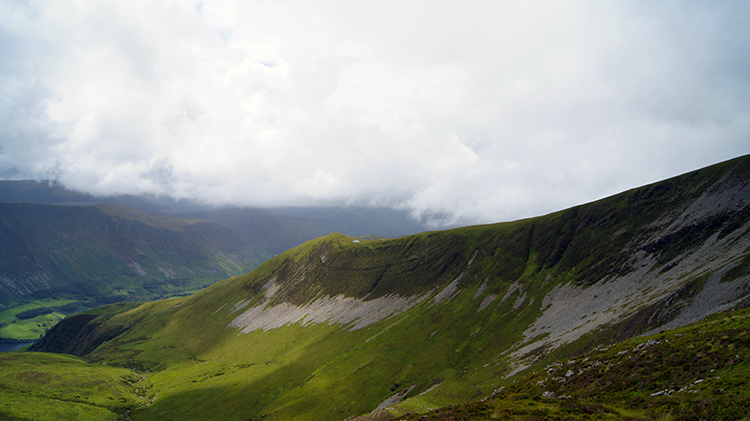
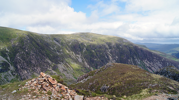 View over Cwm Cau to Mynydd Moel
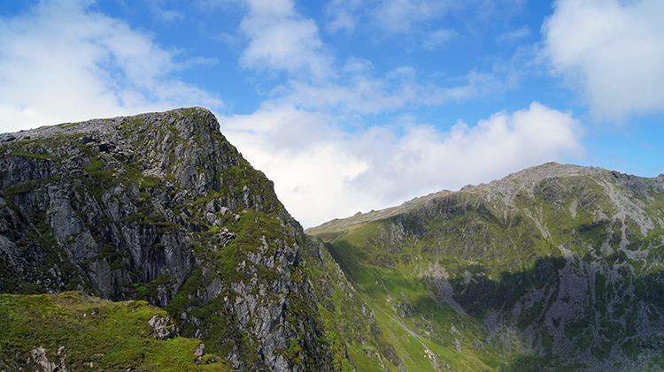 Craig Cau and Penygadair
We reached the 600m height level after Craig Lwyd and though we were still climbing the gradient had eased. As if the climbing of over 500 metres was a celebratory moment the sun came out to greet us onto the higher slopes of the mountain. While we still had just short of 300 more metres to climb it did not seem so bad now. Sunshine does that. Also, this part of the Minfforrd Path, above the south side of Cwm Cau, is where the most spectacular views of the surrounding cliffs are to be had. The view straight across the chasm of Cwm Cau to Mynydd Moel were remarkable. The view to the pointed peaks of Craig Cau to the fore and the ultimate goal of Penygadair were a thrill to look upon. Having these top ranking mountain views in a spell of sunshine was brilliant. And unexpected. One of my WOW moments.
 Craig Cwm Amarch
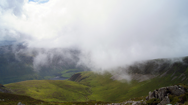 Cloud sweeping in from the west
The sunshine was fleeting though I appreciated it coming to us at the perfect time. As we turned from walking on the slopes above the south of Cwm Cau to the Minfforrd Path crossing Craig Cau on the west side of Cwm Cau I spotted a bank of cloud coming in from the seaboard just north of Aberystwyth. It was not wasting anytime to reach us. I stood and looked at the shapely form of Craig Cwm Amarch which falls away in an even contour to the west. One minute I could see it. The next minute I could not see it. Cloud took the scene. I hoped it was a temporary whiteout.
 Head in the clouds
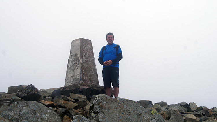 Chris celebrates at the summit
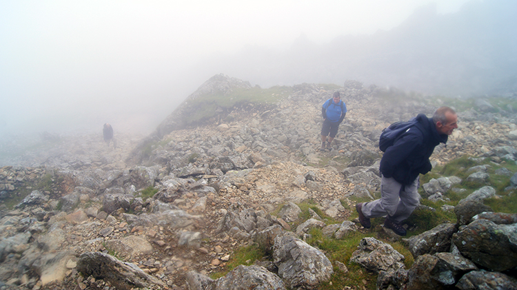
The climb to Craig Cau and then the crossing of the gapland to the summit of Cadair Idris at Penygadair were done with our heads in the clouds. As we had no views to enjoy we amused ourselves with the views immediately local to us and with conversation. There was more entertainment provided in the temporary closed in environment by our meeting with a group of walkers from Liverpool. First we met four gentlemen and one lady who were going in the opposite direction to us. All we hunkered in their warmest clothing as they walked for the cloud had plummeted the temperature at out height of what was now over 750 metres. "Great fun" we all agreed and indeed it was. One of the chaps added "I don't think the rest of our party will agree though. You will see". About 50 metres further on and around a minute later we met the rest of the walking party. The three ladies were not smiling. One said "When we set out we were told it would be fun. Fun? we're cold and we want to go home". We offered consolation. Perhaps it made for light hearted conversation in the group during their evening's entertainment. I hope so.
We continued our climb to the top of Cadair Idris, the final section of walking being on a path meandering in, out and around rocky outcrops and boulder fields. It was fun. And as the final climb to a mountain top and usually the hardest with heads down as much as up looking ahead then the lack of view was a tempered disappointment. At least I could reflect in the fact that my last time on the summit of Cadair Idris was in perfect conditions. Now I was to see another mood of the mountain top. Chris hit the summit first.
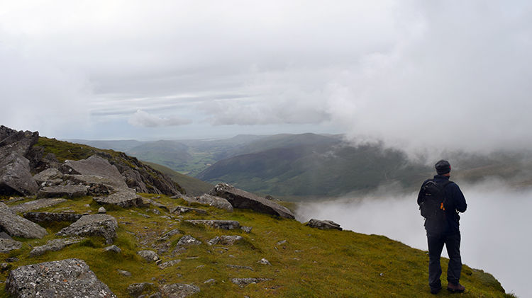 I look out to sea from Cadair Idris
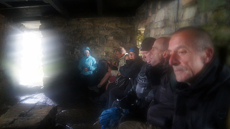 Taking shelter
Having touched the trig point myself, the cloud that had spread itself over the top of Cadair Idris began to dissipate. I walked out to a point just west of the summit to watch the low cloud break down. As it did so views across to the coast unveiled once more. It was moody and most reflective. And for me personally it was another WOW moment as the magnificent picture was un-drawn just as a curtain is. While I looked out over to the west the boys had retired to the mountain shelter on Cadair Idris for lunch. I joined them to see the shelter was fairly well occupied. Where had everyone come from? The Pony Track from the north no doubt, on the very path I had climbed Cadair Idris the first time.
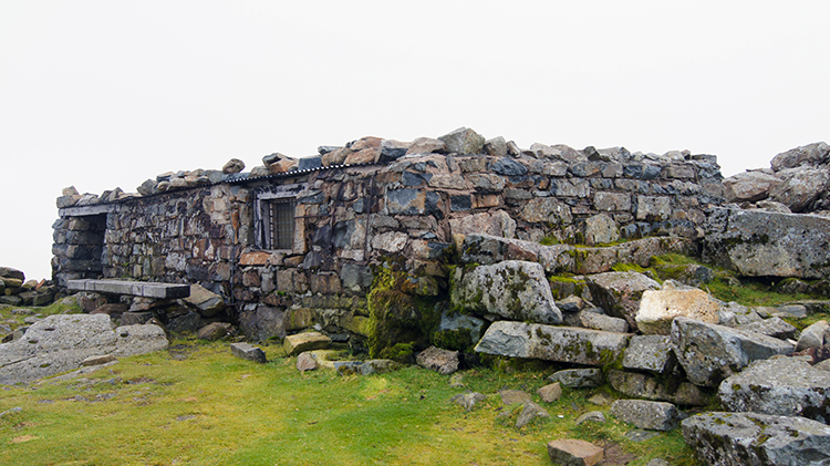 Mountain shelter on Cadair Idris
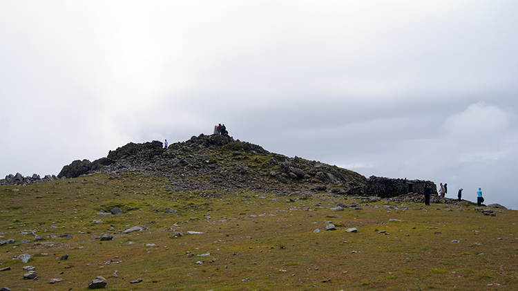 Penygadair
Though cloud had lifted from the mountain a higher bank made sure any sunshine didn't return. "Oh well, at least it is dry and thankfully we have the views to enjoy again" I mused. Having finished lunch and having wished our fellow walkers well, we left the shelter and resumed our walk by heading north-east from Penygadair to Mynydd Moel. I looked back to see more walkers arriving at Penygadair and claiming their moment of achievement at the trig point. Well done all.
 Walking from Cadair Idris to Mynydd Moel
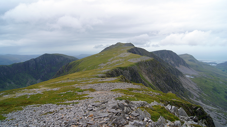 Looking back to Cadair Idris
Cloud continued to lift from the wide and easily contoured summit plateau between Cadair Idris and Mynydd Moel. It is so grand that you could play a football match up here. I thought there were not many mountain tops at over 800 metres high where you can do that. It is an impressive high flatland. Looking forward on the walk to Mynydd Moel is good enough but as you near the satellite summit and look back across the scene to Penygadair it is even better. The slope seems to rise like that of a take-off platform on an Aircraft Carrier. Thoroughly remarkable in my eyes, alluringly beautiful. The backdrop of smaller mountains such as Carnedd Lwyd and Mynydd Pennant leading the eye towards the sea add to the picture.
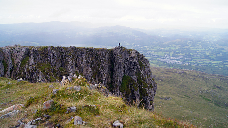 On the edge of Mynydd Moel
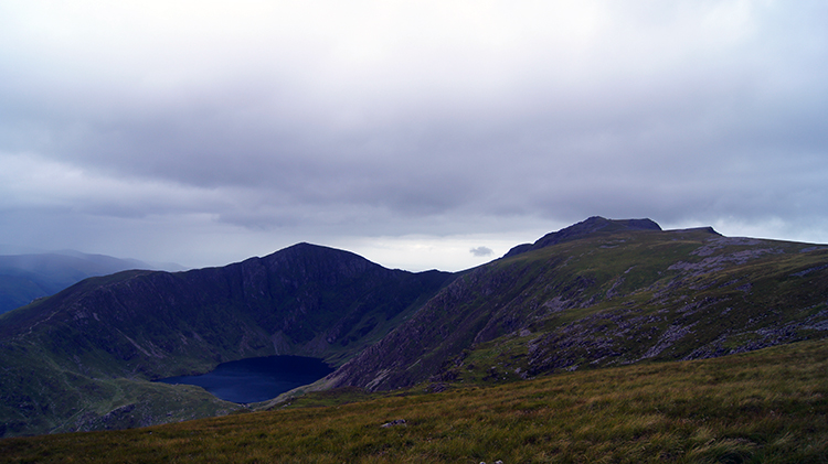 Llyn Cau, Craig Cau and Penygadair
We reached Mynydd Moel. I could not get enough of the stunning environment around and having spotted a narrow spit jutting out to the north was an attraction I could not avoid. I raced across to stand on the very edge, to the prow of the spit before it plunged away from vertiginous cliffs to 100 metres below. Thrilling to me, mad to my friends. And then, after reaching the cairn at the random dispersal of boulders and smaller rocks which mark the summit of Mynydd Moel we began the descent back to Minfforrd. The journey home. A cracking view of Cwm Cau revealed itself one more, this time a view from the east which gave the full picture.
 On the way down
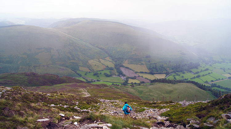 The path gets rougher
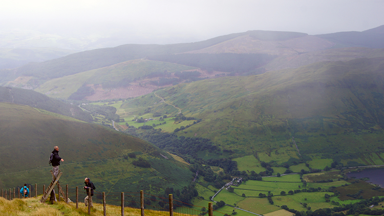
The path home was not clear at first so we simply descended the upper south bank of Mynydd Moel on the true south bearing. The map showed we would come to the fence line which would lead us down. Though it was not really necessary my GPS confirmed the fact. We could see where we were going and we could also see other groups in front of us. At first the going was very easy on a good grassed bank. We came to the fence line and to a ladder stile leading over the fence which confirmed the continuation of the path down. The gradient steepened as we dropped height. The path became broken. Loose rocks, more like scree lined the path. Where previous walkers had slipped and slid on the mud of the path was obvious to see. Care was needed. The path good steeper still. At one point i used the upper wire of the fence as a brake. Others did the same.
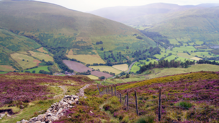 A splash of blossoming Heather
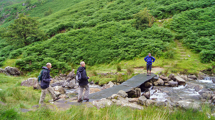 Clapper bridge over Nant Cadair
With care we descended safely. Due to the effort and the attention the climb down took quite some time. We were relieved when the worse of it was over. I looked back at the descent path and I noticed some of the more cautious walkers we had passed on the way down were still quite a way up. They would be some time yet. At around 400 metres we came to a level of ground which was covered in flowering Heather. It always heartens me to see the purple glory of late summer and early autumn on low fells and moorland. We followed the path though the heather and soon after we reached the clapper bridge across Nant Cadair which we had passed earlier on in the day. We crossed the bridge, descended the gorge and finished the walk by having a pot of tea at the cafe towards the end of the path. Job done, all suitably refreshed in mind, body and spirit.


