Mallerstang, Hell Gill, Old Road, Wild Boar Fell and Swarth Fell
Mallerstang which includes the upland expanse of Wild Boar Fell and Swarth Fell is possibly the most remote and least visited part of the Yorkshire Dales. This walk celebrates the area
Google Maps Open Source Maps| Statistics and Files | ||
|---|---|---|
| Start: Aisgill Moor Cottages | Distance: 10.0 miles (16.0 km) | Climbing: 656 metres |
| Grid Ref: SD 77826 96293 | Time: 4.5 hours | Rating: Hard |
| GPX Route File | Google Earth File | About Mallerstang |
| Statistics | |
|---|---|
| Start: Aisgill Moor Cottages | Distance: 10.0 miles (16.0 km) |
| Climbing: 656 metres | Grid Ref: SD 77826 96293 |
| Time: 4.5 hours | Rating: Hard |
| GPX Route File | Google Earth File |
Ordnance Survey Explorer Map (1:25,000)
Summary: Mallerstang is one of my favourite places in the Yorkshire Dales. The attraction to me is that it is so remote in the northernmost least populated part of the national park. Consequently I know I am almost guaranteed peace in solitude when walking in Mallerstang which means I can take my time on walks, absorb in the quiet atmosphere and get close to nature. There is also the natural features of Mallerstang; the valley including Hell Gill and its waterfall and the hills which include Wild Boar Fell, one of the shapeliest in the Dales and Swarth Fell, one of the airiest with a mass of sweeping upland plains. This walk is a gem; a jewel of the Yorkshire Dales.
The Walk: I was returning home from my 60th birthday walking trip. In the last week or so I had completed some walks I had wished to for a long time. I had finally got to Cape Wrath which bad weather caused me to miss during my Great British Walk, I had walked to Sandwood Bay, climbed Suilven and climbed Pap of Glencoe. I had visited Long Meg and her Daughters and after abandoning it in favour of longer Lake District walks on more than one occasion I had climbed Castle Crag too. I had done a few more walks too including ones to Corrieshalloch Gorge and Glen Nevis. This was the last walk of my trip and it had to be special too.
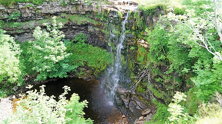 Hellgill Force
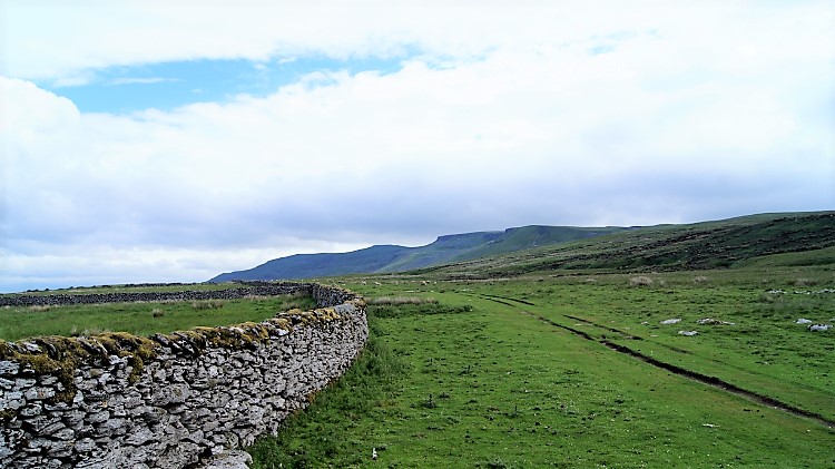 Hellgill Wold
It was not a bad morning at all as I set off from my accommodation in Penrith back home to Harrogate. Had it being raining I would have gone straight home; I had plenty of special walks bagged from the 60th birthday trip. But as it was set fair over breakfast I had thought "Must do Wild Boar Fell again. Only this time I shall add Swarth Fell too". Decision made I arrived in Mallerstang at just after 9.30am and soon after parking up near Aisgill Moor Cottages I was on my way, walking over familiar ground to Hellgill Force. The waterfall was not exactly plunging water down from Hell Gill Beck. A mere trickle that is all, but it was 15th June and the recent weather had been quite dry. Still the setting was as gorgeous as I remembered it. As was the walk in anticipation of what came next while climbing along Hell Gill Beck to Hell Gill Bridge. A mere 50 metres of climbing before I levelled out on the walk north along Mallerstang by way of Hellgill Wold. As I ambled along the path guided by a drystone wall I sensed I was being watched.
 The sheep and the ‘Water Cut’
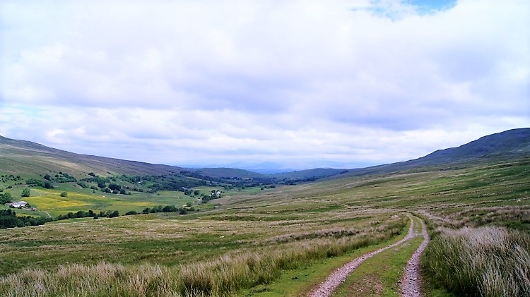 Walking along Old Road, Mallerstang
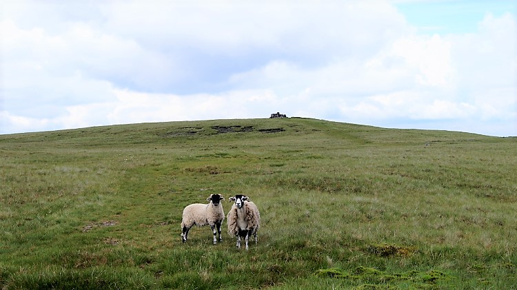
Of course the sheep on the fell were watching me. The ewes all had young lambs to look out for but theirs was a benign observation. So long as I stuck to my walk along the path they would go about their business. Only the ones sprawled out on the path moved. And even then I would try to walk off the path and around those sheep not being attentive, not wanting to disturb them if possible. It was give and take with the sheep, altogether reasonable. The sense of being watched had not been the sheep though. It was the Lapwings. As soon as I had set off walking across the Wold the adults tending eggs or nestlings were off flying over my head and voicing their shrill, wailing cry. As they do they feigned injury in an attempt to draw me off my line. Or more likely to keep me on it; their nest sites being off the path to my right. There were three birds in succession of one another. I played their game and once I was past their immediate area of concern they returned to parenting.
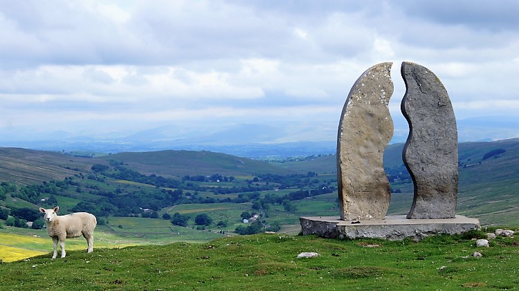
After the cacophony I resumed to the calm of the walk and cast my attentive eyes to an unusual feature looming large directly in front of me. I walked directly on the path to 'Water Cut' by Mary Bourne, a sculpture by which is part of the Eden Benchmarks project. Appropriately sited, it represents the source of the River Eden which at Eden Head was nearby, above me to the right. Also nearby was Ure Head which takes the River Ure into Wensleydale and ultimately out to the North Sea via the Humber. As the River Eden flows west into the Irish Sea at Carlisle, I had just crossed the Penning Watershed. I had not noticed. From the sculpture I headed downhill along Old Road towards the heart of Mallerstang Views of the evolving Eden valley were tremendous.
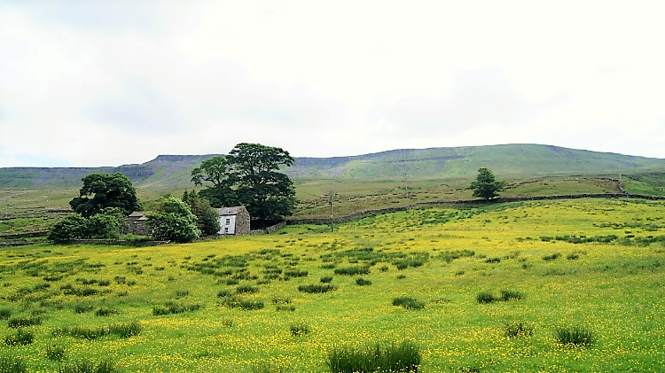 Buttercup delight near Hazelgill
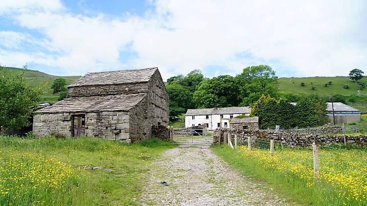 Hazelgill, Mallerstang
The Old Road track led me down into Lower Mallerstang and while descending I often looked left to the towering heights of Wild Boar Fell. It does remind me of Ingleborough, both being flat capped icons of the Yorkshire Dales. Similar profiles, similar heights, 708 and 724 metres respectively. And appropriately one can be seen from the other. I came to my low point of the walk at Thrang Bridge, 269m elevation and spanning the fledgling River Eden. I now had 440 metres to climb. Before so I could enjoy a little of the valley floor, prettied by pastoral meadows, some of them sun yellow with Buttercup. A mix of Whitewash and stone buildings complemented the scene. Drystone walls completed it.
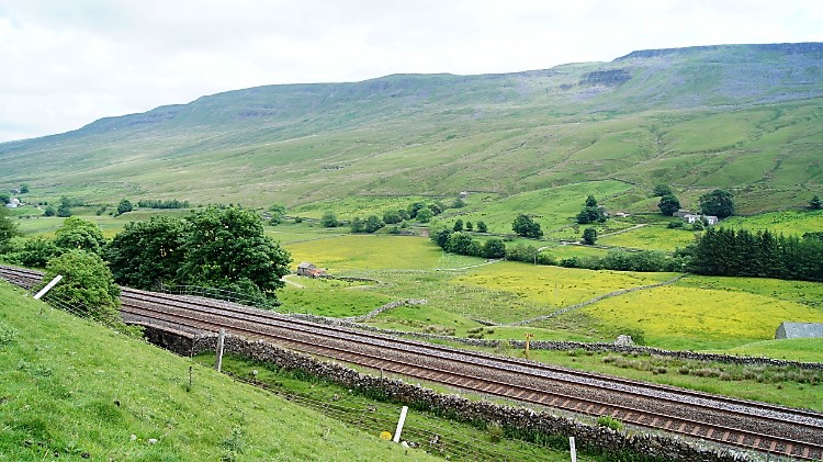 Settle to Carlisle Railway
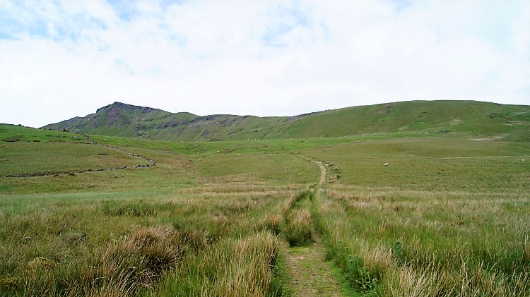 Across Little Wold to High Dolphinsty
After passing close to Hazelgill House I began the climb in earnest, the starting line for the ascent being the Settle to Carlisle railway line. I passed under the railway via a livestock bridge and then began puffing like the old steam trains which used to frequent the railway line. Soon after the initial haul up from the railway to Little Wold I set my sights upon the east facing flank of Wild Boar Fell. Steadily I walked across Little Wold towards High Dolphinsty, the point from where I would make my final climb to the Nab. I recalled the first time I had climbed Wild Boar Fell, cutting off the fork right to High Dolphinsty, instead tracking straight lined up the bank of White Walls. I was with a group of six who all stuck to the path. I had gained nothing, just extra exhaustion from the effort. So this time I stuck to the path, making the extra yards but saving the unnecessary effort.
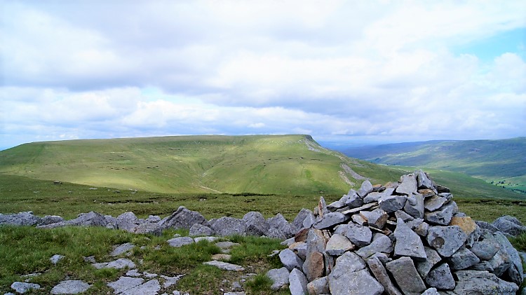
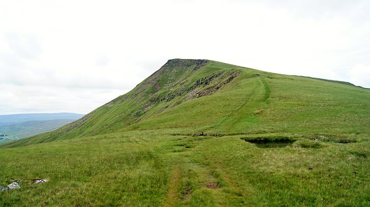 Climbing to the Nab on Wild Boar Fell
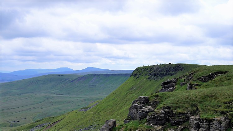 The Cairns, Whernside and Ingleborough
The Nab had been a draw all the way from Little Wold. Its shapely peak is an impressive enticement and once I had crested to High Dolphinsty it looked all the more enticing. Especially as it was within reach to me now. Still I had a deceptive climb of a further 130 metres to attain it. Steadily I set about the work, first on a steady ascent past a small untitled tarn which can be little more than a puddle in high summer. However, and to my surprise it was full of water as I passed by. After the small tarn the climb steepened. I slowed in respect of the gradient, steadily but steadfastly climbing to the peak of the Nab. From my newly earned vantage point I rested a while and took in the gorgeous view south to the Cairns, a group of eight man made structures which stand on the edge of the Wild Boar Fell and Swarth Fell intersection. Just beyond the cairns, a little to the left I could clearly see the profiles of Whernside and Ingleborough.
 Friendly sheep on Wild Boar Fell
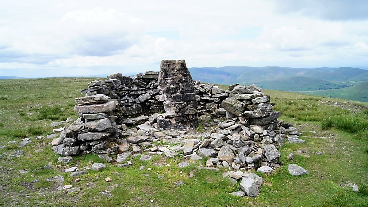 Summit of Wild Boar Fell
After catching my breath and those lovely views on offer I stepped out to cross the relatively flat high plateau of Wild Boar Fell. Noticing it is not entirely flat, more like a convex plain, I crested to the height of the convex where the summit trig pillar stands. On my way I passed a couple of friendly sheep who rather than walking away as I approached appeared to greet me. It was a mother and rather grown up young one. I guess they had not see many people up here, or non aggressive ones anyway. Or perhaps they thought "wonder what titbits this one has got to share". It was not my time for stopping and taking refreshments though so we shall never know. Once I reached the trig pillar which was partly collapsed itself and surrounded by a partly collapsed ring shelter I took a minute to reflect and look around. In view north was the Eden Plain, east the Pennine Moors between Wensleydale and Swaledale which includes Great Shunner Fell. Due south laid the heart of the Yorkshire Dales with Whernside, Ingleborough serving as place-markers. In fact, almost 20 km due south, yet out of sight lies Ribblehead Viaduct. Due west of my standpoint was the Howgill Fells and beyond them the Lake District. Quite a viewpoint it is from the summit of Wild Boar Fell.
 Sand Tarn and the Howgill Fells
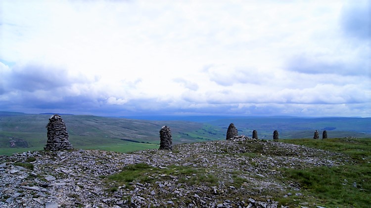 The Cairns of Wild Boar Fell
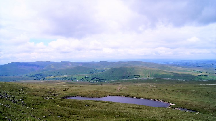
I edged west from the summit to spot Sand Tarn, Wild Boar Fell's highest water. The view of sand Tarn with Ravenstonedale framing the picture is another view to behold on Wild Boar Fell. If up here, I recommend you take it in. I did before starting out on a new walk. Up until now I had followed the route I had taken on my previous walk to Wild Boar Fell and Uldale. Now I was covering entirely new ground as I tracked south east to the group of eight cairns at Yoadcomb Scar which I had seen earlier when standing atop the Nab. Soon I was there; at the Cairns and admiring them up close. Nobody seems to know why they are there, they just seem to have been there an awfully long time. They are similar in relation to each other in shape and in distance between each other as are the cairns at Nine Standards Rigg, but not quite as high. Maybe the same folk built both follies?
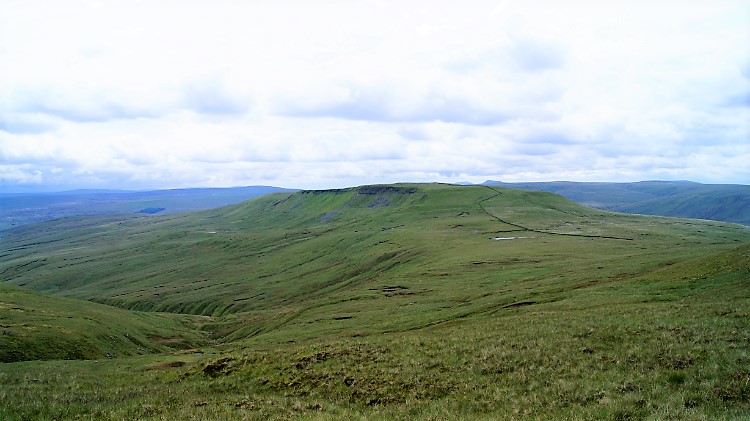 Swarth Fell
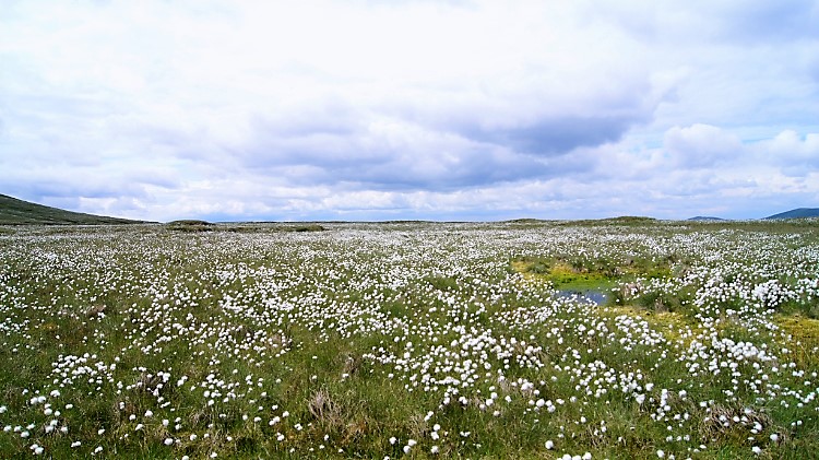 Bog Cotton near Uldale Gill Head
From the cairns I walked a few steps south on the edge of High White Scar and then I stood rigid still and gawped. Mouth wide open and eyes on stalks I feasted on the magnificent swell of Swarth Fell directly ahead of me. It appeared massive, wild uplands filling the picture. And in all the vastness not a soul in sight. I had it all to myself. A good path led me around to the right, all around the Band on the south edge of Wild Boar Fell, a path which would seep me down gently in a smooth curve around Aisgill Head towards Uldale Gill Head. I walked and revelled in the thrill of it. The walk was utterly gorgeous, a sumptuous delight. The path, on a carpet of giving short moorland grass, had just the right spring to make walking effortless. The path led me in a curve around from east to south. Just before I bottomed out in the concave of the dip between Wild Boar Fell and Swarth Fell at Standard Brow/ Uldale Gill Head I passed through a pretty field of Bog Cotton. It was beautiful. At the bottom point I came to an anonymous tarn. It needs a name.
 Summit of Swarth Fell
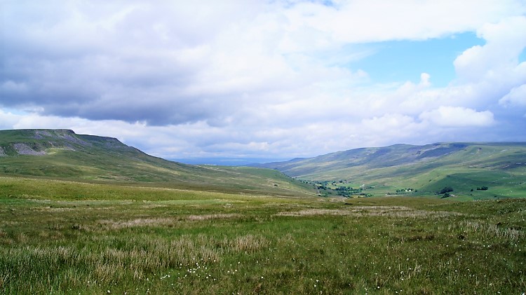 View back to Wild Boar Fell and Mallerstang
From the tarn at around 600 metres elevation I started the climb to Swarth Fell. It was not a tough one, only 80 metres in all and it took me to a new high. Being on top of Swarth Fell was a new thrill for me. There was no formal summit marker up here, just a small pile of stones set in a field of scattered stones. Swarth Fell is by no means pretentious. It a fell blessed for being laid out in its very natural way. Except for a small shelter I found, small and made for just one person to shield themselves from the elements while resting on top of the fell. A couple could not have shared; it was a single person shelter for sure. I crossed the one kilometre length of Swarth Fell top in a south east direction from the true summit to Swarth Fell Pike, all the way enjoying the airy feel of Swarth Fell and the views down to my left, into Mallerstang. As I neared Swarth Fell Pike I looked over the lie of the land and determined my way to get down.
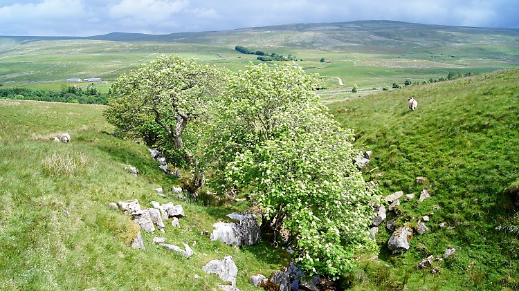 Smithy Gill
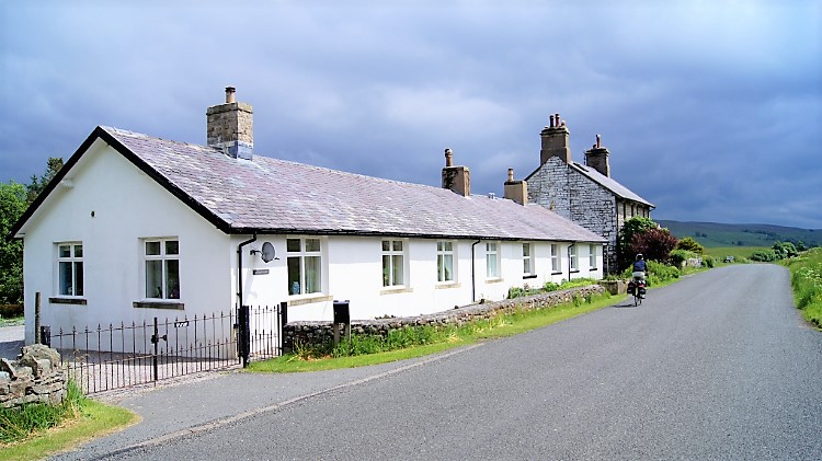 Aisgill Moor Cottages
I decided I would follow Smithy Gill as closely as I could. It would take me in an almost direct line from Swarth Fell Pike to my starting point at Aisgill Moor Cottages, albeit a bit of a dog leg to the right once I had reached the road at Smithy Gill Bridge. With care I tracked down the bank and though I often had to zigzag it was quite an easy undertaking. The profile of the gradient was even all the way as I descended 250 metres in 1.5 kilometres of measured walking. There were the inevitable shimmies down to the gill to admire local views where copses of trees had formed natural havens. They had to be admired. Thereafter a few climbs back up from the steepness of the gill sides. Nothing was too bad. All was fun. And then there I was, at Smithy Gill Bridge and walking along the road back to the starting point. My walk was done. Yes, it was special and a thoroughly appropriate one to cap my week and a bit of walks to celebrate my 60th birthday. With walks like this I am not stopping. For a long time I hope.


