Dallow Moor, Dallowgill Moor and Skelding Moor
This walk is for those who love walking on open moorland with wide open spaces and big skies. From the start at High Skelding the walk heads west along a road to Skell Gill Farm and after passing the farm on the north side heads straight onto open moorland where its unlikely to hear anything but the sound of moorland fauna, particularly the call of moorland birds and of sheep which are scattered all over the moors. The first moor to cross is Dallow Moor and then Dallowgill Moor. There is no discernible transition from one to the other but Dallowgill Moor has the attractive draw of Kettlestang Shooting House where there is an opportunity to rest before climbing the short distance to the trig point on Kettlestang Hill. From the trig point head north as best you can in a northerly direction to meet the road cum track which links Kirkby Malzeard to Bouthwaite. When at the road take time to enjoy the beauty of Dallowgill before continuing the walk east first by the roadside and then over fields to beautiful woodland at Stang Brae which leads to Dallow Hall. From Dallow Hall continue south across fields to Coal Hill before following a quite country road over Skelding moor back to the start.
Google Maps Open Source Maps| Statistics and Files | ||
|---|---|---|
| Start: High Skelding | Distance: 10.2 miles (16.5 km) | Climbing: 293 metres |
| Grid Ref: SE215699 | Time: 4-5 hours | Rating: Hard |
| GPX Route File | Google Earth File | About Dallowgill |
| Statistics | |
|---|---|
| Start: High Skelding | Distance: 10.2 miles (16.5 km) |
| Grid Ref: SE215699 | Time: 4-5 hours |
| Climbing: 293 metres | Rating: Hard |
| GPX Route File | Google Earth File |
Ordnance Survey Explorer Map (1:25,000)
The Walk:
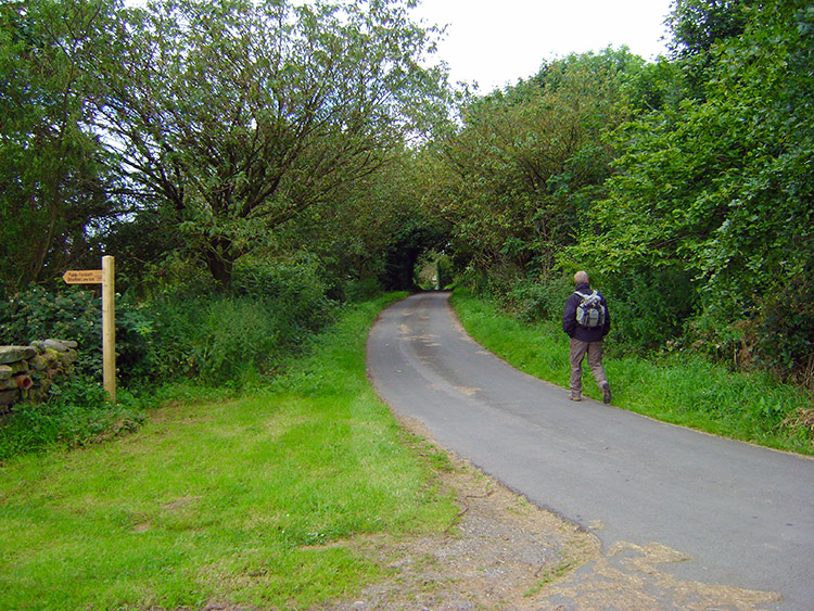 Starting out on the walk from High Skelding
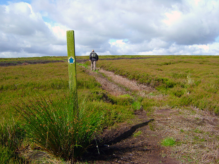 On to Dallow Moor at Skell Gill
Steve and Jan were up from Rugby for the weekend. Jan and Lil planned shopping in Harrogate for the Saturday. What were we to do? It did not take much thinking about, a local walk was required and I resolved to find one I had not done before. Recalling memories of a great walk on Kirkby Malzeard Moor a few years ago I looked in that area of the map and was happy to find Dallow Moor and Dallowgill Moor being just south. Plenty of paths across the moor came to light so I marked out a circular route from High Skelding, drove us the short half hour journey to the walk and by 10.30am we were on our way. Signs were good from the start, it was a lovely morning with plenty of breaks in the cloud revealing good tranches of blue sky.
 Gritstone rock by the track across the moor
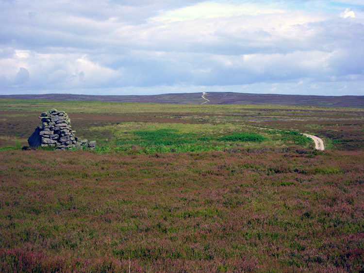
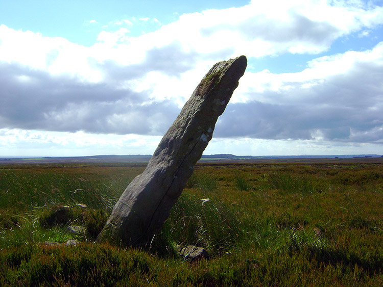 The Long Rod Stone on Dallow Moor
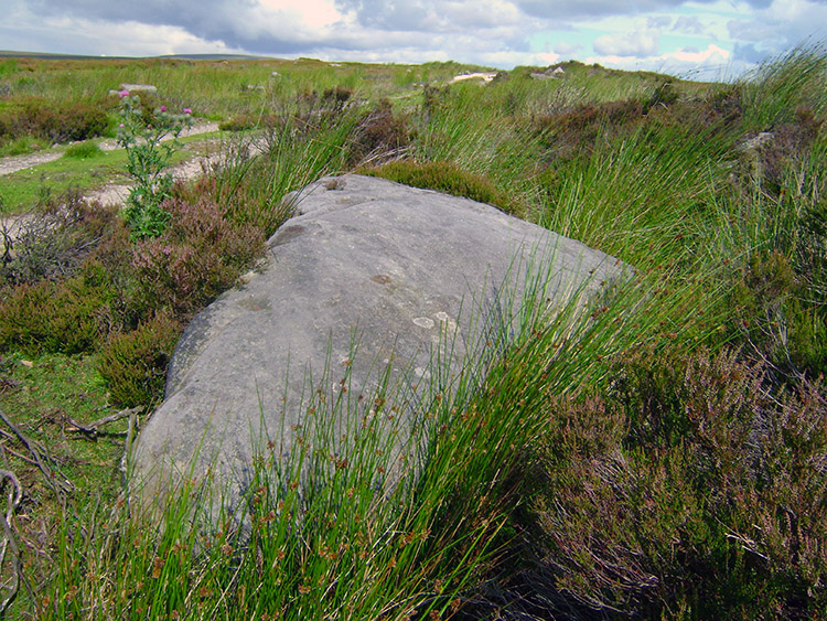
It is great to walk in the open air and in relative solitude while not having to travel so far from home and I was soon into relaxed and walking mode, as was Steve. We strolled briskly from High Skelding along a metalled road to Skell Gill, a farmstead on the edge of the moor and where the road comes to an abrupt end. One moment we were beside fields with curious cattle coming up to the wall by which we passed and minutes later we were onto open moorland with the usual moorland sounds of curlews and ravens from a nearby copse accompanying us. the walking was delightful, very dry underfoot on a good track which took us west and across the deserted Kirkby Malzeard to Pateley Bridge moor road. No real need for the Green Cross Code or Tufty Fluffytail's road crossing procedure here. On crossing the road we continued west and in good spirits while walking on a lovely Saturday morning and on a good track until we reached a standing stone, inclined at 45 degrees which I looked on the map to be Long Rod Stone. I wondered how long it had been there and who had erected it.
 Looking north to Kirkby Malzeard Moor
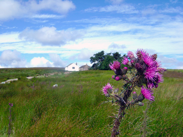 Thistle blossom on Dallowgill Moor
From Long Rod Stone we continued on in the midst of warm sunshine to High Ruckle Hill, all the while looking around at the tranquil scene. To the east we could see over the Vale of Mowbray to the North York Moors and straight ahead to Kirkby Malzeard Moor. To the west the eastern hills of the Yorkshire Dales were shielded by Kettlestang Hill. Continuing on we walked round the track and over South Gill Beck until we reached Kettlestang Shooting Lodge where we took a refreshment break.
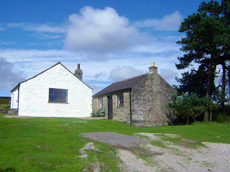 Kettlestang Shooting Lodge
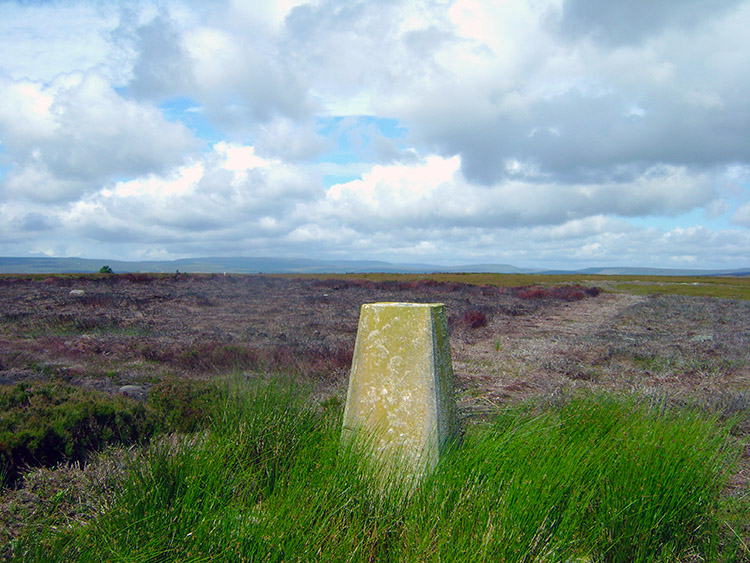 Trig point on Kettlestang Hill
Kettlestang Shooting Lodge was very well maintained, obviously used quite a lot and as we were walking on the last Saturday in July it would be in use very soon. For today, Steve and I were the only people around and we sat in shelter of the lodge, me on a bench and Steve by the lodge wall while looking over the lodge's water pond and across the moor to the south and towards Leeds and Bradford. Otley Chevin was a focal point. After our break we left the lodge and followed a beeline up to the summit of Kettlestang Hill. We had left the track now so following coordinates were required but it was easy to climb to the crest of the hill, albeit in not too much haste as sheep trods were useful to find but hard to see. The effort was well worth it though. from the trig point I could now see the eastern hills of the Yorkshire Dales including Great Whernside.
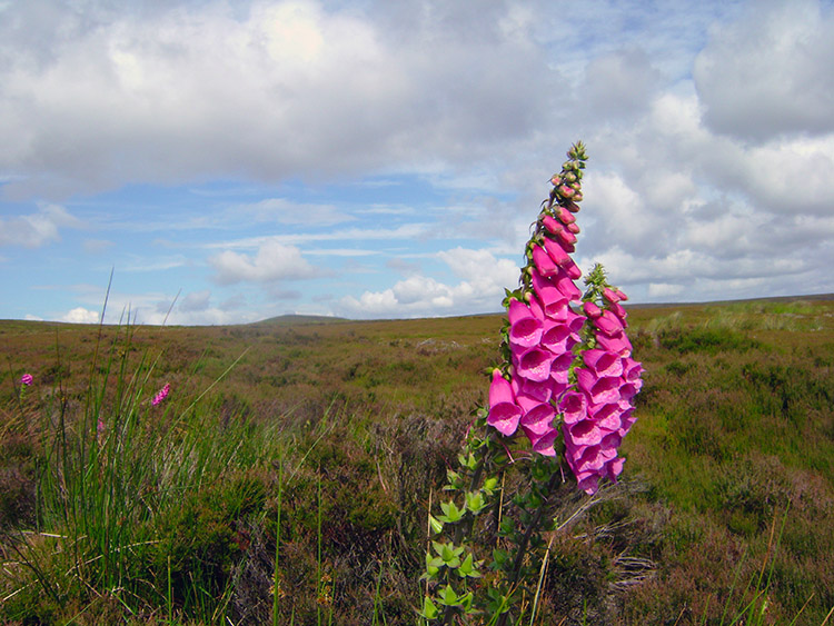 Vibrant pink foxglove on Kettlestang Hill
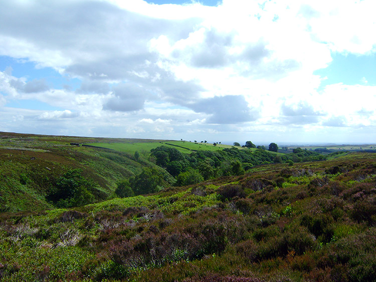 Approaching Dallow Gill
From Kettlestang Hill we made a simple course due north for just over one mile towards Stope Bridge on the border road between Dallowgill Moor and Kirkby Malzeard Moor. The beeline had to be compromised a good few times but only to meander our way down to the bridge by avoiding the deeper patches of heather, deep grassed areas of wet bog and the occasional ditch. It was never difficult though and a good off track thrill which I always enjoy. Steve took the off-route section in good heart too and it did not take us long at all to reach Stope Bridge.
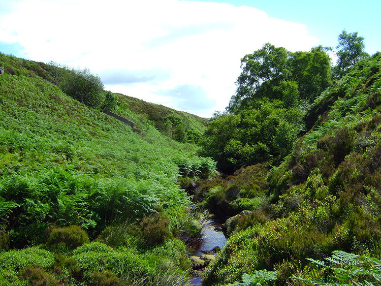 Dallow Gill
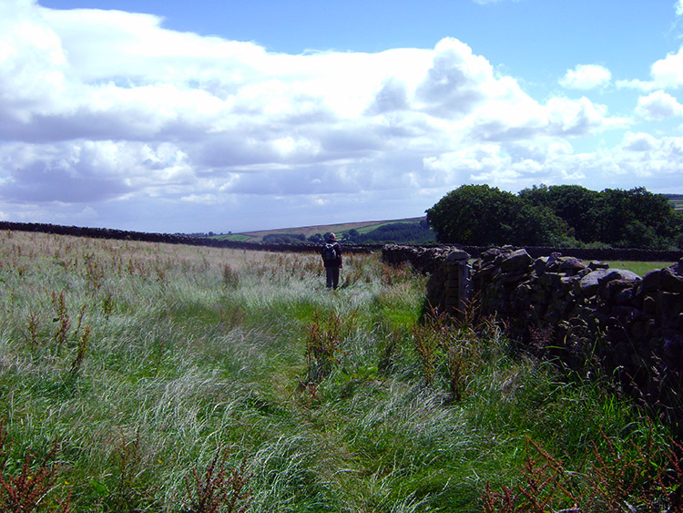 Crossing fields near Dalton Lodge
Steve headed straight for the bridge but I chose to cut to the right and drop into the gill before climbing out again. It was a bit of a struggle at times finding my feet and avoiding hidden rock clefts in the deep undergrowth but in taking due care it was fun and I managed to negotiate the gill crossing safely and in doing so I thoroughly enjoyed the adventure. We met each other again by the roadside and took our second and final break of the walk. As we were doing so the Red Arrows flew straight over our heads, all in formation bar two who were falling into line. Only yesterday they performed at the opening ceremony of the 2012 Olympic Games so they must have been in demand. They seemed to be heading to the Lake District. After our break and our personal fly past we continued on our walk and off Dallowgill Moor by following the road from Stope Bridge east and then leaving it to track south to Dalton Lodge. The walking was now a complete contrast to before, open moorland being replaced by following good paths over lush green fields and past farms and remote barns towards an interesting stretch of woodland.
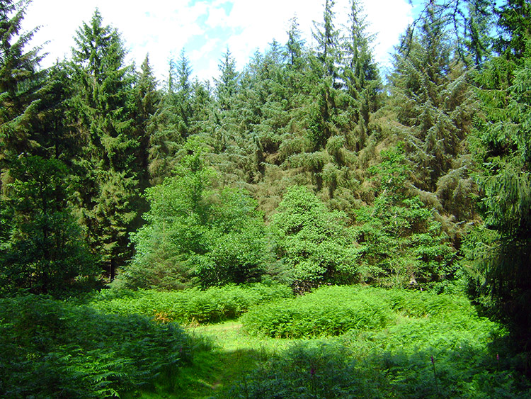
 Stang Brae
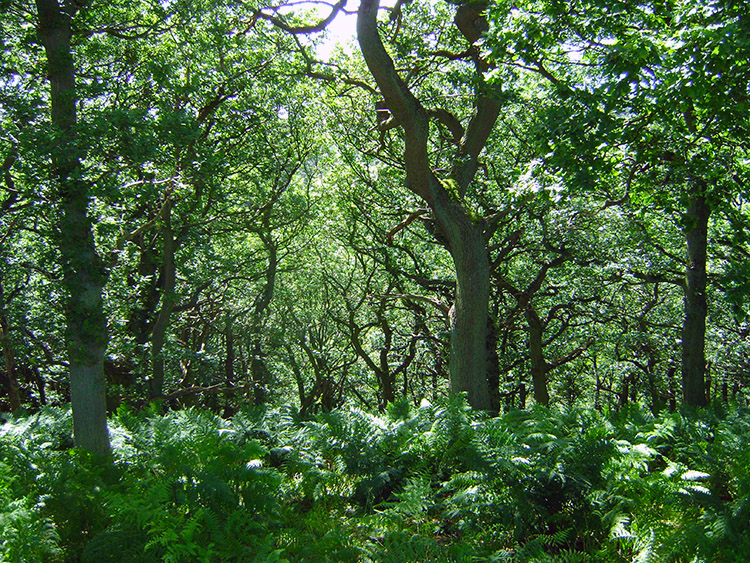
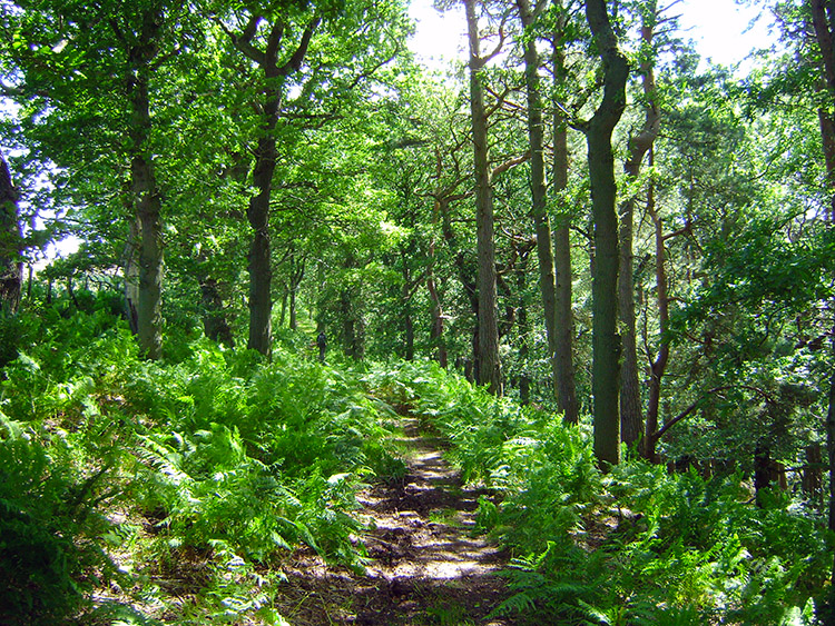 Natural beauty
After half a hours walking across fields we reached the woodland at Stang Brae near Glebe Farm. The woodland was rich in colour, full of deciduous trees and ferns, all the time though the wood walking being enhanced in enjoyment by the wonderful shadows cast in the surroundings by sunshine penetrating the tree canopy. Steve and I both enjoyed the walk through the woods immensely often taking time to stop in our tracks and look at the splendid scenes in our midst.
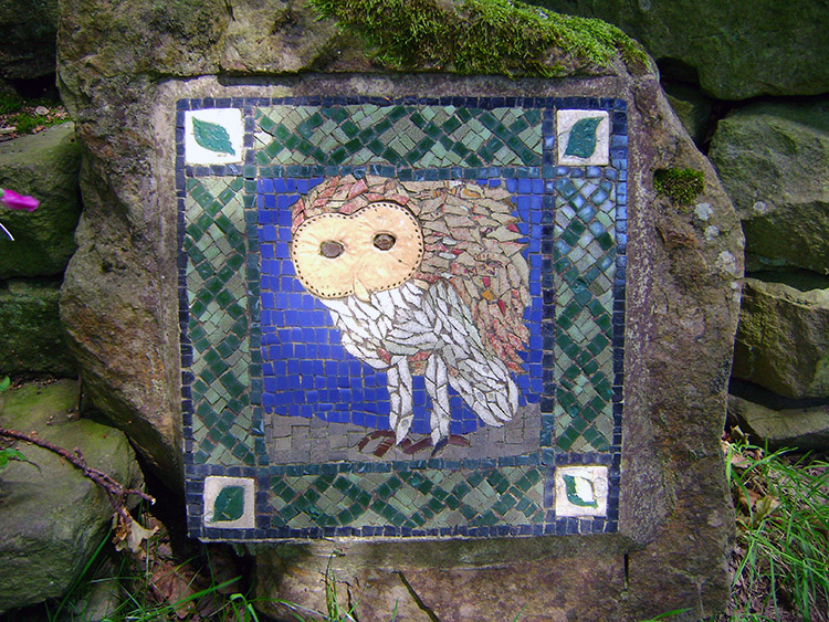 Ceramic Art - The Owl
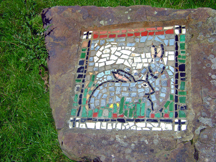 Ceramic Art - Rabbits
On entering the wood and during our walk through we came across interesting and beautiful ceramic mosaics. I had seen one or two before on the previous walk of Kirkby Malzeard Moor and have now discovered they are a series created in 1997 by the local Kirkby Malzeard community and laid out to form the basis of the Crackpots Mosaic Trail. I will be doing that walk soon and adding it to the walks on the website.
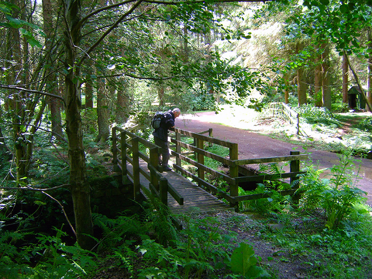 Footbridge in Stang Brae
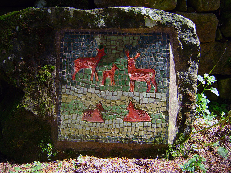 Ceramic Deer tile near Dallow Hall
Continuing through the wood and always on the alert for more mosaics of animals we came to a footbridge over North Gill Beck which we crossed although we could have just walked around the tracked road laid over the gill. The footbridge deserved the attention. Besides the footbridge was yet another ceramic mosaic, this one of a group of red deer. From the bridge we climbed out of the wood to follow the track towards Dallow Hall.
 Woodland near Dallow Hall and Manchester House
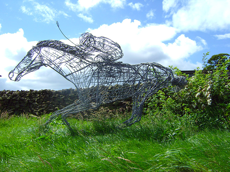 Horse and Rider artwork at Manchester House
On leaving the wood we made a slight mistake by following the track up to Manchester House rather than sticking to the marked route to Dallow Hall. At Manchester House we found a lovely wire sculpture of horse and rider before tracking back to our intended route via Sweethill Barn. From resuming our true path we crossed over the short expanse of Coal Hill moorland and from there it was an easy conclusion to the walk by following a road for one and a half miles back to High Skelding. On the final section views were excellent to the York area and the M62 corridor. Another super walk done, all one could wish for in a superb ten mile circular.


