The Great British Walk
A personal record of my three month walk of the full length of Great Britain from north to south with written journal and photographs. Tracklogs for GPS units and for use with Google Earth are available for download for each stage.
Stage 71: South Zeal to Stowford
Google Maps Open Source Maps| Statistics and Files | ||
|---|---|---|
| Start: South Zeal | Finish: Stowford | Distance: 19.9 miles (32.0 km) |
| Time: 8-9 hours | Climbing: 1,100 metres | Total Distance: 994.4 miles |
| GPX Route File | Google Earth File | About Dartmoor |
| Statistics | |
|---|---|
| Start: South Zeal | Finish: Stowford |
| Distance: 19.9 miles (32.0 km) | Time: 8-9 hours |
| Climbing: 1,100 metres | Total Distance: 994.4 miles |
| GPX Route File | Google Earth File |
Ordnance Survey Explorer Map (1:25,000)
Summary
My final week of the Great British Walk began with a stunning day of walking which included an east to west crossing of Dartmoor and which including the highest places on the moor at Yes Tor and High Willhays. As usual I had a companion but this time it was not Steve who elected to walk around the northern rim of the moor. Instead John Lister joined me on the high moor crossing which was done under the most beautiful blue sky. Fortune did shine on us for had we been on the moor a day before or a day after we most probably have been denied the spectacular sight of the open moor. After the brilliance of the Dartmoor crossing we descended the west side to Lake where John and I met up with Steve to continue walking as a threesome across Devon countryside to Stowford.(Note: My walk of Devon and Cornwall is a part of my Great British Walk from the north coast of Scotland to the south coast of England)
Stage Report
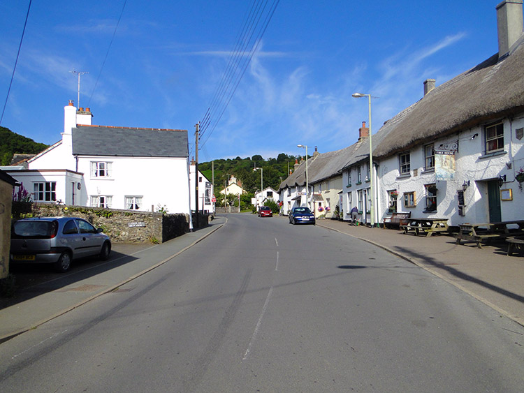
I woke early and opened the curtains in our accommodation bedroom to see a clear blue sky. There was not a cloud to be seen and we were promised it would stay largely that way. Heartened by the thought of a good day on Dartmoor I washed, dressed and then spent some time sitting in the garden sheltered on the east edge of Dartmoor with a stream trickling down below. I watching the stirrings which included the observation of garden birds getting about their daily business. While I watched over the quiet morning scene I contemplated. With ten weeks of walking behind me and just one to go until the end of my journey I had plenty of thoughts whirring in my head. Soon Steve joined me for a chat and he said nothing to suggest his day would be any different to mine. When the time came we had breakfast, packed up and were given a lift by our host back to South Zeal. Stage 71 of the walk had begun.
 Sticklepath
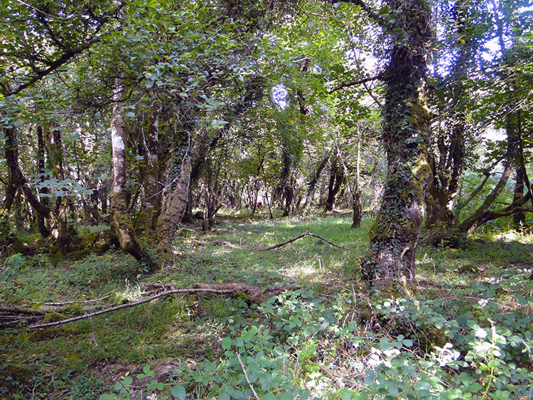 Belstone Cleave
It was sunny and warm, the perfect morning, as Steve I walked from where we had finished yesterday's stage in South Zeal to the neighbouring village of Sticklepath. It was a later than usual start for us but we had a 9.00am rendezvous with John Lister at the Taw Inn. He was waiting for us outside the inn when we arrived and so the three of us sat on one of the pubs outside benches to look over the route plan. Now came the big surprise. "I am not going up on Dartmoor" said Steve. "You what? Where did that come from" I asked. "I do not fancy climbing up over there. Instead I will follow the Granite Way on the old railway around and meet you in Lake". He had already checked out the route on the map and so we agreed to meet in Lake at a pub on a specific grid reference. I let him keep our strip map while we used John's Explorer map and my GPS hand-held to get us over Dartmoor. I said "See you there" and with handshakes we went our separate routes.
"Well I never saw that coming" said I to John as we backtracked from Sticklepath to pick up the Taw-Teign Link which would lead us into Belstone Cleave. It was quite a surprise but I had no doubt Steve would be OK, he is one of the most capable walkers and map readers I know. He would probably make it to our meeting point without a map. I thought no more about it and concentrated on my walk across Dartmoor with John. Before the moor we had the utter delight of walking through the ancient woodland of Skaigh Wood and Belstone Cleave. It was so beautiful from the start as we began to weave our way on the old way through the wood. The old way kept us close to the River Taw which tricked downstream as we walked upstream. The mixed oak, ash, rowan and hazel woodlands had a magical old word appeal, much untouched by modernity and the feeling was enhanced when a Deer scurried past. It could have been avoiding the bows of this regions version of Robin Hood. I could imagine men in Lincoln Green and in felt hats with bow and arrow hunting here in the past. Skaigh Wood became Belstone Cleave almost seamlessly. John and I continued our delightful walk through this magic start to the walking day.
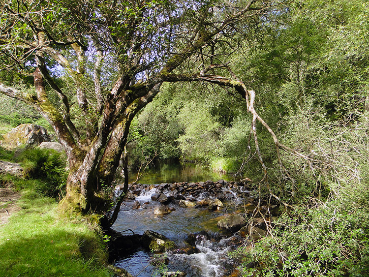 River Taw
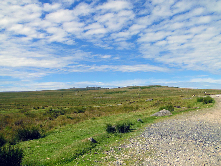 Scarey Tor
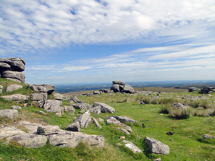
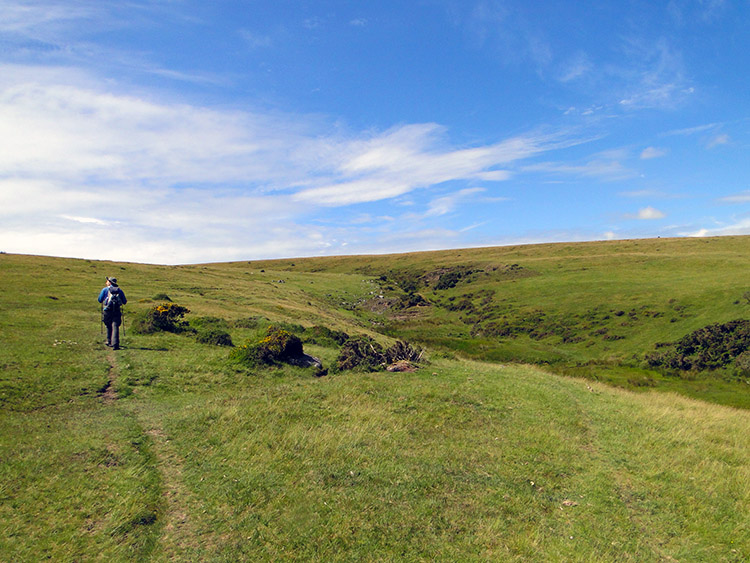
John and I had climbed steadily through Skaigh Wood and Belstone Cleave, making over 70 metres of height in just over a mile. we added another 40 metres to the total by dragging ourselves up the north bank of the cut of the River Taw to reach the village of Belstone. The village was very peaceful as we walked through, the only activity in Belstone being a group of pony riders with their trainer, a Post Office van picking up mail from the village postbox and two brewery workers delivering fresh supplies of ale to the village pub. We passed courtesies with the workmen and continued on from the village and up a road on to Dartmoor by skirting the north side of the crest of Watchet Hill. Tarmac ran out near the village's service reservoir and from there we followed unmade bridleway. We were immediately entranced by the moor. The weather helped us of course, with sunny skies and clear visibility giving us a long range view of the beautiful moorland. I imagined the Tom Petty song "Into the great wide open". It was so appropriate. We could see for miles to the north over the plains of of Devon beyond Okehampton. We could also see all the way west over Dartmoor to Yes Tor and High Willhays which made calculative navigation inconsequential. We could see where we were going without a problem. First objective was Scarey Tor one kilometer to the north west. It was not scary at all, becalmed by the weather.
 Rowtor
 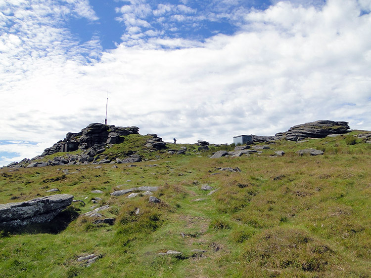 Climbing to Yes Tor
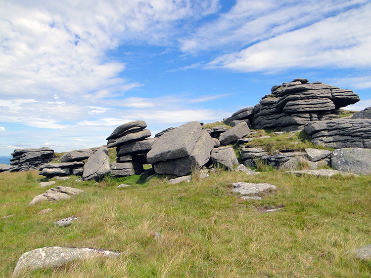
From Scarey Tor John and I walked towards Rowtor, a neighbouring hill with a shapely group of granite stones assembled all over the summit. The map showed that we ought to have been walking over marshy ground but there was no sign of bog. The ground was sun parched dry. The final ascent to Rowtor was a job for me, especially with my 16 kilo backpack strapped to my back. With short paces and a couple of short breathers I made my way up to the rock strewn summit of Rowtor where John, who had much less of a weight handicap, was waiting. We took a short break for a drink on Rowtor, not too long though, as we had a deadline to meet Strolling Steve on the other side of the moor. After our break we walked from Rowtor to skirt round the south side of West Mill Tor and then ascend to Yes Tor which we did with ease. The ground underfoot was excellent, just forgiving enough to provide the perfect walking conditions. The weather remained perfect too, sun shining, little breeze and not yet too hot. But it was getting warmer and sultry as we approached Yes Tor towards midday.
 Yes Tor
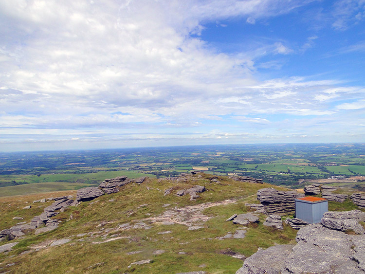 Stunning view from Yes Tor
When we reached the summit of Yes Tor which was marked with a trig pillar we took another break. We needed to cool down from the sweaty exertion of the final climb to Yes Tor, the second most high point on Dartmoor. It was also time to take in the views and Yes Tor is the best place on Dartmoor to appreciate them, even better than its higher neighbour High Willhays which was in my sights. We were at 619 metres high and with Yes Tor being north of High Willhays it provided uninhibited views to the plains of Devon to the north which included the patchwork of fields between Okehampton and Barnstable and all the way to the north Devon coast. Indeed it was a glorious view to behold. The only drawback to the break on Yes Tor was that a swarm of wasps harassed me and John. The wasps buzzed around my head insistently, obviously attracted by the droplets of sweat created by the climb and by the sultry conditions. The only way to get away from them was to exit from Yes Tor but only after I had taken my fill of that stunning view. Wasps were not going to stop me enjoying that.
 High Willhays
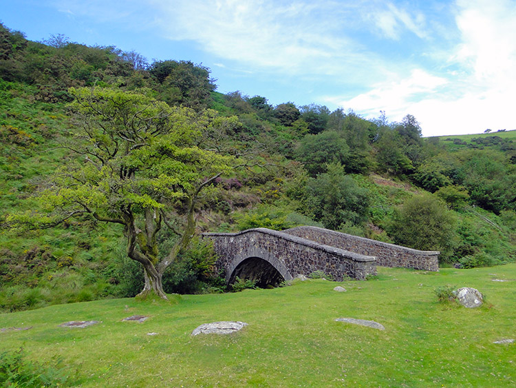 Bridge near Meldon Reservoir
After our time on Yes Tor John and I took our leave and paid a quick visit to High Willhays which by a mammoth two metres beats Yes Tor as the highest point on Dartmoor. Despite the higher stature of High Willhays I did not find it as pretty, just a slight bump on the moor with a scattering of granite rocks. No tors, just single stones randomly strewn around. Looking to our course from High Willhays I could not make out ant significant land features and so we mutually plotted a line which facilitated our descent to Black Tor. We then tracked north west to Shelstone Tor and then by keeping the same course to Vellake Corner. By doing this we had made a safe easy descent of the moor by rounding the west side of Homerton Hill. Having reached the south west edge of Meldon Reservoir John and I saw other walkers for the first time since we had set off. It was a surprise that it had taken so long. I had expected to see more walkers and ramblers up by Yes Tor and High Willhays enjoying the beauty and isolation of Dartmoor. The truth is we had it to ourselves all morning and on a beautiful morning in summer.
Not all the people we saw near to Meldon Reservoir were walking though. We walked across the grass plain of Vellake Corner heading to a point on the north tip of Corn Ridge where West Okement River converged with a small stream coming down from the Corn Ridge and Sourton Tors gap. As we crossed the knee high grass we came to half way and startled a couple laid in the grass. Let me just say they were being affectionate and leave it at that.
 Climbing to Sourton Tors
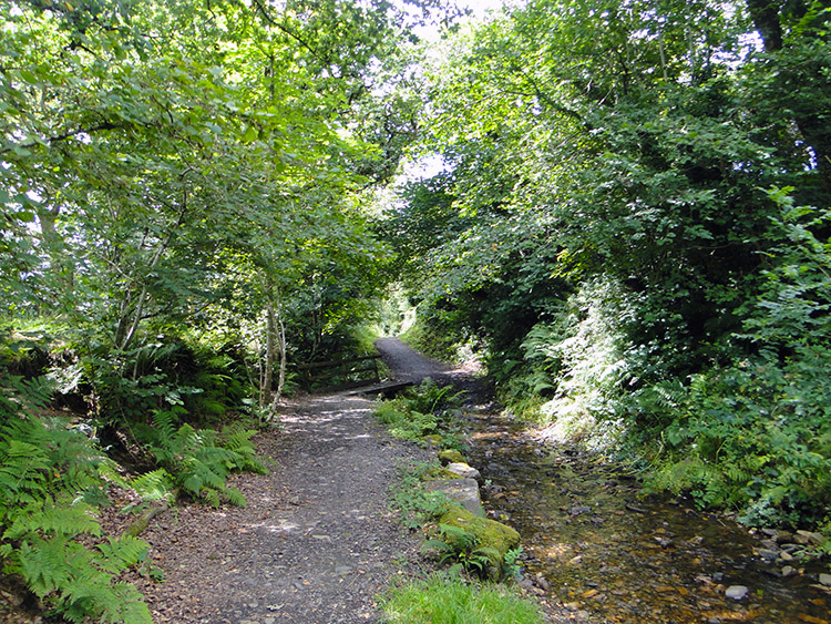 Tor Wood
John had been leading me by just a few metres when he startled the couple and he spent some time getting over the shock while we climbed the gap of Corn Ridge and Sourton Tors which we topped after 40 metres of climbing. That was all the climbing on Dartmoor done, all we had to do now was negotiate our way off the moor to meet Steve. It was so enjoyable doing so. First we stopped to admire the views once more and what immediately took out eyes was a Lake Viaduct which the Granite Way ran along. Steve would be somewhere down there and so the viaduct became the target. It was an easy walk down the gentle slope of Lake Down to get to the viaduct. Just before reaching the impressive structure supporting the old railway we walked into beautiful Tor Wood, a pretty woodland with a little stream running through its centre. The woodland walk led us under the viaduct and it continued towards Lake. The water in the woodland stream was crystal clear and the gentle trickle of the water was so calming as we walked. Eventually the woodland walk ended and a minute or two later we arrived at Lake. We did not have to look for the pub where we were to meet Steve, it was right beside the path. We did not have to look for Steve either. He was sat on a bench waving at us.
 Walking Boot Drinks Holder
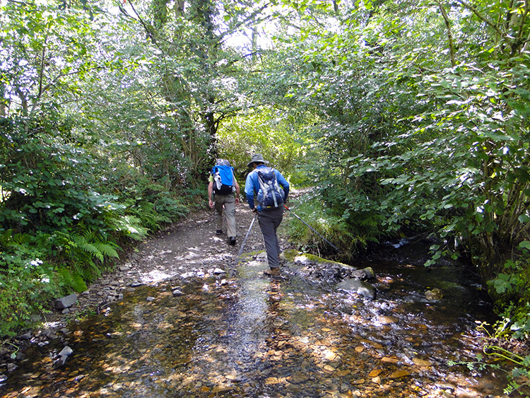 Wading across Crandford Brook
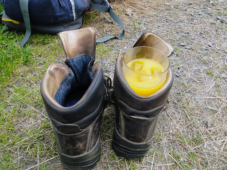
Steve had picked a great spot to meet. The Bearslake Inn is gorgeous and we just had to relax and have a drink there. The building, originally a Devon Longhouse with a thatched roof was enchanting. I had to do the honours and go to the bar. "Three pints of Orange and Lemonade please". I took them outside, threw off my boots, put my drink in a boot for stability and laid out on the grass. While we chilled out the stories of our days so far were shared. Steve had enjoyed himself too.
The sun continued to beam down while we left the Bearslake Inn and crossed the A386 road to pick up the Two Castles Trail which I had planned to follow for the remainder of the stage to Stowford. Following the trail was lovely from the start, the first of it done along lanes and quiet country roads while always under a thin canopy of mature trees lining either side of the path. The canopy was ideal for keeping the fulsome heat of the afternoon sunshine at bay while letting just enough sunshine through the dappling to warm us nicely.
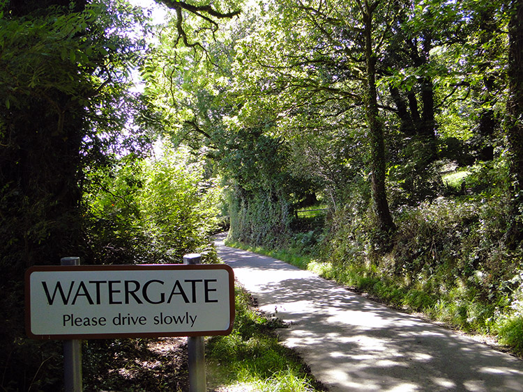 The Watergate Incident
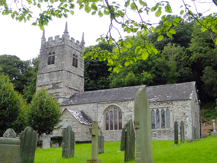 Lewtrenchard Church
The Two Castles Way led us through the village of Watergate though it was hard to notice. A couple of farms constituted the village. At Watergate Cross we left the road to track through woodland to circle around Burley Wood. The map showed an Iron Age Fort and Motte and Bailey castles to have been sited in the woodland. I could not imagine why they were there. We were heading higher to Galford Down which when crested marked the end of the climbing for this stage, all of 1,100 metres which marked today as the second most climbed stage of my entire walk, only beaten by the 1,181 metres of stage 57 from Winchcombe to Birdlip while on the Cotswold Way.
From Galford Down we followed more country lanes and quiet roads while sticking to the Two Castles Trail, leading us to Lewtrenchard. The village which is dominated by the Lewtrenchard Manor and has a fine church. The village also has a forgotten garden which was probably forgotten as it was so well hidden. I could not find it. The village and the neighbouring village of Lewdown which we next reached are part of the Lew Trenchard Parish. Not a lot appeared to be going on in the parish while we walked through. From Lewdown we followed field edges to Stowford where our stage ended. It was 5.30pm when we found our accommodation at Townleigh Farm, a grand spot just outside the village. It had been a long day which would have worn me out in the early days of this walk but now I felt fine. More tomorrow please.


