The Walking Englishman Walks The Thames Path
A personal record of my walk of the Thames Path National Trail with a written journal and with photographs. Tracklogs for GPS units and for use with Google Earth are available for download for each stage.
Journal, Photographs and Download Files
Stage 9: Old Windsor to Hampton Court
Google Maps Open Source Maps| Statistics and Files | ||
|---|---|---|
| Start: Old Windsor | Finish: Hampton Court | Distance: 16.2 miles (26.1 km) |
| Time: 6-8 hours | Climbing: N/A | Rating: Easy |
| GPX Route File | Google Earth File | About Runnymede |
| Statistics | |
|---|---|
| Start: Old Windsor | Finish: Hampton Court |
| Distance: 16.2 miles (26.1 km) | Time: 6-8 hours |
| Climbing: N/A | Rating: Easy |
| GPX Route File | Google Earth File |
Ordnance Survey Explorer Map (1:25,000)
The Walk:
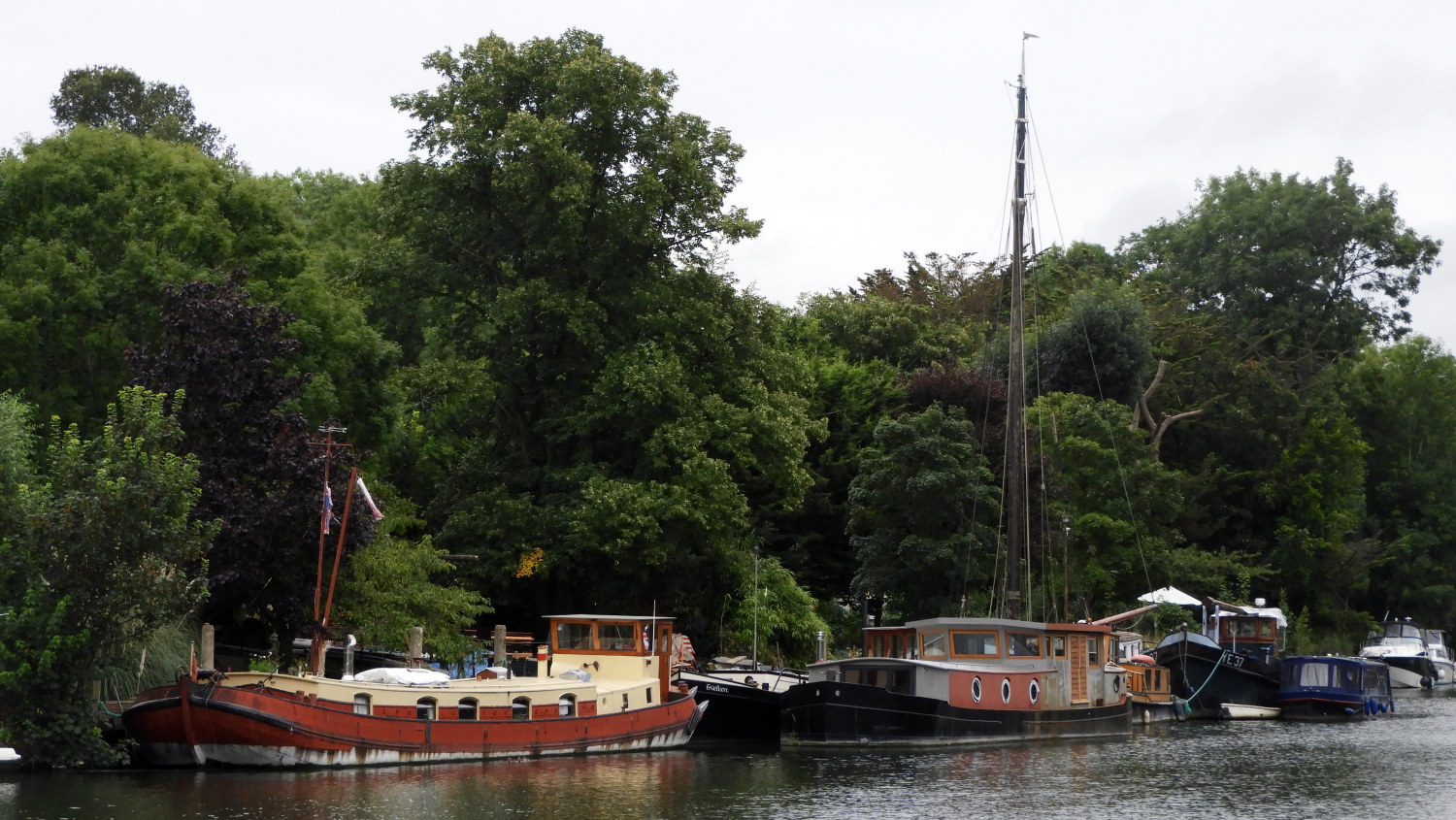 River Thames at Old Windsor
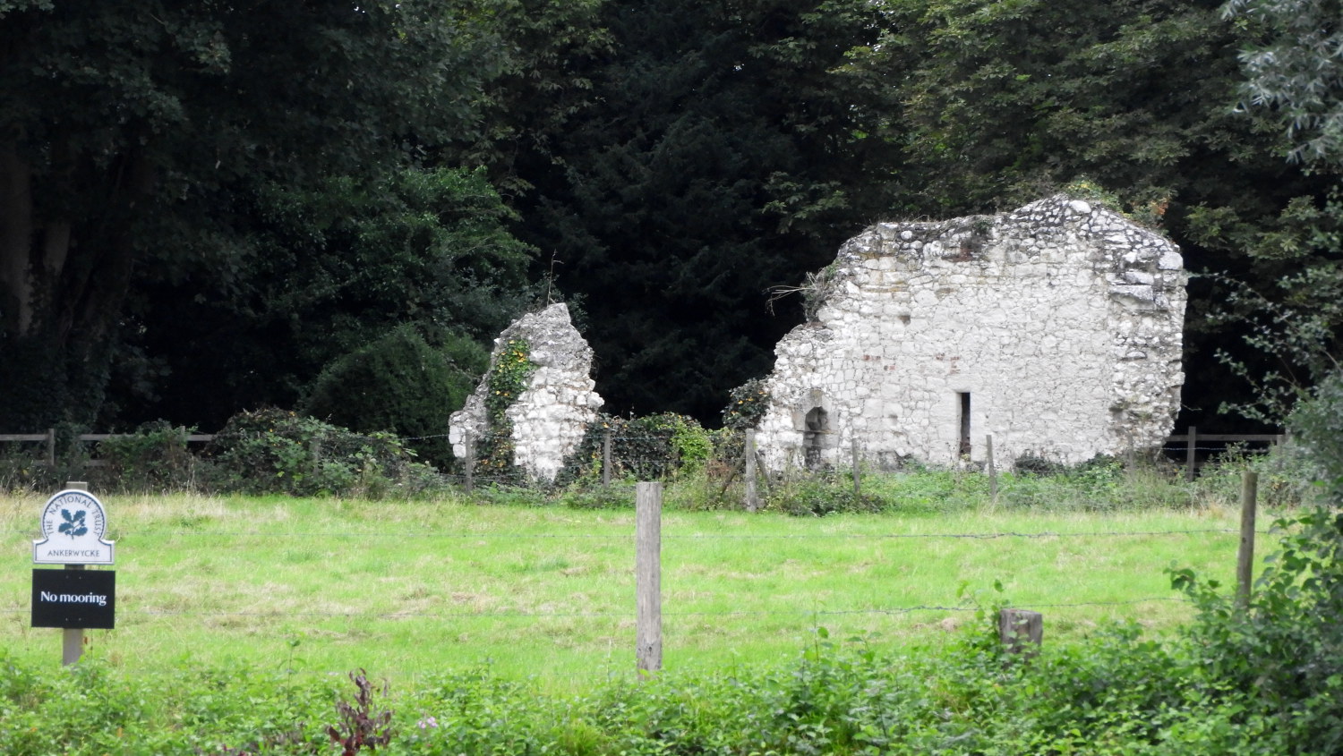 Ankerwycke Priory
After my cousin Robbie and his wife Anna bid me a fond farewell I set off on stage nine of my Thames Path journey, the stage which would deliver me to the western fringe of London. I had been walking for over a week now and everything had seemed to go so quickly. Yet I had seen so much, all of it new to me. And all of it thoroughly enjoyable. Still, I had over fifty miles to go. Much more new stuff to enjoy yet and it was not long before I arrived at the first. The sign said 'Site of Magna Carta'. I had arrived in Runnymead where in 1215 King John had been made to agree the 'Great Charter of Freedoms' with his Barons. Though he reneged on it a year later his successor Henry III was obliged to continue with the general consensus on its establishment and it has been an article of government in Britain ever since. Taking a detour from the Thames Path I visited the site, first visiting the memorial to former President of the United States, John F Kennedy and then the Magna Carta monument. Back on the path, it was only a short way to arrive at the site of Ankerwycke Priory. Near to the ruins of the priory is a remarkable tree which is reputed to be around 2,500 years old. It is the Ankerwycke Yew, which alas was hidden from my viewpoint on the Thames Path.
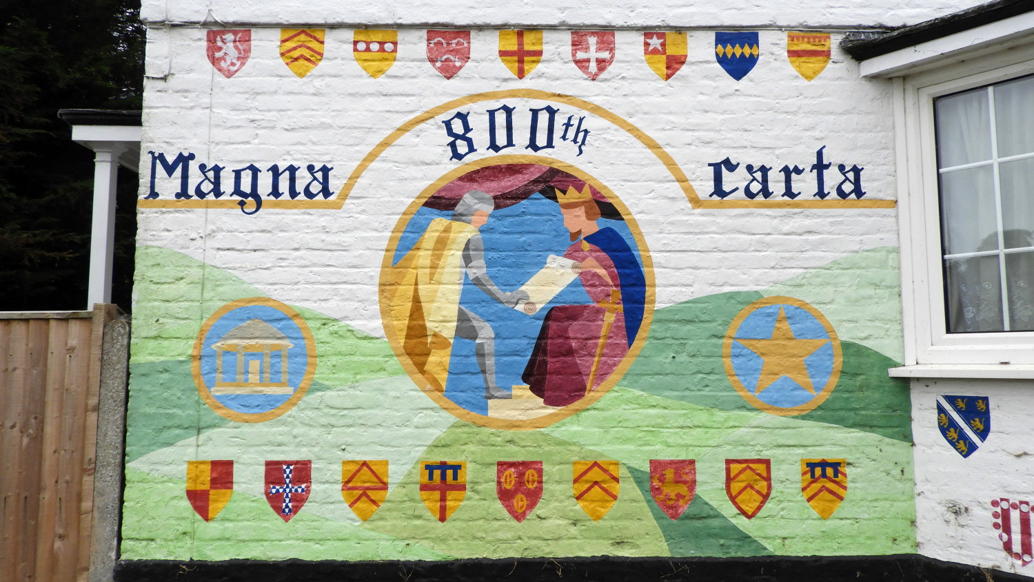 Magna Carta wall art at Bell Weir Lock
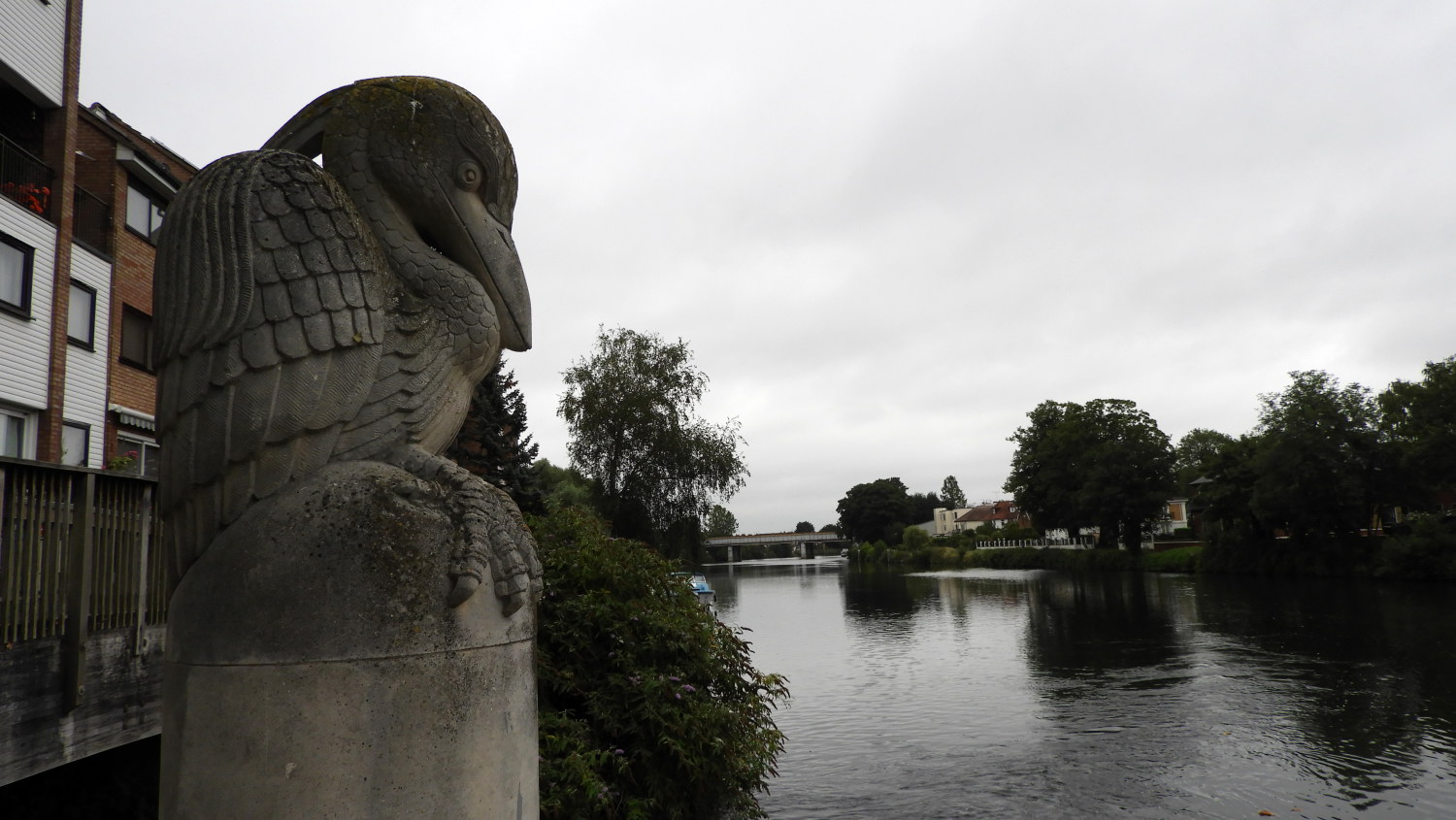 Pelican near Staines Bridge
Next I arrived at Riverside Pleasure Ground which sadly was strewn with litter, most likely from the festivities of the just passed Bank Holiday weekend. Stood in the midst of the rubbish was a magnificent bronze statue of HM Queen Elizabeth II. Beyond the park at Bell Weir Lock was a wall plaque commemorating the 800th anniversary of the signing of the Magna Carta. In just one mile of the path I had been thrilled to all sorts of sights and it was not done yet. Not far beyond the lock I passed under the M25 London Orbital Motorway which was all too evident by the thunderous sound of traffic which reached a height as I walked under the road bridge. Fortunately the further east I walked towards Staines the less the sound of traffic permeated. Of course I was now entering a stretch of urban walking so unnatural sounds would prevail but they were never to be as dominating as they did at the M25. The path took me across the Thames from south side to north side by way of Staines Bridge and then delivered me to the site of the London Stone.
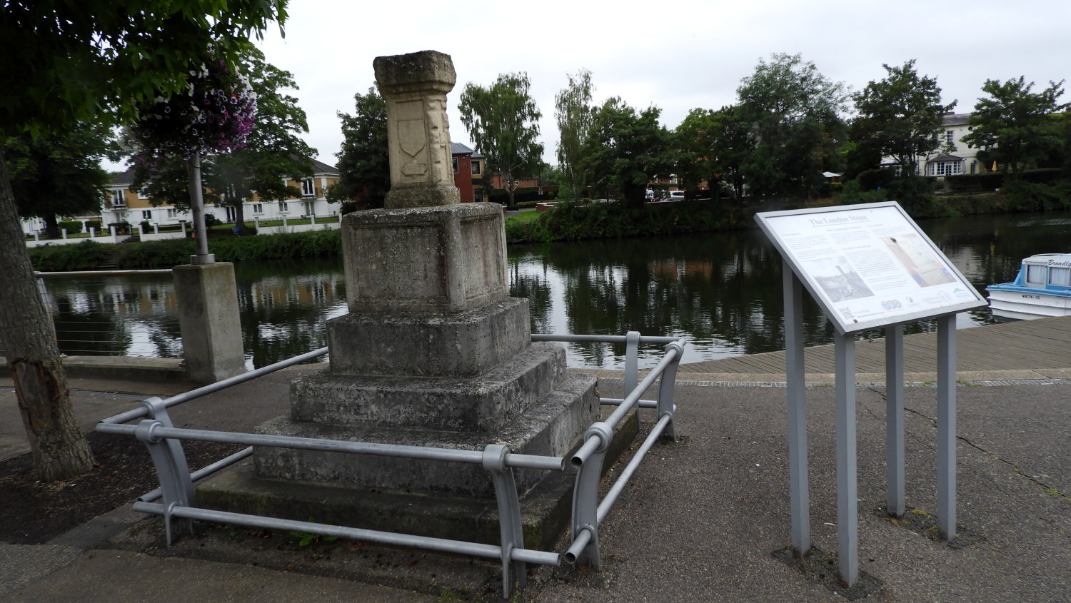 The London Stone
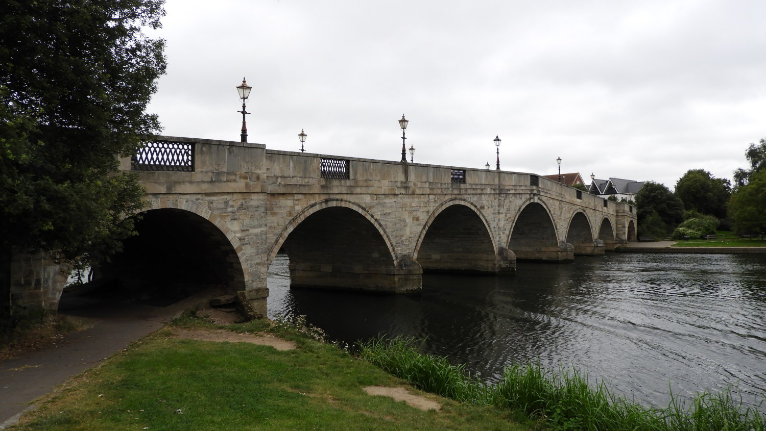 Chertsey Bridge
According to the information board near the London Stone it originally stood near Staines bridge which, before canalisation, was the tidal limit of the Thames. It is 31 kilometres as the crow flies upstream from London Bridge and marked the upstream limit of the city Corporation's control of the river. Just a little further on from the London Stone is a statue of the Swanmaster. In a few short steps of walking since Staines Bridge I had seen Pelican, London Stone and Swanmaster. I had been entertained. Time to walk and chill I though and along the way to Penton Hook Lock I did just that. And then the stroll from here to Chertsey Lock was quietly enjoyable too. Though I did have to duck under a willow tree in Chertsey Meads when the only rainfall of my entire Thames Path walk came drizzling down. It did not last long but it was enough to get the locals putting up their umbrellas and me taking the temporary cover. The rain was a memory by the time I arrived at beautiful seven arched Chertsey Bridge.
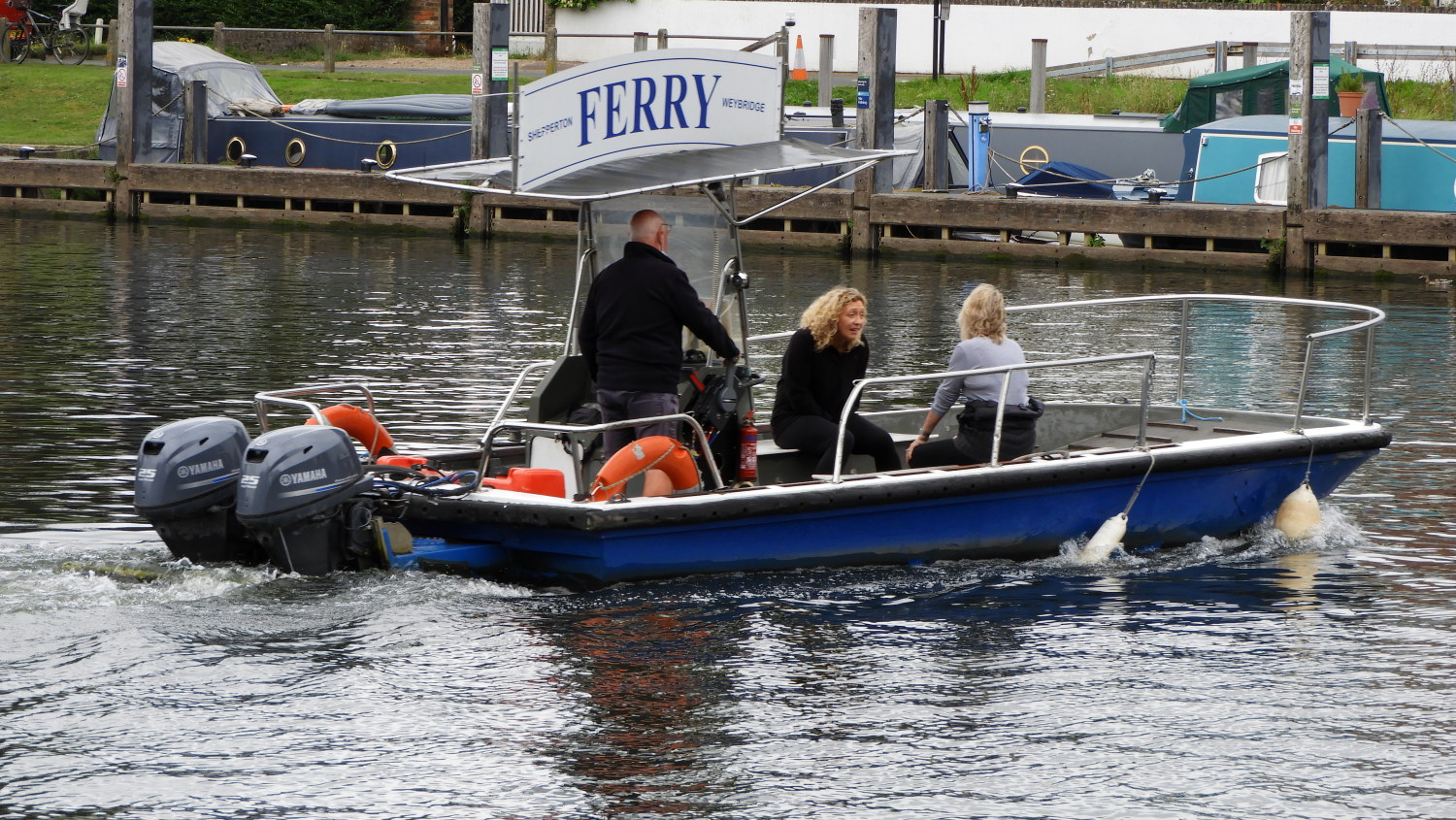 Shepperton to Weybridge Ferry
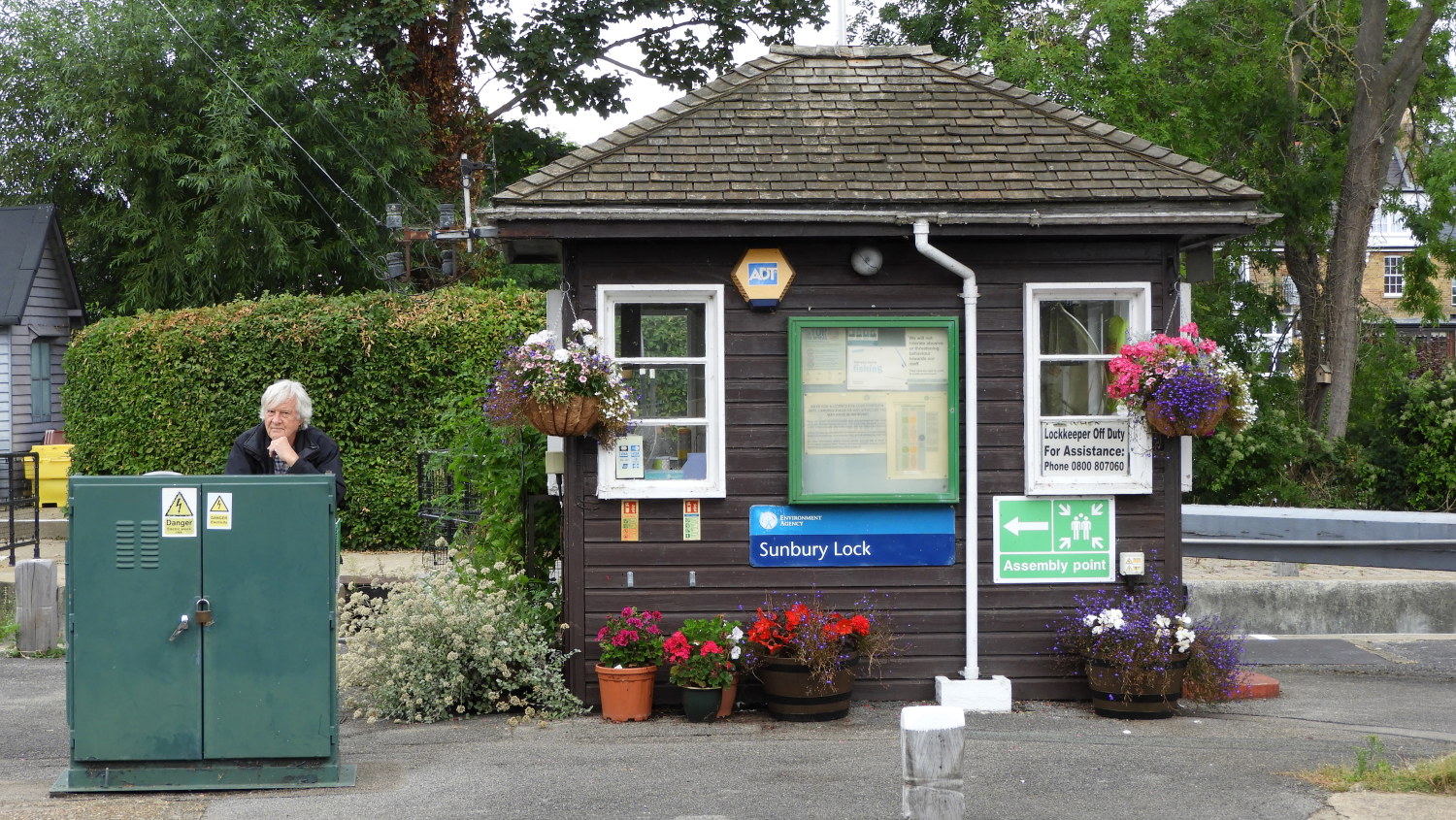 Passing the time at Sunbury Lock
After passing Chertsey Bridge the Thames is all over the place, meandering here, there and everywhere as it accepts the confluence of the River Wey. At Shepperton Lock there are two islands in the middle of the river, the larger one being Hamhaugh Island which is covered in housing. Just beyond Shepperton Lock is the Shepperton to Weybridge Ferry. Who pays the ferryman? I do. The Thames Path continues on the other side of the river from here and the alternative route involves a long detour into Shepperton which would add another couple of miles to my day. So across on the ferry I go, continuing unrelenting beside south bank of the Thames for 100 minutes to reach Sunbury Lock. In that time I covered three miles.
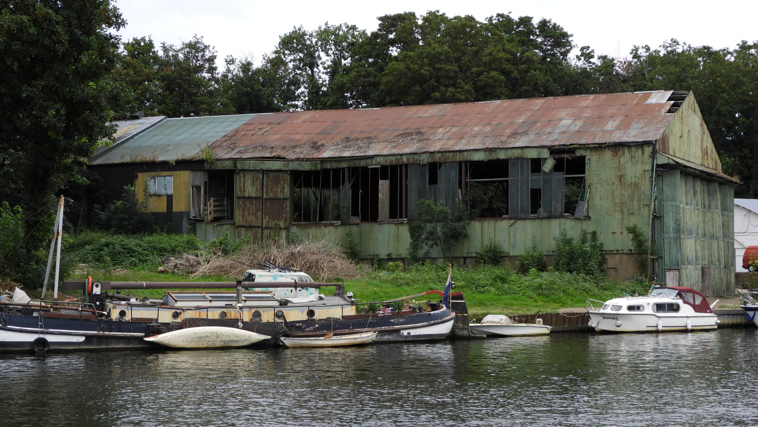 Collapsing building on Platt's Eyot
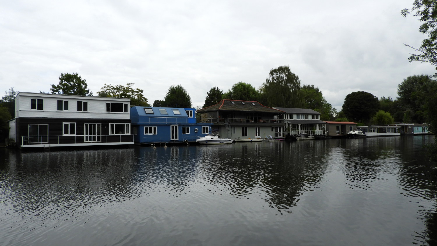 Posh Thames houseboats at Hurst Park
Though I was enjoying a quiet stretch of walking I now knew I was to be in constant sight of urban life. If not exactly in London proper I was certainly in the suburbs. Hampton, West Moseley, East Moseley and Thames Ditton came and went by. One after the other leading me to my end point for this stage of my walk at Hampton Court Palace. On the way I passed all sorts of sights, the first notable one being a huge brick and concrete wall with Metropolitan Water Board engraved into the upper concrete section. A huge reserve of potable water for London's service were being held back by the walls with huge reservoirs the size of towns on the other side of the brickwork. I passed sailing clubs and rowers in the water. At Hurst Park I saw gardens with creative topiary hedges on one side and crumbling buildings on Platt's Eyot on the other side. I also so the exact opposite of decay, grand houseboats. I guessed some would be valued at well over a million pounds.
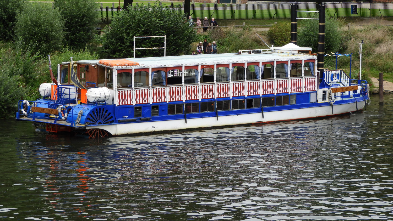 New Southern Belle Paddleboat
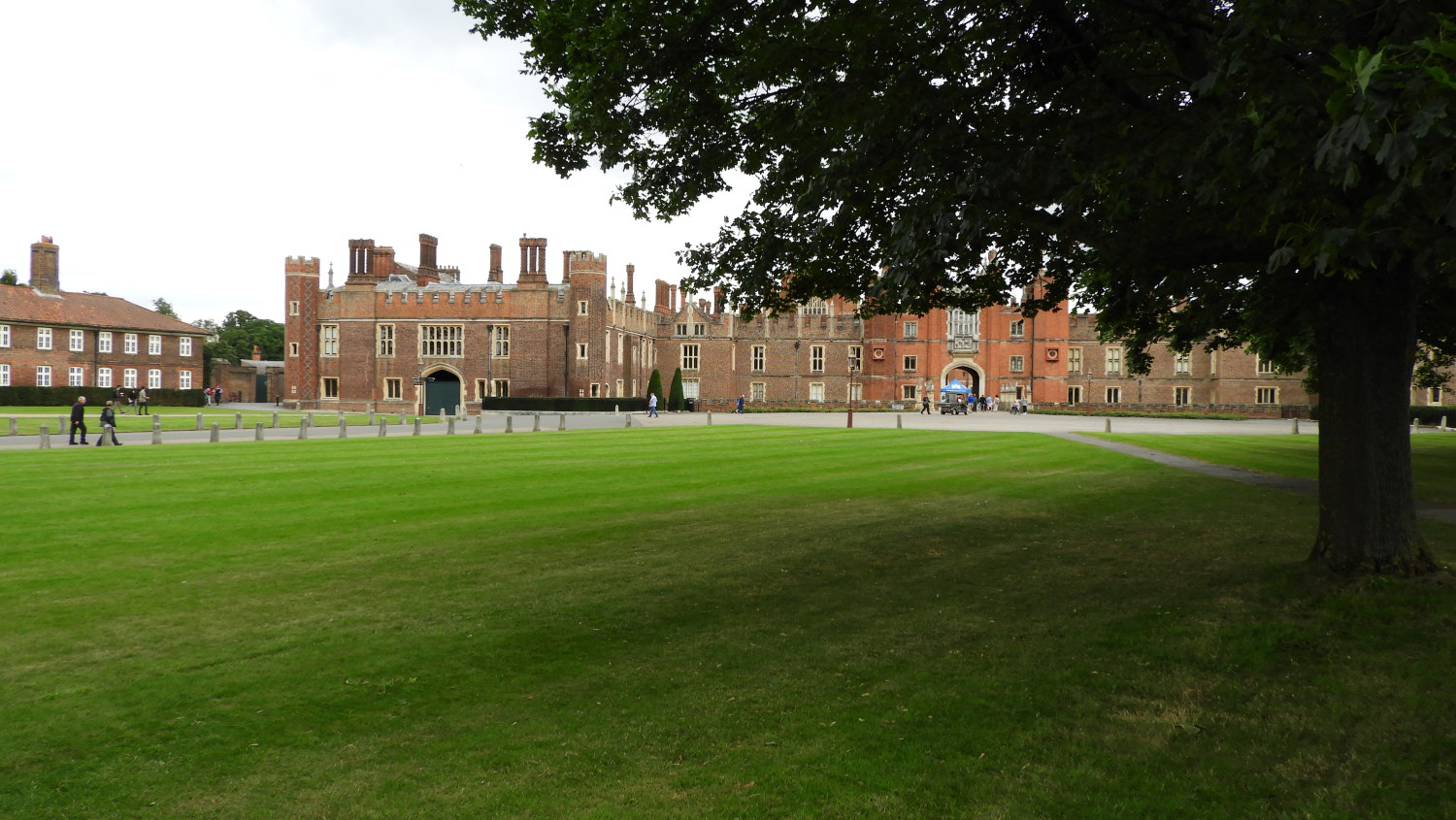 Hampton Court
From Hurst Park I passed the grand building housing Moseley Boat Club and just after passing Moseley Lock I saw a line of people boarding the New Southern Belle Paddleboat. It was a pleasant sight. Slowing down now, on my final steps towards the end of my day, I reflected on how the Thames had, from humble beginnings a week or so ago, taken its time to grow. For the first four or five days it was just a river. Like any other I know in, say, my homeland of Yorkshire. Like the Wharfe or Aire, supporting communities and serving wildlife which could come and go as they pleased. But I was now walking beside a behemoth and its spread was huge. Not like any of those Yorkshire rivers I know any more. Still exciting, but in a completely different way. It knew it would be a new excitement for me following all the way into the capital which would start tomorrow.
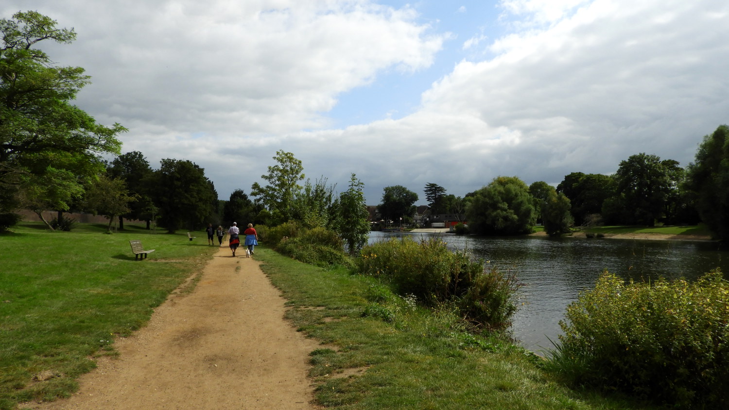 Thames Path at Hampton Court
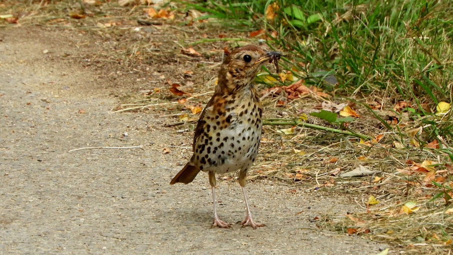 The Thrush with its supper
For today though I still had to reach Hampton Court Palace and find my nearby accommodation. With it being a little after one o'clock in the afternoon I had also to think about what I would do, so I decided to drop my kit off at my accommodation and take a leisurely walk around Hampton Court Park and Bushy Park. "Why not walk the Thames Path to Kingston Bridge then and walk back through the parks? It will knock a little bit off tomorrow's distance" I thought to myself. And that is exactly what I did. It was on that bonus stretch of the Thames Path where I met this beautiful Speckled Thrush. Perfect.


