Ridgeway National Trail
A personal record of my walk of the Ridgeway National Trail with written journal and photographs. Tracklogs for GPS units and for use with Google Earth are available for download for each stage.
Journal, Photographs and Download Files
Stage 2: Hastoe Cross to Chinnor
Google Maps Open Source Maps| Statistics and Files | ||
|---|---|---|
| Start: Hastoe Cross | Finish: Chinnor | Distance: 16.6 miles (26.7 km) |
| Time: 6-8 hours | Climbing: 549 metres | Rating: Hard |
| GPX Route File | Google Earth File | About the Ridgeway |
| Statistics | |
|---|---|
| Start: Hastoe Cross | Finish: Chinnor |
| Distance: 16.6 miles (26.7 km) | Time: 6-8 hours |
| Climbing: 549 metres | Rating: Hard |
| GPX Route File | Google Earth File |
Ordnance Survey Explorer Map (1:25,000)
Summary
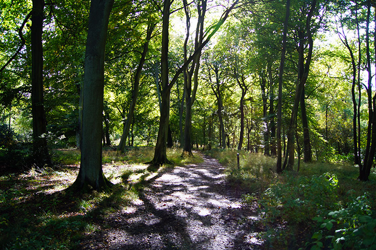
My second stage of the Ridgeway is a fairly long day with over 16 miles of walking. There is plenty of interest throughout the walk so plan to give yourself plenty of time to make the trip. From Hastoe Cross the first few miles include some lovely woodland tracks including Holloway which have been cut out by travellers through the centuries. The lovely town of Wendover is visited and then afterwards a short climb to Bacombe Hill and then along to Coombe Hill with its notable monument to the Boer War. Then walk down through more woodland to cross fields which skirt Chequers, country residence of the Prime Minister. More of the same variety follow to the finish of this stage of the Ridgeway near Chinnor including a nature reserve near Princes Risborough and the charming amble across Lodge Hill a couple of miles from the finish.Stage Report
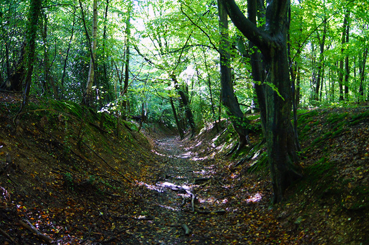
I had a pleasant evening in Tring and spent a good hour over a couple of pints reflecting on the first stage of the walk. "The weather could have been better" was high in my thoughts as was "I hope it is sunny tomorrow, it promises to be so" and true to the weather forecast it was a cloudless mid October morning which I woke to. Hoping to catch the early sunshine I was quickly ready and after the earliest possible breakfast in my digs I was soon on my way out of the lovely small town by walking south up a road and through the underpass of the A41 up the delightful tree sheltered 6 feet deep Holloway road to Hastoe Cross. I was keen to get to the top of the road and out of the canopy into the sunshine.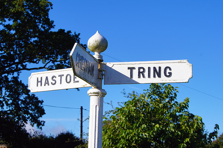 Road sign at the highest point in Hertfordshire
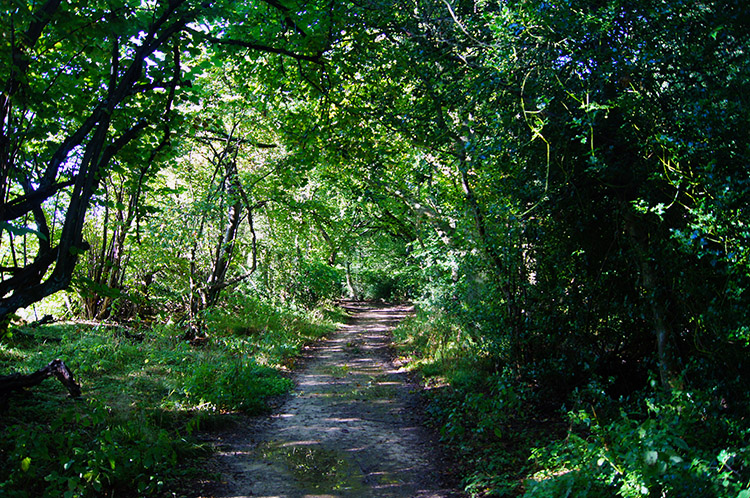 Walking through Pavis Wood
I arrived at the official resumption point of my Ridgeway walk to glorious sunshine. It was a pleasure as mid October is the time of Indian Summer, the last possible chance of warmth before winters grip takes over. I was glad to be out in such great conditions knowing it would likely be March 2013, unless I got other such days during the Ridgeway, that I would be able to comfortably walk without a coat. At Hastoe Cross I was standing at the highest point of Hertfordshire - I did not know it at the time but do now since reading a book about the county tops of England. The book also enlightened me to the fact that yesterday I walked from Ivinghoe Beacon in Buckinghamshire into the short Hertfordshire section of the Ridgeway at Pitstone Hill. Today I would be walking the first full Buckinghamshire stage of the trail. Thus I strode off from Hastoe Cross, the highest point in Hertfordshire and soon left the country for good when I entered Pavis Wood.
 Spectral light in Pavis Wood
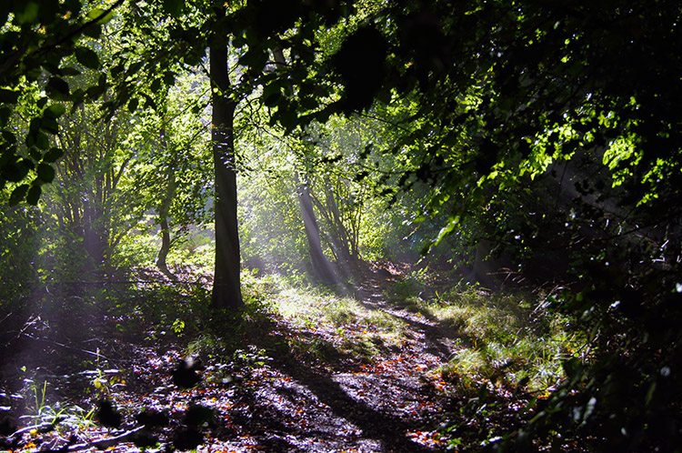
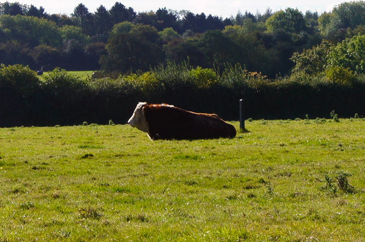 Bull in field at Chivery Hall Farm
The woodland walk was the first of a few delightful woodland stages of the day. Every now and again glints of Autumnal sunlight pierced through the thinning canopies above and provided me with special theatres of light, ever changing like spotlights on a band during a concert. I rocked in my own way to the beat of the suns rays as I walked through Pavis Wood which led me straight into Northill Wood. Where one ended and the other began was indistinguishable. I emerged from Northill Wood by a communications mast near Chivery Hall Farm. The Ridgeway path led me diagonally south west across a field where cows grazed on the far side. As I walked across I noticed a resting bull which did not even flinch as I crossed. The bull and herd were Hereford's, a breed I find easier with walkers than most. I was pleased to cross the field without catching their attention. After crossing two smaller fields, both unstocked, I reached a road and crossed it to follow a bridleway.
 Holloway track in Wendover Woods
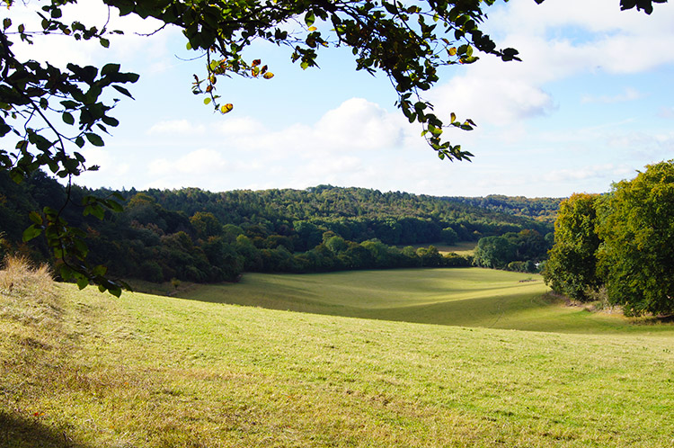 Buckinghamshire countryside near Wendover
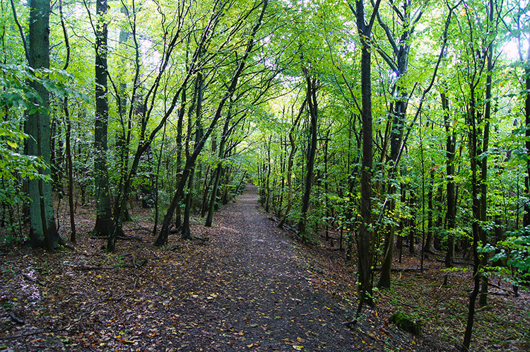
Still smiling as the sun was still shining I soon walked the length of the short bridleway which became a Holloway track through yet more woodland, this being close to the far south edge of Wendover Woods. The Holloway which continued into Hale Wood led to Barn Wood. Between the stretches of woodland there were occasional breakouts into sun drenched glades and clearings. I was so thrilled to be on the trail winding my way along the meandering tracks and three miles into the day I had not met another soul on the walk. It was so peaceful which I found a little surprising as it was Saturday.
 Through Barn Wood toward Wendover
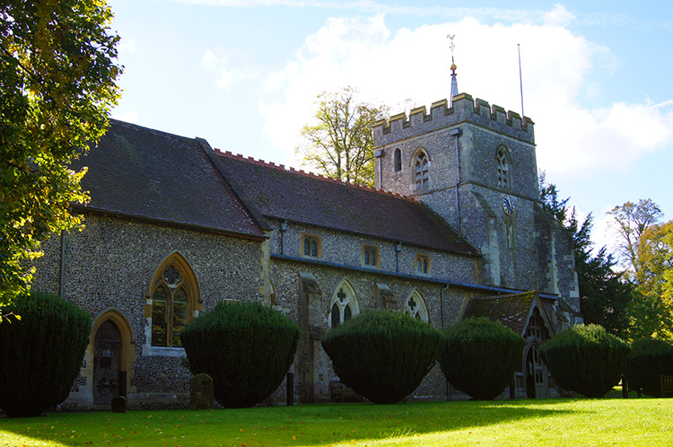 St Mary's Church, Wendover
As I emerged from Barn Wood I followed a good footpath along Hogtrough Lane towards Wendover. Only now, as I neared the town, did I meet my first fellow walkers of the day. Noting I had started early, having almost 17 miles to cover, I realised other walkers would be mostly locals enjoying a leisurely late morning/ midday walk rather than the route march I was on. That was more evident as I walked more briskly than most but I made sure to halt my progress to chat as I met other walkers, even if only to say "Good morning, it is a lovely day for walking". Most of my greetings were reciprocated though I always find the odd walker to be quiet or responsive - possibly shy. After spending 15 minutes walking the three quarter mile of Hogtrough Lane I reached the outskirts of Wendover. First sign of habitation was St Mary's Church to the south of the town.
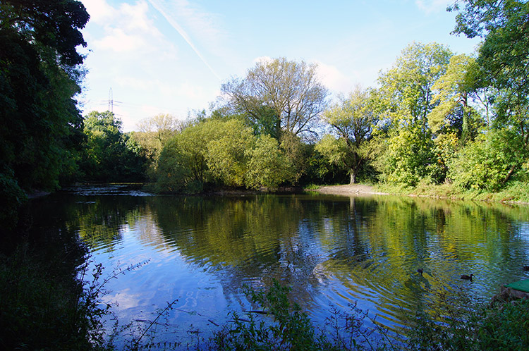 Small pond in Wendover
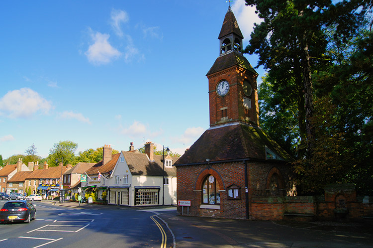 Wendover Clock Tower and home of Tourist Information
Next to St Mary's Church was a delightful small pond which I stopped by for a short while. It was such a peaceful setting to enjoy before continuing on into the centre of town. When I did so I emerged right in the heart of Wendover by the lovely Clock Tower building which serves as the Tourist Information Centre. I called in and had a pleasant conversation with a gentleman on duty who told where to get the best coffee in town. I bought a Ridgeway strip map from him, I had wished to get one local rather than from multinationals but couldn't get one in Tring which I found very odd. Wendover saved the day - I always plot my routes on GPS and carry my own printed OS maps but I also like to take a bespoke map. Now I had one and I looked it over analytically while enjoying my coffee in the recommended cafe. After coffee I bought a newspaper for the evening which I stowed away in my rucksack before ambling through town and over the railway bridge to reach a bend in the road. I did not take the bend but walked straight on through a gate.
 The climb of Bacombe Hill
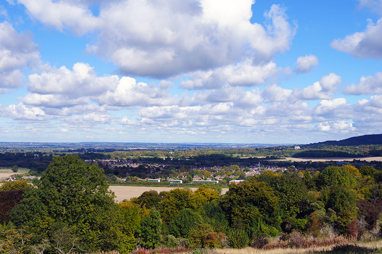 Looking back to Wendover from Bacombe Hill
I had ascended through Wendover since leaving the Tourist Information Centre but once through the gate I was led on a steeper course up a hill. An information board near the gate told me I was in a nature reserve and that I was climbing Bacombe Hill, a rich chalk land jewel of the Chilterns. The climb to the top of Bacombe Hill took me to wide open views of the Buckinghamshire countryside surrounding Wendover. It was a nice contrast to the previous miles of exceptional woodland on this stage of the Ridgeway. I stopped constantly to take in the views from the crest of the hill. In the nature reserve were other walkers enjoying the day and the scenery on offer too, some were families, some couples of all ages and some individuals like myself. All were strolling, no one in a hurry, not even me as it was too nice a place to rush on by.
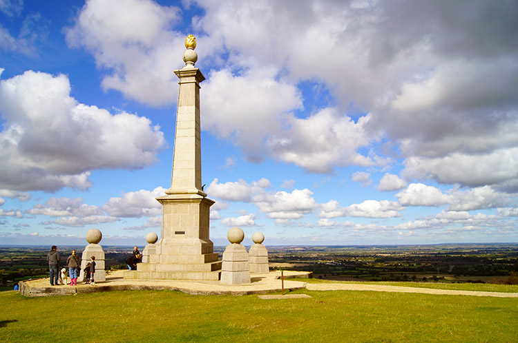 Coombe Hill Monument to the fallen of the 2nd Boer War
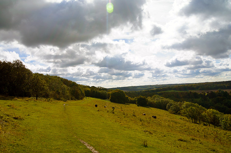 The view south across Coombe Hill
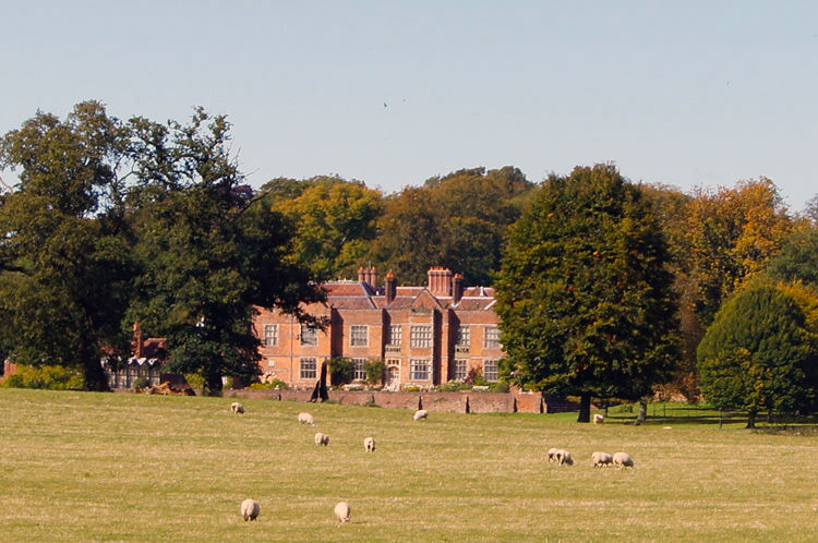
From Bacombe Hill I stayed at height to track upwards along the high ridge line to Coombe Hill, the highest point of the small range at 260 metres high. Near the peak of the hill stood a tall obelisk monument. Some groups of people were gathered near the monument and more nearby were sat picnicking in the warm Autumn sunshine. I read the plaque near the monument which told me it was dedicated to the soldiers of the second Boer War. Another information plaque told me it was the second monument to stand on the hill, the first having being almost totally destroyed by a lightning strike on 29th January, 1938. I guess it was quite a deafening bang when the lightning struck. Bacombe Hill before had offered brilliant views to the north and east, Coombe Hill offered equally spectacular views to the west. Down below me, beyond a wood stood an impressive large country house. I had my first sight of Chequers, country resident of the incumbent Prime Minister.
 Goodmerhill Wood
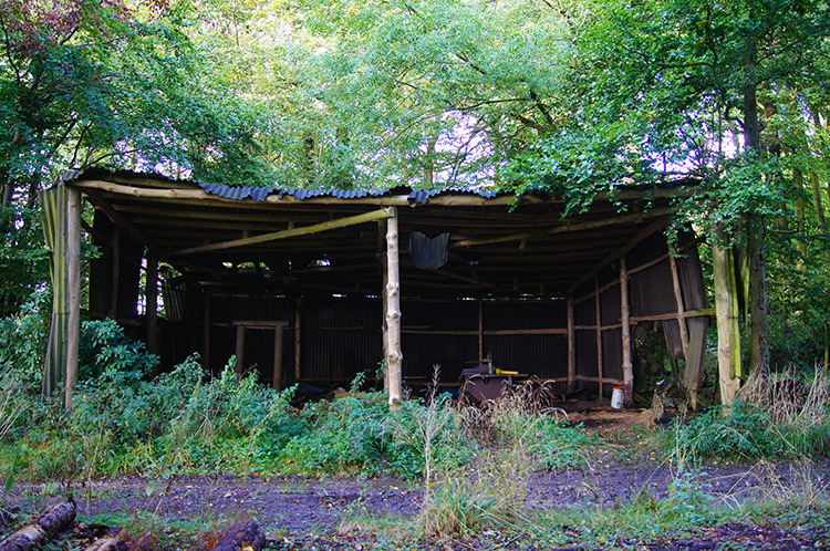 Rickety hut in Goodmerhill Wood
Before I could get a closer view of Chequers I had to descend Coombe Hill on a course due south. This route took me down to cross a road which took me into Goodmerhill Wood. In the woodland the Ridgeway joined the South Bucks Way which I followed for a half mile through the wood. In Goodmerhill Wood were a few old wooden structures clad in corrugated iron. All were in need of some tender loving care as they appeared close to collapsing.
 Chequers, country residence of the Prime Minister
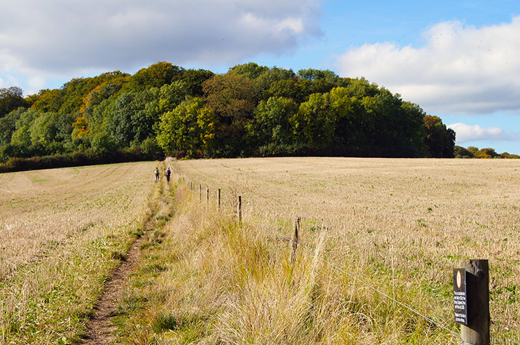 Walkers heading towards Maple Wood
On emerging into bright sunshine once more I crossed a road to follow a path across open fields. As I began crossing the first field the large house to my right captured my attention. I was looking at Chequers, the lovely country residence of the Prime Minister. Conspicuous warning signs warned me not to venture from the path and I heeded their warning to the letter, keeping on the straight line across the field which took me directly across the entrance road to Chequers and then up over a field towards a small wooded hill. A group of four walkers were about 100 yards ahead of me, they too obeying the regular instructions nailed to the posts of a barbed wire fence and keeping to the proper path. I followed the group of four to the end of the field from where the Ridgeway skirted the north side of Maple Wood.
 Grand old tree in Pulpit Wood
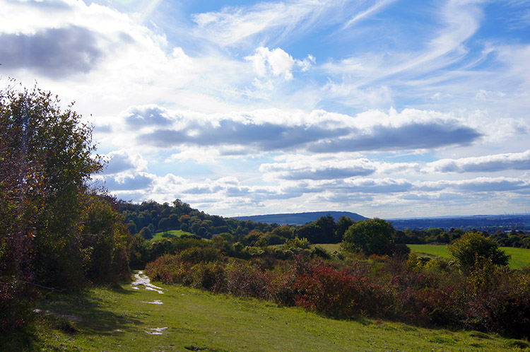 Grangelands and Pulpit Hill Nature Reserve
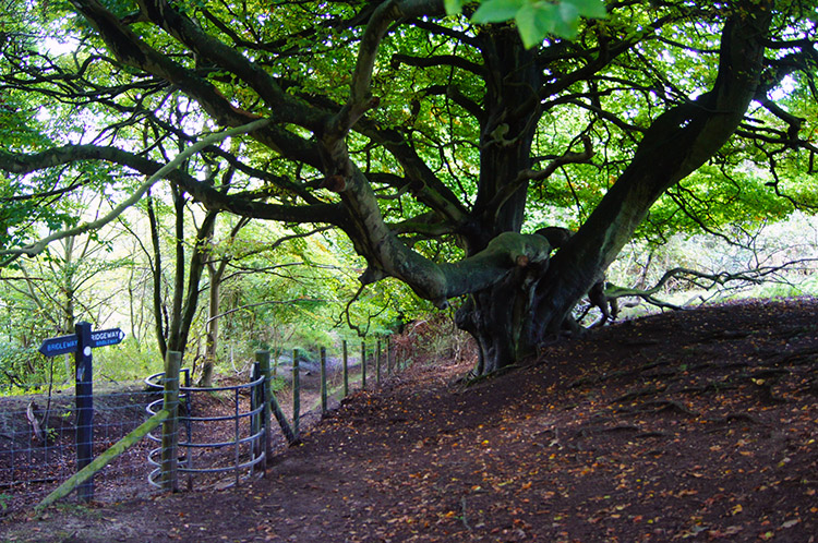
The walk continued to surprise me after skirting Maple Wood. From the north west side of Maple Wood I continued into Pulpit Wood where there were some very interesting ancient trees with large trunks and formidable stem branches reaching out in all directions. Then on leaving the confines of Pulpit Wood I emerged into the relative light of Grangelands and Pulpit Hill Nature Reserve which I walked through on interesting paths, some across open clearings and some in the confines of hedgerows and small shrubs, many of different species to attract various types of wildlife. This day on the Ridgeway was really surprising me with its variety. Not what I had expected at all as I had read the Ridgeway was predominantly upland tracks.
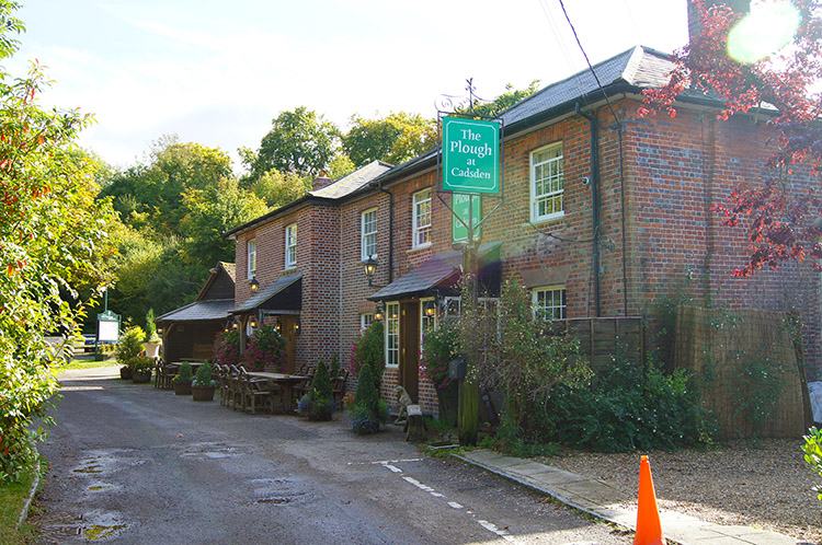 The Plough at Cadsden
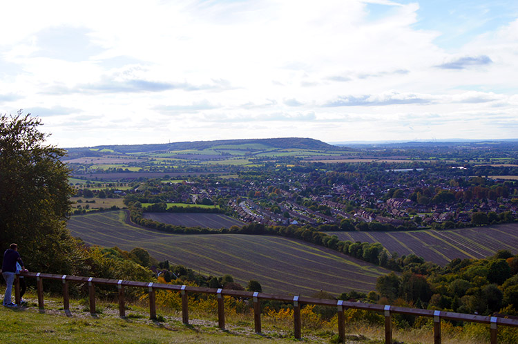 Princes Risborough as seen from Whiteleaf Hill
The final section of walking through the nature reserve was quite muddy, the only stretch of mud I was to experience on the day. I emerged from the muddy stretch, about 100 metres of it, onto Cadsdean Road which I followed for a few yards to reach a pub. The Plough at Cadsdean is next to the Ridgeway and a convenient place to stop for a break if your itinerary and time permits. I left the road and continued straight past the pub to make my steepest climb of the day to Whiteleaf Hill. On the climb I met other walkers, some grunting their way up the steep climb and others finding the ascent a little easier. The climb was a full 100 metres ascent to the top of the hill. On reaching the top I looked down on Princes Risborough. Other groups of walkers looked down on the town and surrounding countryside too, Whiteleaf Hill was a popular place to be, a suitable local viewpoint for families and mature countryside lovers alike as car parking was suitably near to the top of Whiteleaf Hill.
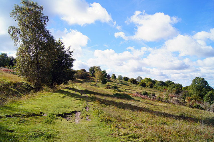
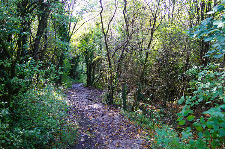 Walking through Coppice on Lodge Hill
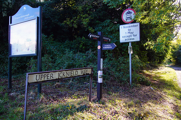 The Ridgeway and Upper Icknield Way near Chinnor
From Whiteleaf Hill I descended as steeply as I had climbed to closely skirt the south side of Princes Risborough. First I followed tracks and lanes then at end of town I came to the least desirable walking of the day by following the A4010 Wycombe Road for 600 metres until I reached Shootacre Corner. A less busy B road followed to a crossing of ploughed fields and including both a railway and road crossing which took me to the tranquility and beauty of Lodge Hill, a small hill with a small wood at the top. After descending Lodge Hill I followed another ploughed field to reach Wigan's Lane which I crossed to follow lovely pasture fields to Hempton Wainhill. The final section of walking was along Swan's Lane to a road leading into Chinnor where I stopped for the day.
Today had being a special day. In the sixteen and a half miles of walking only part of the last section from Princes Risborough to Chinnor was anything but special. The rolling hills, the diversity of different woodlands, the open stretches between, the exceptional views after Wendover and the condition of the paths all combined to make it a memorable day out walking.


