Ridgeway National Trail
A personal record of my walk of the Ridgeway National Trail with written journal and photographs. Tracklogs for GPS units and for use with Google Earth are available for download for each stage.
Journal, Photographs and Download Files
Stage 4: Wallingford to East Ilsley
Google Maps Open Source Maps| Statistics and Files | ||
|---|---|---|
| Start: Wallingford | Finish: East Ilsley | Distance: 13.0 miles (20.9 km) |
| Time: 5-6 hours | Climbing: 260 metres | Rating: Moderate |
| GPX Route File | Google Earth File | About the Ridgeway |
| Statistics | |
|---|---|
| Start: Wallingford | Finish: East Ilsley |
| Distance: 13.0 miles (20.9 km) | Time: 5-6 hours |
| Climbing: 260 metres | Rating: Moderate |
| GPX Route File | Google Earth File |
Ordnance Survey Explorer Map (1:25,000)
Summary
The fourth stage of my Ridgeway walk is one of contrast, the first half of the walk being a very flat riverside walk as the River Thames is followed upstream from Wallingford to the large village of Goring on Thames. After leaving the river and walking north from the village the walk leaves the Thames valley and climbs over 100 metres to the Berkshire Downs which are crossed for the remainder of the stage to the countryside village of East Ilsley.Stage Report
 River Thames near Wallingford
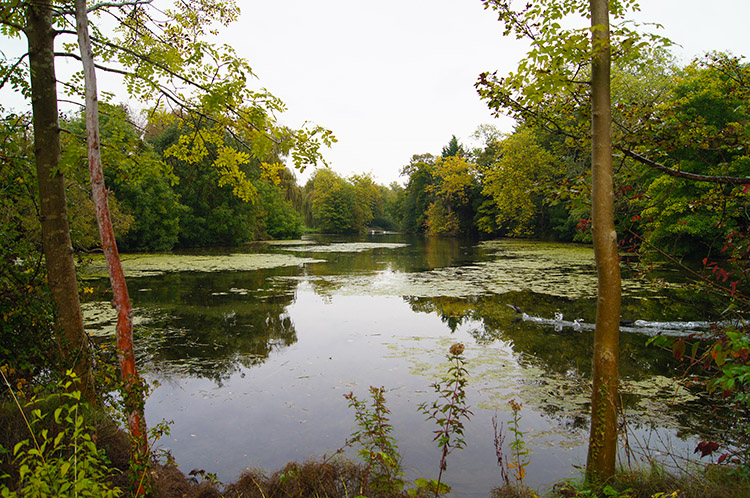 Pond in Mongewell
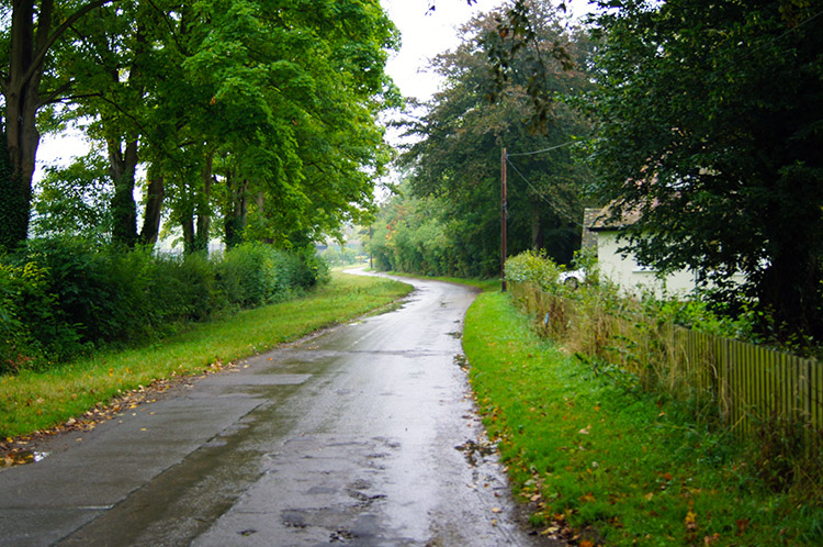
It was another dull start to my 4th day on the Ridgeway. As I traipsed through Wallingford after vainly searching for a sight of the Castle ruins which were hidden for unpaying views by a high wall, I walked past local inhabitants shrouded in coats and waterproofs in vain attempts to keep out the rain. Many faces were hidden, ducked down and looking at the pavement as they made their way to shop for their necessities. I bet many wished they had not had to venture out; it was miserable. Still, I was smiling and possibly one of few around because I was setting off on another days adventure. My first joy of the day was found on the edge of town as I reached the west bank of the Thames and looked across the grey mass of water flowing downstream on its journey to the capital. I had never walked on the Thames Path before but now I was on it and following it for the first half of the day to Goring on Sea. However I was on the wrong bank as the Ridgeway was on the other side and I had to get back to it. I achieved that by crossing the A4130 road bridge to Mongewell.
 Leaf litter near North Stoke
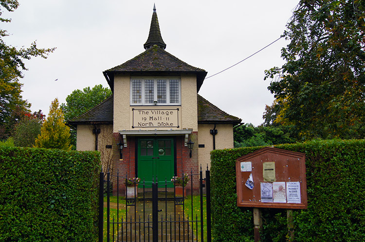 Village Hall, North Stoke
The heavy rain of the morning was already abating at Mongewell and petered out to a fine drizzle as I walked on a course due south from Mongewell to North Stoke. I was not by the Thames for this stretch of the walk but instead followed a line parallel to the river about 300 metres distant, walking along a good track beside the manicured greens of the Springs Hotel and Golf Club. I wish I had known that vocalist Ian Gillan of Deep Purple used to live in what is now the Springs Hotel and that he had a guitar-shaped swimming pool built. I could have checked if it was still there. Instead I was ignorant of the fact at the time so I walked on oblivious. Nobody was on the golf course as I walked by, the only other living sight being a Red Kite circling above in the cloud filled morning sky. Soon I reached North Stoke, a charming village with a fine village hall and lovely houses throughout. I left North Stoke, which had seemed deserted as I walked through, by the churchyard of Saint Mary's.
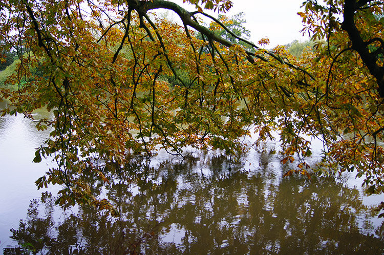 Tree branches touch the Thames
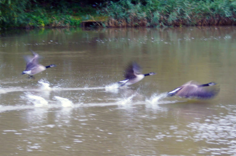 Take off
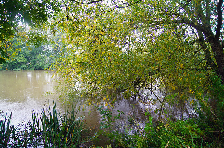
Beyond North Stoke and St Mary's I was soon reacquainted with the Thames. I walked beside the river which was swelled full with water from the recent rains which had been persistent while never torrential to Littlestoke Manor and while doing so looked across to small river craft moored beside a quay at a place called Fair Mile just east of Cholsey. Apparently a ferryman worked between Cholsey and South Stoke, my next destination, until at least 1920. Now there is a seasonal ferry service. No ferries running today though, the only activity on the river were exhibitions of take off and landing by water fowl including ducks and geese. And in the fields which I was walking along there were more groups of geese, vast in numbers and varying types too. Each group carried out a mass takeoff as I walked by though I tried my best not to disturb them. It was a marvellous sight, a huge thrill to see them so close up in their natural surroundings. It was indeed a bonus to the Ridgeway National Trail I did not expect.
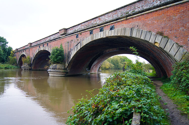 Isambard Kingdom Brunel railway bridge
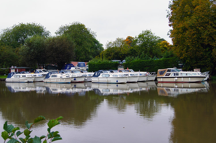 Sheridan Marine
Also on the two mile stretch along the Thames from North Stoke to South Stoke I came to a remarkable railway bridge. When I looked it up and found it was built under the instruction of Isambard Kingdom Brunel I was not surprised, the bridge is a beauty. Built of red brick and with natural stone facades above the three sweeping curved arches, the bridge had me stood in my tracks for quite a while just looking at it in a dumbstruck manner. Then after I my moment of awe I continued my walk along the river and soon came to Sheridan Marine where more posh peoples boats were moored on the Moulsford side.
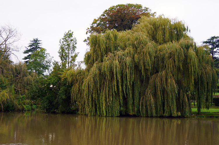 River Thames at Moulsford
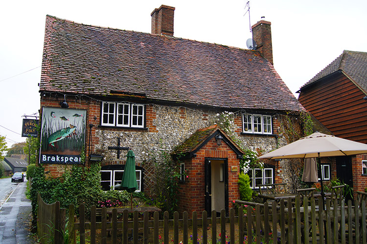 Perch and Pike, South Stoke
Just beyond Sheridan Marine were some plush houses with very impressive riverside gardens and with even more impressive Weeping Willows casting their lower branches into the water. It was lovely in the grey, it would have been utterly spectacular a view in blazing sunshine. Near the trees on the far side of the Thames I watched a Grebe dive under water and then resurface before I left the riverside to walk along a tree lined avenue into South Stoke. As I walked into the village the fine drizzle which had accompanied me for the last hour exploded into a short heavier burst of rain so I was pleased to be protected by the mature thickness of trees along the avenue. I stayed in the protection of the trees until the short shower gave way to fine drizzle once more. Then I walked through South Stoke, a quaint and quiet middle England village just like North Stoke. I walked on by the Perch and Pike Inn, imagining a fine and inviting interior but I was never tempted to enter, I nearly always leave my drinking until after walks. Instead I continued onwards and out of South Stoke to Goring on Thames.
 Goring on Thames
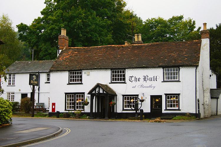 The Bull at Streatley
As I walked out of South Stoke and across a field I spotted a provincial train heading south to north on the railway line running parallel to me at about 100 metres to my left. It was going at a reasonable pace and I did not particularly notice the noise. I thought back to Brunel's bridge I had walked under before the village and guesses it must be the Great Western Railway line I was walking beside. Then I thought no more about it as I focused on the path ahead which led me from the field to a section of the path which took me through a leafy suburb of large detached houses with very large and well maintained gardens, the suburb being equidistant from South Stoke and Goring on Thames. I though rich, plush, cannot afford these. It was peaceful as I walked through the suburb and then.... ROAR... SWOOSH.... ROAR as a fast express train passed on the railway line close by. It shattered the peace. I bet the residents wish they could move the line.
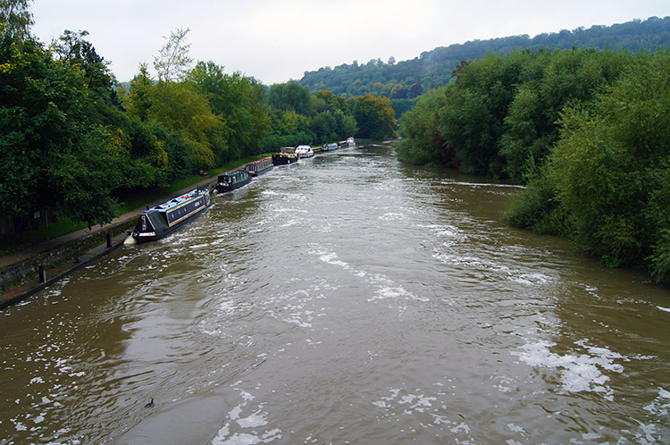
After the deafening noise of the train subsided peace was restored and I continued walking south into Goring on Sea. I looked down to the Thames on my right as I walked along a raised path which led to a road. Now heard my first sounds of urban life on today's walk, the noise of house renovations going on including saws working through wood and hammers breaking masonry. A number of houses I passed had skips in their driveways or out on the roadside. I left the workers to their business and reached the centre of Goring on Thames. I took leave of the path for a short detour into the village centre where I found a cafe serving proper brewed coffee. It was heaven as I enjoyed the coffee and read the local newspaper. After my enjoyable break I resumed my walk by following the Ridgeway and at the same time leaving the Thames Path when I crossed the bridge linking Goring on Thames to Streatley. At the bridge I paused, looked down to the Thames for one last time on this walk, the water of the Thames being brown now instead of the grey at Wallingford, and walked uphill from the river to Streatley.
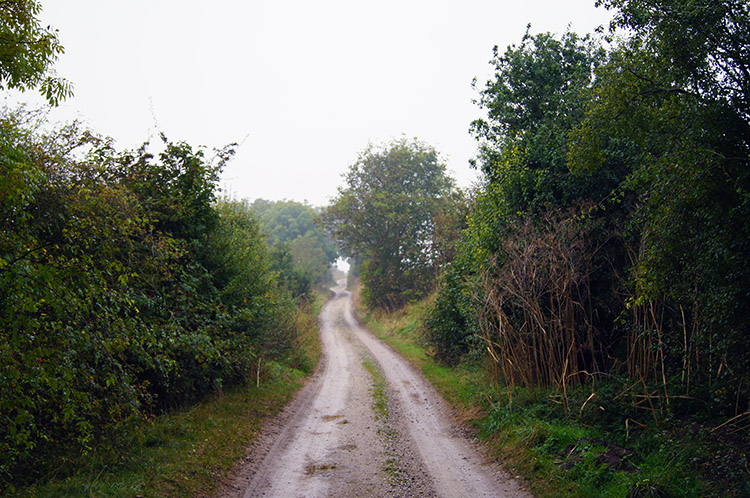
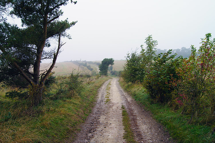
 Leaving the Thames Valley
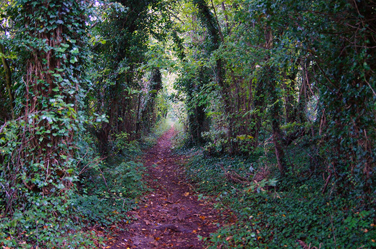 Ridgeway near Thurle Down
From Streatley I continued climbing, for a short while on the roadside of the A417 and then on a quiet road as I skirted the hilltop of Lough Down. I was now climbing steadily out of the Thames Valley and as I walked along the quiet tarmac road which I knew from reading the map would peter out into a track I sensed I was heading towards the classic Ridgeway upland for the very first time. Without consciously noticing I had walked from the familiar noises of urban life and trafficked roads to silence. At a point where the tarmac ended and the unmade road began I came to a way post stating Streatley was 1.9 miles back and that Ivinghoe Beacon, my starting point on the Ridgeway was 44 miles back. Looking forward the way post told me Bury Down was 6.2 miles away and Overton Hill at the end of the Ridgeway and towards the end of my journey was 41 miles away. By adding the extra stretch of my walk from Overton Hill to Avebury I guessed I was just about half way.
 Ridgeway Path near Streatley Common
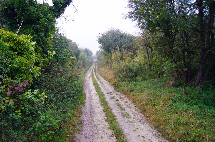 Following the Ridgeway across the Berkshire Downs
The peace I had walked to was interrupted by booms in the near distance. The booms were quickly followed by echoes from the Berkshire Downs and their familiarity told me a game shooting party was out killing birds. The boom boom was coming from Streatley Common and as I continued towards a point on the path bisecting Warren Farm and Starveall the retorts from the shotguns fell silent. A few minutes later I had to step off the Ridgeway path as a convoy of off road vehicles coming down from the higher ground roared towards me. The convoy was led by an open backed truck and tied to a scaffold structure on the open back were row upon row of newly dead Pheasants. Behind the haul followed about a dozen Land Rovers or the like. I walked back from the safety of the track side back onto the Ridgeway after the last vehicle had past and waited for the silence to fall once more. It obliged, washing away my thoughts of the horror of the slaughter.
 No sign of sunshine on the Ridgeway today
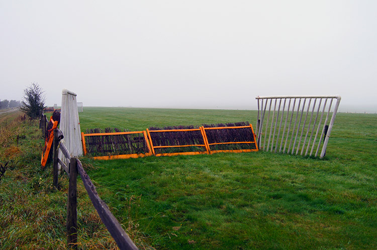 Horse gallops near East Ilsley
I continued my steady relentless climb which reached its zenith at 187 metres elevation as I walked by Warren Farm. I had climbed just 140 metres since leaving the river at Goring on Thames and the difference in sense between 140 metres of elevation could not have been more marked. At river level I had been enclosed in the leafy opulent suburbia of the Thames valley. I was now in wild and open upland, tough hardship land and though it was just over three miles between the two it was chasms away in character. For the first time I really did feel on the ancient Ridgeway all the guidebooks had promised me. Despite the dullness of the day I thought of being in the midst of beauty, exquisite beauty. I was utterly alone and I was loving it. I strode out along the undulations of the high path near the site of a Roman temple at Lowbury Hill and towards East Ilsley Down. Close to the Ridgeway in the fields alongside were horse gallops and steeplechase fences. I was in horse racing country but not one horse or rider was in sight this day. The only soul I saw was an elderly gentleman and his dog out walking near Compton Downs. When I came to him I stopped and we spoke for a good ten minutes. He told me of his love for this area and that he walked every day, whatever the weather. He was a lovely character and after our chat I bid him a good day.
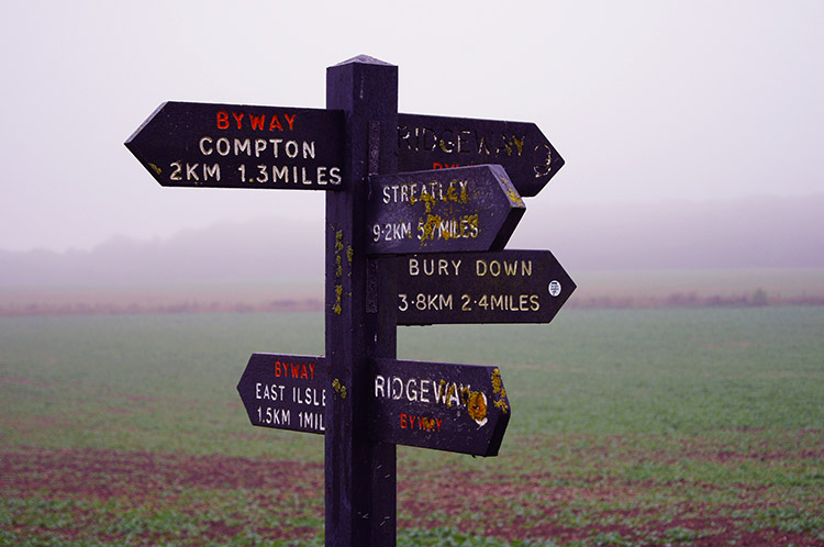 Paths leading in all directions
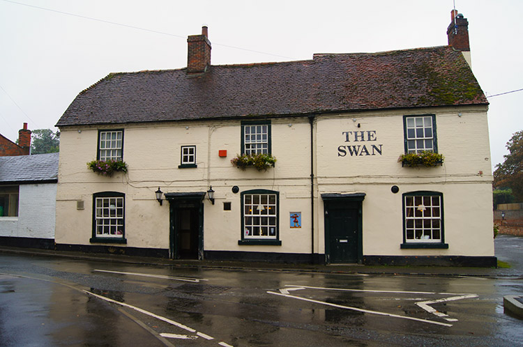 The Swan at East Ilsley
Soon after my pleasant meeting with man and dog I started my descent from the Ridgeway towards my base for the evening in East Ilsley. After passing East Ilsley Barn and before reaching the road leading into the village rain began to fall once more, only this time it was not drizzle, nor was it a short sharp shower as in South Stoke. The whole sky had darkened as I had been descending from the downs and rain was setting in. It was a good job I was coming to the end of my day as I walked into East Ilsley and to my sanctuary of the Swan in increasingly heavy rain. I did not linger, making my way into the Swan, shaking off as much rain from my outer clothing as I could and booking in. After filling in the requisite forms and bring handed my key I made my way to my room. With luck there was a standalone radiator which I switched on to take on its roll as clothes dryer.
Despite the infuriating weather I had really enjoyed this stage of the Ridgeway though I could contest the designation of the first half, it being more river way. However the contrast was wonderful as the walk along and near to the Thames from Wallingford to Goring on Thames was full of interesting moments with a famous river, lovely villages, engaging wild life and marvellous structures. Then after leaving the valley the climb to the Berkshire Downs was such a rite of passage from modern to ancient, from easy living to a real sense of austerity and hardship. I guess its not the case these days but it felt that way and as I sat in my room at the inn I fully anticipated fulfillment in walking the next day on the Ridgeway.


