Yorkshire Wolds Way
A personal record of my walk the Wolds Way with written journal and photographs. Tracklogs for GPS units and for use with Google Earth are available for download for each stage.
Stage Two: South Cave to Nunburnholme
Google Maps Open Source Maps| Statistics and Files | ||
|---|---|---|
| Start: South Cave | Distance: 15.6 miles (25.1 km) | Climbing: 486 metres |
| Grid Ref: SE931317 | Time: 6-8 hours | Rating: Hard |
| GPX Route File | Google Earth File | About South Cave |
| Statistics | |
|---|---|
| Start: South Cave | Distance: 15.6 miles (25.1 km) |
| Grid Ref: SE931317 | Time: 6-8 hours |
| Climbing: 486 metres | Rating: Hard |
| GPX Route File | Google Earth File |
Ordnance Survey Explorer Map (1:25,000)
294 Market Weighton and Yorkshire Wolds Central
Summary: The 76 miles of the Yorkshire Wolds Way includes 40 miles of footpath and 16 miles of bridleway. The remaining 20 miles is either minor road, public path or byway open to all traffic. The idea for the Wolds Way came from the East Yorkshire and Derwent branch of the Ramblers Association. It became an official National Trail in 1982.
I decided to complete the Yorkshire Wolds Way in March 2003. Since I had moved to Beverley in 2000 I had been uninspired by the flat and open landscape. I was soon yearning for the rugged openness of the Yorkshire Dales that I had grown used to while living in Leeds. Despite the criticisms of the Beverley landscape I had enjoyed some nice walks in the area, particularly to the north west of Hull. It's just they were not challenging enough, no big climbs and no great distances. How could I remedy this? Walk the Yorkshire Wolds Way, that was how.
The Walk:
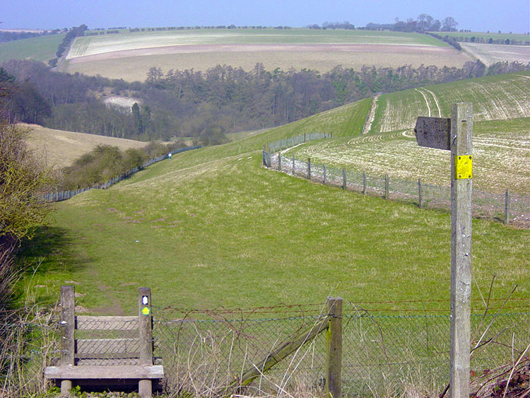 Comber Dale
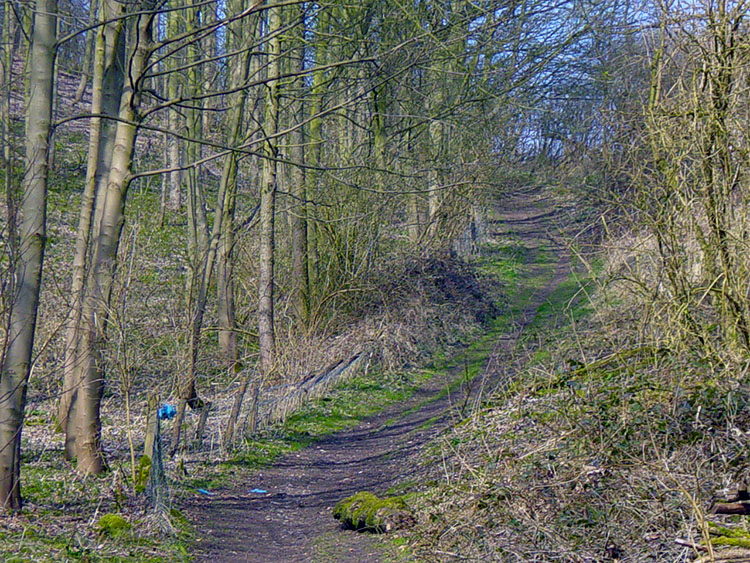
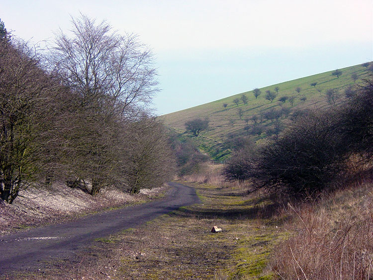 Weedley Dale
It is only the second stage of the walk but already the hustle and bustle of Hull or indeed any populated area seems a distant memory. Walking on the Wolds Way is a peaceful and therapeutic life. On this stage of the walk I was to meet one man and his two dogs in the whole 17 miles although I did see a few fellow Wolds walkers in the distance on a couple of occasions. The day starts by leaving South Cave and climbing into Little Wold Plantation (where I met said man and dogs) which you follow in a easterly direction to Comber Dale. When you reach this quiet little dale you have just about done the first mile of the day and climbed almost 100 metres. It is a nice invigorating start to the day and you can take the lovely scenery of this little dale in as you walk through it to follow the path of a dismantled railway that runs in the bottom of neighbouring Weedley Dale.
 East Dale
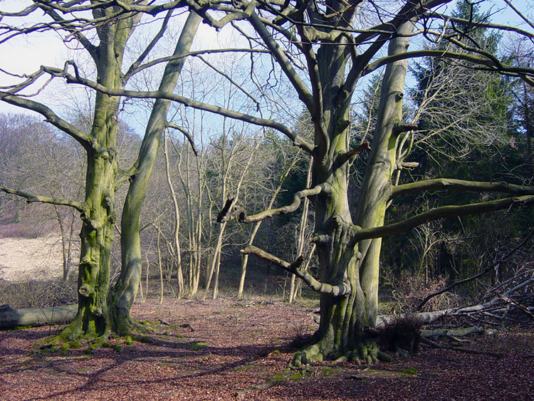 Mature trees beside the Wolds Way
After walking on the route of the old railway line for a while the way turns left and you follow a steady incline through the plantation that is East Dale. The steady climb becomes a little stiffer for the final 200 metres so push on into daylight and catch your breath at the top of the wood.
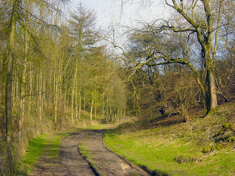
 Climbing to High Hunsley
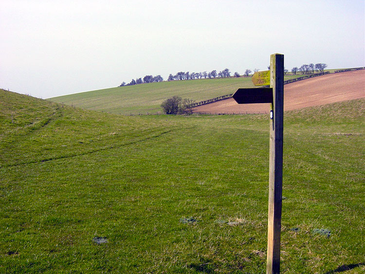 Swin Dale
After a walk around the edge of a large field the path crosses the B1230 at the High Hunsley Beacon, one of many erected for the Queens Golden Jubilee celebrations. The next mile or so is spent travelling alongside country roads and cultivated fields until the walk reaches a stile that leads into the delightful and beautiful Swin Dale. As you drop into the dale and it envelops you it becomes so calming. Enjoy the next mile walking through it as you gaze left and right at the banks of this picturesque and peaceful dale.
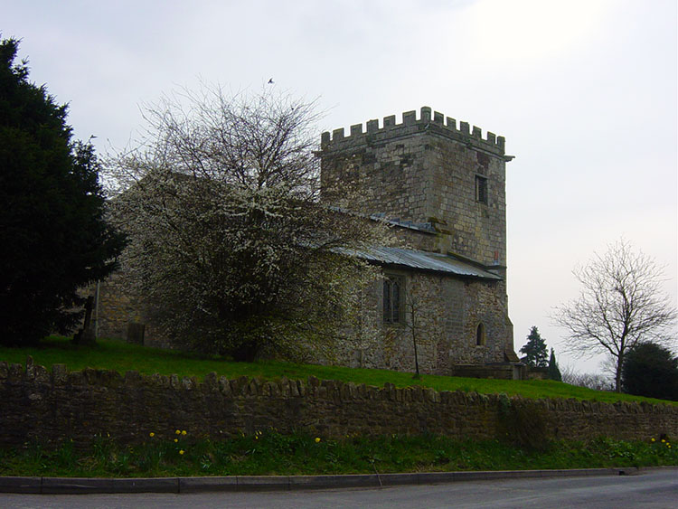 Goodmanham Church
 Path from Goodmanham to Beggar's Bush Well
After the pleasures of Swin Dale the Wolds Way tracks across high Wolds land which is a mixture of bridleways, short lengths of metalled road, and field boundaries for the next five nondescript miles. It is not the most inspiring section, in fact it is the least aesthetic five miles of the entire Wolds Way. This national trial is in the main a beautiful route but intensive farming has done for this bit I am afraid. All I can recommend is that you put your head down and walk briskly through this section until you reach the lovely village of Goodmanham. The church in the village is a particularly fine example of those built in the Saxon period so typical in the Wolds. Follow the signs past the church and out of the village to Beggar's Bush Well which is followed by rounding a few more ploughed fields before crossing the A614. On crossing the road follow a farm track to Londesborough Park.
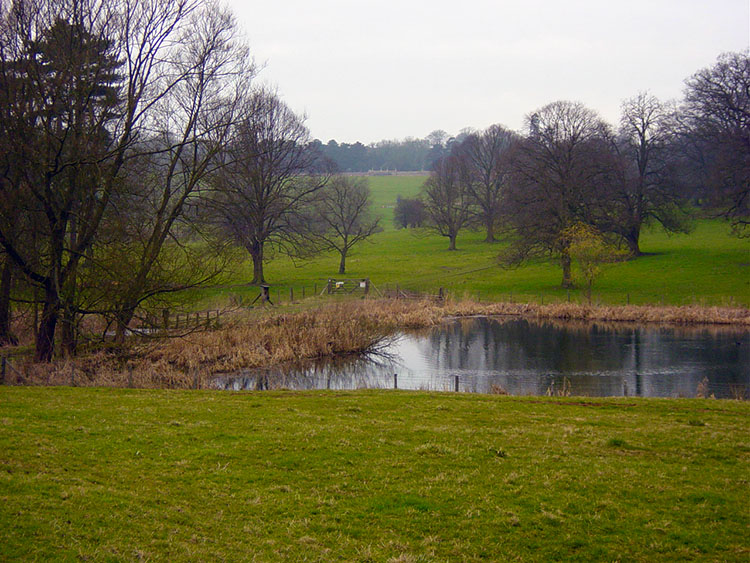 The Lake in Londesborough Park
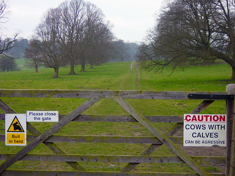 Warning in Londesborough Park
You are welcomed into the park by signs such as 'Bull in Field' and 'Caution, Cows with Calves can be aggressive' but don't let this put you off! I hate to see such signs on public footpaths and particularly on National Trails but I suppose the land has to be productive. Then again a fence between the walkers and animals wouldn't be too much of a problem to organise? Despite the animals, who were nowhere to be seen on my Wolds walk the park is beautifully managed. Ponder the history of the park as you walk through the fields and past the ponds towards the village of Londesborough.
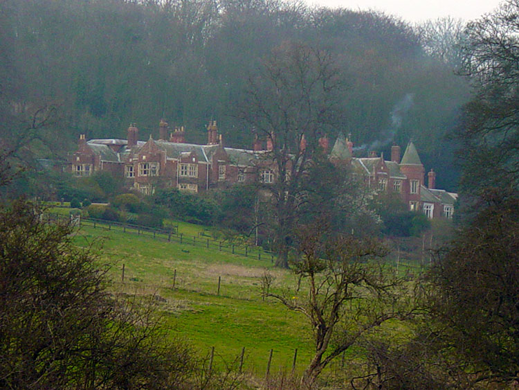 Londesborough
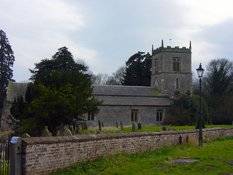 Londesborough Church
Londesborough has some delightful houses and a super church that contains the tomb of a medieval soldier. It is also so quite with virtually no traffic as the village streets are some way from arterial roads. I continued after a brief rest in the village for another three miles to finish in the village of Nunburnholme. This was achieved by following a metalled road to Partridge Hall and then through field and a small coppice. Nunburnholme is noted due to the church rector between 1854 and 1893 being a certain Frances Orpen Morris who combined his clerical duties with writing about nature conservation. His most famous work was the pioneering book written in six volumes 'The History of British Birds' So the Wolds Way is not only about wonderful scenery but is steeped in history too. I looked forward to the next stage.


